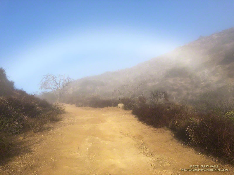
Fogbows form opposite the sun in a manner similar to rainbows, except the water droplets that create a fogbow are much smaller than raindrops. Because a fog droplet is so small, the physics of the interaction is different. The result is often a diffuse, primarily white bow.
The photograph of the fogbow was taken Sunday morning on an out and back run from Wendy Drive to Mugu Peak. The sun was about 14 degrees above the horizon. More about fogbows and other atmospheric phenomena can be found on Les Cowley’s Atmospheric Optics website.
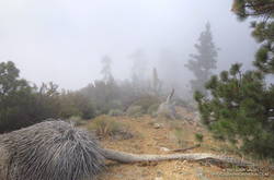
When I started up the trail from Vincent Gap (6585′), the thermometer on my pack read 36°F. For the first few switchbacks, the trail was immersed in cloud. Beneath the tall conifers, the sandy soil was dotted with droplets of moisture extracted from the fog.
I was on my way to Ross Mountain (7402′), one of the most isolated peaks in the San Gabriel Mountains. At the end of a rugged, 3-mile ridge extending south from the summit of Mt. Baden-Powell, the peak overlooks the vast canyons of the Sheep Mountain Wilderness.
This morning, the canyons were filled with a 7000′ deep layer of stratus clouds. With a weak upper low over the Southern Sierra, the question of the day was whether the cloud deck would work up the ridge from Ross Mountain and completely envelop Baden-Powell.
Well acquainted with the trail up Baden-Powell, a combination of fast-hiking and slow-jogging put me on top in a relatively comfortable 90 minutes. I’d tried not to overdo the pace, knowing from previous experience that the return from Ross Mountain would be the tough part of the day.
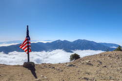
From the summit of Baden-Powell, I gazed across the sea of clouds to Mt. Baldy. There was almost no snow on its steep north face. San Gorgonio Mountain was visible in the haze to the left of Pine Mountain and San Jacinto Peak in the gap between Dawson Peak and Mt. Baldy.
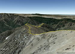
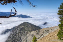
Walking a little down the south side of Baden-Powell, I got my first good look at the South Ridge. Ross Mountain was nearly covered in clouds. Guessing that the deck of clouds might deepen, and a few minutes might make the difference of being in the clouds or out, I started to jog-lope-shuffle down the initial steep slope.
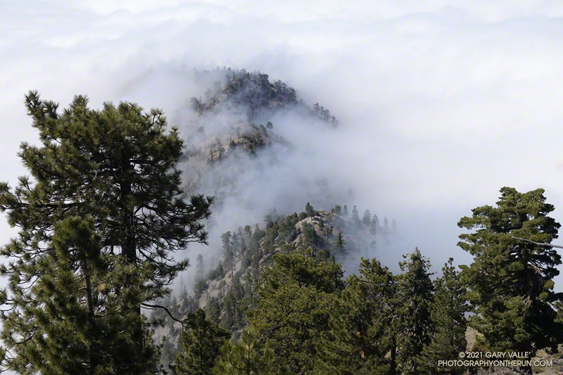
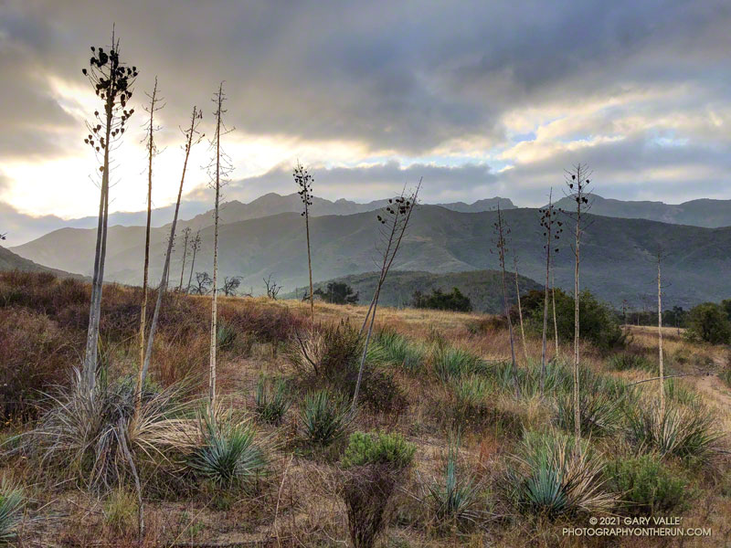
The title photo was taken a bit past Peak 8375, about 1.7 miles from Baden-Powell and 1.2 miles from Ross Mountain. At that time the clouds were spilling over the ridge near Peak 7407 and Peak 7360+, and around Ross Mountain.
The clouds added an aesthetic element to the adventure, as well as a little uncertainty. They accentuated and embellished the terrain, while threatening to make the conditions wet, cold and disorienting. Being familiar with the route helped me to enjoy the experience more than the concerns.
After navigating the false summits along the final stretch of ridge, I finally reached Ross. And, of course, it was in the clouds. That was the tradeoff for the spectacular views of the clouds along the ridge.
I didn’t spend much time on the summit. The more time I could spend out of the clouds, the more enjoyable would be the 2200’+ climb back to Baden-Powell.
It took a little over two hours for the clouds to chase me back up the ridge, but only an hour to run the four miles down from Baden-Powell to the foggy trailhead.
The Hidden Pond – Old Boney Loop is a variation of the XTERRA Boney Mountain Trail Run 21K course. The route is about a half-mile longer and has a couple hundred feet more of elevation gain, but all the key trails are the same. It starts/ends at the Wendy Drive & Potrero Road Trailhead.
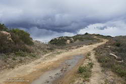
Was that thunder? I warily eyed the dark clouds over the mountains and pondered the situation.
I was about halfway to the top of the Chumash Trail and was planning to run along the crest to Rocky Peak. The run had started in short sleeves and sunshine, but it was pretty obvious that wasn’t going to last.
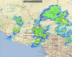
A cold upper-level low had brought badly needed rain to the area for the past two days. The low was moving off to the east, but there was still a chance of afternoon showers and maybe even a thunderstorm.
It was the “thunderstorm” part that I needed to pay attention to. I had enough gear to deal with a downpour and cooling temps, but electrical storms are no fun at all.
I decided to continue to the top of the Chumash Trail and reassess. As I worked up the trail, I pictured the counterclockwise circulation around the low, and how convective cells develop over the mountains and then dissipate as they drift south. The concern was that the cells don’t always dissipate.
It looked like things weren’t getting any better at the top of the Chumash Trail, but it wasn’t worse either. I hadn’t heard any thunder for a while, and most of the activity seemed to be a few miles to the west and east. Having been starved of stormy weather for much of the rain season, I turned right on Rocky Peak Road and headed south toward Rocky Peak.
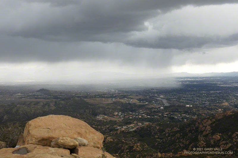
The run from the Chumash Trailhead to Rocky Peak is a challenging mix of technical single-track trail and hilly fire road. There are wide-ranging views of Simi Valley & Simi Hills, the San Fernando Valley, Santa Monica Mountains, Ventura County mountains, and San Gabriel Mountains. On a clear day, the view can extend to the Channel Islands, Saddleback, and San Jacinto Peak.
The actual turnaround point for a run to “Rocky Peak” varies. Some like to turnaround at the high point of Rocky Peak Road that is near Rocky Peak. Most of the time, I turnaround at a viewpoint that is at the end of a spur trail that branches off from the high point of Rocky Peak Road. From time to time, it’s fun to hike over to Rocky Peak and scramble to the top. That’s a bit more involved and requires some route-finding.
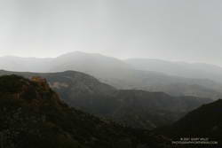
I felt the first raindrops as I reached the high point on Rocky Peak Road and turned onto the spur trail that leads to the overlook. There was some increased development to the east, but it looked like there would be enough time to get over to Rocky Peak, take a couple of pics, and then head back.
I felt a little exposed on top of Rocky Peak. I hadn’t heard any thunder for the past hour, but a cell to the east was spouting heavy rain over the San Fernando Valley, which meant there was probably enough development to produce lightning. I took the title photo and a couple of others and hurriedly descended from the peak.
Back on Rock Peak Road, the sprinkles increased, and the showers became more steady as I ran north toward the Chumash Trail. Under the dark clouds, a raven perched on a large pinnacle cawed incessantly, either enjoying the rain or complaining about it. In the distance, a siren wailed down in the valley. It was cold, and I was very glad to have an extra shirt, sleeves, gloves and a light rain shell.
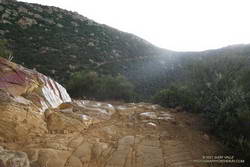
As I began the descent of the Chumash Trail, the sun briefly broke through the clouds, reflecting brightly on the wet sandstone rocks. I breathed deeply, relishing the smell of the cleansed air and wet chaparral, and continued down the trail.
It looks like Downtown Los Angeles (USC) is going to end February — one of the wettest months of the rain year — with only a trace of rain. The current rain year total for Los Angeles is 4.39 inches, which is about 39% of the normal total for this date.
It’s been one of those years where missed rain opportunities have often turned into strong offshore wind events. This chart from MesoWest shows the wind speed and direction for the past 30 days for the Malibu Hills RAWS. Since mid February there has been five wind events with sustained wind speeds over 30 mph and gusts over 50 mph.
Current forecasts suggest Los Angeles will see at least some rain in March, with the first chance around midweek. We’ll see!
I was running up Calabasas Peak Mtwy fire road trying to get a better view of the eastern sky, but the view in that direction was blocked by a steep hillside. The road turned to the northeast up ahead, and I hoped the best moments of a rapidly-evolving sunrise would not be lost.
A couple of breathless minutes later, I rounded a corner and was rewarded with an unobstructed view of a vivid, pink-red-orange mackerel sky. Focusing on the ridgeline near Topanga tower, I shot several sets of bracketed photos.
Excited by the sunrise, I continued up the fire road, scanning my surroundings for another photo. My eye settled on the gibbous moon. High in the sky, it’s bright face was subdued by a thin veil of pinkish-gray cloud. I’d previously experimented with handheld shots of the Moon using my running camera — a Lumix ZS100. Zooming to an equivalent focal length of about 250mm, I held my breath, steadied the camera the best I could, and took a few shots. Here’s one of the images — cropped and sharpened — with enough detail to see craters, maria, and some other lunar features.
At the bottom of Topanga Lookout Ridge there were several bigberry manzanita bushes covered with flowers. A hummingbird was up before sunrise, buzzing about the blossoms, busily drinking the precious nectar. Although it had rained a couple days before, this rain year there had been little rainfall, and a corresponding scarcity of early season wildflowers.
As I climbed higher on the ridge, the mountains northwest of Los Angeles came into view, white with snow from the recent storm. The snow-covered peaks are south of Mt. Pinos and Frazier Mountain, in the area of San Raphael Peak, McDonald Peak, Sewart Mountain and Snowy Peak.
Like snow on a mountain, there is a purity in the form and appearance of clouds. When a long, dark streak appeared across a layer of high clouds, it was hard to miss. In this case, the dark line appears to be the shadow of a contrail of a jet flying above the clouds. At the time LAX was reporting scattered clouds at 19,000′ and 23,000′, with a broken layer of clouds at 28,000′. Given the height of the clouds and orientation of the contrail, it may have been from a flight from San Diego to San Francisco.
Topping out on the ridge, I smiled when I saw the masked couple dancing on the Lookout, and continued west toward Saddle Peak.