Category Archives: nature|weather

Winter Oaks, Summer Temps

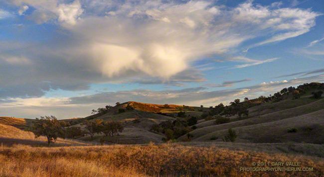
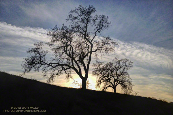
Valley oaks and clouds near sunset

These valley oaks have dropped their leaves, but if you were to go by the warm temperatures we’ve been having in Southern California, you might think it was Summer.

Including today, the high temperature at Pierce College in Woodland Hills, California has reached into the 80s each of the last six days. High temperature records for December 31 – January 5 have been broken at several locations. Among the records broken, yesterday San Gabriel recorded a high of 91, Camarillo 90, and UCLA 89.

It sounds sweltering, and it can be if you’re in full sun, but it’s not like a 90 degree day in July. Days are short, shadows long, and some north-facing slopes never see the sun. And it does cool down quickly. If you take a look at the overnight lows on those six 80+ days at Pierce College, you’ll see the temperature dropped to around 40-42 degrees.

On my run Tuesday afternoon, when the photograph of the valley oaks was taken, the temperature varied by as much as 20-25 degrees between some high and low points.

It has been great weather for running, but I’m ready for a change in the pattern and a little rain!

A Few Clouds with Isolated Virga Near 20,000 Feet

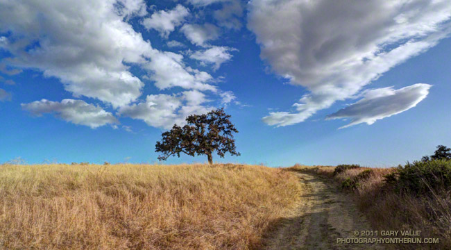
Round-bottom clouds

Spotted these unusual clouds while running in Upper Las Virgenes Canyon Open Space Preserve today. Better known as Ahmanson Ranch, the open space area is on the western margin of the San Fernando Valley, northwest of Los Angeles.

The clouds were strikingly similar to clouds I’d photographed last January following the development and dissipation of a band of mid-level mammatus clouds over the San Fernando Valley. As before, the clouds were round-bottomed and were ragged with virga.

Upper air charts and model analyses indicated the clouds were at an altitude of about 20K-25K, and were associated with a very small scale upper level disturbance.

Here’s a wider view of the clouds.

Related post: Mammatus Clouds Over the San Fernando Valley, More posts…

La Nina and the 2011-2012 Southern California Precipitation Outlook

What a difference a week makes! Last week an unseasonably deep upper level low, unusually strong 170+ kt Pacific jet, and associated cold front combined to produce record-setting rainfall and cool temperatures in Southern California. This week high pressure and a weak offshore flow produced triple digit temperatures in some areas and set new high temperature records Wednesday in Downtown Los Angeles, Long Beach and Santa Barbara.

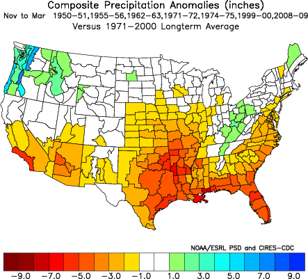
Which pattern is more likely this rain season? Will Southern California tend to be drier like this week, or wetter like last week and last year? Despite last year’s wet rain season, wet La Nina Winters are not the norm. Generally, La Nina conditions result in drier than normal rain seasons in Southern California, and El Nino wetter.

Following a Summer respite La Nina conditions have reemerged in the equatorial Pacific, and appear to be consolidating. Equatorial SST anomalies have continued to decrease and now range from -1.5°C at 100°W to -0.5°C at 170°E. Equatorial Pacific temperature cross sections show substantial subsurface cooling from July 11 to September 11. The Multivariate ENSO Index (MEI) has dropped from -0.5 for July/August to -0.8 for the August/September season. This drops the MEI from a rank of 16th for July/August to 13th for August/September since 1950. This is well within La Nina territory but weaker than last year’s rank of 1st for August/September.


A precipitation composite for seven years* since 1950 in which La Nina conditions persisted or reemerged in the year following a first year La Nina indicates that “on average” the coastal Southern California climate division recorded about 5 to 6 inches less precipitation than normal for the period November through March. The percent of normal water year rainfall recorded at Downtown Los Angeles (USC) ranged from a low of 47% (1971, 7.17″), to a high of 106% (1955, 16.00″). The average rainfall for these years was 70.5%, or 10.7″.

We’ll get the official NOAA/CPC outlooks next week around October 20, when CPC’s Three-Month Precipitation Outlooks and NOAA Winter Outlook are expected to be released.

*The years included in the selection were 1950-51, 1955-56, 1962-63, 1971-72, 1974-75, 1999-2000 and 2008-09. The base period was 1971-2000. The selection was based on the MEI.

Inspiration Point to Islip Saddle Trail Run

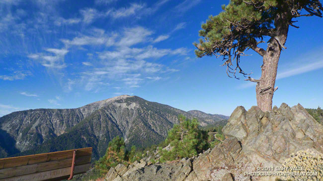
Mt. Baden-Powell from Inspiration Point

The viewpoint above is a few hundred yards up the Pacific Crest Trail from Angeles Crest Highway at Inspiration Point. Craig and I had paused near the start of our trail run from Inspiration Point to Islip Saddle to check out the view. 


The mountain across the way is Mt. Baden-Powell (9,399′).  Three miles away as the bird flies, our earthbound route along Blue Ridge, down to Vincent Gap, and then up the forty-something switchbacks to the top of the peak would total around nine miles. From the top of the peak it would be about eight miles to Islip Saddle.

Zooming in on the peak, the white arrow marks the location of the Wally Waldron Limber Pine. For more than a millennia this grand tree has stood high on this mountain, resisting the strongest of winds and the most perfect of storms. Not all are so durable. A limber pine feet away from the Wally Waldron tree was toppled in a storm last Winter.

Given the short-sleeve weather, the most unexpected discovery on today’s run was ice under the trees just up the ridge from the Wally Waldron tree. The ice had been deposited on the trees a few days before, when an unseasonably strong storm set a new rainfall record for the date in Los Angeles.

The running on the PCT between Mt. Baden-Powell and Islip Saddle was outstanding and the views superb. Along the way we did the short climb to the top of Throop Peak, checked out the Mt. Hawkins Lightning Tree, and enjoyed the cold spring water at Little Jimmy Spring.

Some related posts: Perils of Winter, Surprises of Summer; Wally Waldron Limber Pine; PCT from Inspiration Point to Islip Saddle

Mt. Baldy Run (Part Way) to the Top 2011

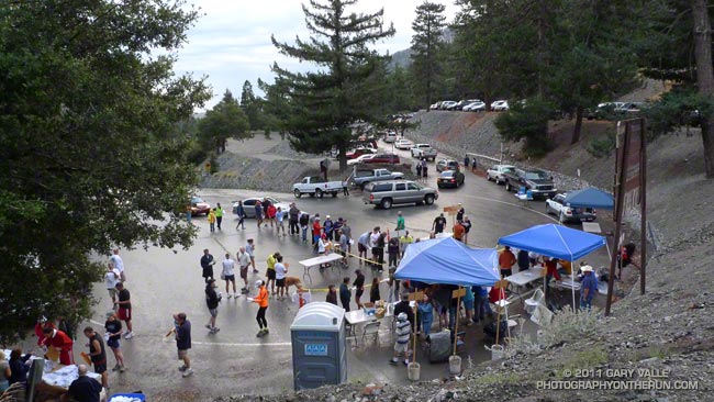
Mt. Baldy Run to the Top Registration Area and Start

Somewhere around the junction of the 210 and 605 I saw a flash of lightning to the south. As if the flash had been a warning, a gust of wind buffeted my car, and a blizzard of dust and debris blew across the freeway. Then it started to rain. Not good — especially when you’re on your way to a race that ends on top of a 10,000′ mountain.
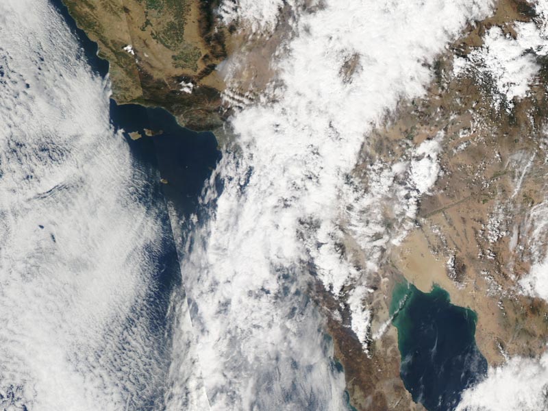


A complicated weather scenario had developed for race day. A very moist layer of monsoonal moisture had been pushed up into Southern California from Baja by a combination of a weak upper level trough off the coast and big upper level high over Four Corners. A combination of factors including an unseasonably strong jet stream had helped trigger a band of showers and thunderstorms that extended from west-southwest off the coast, across the Los Angeles basin, and into the San Gabriel Mountains.

When I drove into the Mt. Baldy Ski Lifts parking lot at around 6:45 am it was raining hard enough I didn’t want to get out of the car. Procrastinating, I went through the admittedly optimistic ritual of applying sun screen. After a few minutes the rain tapered off to sprinkles and I walked down to the Start Line to pick up my bib. The word was conditions were improving and it looked like we were going to be able to get in the race.
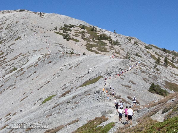


Each year the Baldy Run to the Top attracts 500 to 600 runners. Some are the best of the best and will run the seven miles and nearly 4000′ of elevation gain in under 75 minutes. About two-thirds of the runners usually finish in around 2:15 or less.. A few just want to give it a go and soon find that climbing the rough equivalent of 6500 stairs — at altitude — is more than they bargained for.

Usually the weather is pretty good — some years are a little warmer or cooler, or have a few more clouds than others, but blue skies and sunshine are the norm, and significant rain — or lightning — usually isn’t a problem.

It was deceivingly warm as runners gathered at the start line. The wind chill on top was reported to be a chilly 38 degrees. A few runners had on extra clothing, and a number of runners had an extra top or shell tied around their waste. Some had extra gear stuffed in their packs, but a few — including a couple of shirtless runners — had nothing to combat the weather.
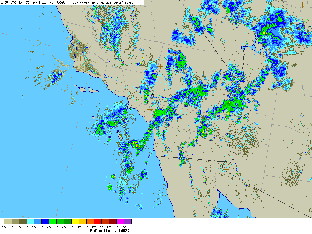


Here’s a UCAR regional NEXRAD composite radar image from about 8:00 am. The approximate location of Mt. Baldy is marked by a black triangle near the center of the image. (Note that radars in the region vary in how they show a particular area and that a cell may be stronger than indicated in the composite. Also there’s some “clutter” in the image that isn’t necessarily rain.)

With what sounded like a more reserved “3… 2… 1… GO!” the race started and pounded down the wet pavement to Manker Flats (6160′), where it turned up the ski area service road. The (mostly) dirt road would take us to the Notch (7800′) and then the top of Chair 4 (8600′). From there a trail would take us across the exposed Devil’s Backbone, then across the south face of Mt. Harwood, and on to the final gut-wrenching 700′ climb to the summit of Mt. Baldy (10,064′). Here’s an interactive Cesium browser View of the race course.

The weather on the way up to the Notch was a little unsettled, but great for running. There was a mix of clouds and sun, and even a brief shower, but overall it looked like the weather might be improving.

Just before rounding the last switchback up to the Notch, a runner with a bib was running down. This was odd because he was running well. Why would he have quit the race? Running up to the aid station at the Notch I still hadn’t caught on, and was wondering why so many people were standing around at the aid station.

That’s when I learned that about 45 minutes into the race, on the recommendation of SAR officials, the race had been shut down. I’m not sure what the “final straw” was but would guess it was nearby thunderstorms and perhaps a growing concern that rain and wind associated with a rapidly developing cell could cause serious problems for runners not prepared for inclement weather.

Here’s what a regional composite radar image looked like at around 9:00 am, and then just one hour later, as a “train” of cells about 20 miles from Mt. Baldy continued to develop and stream into the San Bernardino Mountains in the area of Silverwood Lake, Crestline and Lake Arrowhead.
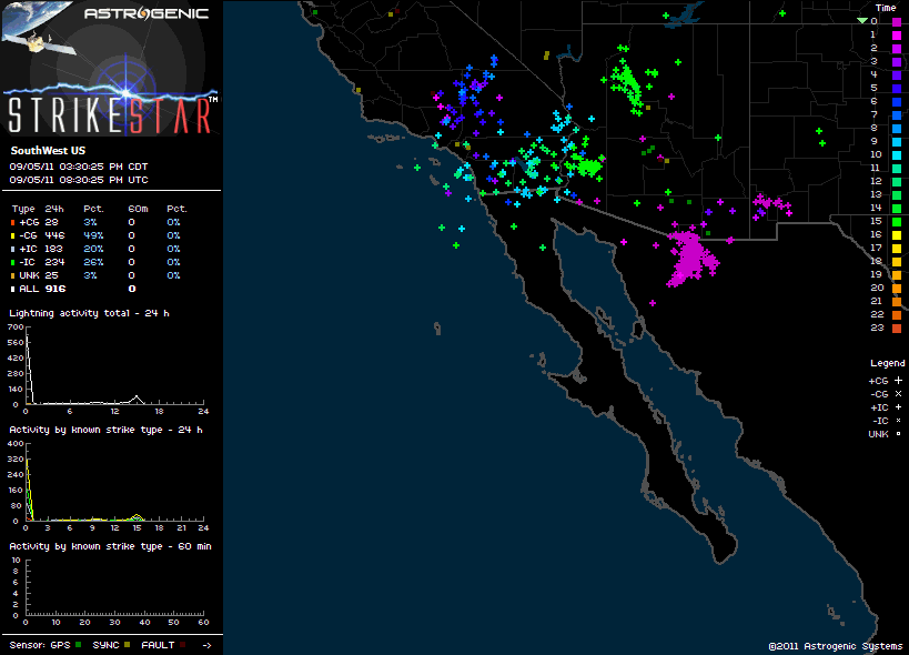


Lightning was not only a risk for runners, but for the 50+ SAR and fire personnel spread across the mountain, and the 25+ volunteers that would be on top of the mountain for the duration of the event.

There was lightning in the area. We saw it driving to the race and I heard at least one clap of thunder while warming up before the race. Here’s an image of Astrogenic StrikeStar lightning detections in the southwestern U.S. from 10:00 pm PDT Sunday to about 1:30 pm PDT race day. Note the high percentage of cloud-ground strokes.

As this composite radar loop from WSI Intellicast.com shows, bands of showers and thunderstorms streamed into the San Gabriel and San Bernardino Mountains most of Labor Day. Cells were moving relatively rapidly and developing over a wide swath that extended from west of Mt. Baldy south and east to San Diego and Palm Springs. (Mt. Baldy is just north of ONT on the radar map.)
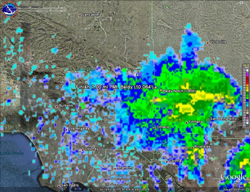


It was pretty much a crapshoot where a particular cell would develop, how strong it would be, and what its extent would be. This regional radar image shows a cell that moved into the Baldy area around 1:00 pm, and this Google Earth/NEXRAD image shows the same cell in relation to  Mt. Baldy at around 1:30 pm.

As frustrated as I was to stop at the Notch, I don’t think there’s any question that officials made the right decision when they shut down the race. And I think most runners understand that it’s not whether a particular runner was able to make it up to the summit and back down OK, but what could have happened with several hundred people on the mountain and an ever-so-slight change in that wavering stream of heavy showers and thunderstorms.

Some related posts: Thunderstorm, Mt. Baldy Run to the Top 2009, Mt. Baldy Run to the Top 2007
Cottonwood Pass – New Army Pass Loop 2011

Craig Kinard running on the PCT near Cirque Peak

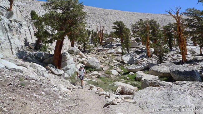
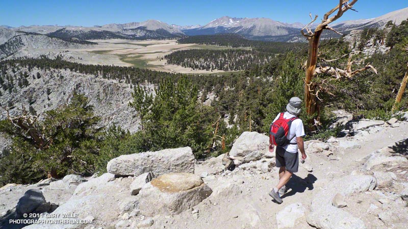
The Cottonwood Pass – New Army Pass loop is a longtime favorite that I try to do at least once a year. There’s nothing quite like running at 11,000′ through a forest of gnarled foxtail pines — some perhaps a thousand years old — then working up a glacier sculpted basin to one of the higher passes on the Sierra crest.


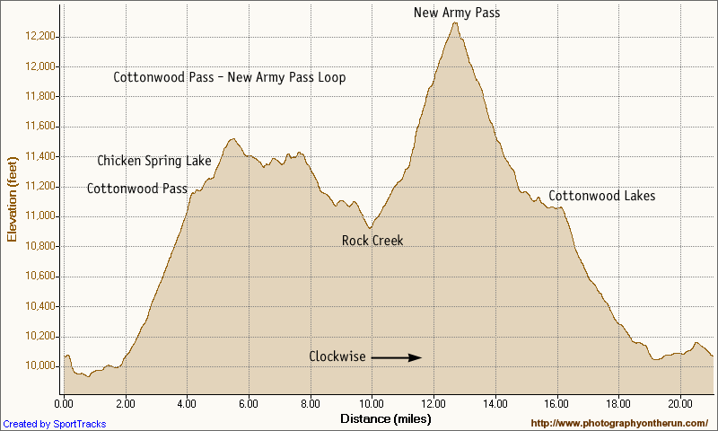
The trail run is the closest high altitude loop to Los Angeles that is almost entirely over 10,000′. Although its 21 mile length and 3400 ‘elevation gain/loss appear relatively moderate from an ultrarunning perspective, keep in mind it is a high mountain run that reaches an elevation of 12,300′, and includes 12 miles that are over 11,000’. Nearly three miles are above tree line. It’s kind of like driving to the top of Mt. Baldy and then starting your run from there.

This year a record-setting snowpack pushed back the date the loop could be done (as a trail run) to late July. I’d hoped to do it two weeks before the Mt. Disappointment 50K, but thunderstorms and flash floods quashed that plan. The next opportunity to do the loop was on Saturday, but once again thunderstorms were in the forecast.


A look at the SWFRS Bald Mountain #5 web cam midday Saturday confirmed the sketchy weather. The camera showed developing clouds from Olancha Peak on the south to New Army Pass, Mt. Langley and Mt. Whitney on the north. We wanted to enjoy the run in short-sleeves and shorts, so postponed the run to today.

And today the weather was perfect! A plus was that Saturday’s rain had dampened the sometimes sandy and dusty trails, improving their condition and refreshing the landscape.


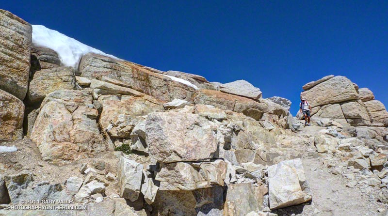
One of the interesting aspects of the run was that patches of snow remained from last Winter’s heavy snowpack. Not only were there patches of snow on New Army Pass, and elsewhere above 12,000′, but there was snow in lower, more exposed locations such as on the southeast-facing slopes above Chicken Spring Lake. Much of this high altitude snow will carryover into this Winter.

Here’s a Cesium browser View and elevation profile of a GPS trace of the loop. The view can be zoomed, tilted, panned, etc. Additional info, a slide show, and more photos are available in previous posts about this loop.

Some related posts: Cottonwood – New Army Pass Trail Run, Cottonwood – New Army Pass Loop, Mt. Langley in a Day from L.A., Climate Change and the Southern Foxtail Pine