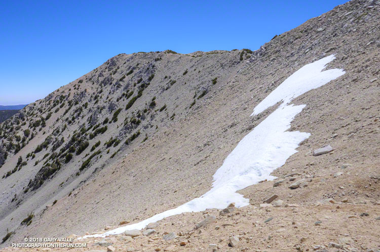
Given that Southern California has had way below average precipitation this rain year, I was a little surprised to find a few widely scattered patches of snow on San Gorgonio Mountain this past Saturday.
The patch of snow in the title photograph was at 11,000′, about a mile from San Gorgonio’s summit. This Google Earth image from last year shows an overview of the area. There was a lot more snow last year, but the same patch — in a deposition area — is near the “San Bern” in the “San Bernardino Peak Divide Trail” label.
There was “shorts and short sleeves” weather for the entire run from the South Fork trailhead.
Given the choice of doing an out and a back run, or a loop, most of the time I’ll pick the loop. Loops encompass more terrain, incorporate more trails, offer more varied scenery, are more adventurous, and normally put you back where you started.
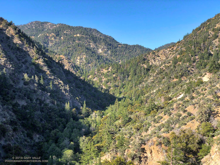
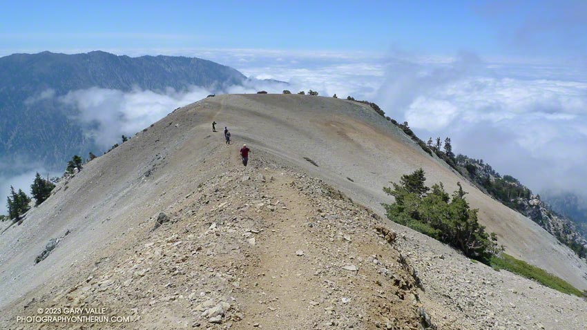
There are many excellent loops in the San Gabriel Mountains. Last week’s loop from Three Points around Mt. Waterman is a run I like to do a few times a year. Today’s run is another favorite — the Islip Saddle – South Fork – Mt. Baden-Powell loop.
This loop combines a demanding descent to the desert on the South Fork Trail with an arduous 5000′ ascent of Mt. Baden-Powell. From Baden-Powell the PCT is followed along the crest back to Islip Saddle. More info can be found in the related posts linked below.
The weather was surprisingly cool for a Memorial Day weekend in the San Gabriel Mountains. At Three Points (5925′) the temperature was a brisk 43°F when I started my run, and it remained in the 40s as I worked up the Three Points – Mt. Waterman Trail toward Twin Peaks and Mt. Waterman. The trail from Three Points is a long-time favorite and part of an adventurous — and scenic — 20 mile loop around Waterman Mountain.
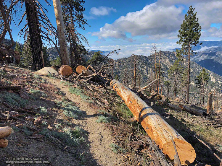
In 2009 the Station Fire ran up the ribs and gullies of the south face of Mt. Waterman, ravaging some slopes, but leaving others untouched. Many trees were killed, including some old growth incense cedars and Jeffrey pines. On a run in March 2017 I counted more than 40 dead trees down on the trail. At that time a few trees had already been cleared from the trail and in the following months many more would be.
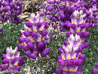
Grape soda lupine along the PCT in Cooper Canyon. Click for larger image.
One particularly hard hit area is about a half-mile west of the Twin Peaks Trail junction. Last Summer dead trees blocked the trail in this area and in places were stacked one on top of another. The title photo is of the same area after the trail was cleared.
On a previous run I’d photographed the growth rings of a burned Jeffrey pine above the Twin Peaks Trail junction and estimated the total at about 325. Today, a recently cut Jeffrey pine just west of the Twin Peaks Trail looked like it might be considerably older. A very rough count of its rings totaled 475.
On this run the Three Points – Mt. Waterman Trail was almost entirely clear of trees and in the best condition I’ve seen since the Station Fire. Many thanks to Alan and the SoCal Hikers & Trail Builders for restoring this trail!
I can’t think of a tougher stretch of trail in the San Gabriel Mountains. From Mt. Baldy Village, the Bear Canyon/Old Mt. Baldy Trail climbs 5800′ in 6.7 miles to the 10,064′ summit of Mt. Baldy (Mt. San Antonio). The route is as rewarding as it is difficult, with inspiring views and interesting terrain.
I had hoped for some remnant clouds from Friday’s storms, but didn’t expect to be using my windshield wipers driving to the trailhead. The dark gray clouds piled against the mountains had a scuddy, stormy look, and I had a difficult time convincing myself that it was just a deep marine layer. But the sun was shining when I parked at the bottom of Bear Canyon Rd. and began to walk up the steep, cabin-lined street.
Clouds pushing up San Antonio Canyon and the southeastern slopes of Mt. Baldy.
The last time I had been on the trail was July 2004, during the Baldy Peaks 50K. That day we started at the parking lot at Icehouse Canyon, and over the course of the race climbed Mt. Baldy twice. The first time from the Village, and the second time from Manker Flats. Today I wasn’t in a race, and would be completely satisfied to climb Mt. Baldy just once.
Running up a moderate section of trail below Bear Flat, I tried to figure out the last time I had run down the Bear Canyon Trail. Sometime before the Baldy Peaks race. I wasn’t sure how long it had been, but long enough to forget how grueling steep downhill can be.
My thoughts are interrupted by a pair of hikers coming down the trail. I ask how they’re doing, and am surprised to hear, “not so good.” They look disappointed and tired, and anxious to get down to the car. I wonder if one of them is ill, or if they just underestimated the difficulty of the trail.
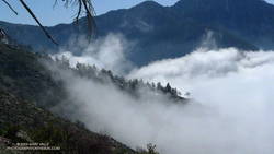
A half-mile later I’m crossing the creek at Bear Flat (~5500′). This is where the fun begins. Here the trail switchbacks up a steep east-southeast facing chaparral slope to Mt. Baldy’s South Ridge, gaining about 1500′ in one mile. On a warm day it can be hellish. On a cool day it isn’t easy. Today it is cool. The cloud layer has continued to crawl up the mountain, and it envelops me as I start up the switchbacks.
A little more than a year ago, these slopes were burned in the 2008 Bighorn Fire. I had expected to see black, burned and barren chaparral in the initial stage of recovery, but instead there is substantial growth, comparable to 2-3 years of recovery in chaparral at a lower elevation.
Click for video snapshot from Mt. Baldy’s South Ridge.
At an elevation of about 7000′, I climb out of the clouds and into the sun. What a day! Benign clouds lap at the mountainside, enhancing already dramatic views. Between 7000′ and 9000′, I encounter several hikers and briefly chat with one veteran hiker, who tells me this is his friend’s intro to hiking! It is a busy day for this trail, and I’m guessing I’ll see more hikers when I descend.
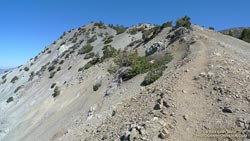
Above 9000′ the open forest of Jeffrey, Sugar and Lodgepole pine becomes more sparse and stunted. The route feels more alpine and climbs onto the rocky crest of an exposed ridge (HD Video Snapshot). A little higher, a large patch of snow accentuates the “you’re getting near tree line” feeling.
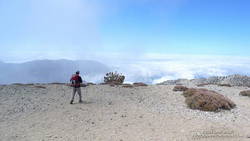
Hiker leaving the summit of Mt. Baldy, and starting the descent of the Ski Hut trail.
Approaching Baldy’s summit, I’m surprised to see a wispy cloud had also ascended the peak and is waiting for me to catch up. On top there seems to be a mix of young and old, veterans and first-timers, excitement and exhaustion. After a few minutes on the summit, I run over to West Baldy. Then it is gravity’s turn, and I take the first steps down the slope.
The descent is just as extraordinary as the ascent, with far-reaching mountain views over a sea of clouds. On an exposed section of the ridge at about the 8500′ I happen on a Sugar pine with a spiral scar from a lightning strike. Such trees are disturbingly common. There is a Jeffrey pine at about the same elevation on Mt. Baldy’s North Backbone Trail with a similar lightning scar.
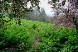
One, two, ten… Will the switchbacks ever end? Finally, through the trees I see the brilliant green of the ferns at Bear Flat. Running becomes easier. I pick up the pace, and in a few minutes turn onto the asphalt of Bear Canyon road.
Here is an interactive, 3D terrain view of a GPS trace of my route on the Mt. Baldy’s South Ridge on the Bear Canyon/Old Mt. Baldy Trail. The map can be zoomed, tilted, rotated, and panned using the navigation control on the right. Track and placename locations are approximate and subject to errors. Snow, ice, poor weather, and other conditions may make this route unsuitable for this activity.