Category Archives: photography

Kern ‘Four Mile’ River Trail

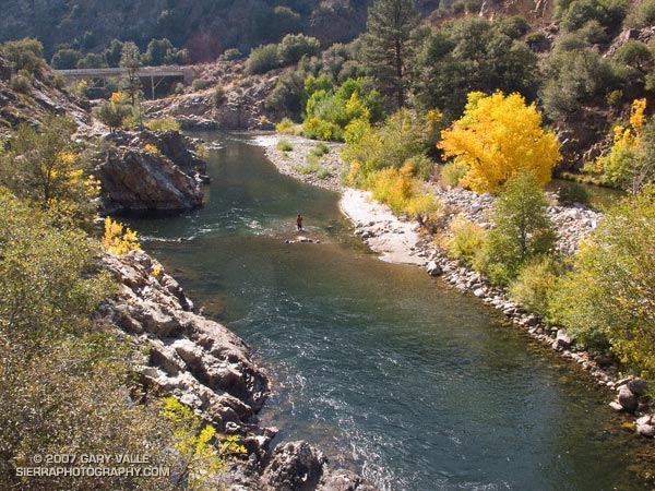
Kern River from the River Trail, upstream of the Johnsondale Bridge.

One of many excellent hikes/runs in the Southern Sierra, the River Trail starts at Johnsondale Bridge — about 19 miles north of Kernville, California on highway Mountain 99 — and follows the river north 4 miles to Four Mile rapid. Here the trail turns east and works up to the Rincon Trail.

This section of the Kern River is part of the beautiful and challenging Forks of the Kern class V whitewater run. Numerous class IV rapids and the class V rapids Carson Falls and Confusion are found on this reach. In the Spring and Summer expert kayakers and rafters may be seen maneuvering among the many boulders and drops. (A Forest Service permit is required to paddle the Forks.)

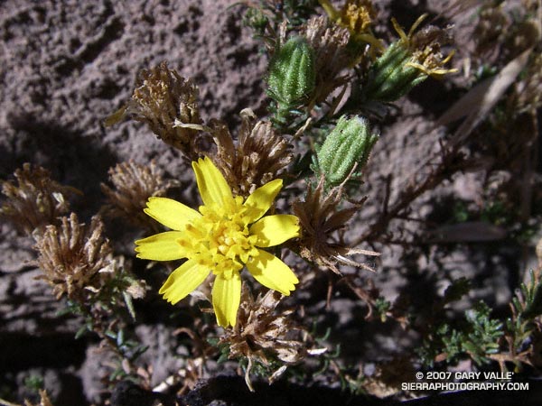
Santa Susana Tarweed

Santa Susana tarweed (Deinandra minthornii)

Listed by the California Native Plant Society as being rare, threatened, or endangered, Santa Susana tarweed (Deinandra minthornii) can be found where sandstone outcrops of the Chatsworth formation occur, such as in the Santa Susana Pass area in the Simi Hills.

This photograph was taken on a run at Sage Ranch on October 1, 2007.
Note: Treated as Hemizonia minthornii in the 1993 Jepson Manual.

Garapito Trail Runs

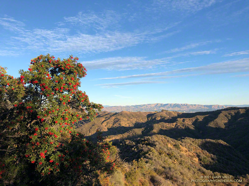
Red -orange berries of toyon along the Garapito Trail

First published October 14, 2007. Updated February 4, 2021.

The numerous interconnecting roads and trails of the eastern Santa Monica Mountains can be combined to create trail runs ranging from a few miles to marathon length or more.

One of my favorite trails in this area is the Garapito Trail — a winding, up and down trail through dense, old growth chaparral. The trail connects Fire Road #30, near dirt Mulholland, to the Eagle Rock Fire road segment of the Backbone Trail, near Eagle Rock. Because it’s such a enjoyable trail, I include it in most of the runs I do from Marvin Braude Mulholland Gateway Park (Top of Reseda). The trailhead is at the southern end of Reseda Blvd., on the San Fernando Valley side of the Santa Monica Mountains.

Each run in the series starts the same way, going up to Mulholland using the single track trail that forks right off the fire road near the Reseda trailhead, and then heading southwest a short distance on Mulholland to Fire Road 30, which works south, up to the Hub.

The shortest run in the Garapito series is the 7.5 mile Garapito Loop. Somewhat longer and more strenuous is the 12+ mile Trippet Ranch Loop. A very demanding run in the series is an approximately 26 mile route out to Saddle Peak and back. The popular run out to Parker Mesa Overlook and back tacks on about 6 miles to any of these routes.

Below are links to 3D, interactive views of GPS tracks of some of the Garapito Series trail runs from the Top of Reseda. The scene can be zoomed, tilted, rotated and panned. Placemark and track locations are approximate and subject to errors.

Garapito Loop Plus Eagle Rock (8 miles)
Trippet Ranch Loop (12.3 miles)
Trippet Ranch Loop Plus Temescal Peak (14 miles)
Trippet Ranch Loop Plus Parker Mesa Overlook (18.6 miles)
Trailer Canyon – Trippet Ranch Loop (17.2 miles)

These are just a few of the many variations that are possible.

Some related posts: Trippet Ranch Loop Plus Temescal Peak; Trail Run to Trippet Ranch, Hondo Canyon and Saddle PeakGo Figure

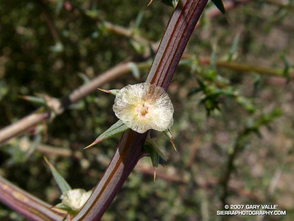
Tumbleweed Blossom

Blossom of tumbleweed (Salsola tragus)

Maybe it’s the result of record low rainfall, or the 2005 Topanga Fire, or a combination of the two — there has been a dramatic increase in the amount of tumbleweed (Salsola tragus) along the dirt roads in Upper Las Virgenes Canyon Open Space Preserve (formerly Ahmanson Ranch).

Like black mustard, and milk thistle, tumbleweed is an invasive plant. According to UC IPM Online tumbleweed is native to southeastern Russia and western Siberia and was first introduced into the United States (South Dakota) in 1873.

The photograph of the tumbleweed flower was taken on a run at Ahmanson Ranch on October 3, 2007.

Some related posts: Dealing With Drought, Milk Thistle Seed Heads, Curly Dock

Southern California 2007-2008 Winter Precipitation Outlook

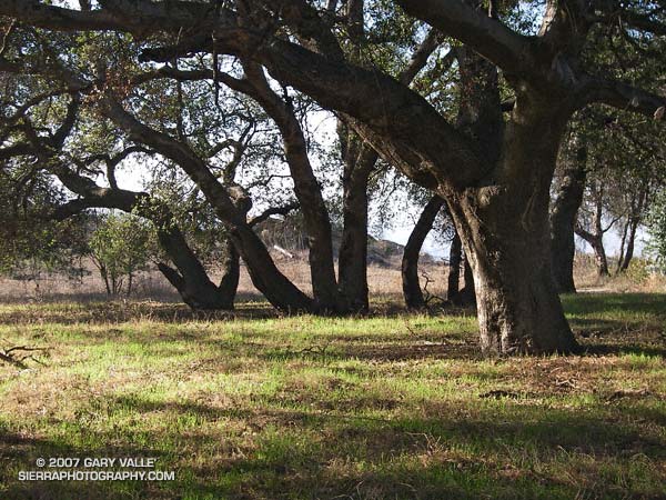
New grass sprouting amid oaks at Sage Ranch on October 1, 2007

Updated January 10, 2008. The ESRL-PSD Composite ENSO plots page was updated today to correct an issue that resulted in the wrong set of years being used for its Winter La Nina composites. As a result the La Nina composite precipitation map in this post has been updated.

Grasses sprouting as a result of our record setting September rainstorm have brushed our sun parched hills, fields, and woodlands with pleasing hints of green. Whether these areas will remain green depends on how much rain we receive this Fall and Winter.

According to the Climate Prediction Center’s Weekly ENSO Update, issued October 1, La Niña conditions are present across the tropical Pacific and are likely to persist through early 2008. As a result, several longer range U.S. precipitation outlooks are similar to this Nov-Dec-Jan Precipitation Outlook, issued September 20 by the CPC.

The precipitation pattern projected for the western U.S. is typical of a La Niña, with an increased chance of higher than normal precipitation in the Pacific northwest and an increased chance of lower than normal precipitation in the southwest.

The September 20 CPC outlook indicates an “equal chance” of below normal, near normal, or above normal precipitation in the Los Angeles area. However, the La Niña has strengthened recently, so the next precipitation outlook may reflect a more pessimistic projection of Los Angeles area rainfall.

As mentioned above, the ESRL-PSD Composite ENSO plots page was updated today to correct an issue that resulted in the wrong set of years being used for its Winter La Nina composites. This updated precipitation map shows the mean Nov-Mar precipitation for the U.S. during 9 La Niña events from 1948 to the present. Note that the average La Niña rainfall indicated for coastal Southern California is in the 7.0-10.5 inch range, rather than the  10-15 inch range previously indicated in the ESRL-PSD graphic.

The two driest water years recorded in Los Angeles since 1877 have occurred in the last seven years. During the most recent, from Jul 2006 to June 2007, downtown Los Angeles (USC) measured only 3.21 inches of rain. In that context 10-15 inches sounds quite wet! We’ll see.

The photograph of new grass sprouting amid oaks is from a run at Sage Ranch on October 1, 2007.