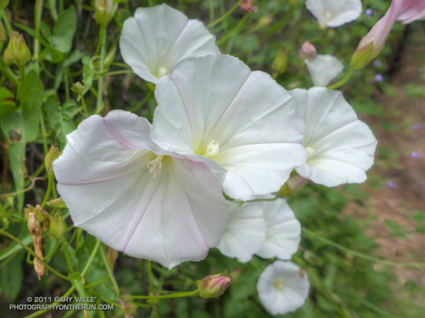
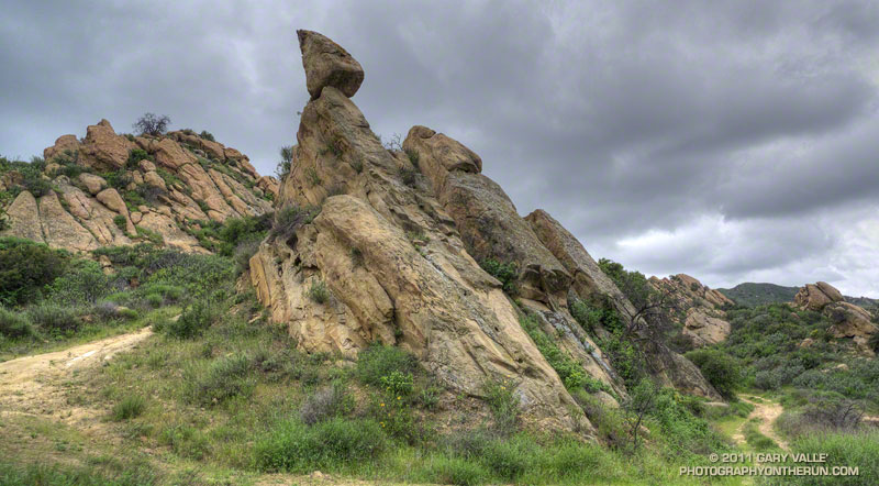
From Sunday’s Trailer Canyon – Trippet Ranch loop.

From Sunday’s Trailer Canyon – Trippet Ranch loop.
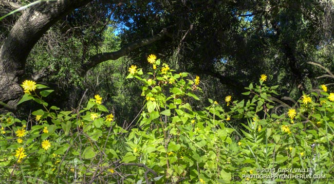
These canyon sunflowers were along the trail in a pretty oak woodland area of upper Las Virgenes Canyon.
I had been kneeling when I took the photo, and as I stood up, turned off the camera and started to take a couple of strides up the trail, was startled to see the large white face of a barn owl headed toward me. The bird wheeled and turned in a patch of sunlight, showing its broad wings and exquisite apricot-orange coloration. Silently, it flew to a nearby tree.
I was a little surprised it had not flown farther away and looked to see if I could get a photo. Nope — the owl had had enough, and flew to a more distant tree. At that instant a small squirrel came scrambling down the oak branch from where I had first seen the owl fly.
I apologized to the owl, told the squirrel he owed me one, and continued up the trail.
Related post: Hawk, Bobcat, and Rabbit
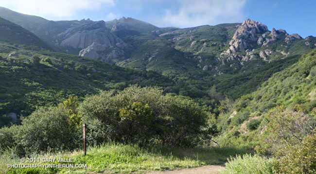
The Wendy Dr. trailhead in Newbury Park is a gateway to some of the most scenic and spectacular trail runs in the Santa Monica Mountains. Runs, hikes and rides on the extensive and diverse network of trails can range from a few minutes, to many miles and hours.
Today my run was of the “few hours” variety. The weather in Pt. Mugu State Park was perfect for a longer run — partly cloudy, light winds, and the temperatures ranged from the high 40s in the morning to the high 60s midday.
La Nina or El Nino, rain seasons as wet as the 2010-11 season are relatively rare. The wet weather produces a cascade of effects, resulting in conditions that might not be seen again for years. Streams that had not run for years were flowing; numerous wildflowers were blooming; the chaparral and other plant communities, and their inhabitants, were flourishing. I did not want to miss anything.
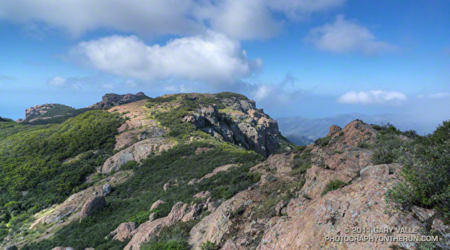
With that thought in mind, my route took me up and over Boney Mountain and Tri Peaks to the Backbone Trail, and then down the Chamberlain Trail and Old Boney Trail to the Serrano Valley Trail. After running through resplendent Serrano Valley, I continued down Serrano Canyon, crossing the creek 15 times, all the while trying to avoid the lush growth of poison oak along the trail. Even the miles returning up Sycamore Canyon were enjoyable, and involved a few stream crossings. The Upper Sycamore Trail and Danielson Road led back to Satwiwa and the trailhead.
On this particular day it was as fine a trail run as I have done, and probably the most scenic loop I’ve done in the Santa Monica Mountains.
Some related posts: Western Rim of Boney Mountain, Conejo Valley Sun and Boney Mountain Clouds
Here are a few additional photographs from the run:
 Boney Mountain NW Ridge 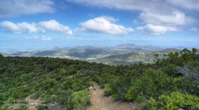 Chamberlain Trail 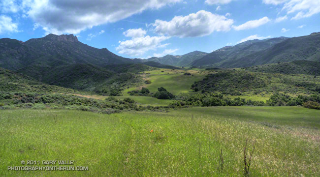 Serrano Valley Loop Trail |
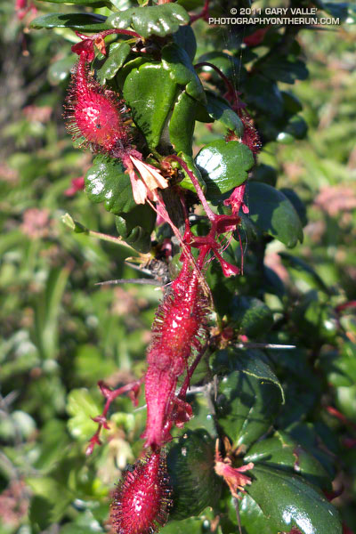 Fuchsia Flowered Gooseberry 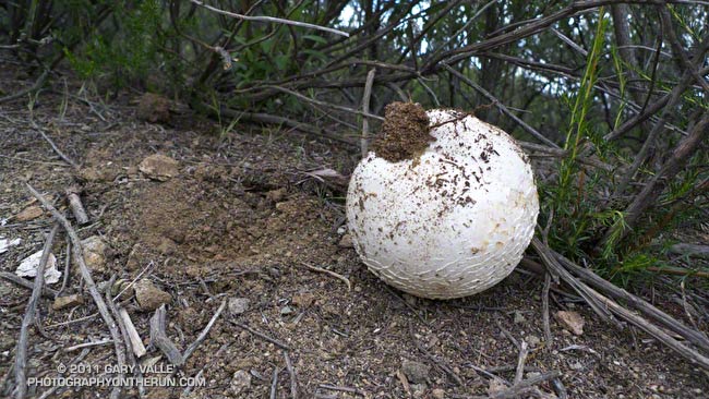 Puffball 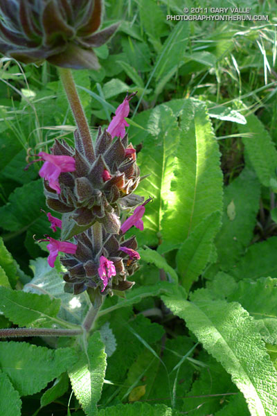 Hummingbird sage |
This weekend I decided to give my legs a break and instead of 9 pounds per foot of ski, binding, boot and climbing skin, treated them each to 13 ounces of running shoe. I was thinking about it the other day — skiing up San Jacinto with my tele gear is a little like strapping two 5 lb. bags of sugar to each foot, going up to (on average) 9,500 feet, and then climbing 4,000 or so stairs. I either need to get lighter gear, or go back to using my Europa 77s!
Today’s run was an elongated loop through one of the more isolated and rustic areas of upper Las Virgenes Canyon. From the Las Virgenes trailhead of Upper Las Virgenes Canyon Open Space Preserve the 14.5 mile route followed upper Las Virgenes Canyon and Bell Canyon roads to the overgrown (and easy-to-miss) single track that leads to the west and connects to the Edison powerline service road. This Park Service PDF includes a map of the area, and this interactive Cesium browser View shows a trace of my route.
After climbing up and over a rocky ridge and down to the junction with the Sheep Corral Trail, the service road continues south along Cheeseboro Ridge all the way back to the Las Virgenes Canyon trailhead. With all the rain, and recent warm weather, Spring was happening in a big way in the chaparral. Over the course of the run I photographed nearly 40 species of plants that were in bloom. Here are a few of the wildflowers:
 Chia 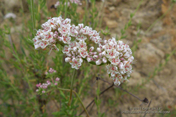 California Buckwheat 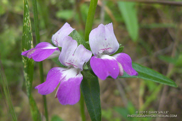 Chinese Houses |
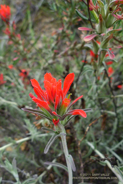 Paintbrush 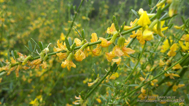 Deerweed 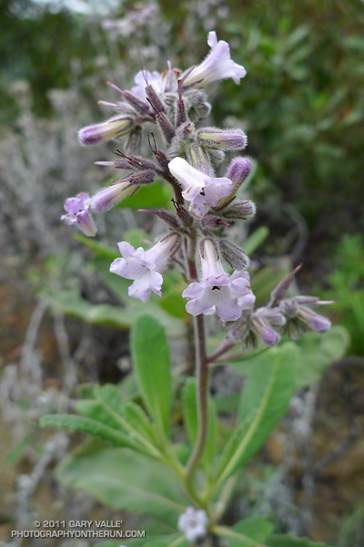 Yerba Santa |
Related post: Upper Las Virgenes Canyon Backcountry
Weather models were forecasting anywhere from 3.5 to 5.5 inches of rain at Van Nuys for the storm coming in tonight, so this afternoon seemed like a good time to get in a run.
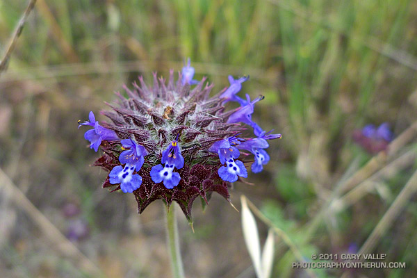
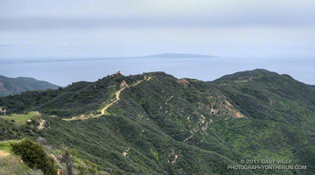
I hadn’t run the Bulldog loop since the Bulldog 50K last August, and needed to catch up on trail conditions, what was blooming, and re-familiarize myself with the difficulties of the Bulldog Climb.
The short version is that the trail along Malibu Creek near the M*A*S*H site wasn’t flooded, but would be in the next 24 hours. Tree poppy, nightshade, hummingbird sage, woolly blue curls, ceanothus and paintbrush were blooming. And the Bulldog Climb was still hard.
It looked and felt like the day before a big storm. Temps were cool, and there was a thick deck of high clouds. Along the crest between the Castro “T” and the Malibu Bowl landslide the wind was blowing in strong gusts from the ESE, and it looked like the clouds might lower, thicken, and unleash a torrent at any time.
Near the end of the run, descending to Tapia Park, I was surprised to see my shadow and some blue sky. That didn’t last for long. By 7:00 the first drops of what would be a record-setting storm started to dot the driveway.
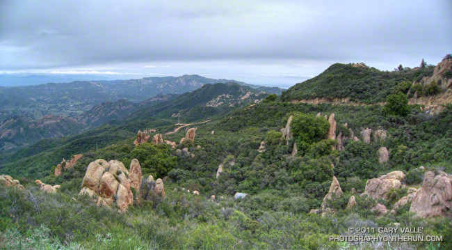
The title photo is a view east along Castro Crest and Mesa Peak Mtwy, and the route of the Bulldog Loop. Saddle Peak is in the distance. Here are a few additional photos. Click for a larger image and description:
 Mesa Peak Mtwy 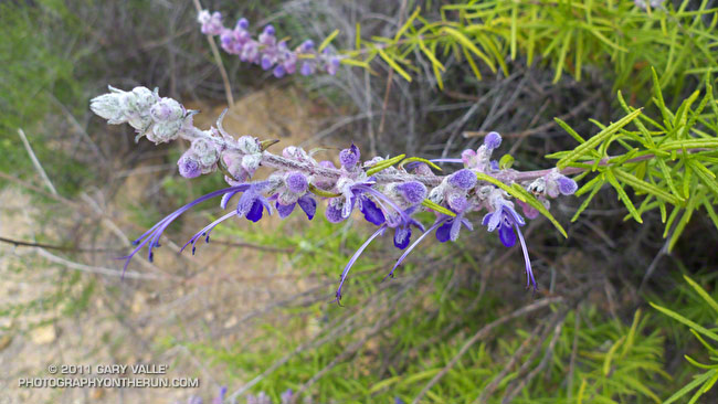 Woolly Bluecurls 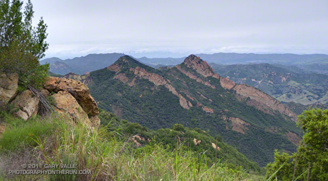 Brents Mountain |
Some related posts: Bulldog 50K 2010 Notes, Malibu Creek State Park Scenic Loop, Bulldog Loop and the Corral Fire
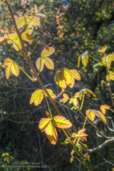
Two consecutive years of more or less normal rainfall is already producing lush growth, numerous wildflowers, and lots of poison oak along the lower elevation trails of Southern California.
These fresh, new leaves of poison oak are along the Phantom Trail in Malibu Creek State Park.
Related post: Sweet Smell of Poison Oak