Category Archives: san gabriel mountains

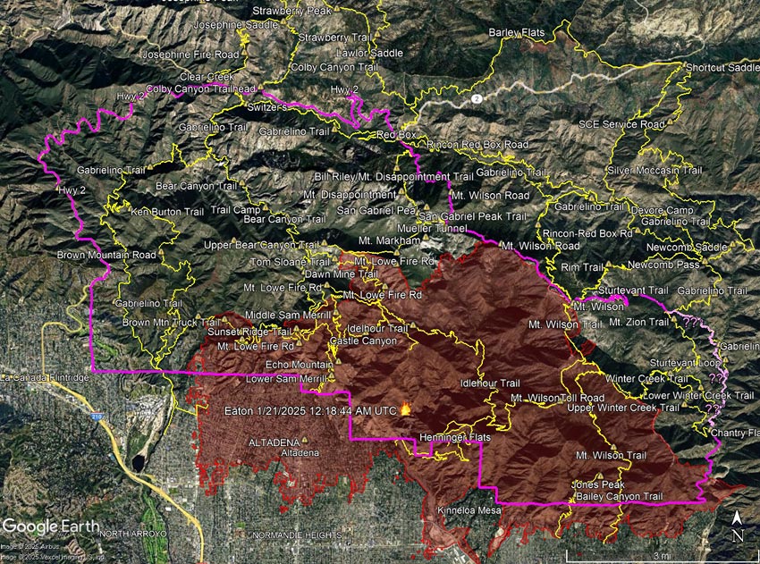
Eaton Fire Perimeter, Approximate Closure Boundary, and Some Area Trails

Eaton Fire Perimeter, Approximate Closure Boundary, and Some Area Trails

The information in this post may be incorrect or out of date. For official information see the Eaton Fire incident page on Inciweb, the Angeles National Forest updates on Facebook, and the Angeles National Forest website. The perimeter is from the Wildland Fire Interagency Geospatial Services (WFIGS) Group and National Interagency Fire Center (NIFC).

This interactive, 3D terrain viewer shows the Eaton Fire perimeter, along with GPS tracks of some trails in the area. Also shown is the approximate closure boundary (magenta) as described and depicted in Angeles National Forest Order No. 05-01-25-05 (Jan 29, 2025). The initial view can be changed using the control on the upper right side of the screen, the CTRL key and your mouse, or touch gestures.

Due to inconsistencies in the CLOSED AREA DESCRIPTION in the order, and the boundary shown on the Forest Service closure maps, the eastern boundary of the closure area could not be determined.  For example, the CLOSED AREA DESCRIPTION describes the boundary continuing “south along the Winter Creek Trail” and then “south along the Upper Winter Creek Trail to Chantry Flat Road.” The closure maps published by the Forest Service do not show this.

The Gabrielino Trail in Santa Anita Canyon appears to better match the border depicted in the Forest Service maps. However, because of the low resolution of the Forest Service maps, it is impossible to be sure. There are other inconsistencies as well. For example, in the Forest Service’s overview map of the closure, the Sturtevant Trail is shown as open (green), but in the order, it is one of the trails listed as closed.

It looks like the area that didn’t burn within the Eaton Fire Closure Area may be larger than the area that did burn. When there is a plausible, atypical threat to public safety from the fire, such closures may make sense. However, the trails in these unburned areas often remain part of a long-term closure. Popular trails outside of the Bridge Fire Burn Area, such as the Devil’s Backbone, Ski Hut/Baldy Bowl, South Hawkins, and Hawkins Ridge Trails, are still listed as closed for the remainder of 2025!

The following trails are listed as closed in Forest Order No. 05-01-25-05. Several of these trails are entirely outside of the Eaton Fire Burn Area.

Mount Wilson Trail
Winter Creek Trail (Upper)**
Winter Creek Trail (Lower)**
Idlehour Trail
Castle Canyon Trail
Sam Merrill Trail (Lower)
Sam Merrill Trail (Middle)
Sam Merrill Trail (Upper)
Echo Mountain Trail
Mount Lowe West Trail
Mount Lowe Trail (East)
Tom Sloane Trail
Gabrielino National Recreation Trail**
Bear Canyon Trail**
Ken Burton Trail**
Mount Zion Trail**
Sturtevant Trail**
Sturtevant Loop**

**Outside of Eaton Fire Burn Area. The Winter Creek Trail above Hoegee’s passes through a 60 yd. stretch of the Burn Area at one point.

Trails aren’t just lines on a map. Each and every trail is a valued resource that shouldn’t be closed for years under the guise of public safety, or because the trail happens to be on the wrong side of a section line, road, or other feature that is convenient to use as a closure border.

Hopefully, the Eaton Fire Closure Order will be modified when the Forest Service determines that the threat from the Eaton Fire  has passed.

Related post: Bridge Fire Perimeter, Approximate Closure Boundary, and Some Area Trails

The Angeles National Forest (Mt. Disappointment) Trail Race Returns

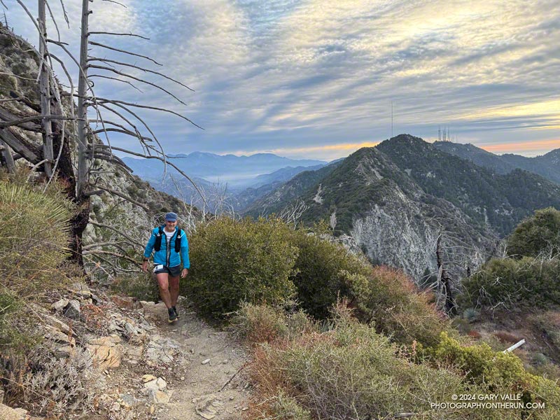
Runner on the San Gabriel Peak Trail during the 2024 ANFTR 25K, working up toward Mt. Disappointment. Mt. Wilson is the peak with the towers. West Fork is in the canyon on the left.
Runner on the San Gabriel Peak Trail, working up toward Mt. Disappointment. Mt. Wilson is the peak with the towers. West Fork is in the canyon on the left.

Even in Southern California the weather can be a little fickle. Just two weeks ago, heat had been one of my concerns for the No Name 50K. During that race the temperature reached into the mid-80s. Heat definitely wasn’t an issue for this morning’s race on Mt. Wilson. Several days out one computer model had forecast sleet and a temperature of 32°F! Instead, at the start of the race runners were treated to a spectacular sunrise and a temperature of around 40°F.

After a five year hiatus, the Angeles National Forest (Mt. Disappointment) Trail Race is back. Started in 2005 by R.D. Gary Hilliard, this was the 14th running of the highly regarded event. Today we ran the 25K course, but in 2025 a 25K and 50K will be offered.

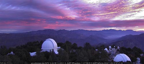
Sunrise on Mt. Wilson (thumbnail)
Sunrise from the ALERTCalifornia Mt. Wilson East Camera a few minutes after the start of the race. Click for larger image.

Whatever the distance, a hallmark of any ANFTR/Mt. Disappointment courses is that it starts and ends on top of Mt. Wilson (5739′). While not particularly high, the altitude is just high enough to take the edge off a runner’s performance. Many a runner has underestimated the difficulty of the final five-mile climb from West Fork to the top of Mt. Wilson — especially on a hot day in July or August.

My race went well, and I left enough in the tank to enjoy the climb up the Kenyon Devore Trail!

Thank you Gary and Pam for your dedication, passion, and the hours and hours of work required to put on a quality event! And thanks also to all the volunteers, runners, and others that support the race.

Here’s a high-resolution, interactive, 3D-terrain view of the ANFTR/Mt. Disappointment 25K course.

All the results from 2005 to 2024 are available on UltraSignup.

Next year, Jakob Herrmann will be taking over the reins of the event. The race is on Saturday, September 27, 2025, and registration for the 25K and 50K is already open.

Some related posts:
A Morning Thunderstorm, Debris-Covered Trail, Fast-Paced Fire Road, and Tough Climb on the ANFTR 25K Course!
Another Scorching Angeles National Forest/Mt. Disappointment Trail Race

Bridge Fire Perimeter, Approximate Closure Boundary, and Some Area Trails
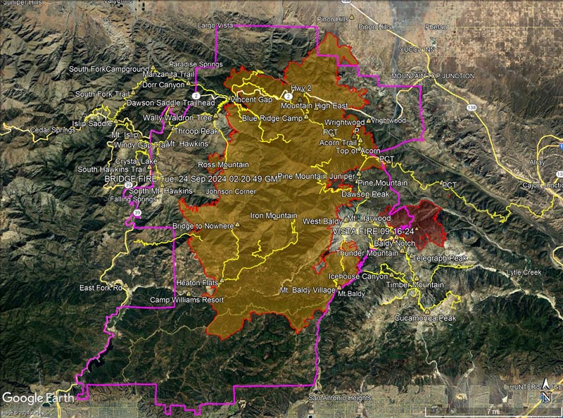
2024 Bridge Fire Perimeter and some trails in the area

October 18, 2024.  Updated approximate Bridge Fire Closure boundary for Forest Order 05-01-24-11.

October 13, 2024. Updated Bridge Fire perimeter. Added the Vista Fire perimeter. Added trails from the National Forest System Trails Feature Layer. Added a “guesstimate” of the Bridge Fire Closure boundary. See below for an explanation.

The information in this post may be incorrect or out of date. For official information see the Bridge Fire incident page on Inciweb, the Angeles National Forest updates on Facebook, and the Angeles National Forest website. The perimeters are from the Wildland Fire Interagency Geospatial Services (WFIGS) Group and National Interagency Fire Center (NIFC) website.

Following are several 3D terrain views of the Bridge Fire perimeter from various perspectives:

Overview of the Bridge Fire perimeter

View of the Bridge Fire perimeter zoomed in on the Wrightwood area.

View of the Bridge Fire perimeter zoomed in on the Mt. Baldy area.

View of the Bridge Fire perimeter zoomed in on the Mt. Baden-Powell area.

The initial view can be changed using the control on the upper right side of the screen, the CTRL key and your mouse, or touch gestures.

As mentioned above, a guesstimate of the Bridge Fire Closure boundary (magenta) for Forest Order 05-01-24-11 (Oct 17, 2024) is now included in the views. The boundary corresponds closely with the PDF map(s) of the closure published on the Angeles National Forest website. There seems to be at least one discrepancy between the Forest Service maps and order description. In the area of East Fork Road, the order description appears to place the closure boundary one section to the west (dashed line). I contacted the Forest Service for clarification, but have received no reply.

Multi-year fire closures have become common on the Angeles. Generally, trails and the land affected by trail are is a minuscule percentage of the area burned. Some jurisdictions reopen parklands and open space areas weeks after a fire with no apparent negative impact on the area’s recovery. Is there science to support multi-year closures of trails in fire areas?

In some cases, closures include trails that are outside of the fire’s perimeter and didn’t burn. These closures may make sense in the short term — when there is a plausible threat from the fire, such as the recent flare-up east of South Mt. Hawkins. But many times, these unburned trails remain part of a long term, multi-year closure. Sometimes it seems the trail just happens to be on the wrong side of a section line, road, or other feature that is convenient to use as a closure border.

Trails that were closed in Forest Order 05-01-24-10, but now appear to be open according to Forest Order 05-01-24-11:

Dawson Saddle Trail
PCT east of Windy Gap to Vincent Gap

Trails outside of the Bridge Fire and Vista Fire perimeters that remain closed according to Forest Order 05-01-24-11:

Devil’s Backbone Trail
Hawkins Ridge Trail
South Hawkins Trail

The following summits are within the updated closure area, but did not burn and are accessible via unburned trails. Peaks marked with ** are just inside of the closure boundary:

Mt. Baldy
Mt. Baden-Powell**
Mt. Burnham**
Mt. Hawkins**
Throop Peak
Sadie Hawkins
South Mt. Hawkins

For those of us passionate about the outdoors, the closure of any trail or peak is a loss. But the long term closure of the most popular trails and peaks in the San Gabriel Mountains without justification would be indefensible. Hopefully, the closure order will be modified when the Forest Service determines the threat from the Bridge Fire is past.

Feeling a Little Like Fall on the Three Points – Mt. Waterman Loop

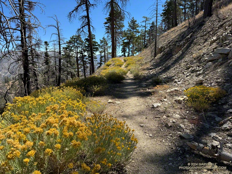
Rabbitbrush along the PCT east of Winston Peak.

Even with the warm weather, it was beginning to feel a little like Fall in the San Gabriel Mountains. Yellow goldenrod and red California fuchsia bloomed along the trail,  and the canyon live oaks were covered in green acorns.

Mt. Pacifico (7124') from low on the Three Points - Mt. Waterman Trail.
Mt. Pacifico (7124′) from low on the Three Points – Mt. Waterman Trail.

I was back on the Three Points – Mt. Waterman Loop and having a better time of it than in June. The June run had been near the Summer Solstice, with in-the-sun temperatures reaching 100°F. Today’s run was a few days away from the Fall Equinox. Not only was the temperature about 10 degrees cooler, the sun was lower in the sky and less intense.

But much was the same as in June. There was still plenty of whitethorn on the first couple of miles of the Three Points – Mt. Waterman Trail — and a few prickly passages for anyone wearing shorts and short sleeves. Some trailwork had been done higher on the mountain, but a few fallen trees were still on the trail. Most of these were easy to step over, around, under, or through.

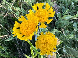
Late season Bigelow's sneezeweed at Waterman Meadow.
Late season Bigelow’s sneezeweed at Waterman Meadow.

There was very little monsoon rainfall this Summer, but consecutive wet rainy season and a tropical storm had already recharged the seeps and small creeks. The creeks were only slightly lower than in June, and the places that had been wet and muddy in June were still wet and muddy. At Waterman Meadow, a few late-season blooms of sneezeweed beamed yellow in the midst of the greens of the grass and ferns.

The high point of the Three Points – Mt. Waterman Trail is near the junction with the trail to the summit of Waterman and the trail that comes up from Highway 2. It’s at an elevation of about 7686′. Including detours to get around downed trees, the junction is a bit more  than 6 miles from Three Points. The junction marks the start of a nearly 2000′ descent over 4.7 miles to the PCT in Cooper Canyon.

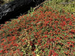
A dazzling display of California fuchsia along the Burkhart Trail.
California fuchsia along the Burkhart Trail.

This morning, I encountered no one on the Three Points – Mt. Waterman Trail and only one pair of hikers on the normally busy Mt. Waterman Trail. Buckhorn Campground was nearly empty. I topped off my water at a convenient faucet at the campground and then started down the Burkhart Trail.

The creek in the canyon below the Burkhart Trail happily bubbled and gurgled, its water easily outpacing me as I descended to the PCT. Some work had been done on the trail to help those hiking to Cooper Canyon Falls cross the muddy seeps. Near one seep, a patch of dazzling red California fuchsia contrasted sharply with the coal black of a tree burned in the Bobcat Fire.

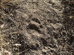
A black bear track on the Three Points - Mt. Waterman Trail.
Black bear track.

I wouldn’t say the trail has been abandoned, but it’s been quite a while since any trailwork has been done on the PCT between the Burkhart Trail and Cloudburst Summit. A mass of trees is still blocking the trail near the creek crossing at the bottom of Cooper Canyon. As expected following a fire, trees continue to fall on the trail. Parts of the trail along the creek or near seeps are overgrown with “Hey Bear!” willows.

The PCT in Cooper Canyon has been isolated by the 19-year closure to protect the critically endangered mountain yellow-legged frog. In December 2005, Angeles National Forest “temporarily” closed the Williamson Rock climbing area and the PCT between Eagle’s Roost and the Burkhart Trail. This Summer, the Forest Service extended the closure to at least December 31, 2026.

It’s difficult to accept that the Forest Service, conservation groups, and involved agencies have not agreed on a solution. Can’t the short stretch of the PCT that impacts frog habitat be rerouted? Only a few climbs at Williamson Rock directly impact the frog habitat. Does the entire climbing area need to be closed? Can’t bridges, walkways, and other structures be used to protect and even enhance frog habitat? There has to be solution. In 2005, I could not have imagined that 21 years later Williamson Rock would still be closed, and I might not have the opportunity to climb there again.

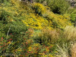
Goldenrod and California fuchsia cover a slope along the PCT in Cooper Canyon.
Goldenrod and California fuchsia along the PCT in Cooper Canyon.

On this run, it wasn’t necessary to stop at Cooper Camp to cool off. Although the temperature was in the 90s on the south-facing slopes traversed by the PCT, there was a bit of a cooling breeze. This and the lower sun angle made it far more pleasant than earlier in the year.

Continuing up the trail above Cooper Camp, I could see smoke from a flare-up on the north flank of the Bridge Fire. Closures related to the Bridge Fire will further isolate the Cooper Canyon segment of the PCT. Multi-year closures are common on the Angeles, and often the closures include popular trails that were not burned.

From Cloudburst Summit, it’s a little over five miles of (mostly) downhill to Three Points. Most of the running is on an old road bed. Although it can be tedious — especially when it’s hot — the segment is relatively fast-paced. Depending on the year, there are usually a couple of places to soak a hat and pour water over your head. But, as I learned one hot day, a rattlesnake may take exception to your intrusion!

Some related posts:
Bridge Fire Perimeter and Some Area Trails
Facing a Future of Runaway Wildfires in Southern California
Hot Weather on the Three Points Loop
Williamson Rock

Facing a Future of Runaway Wildfires in Southern California

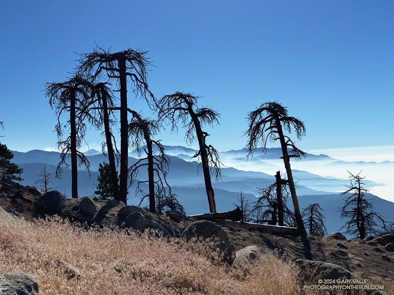
A group of Jeffrey pines on Mt. Waterman killed by the Bobcat Fire with smoke from the Bridge Fire in the distance.

It was a sobering sight. I had stopped at a point on Mt. Waterman burned by the Station Fire in 2009 and the Bobcat Fire in 2020.

To the east, smoke from the Bridge Fire filled the canyons and clung to the ridges between Mt. Baldy and the East Fork San Gabriel River. A group of skeletal Jeffrey pines, once full and green, stood starkly in the foreground.

Another devastating fire had stormed through the San Gabriel Mountains, destroying homes and ravaging the forest and all that lives within. Not far away, the Line and Airport Fires were also burning, the extent of the three fires totaling over 117,500 acres.

Conventional methods of land and fire management usually do not prevent the rapid spread of a fire when forest or weather conditions are extreme — and extreme conditions are now the norm.

Incremental changes to long-established policies will not be enough to prevent runaway wildfires. Novel approaches must be considered, researched and evaluated. New tools and technology, including AI, need to be more widely applied. The hesitancy to spend money proactively must be overcome.

Today, it is difficult to do a hike or run of more than a few miles in the foothills or mountains of Southern California without passing through an area that has been burned in the past 25 years. In 50, 100, or 200 years what will the outdoor experience be? Will conifers only exist in widely scattered stands? Will the ecology be forever compromised?

Every effort must be made to mitigate the impacts of runaway wildfires and preserve the nature and ecology of our open space areas and wildlands.

Some related posts:
Bridge Fire Perimeter and Some Area Trails
After the Bobcat and Station Fires: Three Points Loop Around Mt. Waterman
After the Station Fire: Pine Seedling Along the Mt. Waterman Trail
Waterman Mountain: Fallen Trees, Forest and Ferns
After the Station Fire: Three Points – Mt. Waterman Loop

Back to Baden-Powell – August 2024

Thumbnails of a few photos from the 16-mile out-and-back trail run to Mt. Baden-Powell from the Islip Saddle Trailhead.Above are thumbnails of a few photos from the 16-mile out-and-back trail run to Mt. Baden-Powell from the Islip Saddle Trailhead. Click on an image for a larger photo and more information.

I plucked a currant from the bush and popped it into my mouth. In some years, the red berries are little more than a desiccated bit of pulp. This year’s crop was plump, flavorful, and almost could be described as juicy.

Almost two months had passed since I’d been on the PCT between Islip Saddle and Mt. Baden-Powell. Not a lot changed in the routine of the city in those seven weeks. The street sweeper still came by on Wednesday mornings, the trash was picked up each Friday, and the neighborhood looked pretty much the same as it did at the end of June.

But a lot happens along a mountain trail in seven weeks. The Poodle-dog bush was now wilted and brown. Currants and elderberries had ripened. Rabbitbrush, the messenger of Fall, was blooming, its yellow replacing the pastel purple of Grinnell’s beardtongue. Chinquapin bushes were covered in spiny, green nut burs. Pendulous, resin-coated cones hung from the ends of the long limbs of the sugar pines.

Angeles Crest Highway was still closed between Islip Saddle and Vincent Gap. Gone was the noise of vehicles on the road below, replaced by the sound of the wind in the trees and the occasional outburst of a Clark’s nutcracker.

At the saddle near Mt. Hawkins, I stopped to photograph the stump of the Mt. Hawkins lightning tree. Perhaps weakened by one or more lightning strikes, this Jeffrey pine lost its crown during the Winter of 2019-2020. Now without bark, it’s easy to see that lightning followed the spiral grain of the tree. This tree has a right-hand spiral grain.  When viewed from above, it is twisted counterclockwise.

Once again, the visibility from the summit of Mt. Baden-Powell was excellent. San Gorgonio (57 miles) and San Jacinto (72 miles) could be seen far to the east.

It was windy and cool at higher elevation. The National Weather Service’s Wind Chill Temperature formula doesn’t apply to temperatures over 50°F, but with bare arms and legs, it can be surprisingly chilly when there is a strong wind and the temperature is in the 60s. Had I not been pushing the pace, I would have needed to pull the sleeves and shell from my pack.

Here is an interactive, high resolution, 3D terrain view of the out and back from Islip Saddle to Mt. Baden-Powell. An alternative start at the Windy Gap Trailhead in the Crystal Lake Recreation Area is also shown. Starting at this trailhead adds about 800′ of elevation gain. The map can be zoomed, tilted, rotated, and panned using the navigation control on the right. Track and placename locations are approximate and subject to errors. Poor weather and other conditions may make this route unsuitable for this activity.

Some related posts:
Out and Back Trail Run from Islip Saddle to Mt. Baden-Powell – July 2024 Update
Mt. Hawkins Lightning Tree
It’s Mid-July And There Is Still Snow in Los Angeles County!