Category Archives: trails|san gabriels

Blue Skies and Short Sleeves on Strawberry Peak

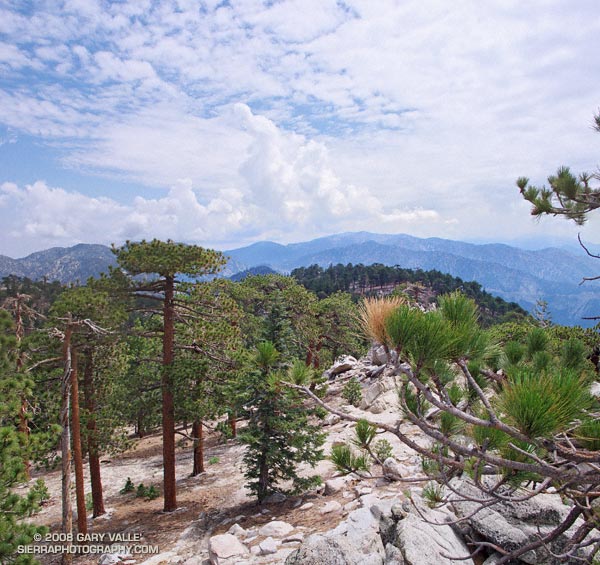
Mt. Baldy from near the summit of Strawberry Peak, in the San Gabriel Mountains.

My legs were still pretty worked from the Boney Mountain Half Marathon. Instead of backing off of the pace on my weekday workouts, I had continued to experiment with a change in running technique that was resulting in faster paced runs. I was excited about the increase in speed, but logging fast times on oft-run courses after a strenuous race doesn’t equal recovery. Neither does blasting up a peak in the San Gabriel Mountains.

But it was one of those impossible to ignore, blue sky, short-sleeved Southern California Winter weekends. This would be an unprecedented eighth straight January day that the high temperature in Los Angeles exceeded eighty degrees. In the yin yang of weather, the western half of the U.S. has been enjoying unusually warm temps, while the eastern half of the country shivered.

Taking maximum advantage of the good weather, yesterday I had done a little kayaking on the Kern River, this morning some rock climbing at Stoney Point, and now we were huffing and puffing up Strawberry Peak (6164′) — and doing it “for time.”

We had started at Red Box, the shortest and technically most moderate way to climb the peak. By this route it’s about 3.4 miles to the summit, with an elevation gain of roughly 1600 ft. About two-thirds of that distance is well-graded trail, the rest is steep use trail up a broad, brush covered ridge.

About halfway between Lawlor Saddle and the summit of Strawberry it became plainly and painfully evident that my legs had given their all. I complain. Miklos — always sympathetic — asks why I can’t go any faster.

On the final steep push to the summit ridge I try a different tactic to slow the pace, and tell a story about an unbelievably angry and aggressive raccoon I once encountered near here. But like President Jimmy Carter’s rabbit incident, it loses something in the telling. Redlined, we crest the summit ridge and sprint (relatively speaking) toward the summit.

On the summit, there is not a breath of wind. The view is exceptional. To the southwest, sunlight gleams on the waters of the Pacific near Palos Verdes, and to the west snow gleams white on Mt. Baldy. Some 90 miles distant, near Palm Springs, is the asymmetric silhouette of Mt. San Jacinto.

Soon we’re headed down. As I drop below the summit ridge, a snowball whizzes past my ear, crashing on the trail ahead. It has been warm and dry for weeks, but remarkably, there are a few patches of snow. It is a reminder that Winter is not over, and like the snow, is lurking in the shadows.

Twenty-Two Miles and Two Classic Climbs

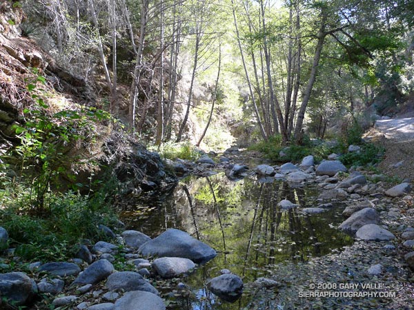
The West Fork San Gabriel River at the Rincon-Edison road crossing.

We stopped for a few moments at the river crossing, where water stood in pools waiting for Winter rain. Instead, cold air flowed down its course, cool and refreshing. From this point there would be little shade. Rarely cold, the climb out from the West Fork San Gabriel River to Shortcut Saddle is often warm, and sometimes debilitating.

Miklos, Krisztina and I were doing the Shortcut Saddle – Mt. Wilson loop — an approximately 22 mile loop that includes two memorable climbs from the Mt. Disappointment 50K and 50M runs. The loop also incorporates the Rim Trail, an adventurous trail that is rough, steep, and washed out at points, but also includes long stretches of excellent trail running. The route starts with almost four miles of downhill on the the Silver Moccasin Trail — a good warmup and a great way to start a trail running day.

Thankfully, today the weather was cool and the Fall shadows long. This translated to more running and a faster pace up Rincon-Edison road. Even so, we were happy to reach the point where the Silver Moccasin Trail shortcuts the last long switchback of the road, and followed this more direct route up to the trailhead.

Our variation of the climb from the W.F. San Gabriel River to Shortcut Saddle on the Rincon-Edison Road was about 5.6 miles long, with an elevation gain of about 1925 ft.  The climb from the W.F. San Gabriel River at West Fork campground up the Gabrielino and Kenyon DeVore trails to the Mt. Wilson parking lot worked out to about a 2550′ elevation gain in 5.2 miles. The total elevation gain for the loop is about 4500′.

Related posts: Angeles High Country, Mt. Disappointment 50K 2008 Notes

Mt. Disappointment 50K 2008 Notes

North face of Strawberry Peak from near the junction of the Strawberry and Colby Canyon trails.

Note: The Mt. Disappointment Endurance Run is now the Angeles National Forest Trail Race.

Updated 8/05/09. Added browser view of GPS trace of the course. Uses Google Earth plugin.

Updated 8/20/08. Added Split Rank listings (PDF) for 2007 50K and 50M, and related comments.

Winding down the precipitous Mt. Wilson road, I thought about the run ahead. To my left granite and pine glowed golden in the morning sun, and to my right the mountain plunged in long shadows, 2000′ into the canyon of the West Fork San Gabriel River.

In a few hours I would be somewhere down in that canyon, plodding along sun-baked Red Box road. By then the temperature would be in the mid-eighties, but in the full sun it would feel like a hundred. That would be around mile 23. I kicked a pebble and winced as it almost hit the heel of the runner in front of me. Only at mile 1-something, there were a lot of miles to go.

This was the fourth running of the Mt. Disappointment 50K, and my fourth as well. If ever a race route mirrored the character of its organizer, the Mt. Disappointment Endurance Runs reflect the tough and tenacious character of race director Gary Hilliard. Starting and ending near the summit of 5710′ Mt. Wilson, the figure-8 50K course is a challenging mix of mostly single track trails and dirt roads with an honest 5800′ of elevation gain/loss. A very difficult 50 mile option was added in 2007, and is a favorite of runners training for the Angeles Crest 100.

Even for the experienced trail runner, the Mt. Disappointment 50K is no gimme. Consider the following stat:


Nearly half (44%) of the 5800′ of elevation gain is in the last 5.3 miles of the 31.5 mile race!

Did you push the downhills too hard? Not eat enough? Electrolytes low? Whatever miscalculations have been made earlier in the race will be rung up here — ka-ching! The runner that has nothing left for this climb can take hours to complete it.

One possible gotcha is that 8.6 miles of the first 11 miles are downhill, and it is very difficult to resist being swept along by gravity and the crowd. The early enthusiasm of surrounding runners is contagious.  In 2007, I pushed the pace to Clear Creek too hard, and bonked on the backside of Strawberry Peak. I could barely run. The uphill stretch on the Strawberry Trail to Lawlor Saddle seemed to go on forever, and even the downhill to Red Box was hard to run. I didn’t see how I could finish the race.

How bad did it get? Out of curiosity I used the splits from the 2007 race to calculate each runner’s rank at each aid station, as well as their time between each aid station. At Clear Creek my rank was 58th, and by Red Box it had blossomed to 82nd. That means between Clear Creek and Red Box I was passed (and encouraged) by 24 runners. Here are the calculated 2007 50K Split Ranks and the 2007 50M Split Ranks. Some splits were missing and had to be estimated — these could be wildly inaccurate.

I did finish, but it wasn’t fun. This year I was determined not to repeat that experience. The plan was to be about 10 minutes slower at the Clear Creek aid station; gain back that time, and more, by Red Box (Aid #3); run the Red Box Rd. segment in about an hour; and then do the final climb back to Mt. Wilson in about 1:40. That would put me closer to my 2005 and 2006 times.

Here are some notes from along the way. Times are from aid station to aid station, and are approximate.

Mile 0 to 5.7 (Red Box Aid #1): Kept the pace easy on the paved road down to Eaton Saddle. Didn’t push the climb up Mt. Disappointment, or on the steep, switchbacking trail down to the Mt. Wilson road. 2007: 59 min 2008: 66 min

Mile 5.7 to 10.8 (Clear Creek Aid #2): Continued to hold back some on the pace down the old roadbed to Switzers. Felt good on the short climb from Switzers to Clear Creek and passed a couple of runners. 2007: 58 min 2008: 63 min

Mile 10.8 to 21.2 (Red Box Aid #3): Ran some of the more gradual uphill stretches on the Josephine Fire Road, but walked the majority of it. Passed a few people. The average grade of the 2.8 mile segment up the Josephine Fire Road is about 520 ft./mile, which is somewhat less than Kenyon-Devore’s 616 ft/mile. Enjoyed some watermelon and chips at the “water only” aid station at the top of the climb (mile 13.4). Time up the hill was 43 minutes — about the same as in 2007. Unlike last year was able to run and enjoy most of the Colby Canyon Trail, as well as the downhill from Lawlor Saddle to Red Box. The uphill stretch from the Colby Canyon Trail JUnction to Lawlor Saddle was still a long — and warm — 1.8 miles. Its average grade is about 411 ft/mile. 2007: 172 min 2008: 150 min

Mile 21.2 to 26.2 (West Fork Aid #4): In previous years this section has been the most difficult for me, and it was again this year. I could whine about the heat, but I think this is where extra training miles would make a big difference. I was happy to see the creeks running again this year, and stopped a couple of times to dump water on my head. Ahhhh… 2007: 66 min 2008: 61 min

Mile 26.2 to 31.5 (Finish on Mt. Wilson): By the time I got to the West Fork aid station, I was ready for something other than downhill. At the aid station I gulped down three cups of defizzed Coke and some water, and refilled one bottle with Heed and the other with ice and water. I still had two GU’s for quick energy later in the climb. I was able to run part of the 1.5 miles up the canyon to where the Kenyon DeVore trail splits from the Gabrielino trail, and the 3.1 mile Kenyon-Devore trail went well. Many of my long trail runs this Summer — in the Sierra, San Gabriels and on San Gorgonio — have been on steep terrain, and that, along with a slower start, probably helped here. 2007: 112 min 2008: 100 min

Overall, my time was 27 minutes faster than in 2007. But that’s just a figure on paper and doesn’t begin to describe how much better I felt during the race, and how much more I enjoyed it. Start slow, start slow, START SLOW is an ultrarunning adage we all know, but in the fervor of race it is often one of the first maxims that is forgotten.

Again this year, Gary Hilliard and crew made sure everything was just so — trails, aid, awards, finish line food, 2000 lbs. of ice, Brooks t-shirt, goody bag and more. Always an adventure, the Mt. Disappointment 50K is a trail running classic. Many thanks to all that make it happen!

Here’s a Google Earth imageGoogle Earth KMZ file, and Cesium browser View of a GPS trace of the course, with mile splits generated by SportTracks. In Google Earth, click on the red icon for the split time, pace and elevation change.

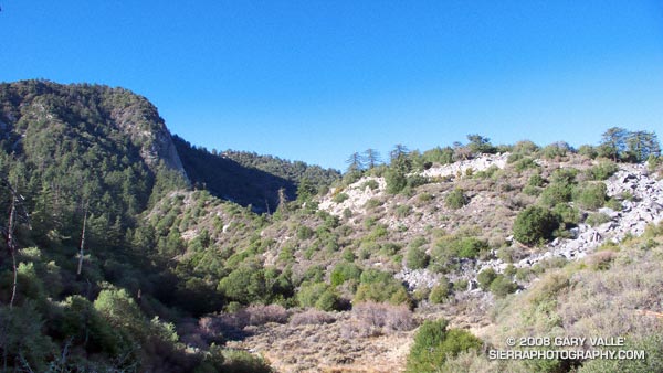
The title photograph was taken at about mile 17.5 on the course, just past the junction of the Strawberry and Colby Canyon trails, and is looking back at the terrain traversed by the Colby Canyon Trail on the north side of Strawberry Peak. It is from November 2007.

P.S. About 20 minutes after I finished the 50K, Jorge Pacheco completed the 50 mile race in an astounding 7:41, crushing the course record he set last year by almost 45 minutes! Full results are posted on the Mt. Disappointment Endurance Runs web site.

Google search: $g(Mt. Disappointment 50K), $g(trail running)
Islip Saddle – Mt. Baden-Powell South Fork Loop

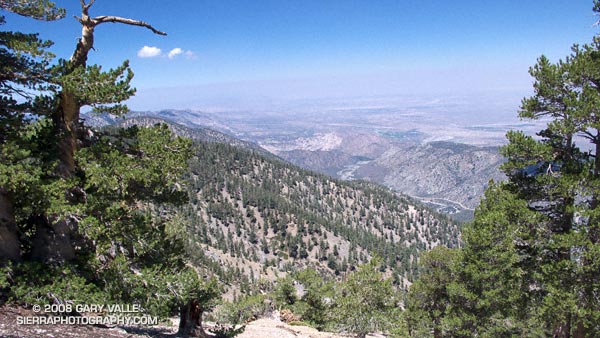
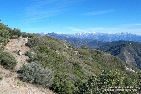
View of the South Fork Big Rock Creek and Devil's Punchbowl from Mt. Baden-Powell.

Maybe it’s because it’s been in the news recently,  but when pondering how to characterize today’s trail run, I couldn’t help but think of the JFK quote, “We do these things not because they are easy but because they are hard…” This loop is arduous, adventurous, and challenging. While the difficulty of this route is one of the things that makes it interesting, it isn’t just the difficulty that makes it appealing.

Part of the appeal is the mix of trails and terrain, and the contrasting environments. The high point of the route is 9,399′ Mt. Baden-Powell. Cool, airy and alpine, it is the home of ancient Lodgepole and Limber pines. The low point of the route is 4,560′ South Fork Campground. On the margin of the Mojave Desert, it is often hot and sometimes torrid. Midday temperatures here can reach well over 100°F. The route encompasses life zones ranging from the Upper Sonoran to the Hudsonian, and passes through a variety of plant communities. The San Andreas Fault Zone runs along the base of the mountains, torturing the area’s rocks, and producing a complex and fascinating geology.


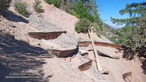
Erosion gulley on the Manzanita Trail.
From Islip Saddle the route descends the South Fork trail to South Fork Campground, then climbs 5000′ on the Manzanita and Pacific Crest trails to the summit of Mt. Baden-Powell. From here it follows the PCT back to Islip Saddle. In general, the part of the route that is on the PCT — above Hwy 2 — is well marked and maintained. However, on the South Fork and Manzanita trails — below Hwy 2 — you are on your own.

There are rock slides on the South Fork trail, and there are steep, washed out erosion gullies on the Manzanita trail. Recent thunderstorms have further damaged the eroded sections of the Manzanita Trail. In addition, the Manzanita trail crosses boulder-strewn washes that can make the trail difficult to follow. It is not a trail I would want to be on when there is heavy rainfall. The South Fork and Manzanita trails are part of the High Desert National Recreation Trail.

Google Earth images and KMZ files, and more info about the loop can be found in the posts Complications, Wally Waldron Limber Pine, and Heat Wave.

Three Points Loop Plus Mt. Waterman

If you spend much time in the mountains, sooner or later you’re going to get caught in a severe thunderstorm. I don’t mean you’re going to hear a little thunder and get a little wet. I mean you’re going to find yourself in the middle of a heart-pounding, ear-splitting, ozone-smelling, sense-numbing storm that drenches you through and through and wrings the nerves from your body.

Having been caught in such thunderstorms while climbing in Yosemite, running in the San Gabriels, and running at Mt. Pinos, I do my best to avoid the beasts. Sometimes, it is not an easy thing to do.

Take this weekend for example. I have a 50K race coming up, and in addition to increasing my weekday mileage, I needed to do a Sunday run of about 20-25 miles — preferably in the mountains.

The Sierra was out. A monsoon pattern virtually assured widespread, and possibly severe, thunderstorms. Some forecast models were saying that the focus on Sunday might be the Ventura County mountains, so Mt. Pinos — the site of my most recent thunderstorm adventure — was also out. Both San Gorgonio and San Jacinto had been hit pretty hard on Saturday. That left the San Gabriels, and thunderstorm activity was expected there as well.

The choices were A — get up really early and try to beat the heat and humidity and run local; or B — get up really early and try to get in a mountain run before the weather OD’d…

Running up the Mt. Waterman Trail, one of my ever-optimistic running partners voiced, “Hey, have you heard about the unusual number of lightning deaths recently?” So far it had been a spectacular day. A broken layer of mid-level clouds — remnants of yesterday’s storms — shrouded the sky. By keeping things a little cooler, the clouds had delayed the development of today’s thunderstorms.

We had started at Three Points and run up the Pacific Crest Trail to Cloudburst Summit, then down into Cooper Canyon, where we left the PCT and ascended the Burkhart Trail to Buckhorn Campground. In Cooper Canyon it was obvious there had been heavy rain the day before. Everything was wet, and the willows and lupines along the creek glistened in the muted morning sun. Rivulets of rainwater had incised rills in the trail, pushing pine needles and other debris into patterned waves.

I had already lost the “when it would start raining” bet. I had said 11:00. It was 11:00 now, and still there was very little cloud development. So little in fact, we decided to do a quick side trip to Mt. Waterman (8038′), and jokes were being made about the rain gear in my pack. (My GoLite 3 oz shell made a huge difference in the severe thunderstorm on Mt. Pinos.)

About the time we summited Waterman, things started to cook. The canopy of protective clouds was beginning to thin and dissipate and some cumulus cells were starting to build. I wondered if we would make it back to the car before it dumped.

We didn’t. About 30 minutes later, as we worked down the back side of Mt. Waterman toward the junction with the Twin Peaks trail,  we heard our first grumbling of thunder. In another 30 minutes it started to rain; slowly at first, with large icy drops, then building in intensity, as prescribed in long established thunderstorm protocols. Periodic claps of thunder echoed overhead, and to the north and east.

About 3 or 4 miles of trail remained. Here, the trail winds in and out of side-canyons and for the most part is well below the main ridge, but at some points it is very exposed. Minutes before, we had run past a lightning scarred Jeffrey Pine. Burned and blackened, the bolt had killed the tree. I pick up the pace and try to put the tree out of mind.

It rained hard for a while and then the intensity diminished. The air temperature didn’t drop and the wind wasn’t strong. It seems most of the lightning is cloud-to-cloud and away from us. I’m drenched, but happy — instead of being fierce and frightful, this thunderstorm has been almost puffy-cloud friendly.

In steady rain, we cross Hwy 2 and jog up the trail toward the Three Points parking lot (5920′). As we near our cars, we’re startled by a loud boom of thunder directly over our heads — a not so gentle reminder that thunderstorms come in all sizes, and none come with a guarantee.

Here’s a Google Earth image and Google Earth KMZ file of the loop, including the side trip to the summit of Mt. Waterman.

Some related posts: Manzanita Morning, Three Points – Mt. Waterman Loop

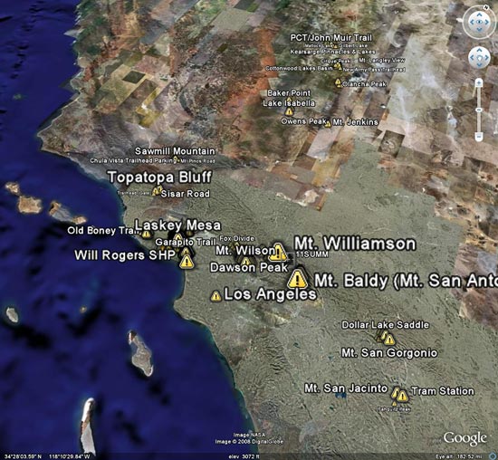
Google Earth KMZ Files of Southern California Trail Runs

Introduced around 2000, the Garmin eTrex was the first GPS unit I used to trace a trail run. The GPS tracks were imported into TOPO! where the length of a run could be measured, an elevation profile generated, and the topography of the run examined.

Since the eTrex was designed to be used in an “orienteering” position — flat in your hand in front of your body — it would frequently have trouble receiving GPS satellite signals if hand-carried while running or hiking. About the time enterprising hikers and runners began to resolve this issue with creative hats, holsters and harnesses, Garmin released the Forerunner 201, greatly simplifying the task of tracing a route.

In 2005, while preparing a presentation about kayaking Piru Creek for a meeting with the Forest Service, I stumbled onto Keyhole.com. To say I was blown away by this bit of “Eureka” technology would be an a gross understatement. Now, in addition to seeing Piru Creek in photographs, and on a topo map, you could get a “before you paddle” preview using Keyhole — even if you couldn’t paddle class IV whitewater! Google acquired Keyhole in late 2004 and launched Google Earth on June 28, 2005.

Shortly after Google Earth was launched, SportTracks added the ability to launch Google Earth and view the GPS trace of a run or other activity. Since SportTracks could also directly import data from Garmin’s Forerunner, the software made it very easy to view a run in Google Earth.

I’ve been working on updating the posts on Photography on the Run that reference a trail run to include a link to a Google Earth KMZ file. A KMZ file is just a zipped KML file, and either can be opened in Google Earth. A list of the trail runs with KMZ file links can be found by clicking “Google Earth KMZ Files of Trail Runs” in the sidebar.

These are actual tracks recorded by a GPS during a trail run and may contain GPS errors, route-finding errors, and wanderings that are difficult to explain. In a few instances tracks have been modified to correct errors, or to remove side excursions that are not part of the usual route, but not all errors have been corrected. No claim is being made regarding the appropriateness or suitability of the routes indicated.