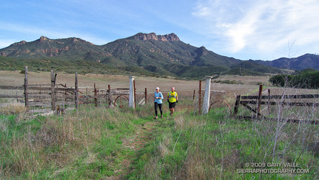
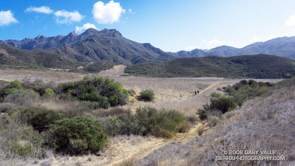
This is one of my favorite medium length trail runs in the Santa Monica Mountains. It starts at the Ray Miller trailhead and explores the scenic grasslands of the Serrano and La Jolla Valleys. Along the way there are spectacular ocean and mountain vistas from the Ray Miller Trail and the summit of Mugu Peak.
Most of the route is on single track trail, and except for a short out & back segment to “The Ranch” in Serrano Valley, it is a complete loop of about 20 miles. Many variations are possible.
One of the better online maps I’ve found of the area is an Interagency Trail Management Map produced by the NPS Santa Monica Mountains National Recreation Area GIS Lab. It shows the status of trails and public lands in the Santa Monica Mountains and is broken into three parts: West – Central – East. Additional NPS SMMNRA trail management plan maps include Proposed Backbone Trail Facilities and Trails and Proposed Regional Trails.
Here is a Cesium browser View of a GPS trace of our route from the Ray Miller trailhead and through Serrano and La Jolla Valleys.
The idea was to do an interesting trail run that wasn’t quite as long and strenuous as last week’s Bandit 30K Course Preview. That was the idea. I could have calculated the mileage and elevation gain of our projected route, but sometimes part of the fun of trail running is not knowing the exact route, how long it will take, or how strenuous it might be.
This particular exploration would visit two of the most scenic areas in the Santa Monica Mountains — Serrano Valley and La Jolla Valley. Many variations of this loop are possible. Our base route included the Ray Miller/Backbone Trail, Fireline Trail, Serrano Canyon Trail, Serrano Valley Trail, Old Boney Trail, Wood Canyon Vista Trail, La Jolla Valley Loop Trail, La Jolla Canyon Trail and connecting roads.
In addition to its wonderful scenery, this course is characterized by moderate uphills that are generally very runnable. The side trips to to the old ranch site in Serrano Valley, and to Mugu Peak pushed the route beyond the 30K mark, but were worth every step. Here’s a Google Earth image and Google Earth KMZ file of a GPS trace of the route. Since none of us had done the eastern leg of the La Jolla Valley Loop Trail, this time we did Mugu Peak from the east. The route around the valley to the western side of Mugu Peak is also shown.
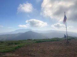
Scruffy clouds clung to the mountain ridges and summits, confirmation that a weak cold front was moving through the area, cooling temperatures and stirring up the wind. The forecast for the Santa Monica Mountains National Recreation Area had mentioned 25 to 35 mph winds with gusts to 60 mph. So far the weather in Pt. Mugu State Park had been nearly perfect — breezy and little chilly, but without the impenetrable winds that can take all the joy out of running.
Earlier we had climbed the Fossil Trail, a steep mile-long trail that connects the Upper Sycamore Trail, near its junction with Sycamore Canyon Road, to the Old Boney Trail. With only a few weeks remaining to the Solstice, shadows in the canyon were long and the light wintery. I thought we might have missed the fossils, but we happened on a nice exposure about a tenth of a mile below the Old Boney Trail junction.
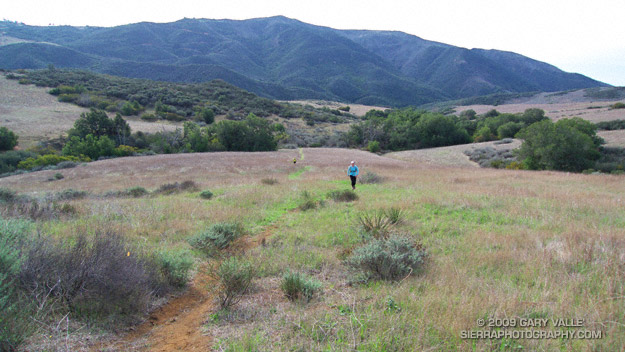
About 5.5 miles later, we turned off the Old Boney Trail and descended to the rolling grasslands of Serrano Valley, another “must see” area of the Santa Monica Mountains.
Located on the east side of Big Sycamore Canyon, Serrano Valley is a more rugged counterpart to La Jolla Valley, just three miles to the west. Overseen by the castle-like summits of Boney Mountain, its vistas have a roughhewn edge, reminiscent of the most wild areas of the western U.S.
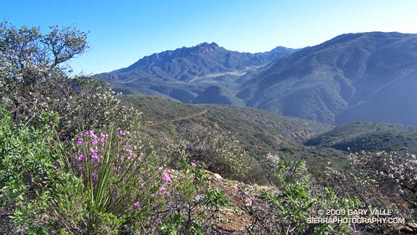
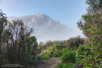
Illuminated by the rising sun and partially enveloped in cloud, Boney Mountain’s Western Ridge looked so inviting I thought about abandoning my planned run and climbing the ridge instead.
Boney Mountain’s Western Ridge from the Old Boney Trail
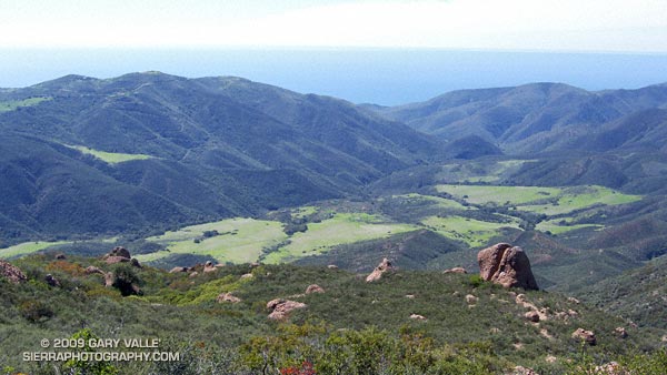
Pt. Mugu State Park is a great place for long, self-supported trail runs. The scenery is superb, the trails are generally in good condition, and water is usually available in several locations.
Today’s run took me to two of the most scenic areas in the Park — Serrano Valley and La Jolla Valley. This archived PDF map shows many of the trails in the area. The Wendy Drive trailhead is in the upper right corner of the map. La Jolla Valley is marked and Serrano Valley is near the “PARK” in the label “POINT MUGU STATE PARK.” Also see the Pt. Mugu State Park maps on VenturaCountyTrails.org
The marine layer kept the temperature cool for most of the run, but the sun finally broke through as I ran up Sycamore Canyon on the Two Foxes trail, on the way back to the Wendy Drive trailhead.
After doing a climbing /trail running combo in Pt. Mugu State Park last Sunday, I headed back to Wendy Drive this morning to do a trail run to Mugu Peak and back.
The plan was to get in a long run (20 miles) with fewer “get your feet wet” stream crossings, and also check out the conditions on several trails I hadn’t done this year.
Boney Mountain (left skyline) from Mugu Peak
So much for keeping the feet dry! The temp was in the mid-30s when I turned off Big Sycamore Canyon fire road and onto Wood Canyon fire road. The main creek draining Sycamore Canyon cuts across the fire road here, and there was no way I was going to get across it without wading. Some smaller stream crossings followed, ending with Wood Canyon Creek.
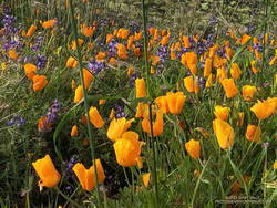
California poppies mixed with lupine along the Mugu Peak Trail
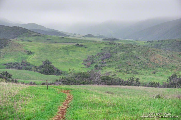
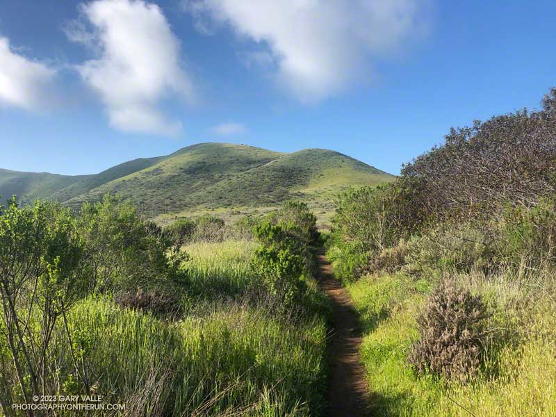
Several trails/roads converge at the top of Hell Hill, and I turned right onto the fire road that leads to the La Jolla Valley Loop Trail. I like to do Mugu Peak as part of a counterclockwise loop that combines segments of the La Jolla Valley Loop Trail and Mugu Peak Trails.
Long stretches of the La Jolla Valley Loop Trail between the walk-in camp and Mugu Peak were sopping wet. I’ll be curious to see how quickly it dries out, but today (April 2) it was really, really wet.
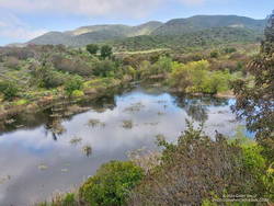
La Jolla Loop pond is rarely this large — or even a pond.
Mugu Peak was pretty much as it always is on this side — busy and steep. The steepness of the “Direct” trail helped wring the water from my Ultraglides and Injinji socks. By the time I reached the top, my feet were only damp.
Mugu Peak is VERY popular, and there are almost always a few people taking in the wide-ranging views from the summit. Most do the short, steep hike from PCH on the Chumash Trail. A few start at the Ray Miller Trailhead — or like I was doing today — the long route from Wendy Drive.
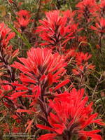
Vivid red paintbrush along the La Jolla Loop Trail
Although I usually climb the peak, two other options are worthwhile: the loop around the ocean-facing side of Mugu Peak and
the loop around La Jolla Valley.
The wildflowers along the Mugu Peak Trail and La Jolla Loop Trail were fantastic. California poppies were plentiful on the south-facing slopes. The vibrance of the bright orange poppies could not have been better accentuated than by purple lupine. Yellow bush sunflower, royal blue phacelia, and rich red paintbrush also decorated the trail.
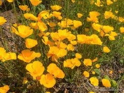
Bright yellow collarless poppies along Danielson Road.
I followed my usual route on the way back to Wendy — returning to the Hub, descending Hell Hill, retracing my steps in Wood Canyon, then following the Two Foxes single-track trail north to a short connector to Sycamore Canyon Road. This is near the Danielson Multi-Use Area. Once on Sycamore Canyon Road, the route back was the same as last week — up 1.8 miles of paved road and then onto the Upper Sycamore Trail. After that, up Danielson Road and across Satwiwa to the Wendy Drive trailhead.