Back on the Old Boney and Serrano Valley Trails

Boney Mountain from the Serrano Valley Trail.

Not all trails will have a smooth tread, good footing, trimmed vegetation, trail signs and other luxuries. What you see is what you get, and sometimes what you get is not perfect.

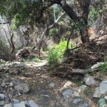
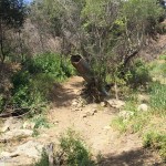
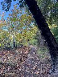
That was the case on last May’s run to the Serrano Valley from Wendy Drive. A long stretch of the Old Boney Trail was all but impassable. The trail was badly overgrown, the day foggy and gray, and everything was dripping wet.

Sycamore leaves scattered along the Serrano Canyon Trail (thumbnail)
Serrano Canyon Trail

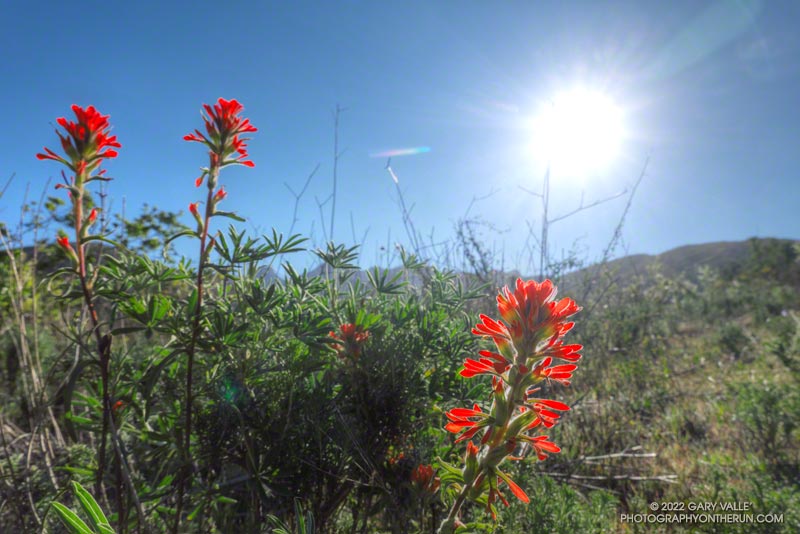
But there is just something about immersing yourself in the good and not-so-good that nature offers. It’s part of what nature is. The splendid display of wildflowers seen on that run was a result of the rainy season that produced the overgrown trail.

Curious to see how that section of trail had changed in seven months, this morning I was back on the Old Boney Trail and on my way to Serrano Valley. It had rained around 4 inches during the week, and I expected the mud to be like glue and creek crossings wet.

Use of the trail had improved its condition. There were still some overgrown sections but most of the time I could see my feet, as well as the ruts and rocks on the trail. It was muddy in the usual places but the globs of mud on my shoes didn’t reach dinner plate proportions.

The Fireline Trail climbs out of Sycamore Canyon. Boney Mountain is in the distance.
Fireline Trail with Boney Mountain in the distance.

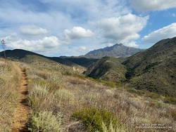
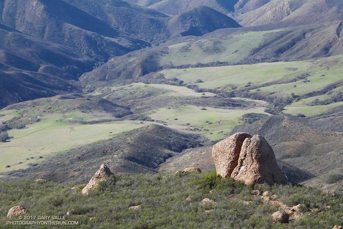
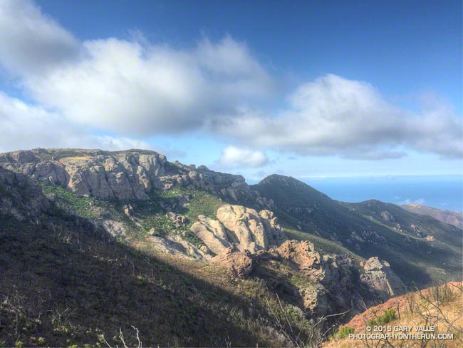
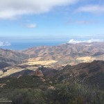
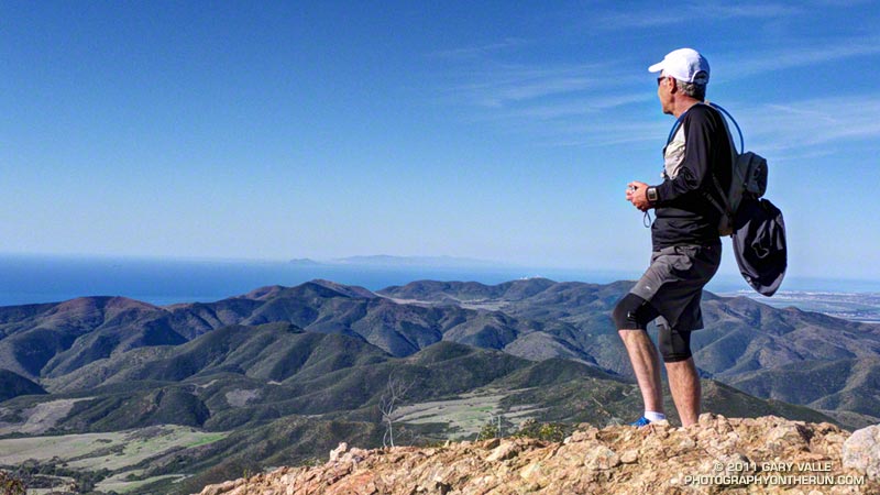
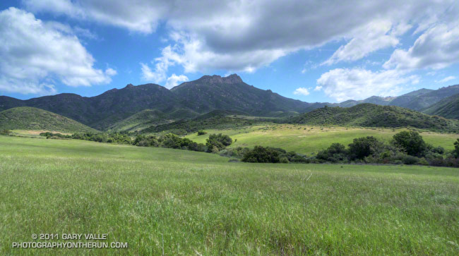
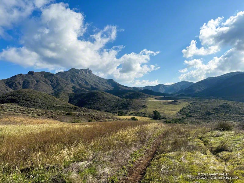
In the wake of the storm, the weather was exhilarating. Postcard clouds decorated the crest of Boney Mountain and a cool breeze filtered through the canyons. Despite all the rain, Serrano Creek was flowing at a modest level, and I emerged from Serrano Canyon with dry shoes.

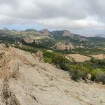
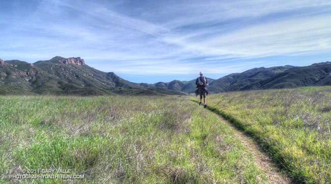
It was a day for a longer run, and when I reached Sycamore Canyon fire road, I turned left (south) and continued down the canyon to the Fireline Trail. Going up the Fireline Trail to Overlook Fire Road extended the run and expanded the views. A right turn on Overlook Fire Road lead to the top of the Ray Miller Trail, and from there to the Hub. These junctions offer additional opportunities for extending the run.

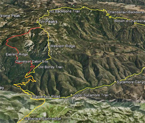
Today, I ran down Hell Hill, over to the Two Foxes Trail via Wood Canyon Fire Road, then picked up Sycamore Canyon Fire Road near the Danielson Multi-Use Area and followed it to the Upper Sycamore Trail, Danielson Road, and Satwiwa. This interactive, 3D terrain view shows the route.

Some related posts:
A Really Overgrown Trail, Thirty Creek Crossings, and Thousands of Wildflowers
Old Boney to Serrano Valley, Plus Fireline and Overlook
Serrano Valley from Wendy Drive

Old Boney to Serrano Valley, Plus Fireline and Overlook

Paintbrush along the Old Boney Trail in Pt. Mugu State Park

Serrano Valley and Canyon had been on my run list for a few weeks. I was curious to see how December’s rainfall had affected Serrano Canyon. Runoff from those storms had (once again) washed out sections pf the Blue Canyon Trail and Upper Sycamore Trail. Had the Serrano Canyon Trail also been damaged?

Greenbark Ceanothus along the Old Boney Trail

It was a good day to visit Serrano — I was looking to do a longer run; the weather was perfect; the meadows green; and many wildflowers were in bloom.

There are a couple of ways I like to run to Serrano Valley from the Wendy Drive Trailhead. Both do the initial 1.6 mile, 900′ climb up the Old Boney Trail from Danielson Road. At the top of the climb, one route goes up and over Boney Mountain’s western ridge to the Backbone Trail, and the other continues on the Old Boney Trail. Both routes join at the Chamberlain junction of the Backbone and Old Boney Trails. I’d done the western ridge of Boney Mountain recently, so opted for the Old Boney route.

Prickly phlox along Overlook Fire Road

Wildflowers were everywhere. The December rain and February heat wave seems to have encouraged many plants to bloom — among them blue dics, Encelia, clematis, California poppy, greenbark Ceanothus, shooting star, nightshade, paintbrush, poison oak, milkmaids, prickly phlox, hummingbird sage, and larkspur.

Serrano Valley was Spring-green and spectacular. Serrano Creek was gurgling away, and the Serrano Canyon Trail had survived December’s storms. After a pleasant run down Serrano Canyon, I stopped to get some water from the faucet at the junction of the Serrano Canyon Trail and Sycamore Canyon.

A right turn here — up Sycamore Canyon — produces a run of about 20 miles. Today I was looking to do a little more than that, so turned south and ran about a quarter-mile down Sycamore Canyon and picked up the Fireline Trail. This trail gains about 700′ in elevation on its way up to Overlook Fire Road.

California poppies along Overlook Fire Road, above La Jolla Valley
La Jolla Valley from Overlook Fire Road

Overlook Fire Road leads northwest to the top of the Ray Miller Trail. I was feeling good and briefly debated descending to the Ray Miller Trailhead. I did a quick estimate of the mileage. I was at about mile 14. Descending Ray Miller would add about 2.5 miles, and then the run back from the trailhead to Wendy would add another 12 miles. Hmmmm… nearly 29 miles. My legs were way ahead of my brain, and were already continuing up Overlook Fire Road.

I followed the usual route back — Overlook -> Hell Hill -> Wood Canyon -> Two Foxes -> Sycamore Canyon -> Upper Sycamore -> Danielson Road -> Satwiwa. The paved part of Sycamore can be a bit tedious and it helped when I happened upon a couple of friends.

Here is an interactive, 3D terrain view of the GPS track of my route. The map can be zoomed, tilted, rotated, and panned. To change the view, use the control on the upper right side of the screen. Track and placename locations are approximate and subject to errors. Poor weather, and other conditions may make this route unsuitable for this activity.

Some related posts: Over Boney Mountain to Sandstone Peak and Serrano Valley, Serrano Valley from Wendy Drive, Pt. Mugu State Park Debris Flows and Flash Floods

Chamberlain Rock and Serrano Valley from the Chamberlain Trail

Chamberlain Rock and Serrano Valley from the Chamberlain Trail

From today’s New Year’s Day run over Boney Mountain to Sandstone Peak and Serrano Valley from Wendy Drive.

Some related posts: Over Boney Mountain to Sandstone Peak and Serrano Valley, Chamberlain Rock

Over Boney Mountain to Sandstone Peak and Serrano Valley

Volcanic rocks along the western escarpment of Boney MOuntain

While running in the Marin Headlands last weekend it occurred to me that it had been at least a couple of months since I’d done a a run in Pt. Mugu State Park. In addition to following the recovery of the area since the May 2013 Springs Fire, I’ve been surveying the effects of the December 2014 flash floods in Sycamore Canyon and its tributaries and hadn’t yet looked to see what happened in Serrano Canyon.

When doing a run in Pt. Mugu State Park I almost always start at the Wendy Drive trailhead. I’ve run from that trailhead to Serrano Valley and Canyon a couple of ways. Both routes connect by way of Satwiwa and Danielson Road to the Old Boney Trail. One follows the Old Boney Trail all the way to the Serrano Valley/Canyon Trail. The other climbs up and over Boney Mountain, eventually connecting to the Backbone Trail, and then descends the Chamberlain Trail and rejoins the Old Boney Trail about a mile east of the Serrano Valley/Canyon Trail.

Today’s run was a variation of option B. After climbing Boney Mountain to Tri Peaks, I ran over to Sandstone Peak using the Tri Peaks and Backbone Trails. Sycamore Canyon Fire Road, Two Foxes Trail and Upper Sycamore Trail were used to get back to Satwiwa and the Wendy Drive trailhead from Serrano Canyon.

Some related posts: Pt. Mugu State Park Debris Flows and Flash Floods, Just Me and the Meadowlarks, After the Springs Fire: A Run Through Pt. Mugu State Park

Boney Mountain – Serrano Valley Adventure Run

Craig running in Serrano Valley

Craig had never done any rock climbing, but was doing a great job of scrambling up the steep gullies, and climbing the short sections of knobby, low angle volcanic rock. We were climbing up through a maze of brush and rock formations on the steep ridge that follows Boney Mountain’s western escarpment. The scramble up the western ridge would be well worth the effort. The route is a shortcut to the Backbone Trail and some of the most spectacular running in the Santa Monica Mountains.


Our run had started at Wendy Drive & Potrero Road in Newbury Park. We were doing a 20 mile loop that was about as varied as a trail run can be. In addition to the 1.5 mile ascent of Boney Mountain, there would be about 13 miles of single track trail, 4.3 miles of dirt road, and even 1.7 miles of paved road.

After getting through the maze to the Backbone Trail we would do the classic run down the Chamberlain Trail to the Old Boney Trail. From the bottom of the Chamberlain Trail there are four major variations. Three of these lead to Big Sycamore Canyon and one loops directly back to the start of the climb up Boney Mountain:

– Turn left (west) on the Old Boney Trail and at the junction of the Serrano Valley & Old Boney trails follow the Serrano Valley Trail and then the Serrano Canyon Trail to Big Sycamore Canyon. This was the route we were doing today.

– Turn left (west) on the Old Boney Trail and follow it all the way to Big Sycamore Canyon.

– Turn right (east) on the Old Boney Trail and at the junction of the Blue Canyon & Old Boney trails, continue down the Blue Canyon Trail to the Danielson Multi-use area in Big Sycamore Canyon.

– Turn right (east) on the Old Boney Trail and at the junction of the Blue Canyon & Old Boney trails, turn up the Old Boney trail and  follow it  over the shoulder of Boney Mountain and back to the point where the ascent of Boney Mountain began.


In Big Sycamore Canyon there are many options. Today we would run up Sycamore Canyon Rd to Wood Canyon Rd and pick up the Two Foxes Trail. This trail continues up-canyon and eventually rejoins Sycamore Canyon Rd, which would take us to the Upper Sycamore Trail, and from there to Danielson Road and Satwiwa. Here’s an interactive Cesium browser View of a GPS trace of our route. And here are archived maps of Rancho Sierra Vista/Satwiwa and Pt. Mugu State Park originally from the NPS Santa Monica Mountains web site.  Also see the Pt. Mugu State Park maps on VenturaCountyTrails.org.

Note: There is an easier alternative to the western ridge route on the north side of Boney Mountain. The route starts near the Danielson Memorial, and ascends a use trail up the eastern ridge on the north side of the mountain. In places the (unmaintained) trail is very steep, eroded, and rubbly but it is more straightforward and less technical than the western ridge.

Some related posts: What a Great Day for a Trail Run, Sandstone Peak from Wendy Drive, Boney Mountain Views