Category Archives: photography

Lower Kern River

The class IV rapid Deadmans Curve on the Lower Kern River.

Runoff from the Upper Kern River is stored in Lake Isabella and then released to the Lower Kern River according to flood control and irrigation requirements. The releases for summertime irrigation normally produce good flows for rafting and kayaking.

Although only a 2.5-3.0 hour drive from Los Angeles, the class IV Miracle to Democrat run on the Lower Kern River is usually remarkably uncrowded. Sure, you’ll probably see a few rafts, but nothing like the log jam of rafts on some other rivers. It’s not unusual to paddle for a couple of hours and not see another group.

On the 11 mile reach between Miracle Hot Springs and the Democrat Day Use Area, there are eight rapids  that are rated class III+ or class IV, many class II and class III rapids, and one class V rapid. The class V rapid, Royal Flush, is normally portaged. There are numerous places for kayakers to surf, spin and play along the way. Depending on how much time is spent playing, paddlers may choose to take out at Delonegha, at about the 7 mile point, or continue on the “Big Five” section to Democrat.

In this post’s photo, the kayaker is paddling the rapid Deadman’s Curve, aka Powerful Possum. This class IV rapid plunges down a big drop with surprising speed into steep waves and pushy diagonals.

Note: It is extremely important to wear a personal flotation device (PFD) when on a river. If you’re not an experienced whitewater kayaker or rafter, contact an outfitter for more information about paddling trips and instruction.

Gumplant

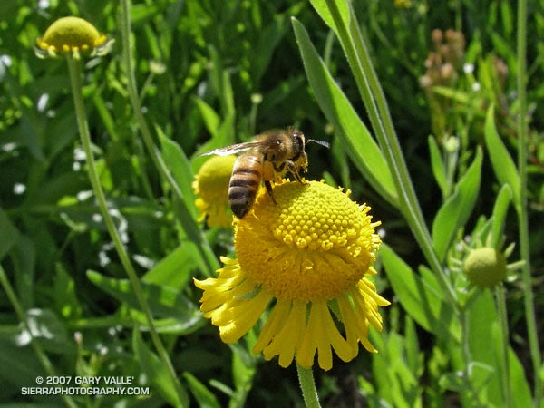
Gumplant (Grindelia hirsutula var. hirsutula) in Upper Las Virgenes Canyon Open Space Preserve

In a Spring in which there has been little rain and a reduced number of wildflowers, the vibrant yellow of gumplant has been a welcome sight along Ahmanson’s main trail in Upper Las Virgenes Canyon Open Space Preserve near the Victory trailhead.

This appears to be Grindelia hirsutula var. hirsutula, a species considered rare in Ventura County. It is reported that a species of gumplant was used medicinally by the Chumash, and other native peoples within its range, for treatment of pulmonary problems.

Peaks Along Pleasant View Ridge

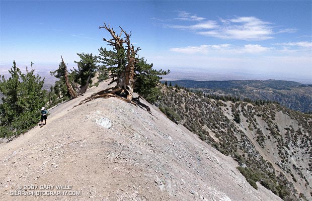
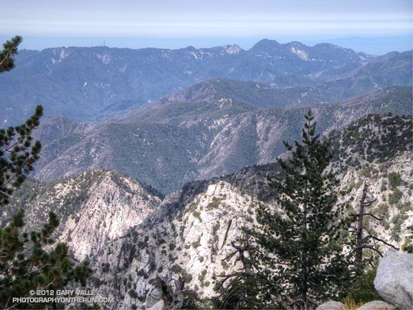
Peaks along Pleasant View Ridge in the San Gabriel Mountains.

Sitting on a weather worn log, I emptied the grit from my shoes and asked Miklos how much water he had left. We had just finished the 3 mile segment of Pleasant View Ridge, between Mt. Williamson and Burkhart Saddle and were debating continuing along the ridge to Will Thrall Peak and the next peak to the northwest. Abiding by the “here now, climb it now” philosophy, we took the first few steps up the steep slope.

A little more than a mile and 1200′ of gain later we were enjoying the panoramic view, and pondering why there would be a benchmark stamped “PALLETT” on the summit of a peak named “Pleasant View Ridge,” on Pleasant View Ridge, in plain view of Pallett Mountain.

With the addition of the segment from Burkhart Saddle, this extended version of the Pleasant View Ridge hike/run included the following peaks and high points:

Mt. Williamson (8214′) – As marked on the Crystal Lake topo.

Point 8244 – The Mt. Williamson register is normally here.

Point 8248 – This is the highest point on Pleasant View Ridge.

Peak 8160+ – Peak east-southeast of Pallett Mountain.

Pallett Mountain (7760+’) – Peak just east of Burkhart Saddle.

Will Thrall Peak (7845′) – Peak just west of Burkhart Saddle.

Pleasant View Ridge 7983′ – Peak northwest of Will Thrall marked with a benchmark stamped “PALLETT.”

Pine Drops

Pine drops (Pterospora andromedea) on the Pacific Crest Trail near Little Jimmy Trail Camp

Pine drops (Pterospora andromedea) and snow plant (Sarcodes sanguinea) are related nonphotosynthetic plants that are found under pine and related trees, primarily in the mountains of the western U.S.

At one time it was believed that these plants were saprophytes, and obtained needed nutrients directly from decaying organic matter in soil. However, research has revealed a more complex parasitic relationship in which the plant obtains carbohydrate from a pine tree, by way of a shared mycorrhizal fungus.

The photograph was taken on the run described in Heat Wave, on July 16, 2006.

Related post: Snow Plant

Golden Yarrow

Perfectly sized to work the minute central disk flowers of golden yarrow, a tiny insect -- perhaps a species of bee fly -- hovers a few millimeters from the plant.

Perfectly sized to work the minute central disk flowers of golden yarrow, a tiny insect — perhaps a syrphid fly — hovers a few millimeters from the plant, assessing the risk of continuing to feed.

The compound flower head of the golden yarrow (Eriophyllum confertiflorum) is about the size of a green pea (10mm), and the individual disk flowers at its center are about 1/5 as large (2mm).

From a run at Sage Ranch Park on May 28, 2007.

Related post: Bee Fly on Western Wallflower.

Rocky Peak

Rocky Peak in the Santa Susana Mountains

Each year, thousands hike, ride or run the 2.3 miles up Rocky Peak fire road to a high point with a nice view of Simi Valley. This is near the point marked “ROAD” in this overview photo. Many turn around here, but some continue along the main road to the Johnson Trail, Chumash Trail, Fossil Point, or beyond.

Another option is to follow a spur trail that branches off the main road at the high point about a quarter-mile to an airy overlook. From this viewpoint you can see the San Fernando Valley and surrounding mountains, and trace your route through Rocky Peak Park’s unique sandstone formations.

The overlook marks the end of the “easy” trail and the beginning of a rough, rudimentary trail that leads east-northeast through large boulders and outcrops to the summit of the Rocky Peak (2714′).

The summit of Rocky Peak is one of the points that defines the border between Los Angeles and Ventura counties. Last year, I was surprised to find evidence that a coyote had recently visited this summit!

Here’s a Google Earth image and Google Earth KMZ file of a GPS trace of my route to the summit.

Some related posts: San Fernando Valley from Rocky Peak, Rainy Morning on Rocky Peak Road.