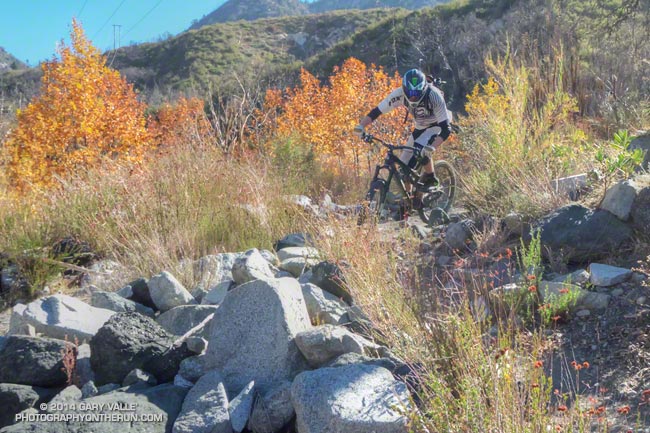
Downhill mountain biker on a technical single-track trail in the San Gabriel Mountains.

Downhill mountain biker on a technical single-track trail in the San Gabriel Mountains.
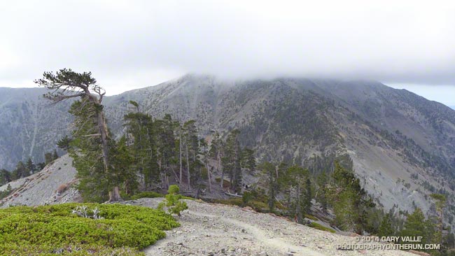
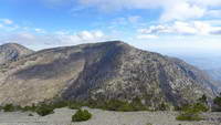
Mt. Baldy from the North Backbone Trail
According to my car’s thermometer the temperature in the west San Fernando Valley was 86 degrees. To the east a large patch of middle-level clouds had morphed into a large lenticular cloud. Over the course of a few minutes the wave cloud continued to transform, dividing into a train of alto-cumulus waves.
I just shook my head. A few hours earlier and 60 miles away, I had been freezing. The plan had been to do a “Baldy Over the Top” run to the old juniper on the north side of Pine Mountain. Around 8:45 am, as running partner Ann Ongena and I crested the cloud-capped, 10,064′ summit of Mt. Baldy, the wind chill temperature had been around 30 degrees. The air temperature was in the low 40s, but with the wind blowing at least 40 mph and gusting to over 50 mph it had been brutally COLD. Especially in running shorts.
Spending zero time on the summit, we waved to the hikers huddled in the rock windbreaks as we sprinted by. The hope had been that the wind (and temperature) would moderate as we descended the North Devil’s Backbone on the back side of Baldy.
It didn’t. Wind-driven clouds continued to sweep past the ridge as we ran down the steep path. At the first opportunity we stopped in the wind shadow of a clump of stunted lodgepole pines and put on wind/rain shells. The shells were three ounces of magic — without them it would have been foolhardy to continue.
As we descended to the Baldy – Dawson Saddle and then climbed up to Dawson Peak I kept looking back over my shoulder to the cloud-shrouded summit of Mt. Baldy. Were there more clouds? Was the ceiling lower? Was there more vertical development?
The day before I had checked the forecast from the NWS and the forecast models. A dissipating cold front was approaching the area from the north, but wasn’t expected to pass through until sometime tonight. No measurable rain was forecast for the Los Angeles area. The last time I had checked no clouds had been forecast for Saturday morning — but there they were. I had expected some southwesterly winds ahead of the front, but nothing like this.
I didn’t like being on the back side of the mountain in potentially bad weather knowing that “home” was on the front side. We had just enough gear to deal with the current conditions. I didn’t think it was very likely, but if the weather deteriorated…
Many of the incidents that occur in the outdoors are the result of a series of misjudgments. If you’re already on the edge it’s usually best to call it before things get REALLY complicated.
And that’s exactly what we did. After descending a short distance down the ridge from Dawson Peak we turned around. Even if the outing was going to be a bit shorter than planned, it was still going to be an outstanding hike and run in extraordinary conditions with over 6000 feet of elevation gain.
It was just as windy, cold and cloudy on the second trip over the top of Baldy as it had been on the first and we spent about the same number of milliseconds on the summit before picking up the Devil’s Backbone trail and running down.
Some related posts: Mountain Weather, Atmospheric Dynamics
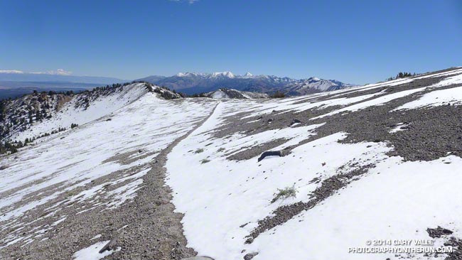
With this year’s El Nino developing in fits and starts and drought-plagued California clinging to hopes of an above average snowpack, a little September snow is a big deal, even if it’s just a dusting.
The first low pressure system of Fall resulted in significant rain in many areas of Central and Northern California, with amounts falling off quickly to the south. According to the NWS, Redding recorded over 3 inches of rain; Red Bluff nearly 2.5 inches; South Lake Tahoe 1.8 inches; Downtown Sacramento and San Francisco both recorded about 0.5 inch.
For a rain-starved, heat-desiccated Southern Californian it was great to get out and play in the snow. I had a window of about three hours to do a run and the run/hike up San Joaquin Ridge from Minaret Summit was superb!
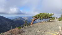
Here are a few photos from the run.
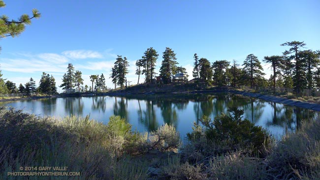
The contrast in temperature was remarkable. On a run at Ahmanson earlier in the week the temp had been over 100. Here on the north shore of Big Bear Lake it was about 60 degrees cooler.
It was 4:45 am and 54 two-legged runners, and one four-legged runner (Lacey) were scattered around the Meadow’s Edge Picnic Area. Some runners were sitting in cars with the motor on and heater running, some were checking in and picking up their bib numbers and making last minute preparations. One bare-armed runner in shorts and a singlet had appropriated a bathroom in lieu of a jacket.
At about 5:00 am were were on our way. The stars glittered brightly on an inky background of mountain sky. Surrounded by a frame of pines the iconic Winter constellation Orion ran across the southeastern sky, the brilliant dog star Sirius following at his side.
There were many changes and improvements for the 2014 edition of the Kodiak 100M & 50M. In addition to the 50M beginning at Meadow’s Edge and starting an hour earlier, nearly all of the miles to Rim Nordic (~ mile 23) were on dirt road. As much as I like single track, there were some significant benefits to this. Most importantly, it got us to Rim Nordic earlier in the day and in better shape to deal with the difficulties of the Siberia Creek section of the course.
The loss of the PCT single track on the first part of the 50 mile course was offset by the addition of the Skyline single track following the Siberia Creek climb. The Skyline and Siberia Creek Trails are both spectacular. When combined they are among the most challenging, aesthetic and rewarding trails in Southern California. Thanks to the trail work by the Big Bear Valley Trails Foundation and Kodiak volunteers the Siberia Creek Trail was in better shape this year.
The weather was outstanding! Once the sun was up, my sleeves came off and it was shorts and short-sleeves for the remainder of the day. Reflecting the good weather, the changes in the course, the improved aid stations, and perhaps a better understanding of the character of the course, the finishing rates for both the 50M and 100M were up significantly from last year. Half of the runners that started the 100M finished and about 85% of the 50 milers finished.
Here are some photos taken during the 50 mile. The 50M/100M mileages mentioned in the descriptions are approximate.
Many thanks to R.D. Matt Smith and all of the event staff, volunteers, sponsors and runners! For more photos, stories, results and info checkout the Kodiak web site and Facebook page.
P.S. Lacey and her “Dad” Aaron Sorensen both finished the 50 mile in fine style!
Related post: Kodiak 100 & 50 Mile Ultramarathons 2013
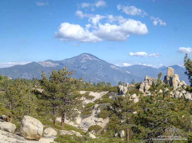
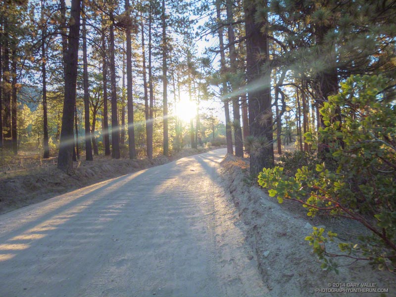
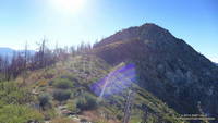
At an elevation of nearly 7400′ Inspiration Point is one of the most exhilarating places in the San Gabriel Mountains to start a trail run. Here the Pacific Crest Trail follows along Blue Ridge, an exceptionally scenic ridge with views of the range’s tallest mountains and deepest canyons.
Today I was looking to do something at higher altitude and it occurred to me that I could run east on the PCT from Inspiration Point and add a bit of adventure by ascending Mt. Baldy’s North Devil’s Backbone to the Pine Mountain Juniper. I’d first noticed this old tree on a climb of the North Devil’s Backbone in 2006. In 2010 I hiked and ran over the top of Mt. Baldy from Manker Flat and measured the girth of the tree. It’s rocky, ridgetop location and relatively arid environment might have significantly slowed its growth and it could be older than the 800 years or so its size suggests.
Even though it was Labor Day weekend, and the weather was perfect, no one was on the North Devil’s Backbone trail.
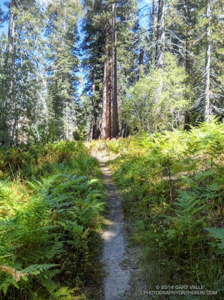
Here are a few photos from the run.
Some related posts: Pine Mountain Juniper, Lightning Tree, Mt. Baldy North Backbone Trail, North Backbone Trail Revisited, Mt. Baldy Run Over the Top
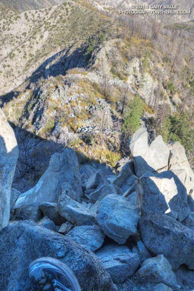
It was about 8:30 a.m. and I was nearly to the top of the steep, rocky ridge on the west side of Strawberry Peak. I gazed over the rocks and ridges to the layer of stratus that partially filled the Los Angeles basin and valleys and tried to find Saddle Peak or Castro Peak. These peaks would mark the location of Malibu Creek State Park. Today some friends were doing the Bulldog 50K and I wondered if the marine layer was too shallow to take the edge off the heat forecast for later in the day.
The loop over the top of Strawberry Peak is a more adventurous variation of the Strawberry Peak Circuit. Closed for 4 1/2 years by the Station Fire, the trails necessary to do the circuit and approach the peak — Josephine Peak Fire Road, Strawberry Spur Trail, part of the Colby Canyon Trail and Strawberry Peak Trail — reopened in late May. The trails from Josephine Saddle to the summit of Strawberry and from the summit down to Lawlor Saddle are unofficial paths created by use.
I’d done the circuit around Strawberry in July a couple of weeks before the Angeles Crest 100. Today’s hike, run and climb over the top of the peak was a fun way to continue to recover from the exertions of that event. As was the case with the Strawberry Peak Circuit, I started the loop at Clear Creek, but it is also possible to start at Switzer’s Picnic Area or Red Box.
Like anything adventurous, if it’s in your comfort zone the challenges can be fun; if not, the adventure can quickly turn into a nightmare. This route requires rock climbing and route-finding skill and a bad choice can ruin your whole day. Strawberry Peak has been the site of numerous search and rescue operations. The rock on the west side of the peak is of variable quality and if you go off-route it’s easy to become trapped in a spot where you can’t safely go up or down.
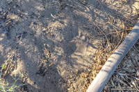
Not only is the route-finding tricky on the rock climbing sections. As a result of the growth of Poodle-dog bush following the Station Fire, the use trail on the upper ridge on the west side of the peak is more circuitous than it used to be. Although much of the Poodle-dog bush was wilting and in some cases dying, it can still cause dermatitis. By staying on the use trail it was mostly avoidable. There was a bear track on this section of the ridge and I wondered if the tracks I’d seen on the Strawberry Peak Circuit were from the same bear.
The last section of rock climbing ends abruptly just below the summit. The use trail on the east side of the summit involves no rock climbing and sees much more traffic. Though steep and loose, by fell-running standards it is mostly runnable. At Lawlor Saddle the maintained trail begins and continues to Red Box. From there the loop is closed using the Gabrielino Trail and Nature’s Canteen Trail. Since I was last on the trail in July, the Nature’s Canteen Trail had been re-cut and was in great shape.
Some related posts: Strawberry Peak Traverse, Strawberry Peak Circuit