Category Archives: photography|trail running

Serrano Valley – La Jolla Valley Scenic Loop

Lynn and Frank at the ranch in Serrano Valley.

This is one of my favorite medium length trail runs in the Santa Monica Mountains. It starts at the Ray Miller trailhead and explores the scenic grasslands of the Serrano and La Jolla Valleys. Along the way there are spectacular ocean and mountain vistas from the Ray Miller Trail and the summit of Mugu Peak.


Serrano Valley
Most of the route is on single track trail, and except for a short out & back segment to “The Ranch” in Serrano Valley, it is a complete loop of about 20 miles. Many variations are possible.

One of the better online maps I’ve found of the area is an Interagency Trail Management Map produced by the NPS Santa Monica Mountains National Recreation Area GIS Lab. It shows the status of trails and public lands in the Santa Monica Mountains and is broken into three parts: WestCentralEast. Additional NPS SMMNRA trail management plan maps include Proposed Backbone Trail Facilities and Trails and Proposed Regional Trails.

Here is a Cesium browser View of a GPS trace of our route from the Ray Miller trailhead and through Serrano and La Jolla Valleys.

Related post: Serrano Valley – La Jolla Valley Loop, Serrano Valley from the Chamberlain Trail

Mountain Solitude

Descending from Pallett Mountain on Pleasant View Ridge, in the San Gabriel Mountains.

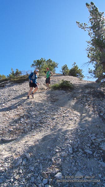
It was a little eerie. There wasn’t so much as an animal track or old bootprint on the trail ahead. The path was perfectly smooth, and I felt a bit guilty as my running shoes left their patterned tracks under foot. Lynn, Frank, and I were working up the Pacific Crest Trail on the west side of Mt. Williamson in the San Gabriel Mountains, near Los Angeles. As we switchbacked up the trail, the mountain seemed to sigh, happy to have enjoyed at least a few days of solitude.


Angeles Crest Highway
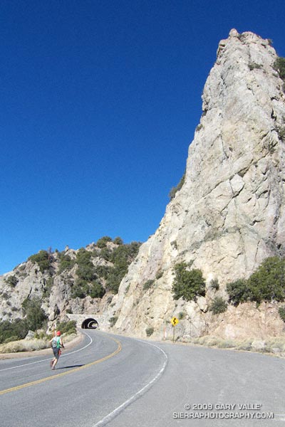
Closed in early September by the Station Fire, this part of Angeles National Forest did not burn. It reopened in October, but is difficult to access because of the continuing closure of Angeles Crest Highway. To get to this point, we had run from the Antelope Valley side of the mountains. First up the South Fork Trail to Islip Saddle, and then along Angeles Crest Highway, through the tunnels, to the PCT near Kratka Ridge. A steep climb up the PCT put us where we were now — nearing the summit of the usually busy peak.

Of course that was part of the fun of trail running. By the time we reached the summit of Mt. Williamson, we would have gained about 3600′ of elevation, and would be a little more than half way through our 21 mile run. From Williamson’s summit we would head west along Pleasant View Ridge, and then descend the Burkhart Trail to Devil’s Punchbowl. The ups and downs along Pleasant View Ridge, and the “minor” climb out from Cruthers Creek, would add another 1500′ or so of elevation gain.


Big horn sheep track
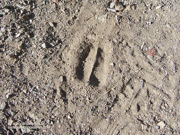
The run up the rugged South Fork trail had been interesting. Low on the trail we had picked up the blocky hoof prints of what was probably a large bighorn sheep. Intent on the tracks, and telling stories of Tom Brown and the Pine Barrens, we almost didn’t notice two deer hunters hiking up the trail ahead of us. Another mile or two up the trail we heard something large moving through the brush, and were surprised to see  a sizable black bear bounding down a slope. I wondered if it might be the sire of the cubs we had seen on this trail earlier in the year. A little higher still, we found a beautifully colored California mountain kingsnake, warming itself in a patch of morning sun.

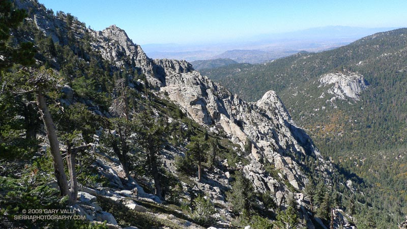
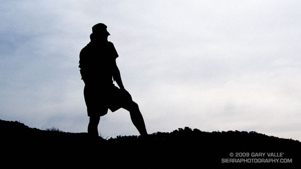
Those encounters had been a couple of hours before. Now we were just below Williamson’s summit ridge. Reaching the crest, we ran the few remaining yards to its eastern summit. The visibility was stunning. To the south, we could see the thin ribbons of Catalina Island and San Clemente Island, more than 75 miles distant. To the east, Mt. San Jacinto loomed above the shoulder of Mt. Islip. To the north an indistinct line of white floated above the horizon. Was it the Sierra?


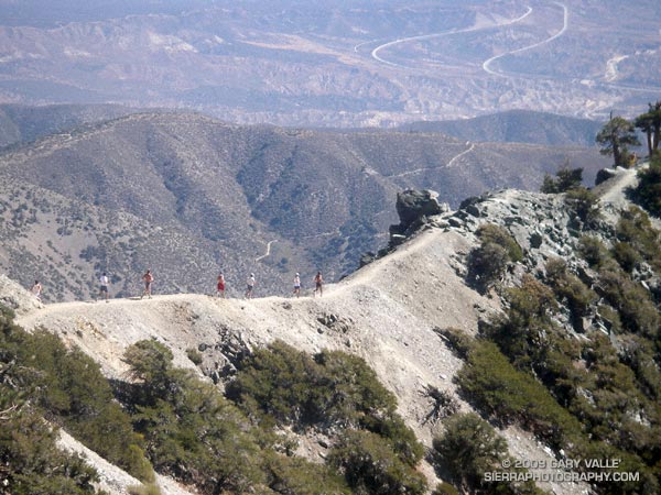
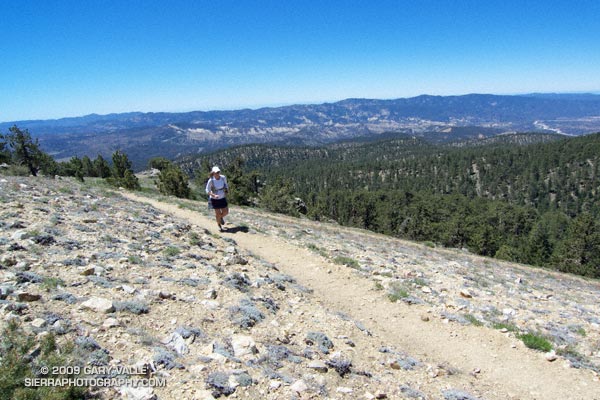
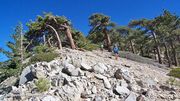
The 3 mile traverse of Pleasant View Ridge between Mt. Williamson and Burkhart Saddle was strenuous, but spectacular. The path along the ridge was also untrodden, and it wasn’t until Pallett Mountain that we noticed the first footprints. From Pallett Mountain the route dropped more than 3000′ — much of it excellent running on the Burkhart Trail. It wasn’t until mile 20, when we turned off the High Desert National Recreation Trail and started the mile descent to the Devil’s Punchbowl parking lot, that we finally encountered another person — a runner, jogging up the hill.

Here’s a Cesium browser View of a GPS trace (yellow) of the point to point route, and an elevation profile generated by SportTracks. Using the High Desert Recreation Trail as a connector (red trace in the Google Earth view), the route could be extended to a loop.

Some related posts: Peaks Along Pleasant View Ridge, Pleasant View Ridge Snow

Autumn Trail Running on Mt. San Jacinto

Autumn trail running along Wellman Cienega in the San Jacinto Wilderness.

Spectacular Autumn trail running along Wellman Cienega in the San Jacinto Wilderness.


Tahquitz and Suicide Rocks from the PCT
Lush with ferns and corn lilies in the summer, Wellman Cienega is a mountain seep high on the eastern slopes of Marion Mountain. It’s a couple of miles into an excellent 5 mile downhill segment from the top of San Jacinto to Saddle Junction.

From today’s trail run to San Jacinto Peak (10,834′) and Tahquitz Peak (8828′) from the top of the Palm Springs Tram at Long Valley.

Here’s a Cesium browser View of a GPS trace of the route, and an elevation profile generated in SportTracks. The total elevation gain/loss on the 20 mile run was about 4000′.

Related post: Room with a View

The Run Down After the Run to the Top

Runners Descending the Devil's Backbone on Mt. Baldy

Runners Descending the Devil’s Backbone on Mt. Baldy

It’s a lot more fun working with gravity, than against it! For many runners, the run down from the summit of Mt. Baldy is as much a part of the Run to the Top experience as the race up.

Grueling sections of trail are effortlessly retraced, and there is more of an opportunity to enjoy the Devil’s Backbone, and other spectacular sections of trail. Those needing more mileage skip the chair lift ride down from the Notch, and continue down the service road, following the route of the race.

Related post: Mt. Baldy Run to the Top 2009

Chumash Wilderness Trail Run

Lynn Longan running up the switchbacks near the Condor Observation Site on Mt. Pinos.

 The out and back trail run from the Chula Vista parking lot on Mt. Pinos to the top of Mt. Abel is one of the best “short” mountain runs in Southern California. Most of the run is on the Vincent Tumamait Trail —  a technical single track trail in the Chumash Wilderness in Los Padres National Forest.

Llama on the trail/road up to the Condor Observation Site and summit of Mt. Pinos.Ranging in elevation from about 7700′ to 8800′, the run packs a lot into its 15 mile length, combining great scenery with demanding uphills and superb downhills through old growth pine and fir forest. The summit area of Mt. Pinos is open and alpine with views that can range from the ocean to the Sierra.
 
Yellow monkeyflower and western blue flag (iris) at Sheep Camp.About 4 miles from the parking lot is the North Fork Trail junction. A short side trip on this trail leads to the seeps, spring and wildflowers at Sheep Camp. The Vincent Tumamait Trail ends at Cerro Noroeste (Mt. Abel) road, but it is not difficult to work up through the pines about 1/3 of a mile to the campground on Mt. Abel’s summit.

Usually about 20-30 degrees cooler than lowland hot spots such as the San Fernando Valley, the run is a great way to beat the heat on a hot summer day. See the post Vincent Tumamait Trail for more info and additional trail running options.

The title photo is of Lynn Longan, running up the switchbacks near the Condor Observation Site on Mt. Pinos.

Where the Heart Is — and Lungs, and Stomach and…

Maybe because we’re involved in outdoor sports, we’re more aware of basic human anatomy than some other segments of the population, but I am still stupefied to read the results of a recent study in which less than one-third (31.4%) of the participants correctly identified the location of the lungs on a diagram of the human body.

The study, published in BMC Family Practice (2009, 10:43), was intended to evaluate the anatomical knowledge of different patient groups and the general public, and compare the results to a similar study done in 1970.

In the 2009 study, less than half (46.5%) of the participants correctly identified the location of the heart, and a little more than one-third (38.4%) could identify the location of the stomach.

The percentage correct for each item of the anatomy tested (heart, lungs, stomach, intestines, bladder, thyroid, liver and kidneys) averaged 51.4% in 1970 and 52.5% in the 2009 study.