Category Archives: running|adventures

Mt. Baldy North Backbone Trail

Lodgepole Pine and distorted mountain wave clouds near Dawson Peak.

As I drove under the ski lift on the narrow dirt road, I wondered if I was in the right place. I had turned off of Angeles Crest Highway a few minutes before, and hoped I was still on Blue Ridge Road. My intended destination was an isolated turnout that serves as the trailhead for the North Backbone Trail. This classic trail follows a roller-coaster ridgeline to Mt. Baldy’s broad 10,064′ summit.

Bouncing along the dirt road, I surveyed the sky. The forecast had been for partly cloudy skies, but the morning had dawned overcast and crimson red, and now there was talk of rain. Autumn in the mountains is like that.

The North Backbone Trail is usually not as busy as the usual routes that ascend Mt. Baldy (Mt. San Antonio). One of the reasons is the bumpy six mile, back country drive to the trailhead. Another is the undulating round-trip route gains (and loses) about 4750′ over about eight miles. It climbs over – or nearly over – three highpoints: Point 8555, Pine Mountain (9648′), and Dawson Peak (9575′).

Rounding a corner, I’m surprised to see a small turnout jammed with cars. It’s not hunting season yet, so there must be a group already on the ridge. Squeezing into the last available space, I check that I’m not blocking the road or the car behind me, grab my pack, and jog down the trail to a saddle. To the east Mt. San Jacinto is sandwiched between low clouds and high, and I wonder what the day will bring…

As I reach the summit, the sun breaks through the clouds for the briefest instant. As if driven by my efforts on the ups and downs of the trail, the blues, whites and grays of the sky and clouds have been continuously changing. In turn, the intricacy of the clouds and their motion has energized me. It has been a extraordinary ascent, full of exertion, discovery, wonder, and awe.

A hiker on the summit smiles and waves, and walks over to me. Excited, he tells me that he is 57 and just started climbing peaks two years ago. This is his 57th summit. Days like today are why.

The North Backbone Trail is a treat for the fit and experienced adventurer. In fair weather, and without any snow and ice, it is a strenuous, but relatively straightforward climb. The ups and downs are generally quite steep and there are a few loose, rubbly sections. I hiked the ups, and jogged the flats and downhills. It is not a place to be in a thunderstorm.

The photograph of a Lodgepole Pine and mountain wave cloud was taken on the slopes of Dawson Peak, on my way back from Mt. Baldy. About an hour later, as I descended from Peak 8555, it started to rain. Autumn in the mountains is like that.

Here’s a Google Earth image of a GPS trace of the route from North Backbone Trail Revisited.

Some related posts: Mt. Baldy Run Over the Top, Pine Mountain Juniper, Mt. Baldy Runner

Cottonwood – New Army Pass Loop

Rock Creek trail below New Army Pass.
Upper Rock Creek Canyon

The climb up the glacier sculpted canyon hadn’t been too bad. How could it be on a day like this? Winds were light, and the temperature was refreshingly cool – perfect for running in shorts and a lightweight long-sleeve top. As I had worked up the Rock Creek trail, marmots, fat for the Winter, had whistled warnings of my approach and then waddled for cover. Amicable clouds embellished the high mountain sky, and sun-chased shadows quietly set the pace.

Mt. Langley from New Army Pass.

Atop New Army Pass, I marveled at the diverse landscape. To the north loomed the massive hulk of Mt. Langley. Invitingly close, I had climbed the peak from this point several times before. Today, the additional 5 miles and 2300′ in elevation gain were not part of the plan. Just a few hours before I had been in the San Fernando Valley at an elevation of 800′. Now above 12,000′, I was happy to feel more or less normal, be able to run the flats and downhills, and enjoy the day. (See the note regarding altitude sickness and acclimatization at the end of this post.)

New Army Pass (12,300′) is at about mile 12 of the approximately 21 mile loop. On May 1 California Cooperative Snow Surveys reported the Southern Section Sierra snowpack at 177% of normal. Four months and a very hot summer later, remnants of that snow could still be seen on the Sierra crest near the pass.

Long Lake in the Cottonwood Lakes basin.

My route had started at Horseshoe Meadow, climbed to Cottonwood Pass, and then followed the Pacific Crest Trail and a connecting trail to the Rock Creek trail. From New Army Pass the route would drop down to Long Lake, and then head east to Cottonwood Creek, where it would follow a roundabout route back to the trailhead.

Nearly the entire loop is at or above 10,000′, and almost 12 miles of it are above 11,000′. Many miles of the route are in stands of hardy and picturesque Southern Foxtail Pine. A close relative of the Bristlecone Pine, Foxtail Pines can live to be more than 3000 years old.

In places along the crest, impervious trunks of long dead Foxtail Pines lay in the talus. Many of these ancient trees are larger than the live Foxtail Pines surrounding them. In some cases the relic trees are found above the current treeline – a stark reminder of the changeable nature of Earth’s climate.

The title photograph was taken on the Rock Creek Trail at an elevation of about 11,200′ looking west. Mt. Anna Mills is the sunlit peak on the left, and Mt. Guyot is the peak on the right. In the distance are peaks of the Great Western Divide. An USGS aerial photograph of the area suggests that the mound of rocks to the right of the trail may be a moraine associated with a small rock glacier. The red arrow in the aerial photo indicates the approximate position and direction of the photo on the trail. It could be the feature originated as a landslide, but semi-concentric surface ridges in the debris appear to be evidence of fluid motion at some point in the past.

Here’s a Google Earth image and Google Earth KMZ file of a GPS trace of the loop.

Note: There is much information available on the Internet regarding altitude sickness and acclimatization. As a starting point see UIAA Medical Commission – Advice and Recommendations and Wikipedia: Altitude sickness.

Peru Running


Runners on a high plateau above the Sacred Valley of the Incas.


We did this acclimatization run early in our running adventure in Peru. The grain field is on a plateau at about 11,000′, and parallels the Sacred Valley of the Incas, and Urubamba River.


The run took us across the plateau, down to the Maras salt mines, and then down into the Sacred Valley at a little over 9000′. Excited about the trip, we ran most of the way back to the hotel in Yucay. That evening we enjoyed Pisco Sours and an excellent dinner, and then drifted off to sleep dreaming of big mountains and expansive views.


The high peaks beyond the valley are part of the Cordilla Urubamba and are over 5000m (16,400′). The highest point on the Inca Trail, the “pass of the dead woman,” is at about 13,800′. Later in the trip we would cross two 5000m passes while running a circuit of Mt. Ausangate.


The photograph is from July 15, 2003. The trip organizer, Devy Reinstein of Andes Adventures, is a accomplished runner, and a genius at travel logistics and organization.

Thunderstorm

Developing cumulonimbus near Mt. Abel

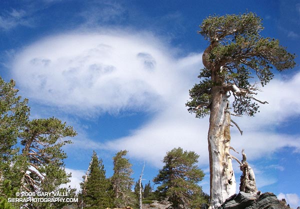
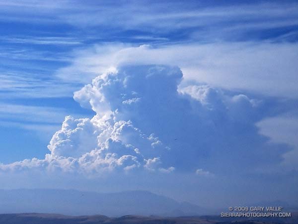
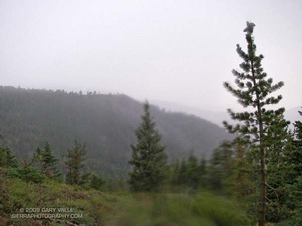
Developing Cumulonimbus Near Mt. Abel

Saturday, Pierce College in Woodland Hills set an all-time record high temperature of 119°F. Following a preliminary review, a NWS forecaster said this was probably the highest temperature ever recorded at an official weather station in Los Angeles County.

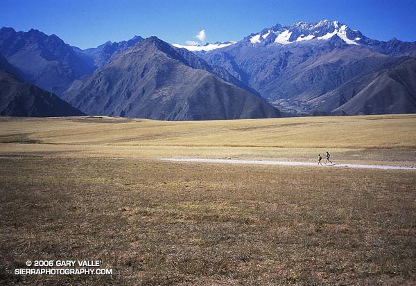
To escape this oppressive heat, and avoid the scorching temperatures of last week’s long run, my intent was to get to the highest elevation possible, as early as possible, and stay as cool as possible. At an elevation of about 8400′, the Mt. Pinos Chula Vista trailhead is nearly 2000′ higher than Islip Saddle in the San Gabriel Mountains, and is usually a good choice for a run on a warm day.


San Gabriel beardtongue (Penstemon labrosus) near Sheep Camp.
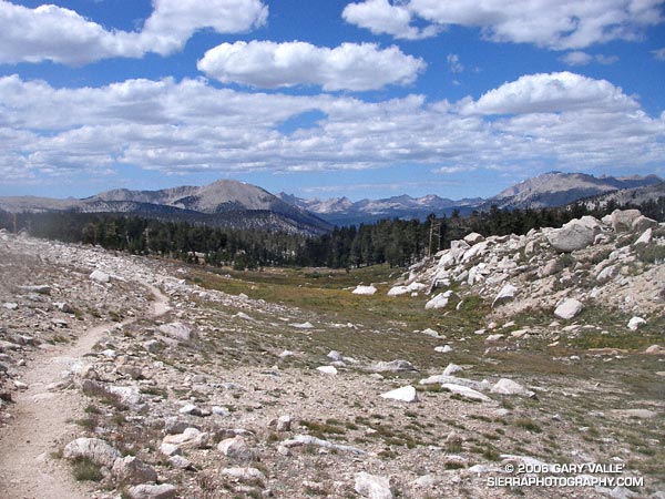
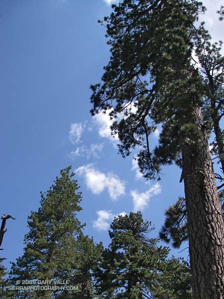
A little after 7:30 a.m., under nearly cloudless skies, I jogged out of the Mt. Pinos parking lot reveling in the cool mountain air. I didn’t have a specific route in mind, but thought I would probably do a longer variation of the Mt. Pinos to Mt. Abel run described in my Vincent Tumamait Trail post. Energized by the cool temperature, it didn’t take long to work up and over the summits of Mt. Pinos (8831′) and Sawmill Mountain (8816′), and then down the North Fork Trail to the spring at Sheep Camp (8200′).

Surrounded by the greens of the spring, and the yellows and reds of wildflowers, I gulped cold water, and thought about where to run. A sign at the “T” with the Tumamait Trail listed the distance to “Lily Meadows Camp” as 3 miles. I hadn’t been on that section of North Fork trail since preparing to run the Inca Trail in 2003.

Deciding to continue down to Lily Meadows Camp, I crossed over the spring and followed the little used, pine needle covered trail southeast along the hillside. The trail dropped steeply along a rounded ridge, where mountain quail fretted among the manzanita and fallen trees, and the minty fragrance of Pennyroyal drifted up from the margins of the trail. Quicly losing elevation, I reminded myself that whatever I ran down, I would have to go back up.

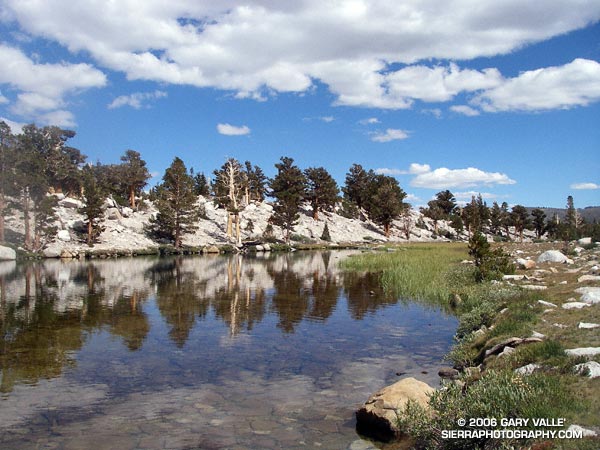
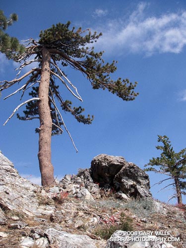
After about a mile and a half, the path switchbacked down to the North Fork of Lockwood Creek. Here, the grade lessened and long stretches of nearly perfect trail running led to Lily Meadows Camp (6250′). Old growth Jeffry pines towered above the camp, and a Monarch butterfly flittered about on a current of air. The pleasant, Sierra-like environment was a welcome change from the 100 degree heat of the previous week!


The first cloud!
An 1800′ climb and an hour later, I’m back at Sheep Camp, refilling my Camelbak®. Suddenly a shadow sweeps over the forest, and a small cloud – the first cloud – looms overhead. It’s just after 11:00 a.m., and the heat of the day has triggered some cloud development. After taking a few photos and eating a Clif® Bar, I decide I better get going, and jog up to the junction with the Tumamait Trail.

Reaching the trail junction at about 11:30 a.m., what had been a single tattered cloud in the sky is now several, and my “inner voice” of experience says, “Turn right, you can be back to the car in under an hour!” But it has been such an enjoyable day, and there aren’t that many clouds… I turn left towards Mt. Abel.

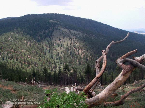
At first, shadow and sun play tag among the trees and I join in, chasing the clouds down the twisting and turning trail. The partly cloudy skies are postcard perfect, and I wonder if my concerns are ill-founded. But as the superb downhill segment transitions to up, a gray gloom invades the forest. At Mt. Abel Road, it’s noon. Rationalizing that the extra minutes required to scramble up to Mt. Abel’s summit won’t hurt, I cross the road and head up the steep slope.


The sun breaks through the darkening sky, illuminating the face of Grouse Mountain.
Seven minutes later, I’m back at Mt. Abel road. For a brief moment, a narrow shaft of sun breaks through the darkening sky, illuminating the face of Grouse Mountain. It washes across the slopes of the mountain, and then suddenly all is in shadow. At that instant, I know I’m in a race that I cannot win.

A quarter mile down the trail, the first cold drops of rain dampen my bare legs, and in another quarter mile, there is a rumble of thunder to the north, and then another rumble behind me. Part way up Grouse Mountain, there is a flash, and then directly above me an immediate ear-splitting, crackling clap of thunder. From the first few clouds to the first lightning has taken little more than an hour!

In an astonishingly short period of time, the rain, lightning and thunder grow in magnitude. Flash – boom! Flash – boom! The storm engulfs me as it grows in intensity. In the expanded microseconds that follow each lightning flash, I  breathe a sigh of relief that I’m not struck, and then bodily recoil from the immediate and overwhelming power of the crashing thunder.

Cresting the shoulder of Grouse Mountain, I think back to a storm in the San Gabriels, where instead of striking an obvious ridge, a bolt of lightning struck a nondescript tree on the slopes below. There is no place to hide from this monster. I adopt a tactic of almost sprinting through open areas, past tall trees, and when the electric motor smell of ozone fills the air. In areas that seem a little safer, I slow my pace.

At the top of another long climb, near the North Fork trail junction, I’m surprised to see a group of 8 or 9 hikers huddled under a pine tree. They are probably surprised to see someone running along the hilltops. From the first rumble of thunder, I’ve been considering whether hunkering down in the forest off the ridge might be a better strategy. If I had my shell pants, or my runner’s emergency bivi sack (a plastic trash bag), it might be. But wearing just my rain shell, a short-sleeve synthetic top and running shorts, I’m under-dressed for this get together.

Off to the east, in the direction of Mt. Pinos, the sky seems lighter. Maybe the wind is shifting the cells to the west and north. I have no idea how long this thing is going to last, and the pounding rain and gusty winds are sleety cold. I don’t want to stop. Not at all sure it is the better choice, I wish the hikers the best, and continue up the trail toward Sawmill Mountain.

The storm, and my emotions, wax and wane in a recognizable, but hard to define pattern. Periods of awe, elation and fear cycle with the storm. It has only been 30 minutes since the rain and thunder began, but in my distorted world, it might have been 30 hours. The steady rain has flooded the trail, and I feel like I am crossing a never ending creek.


Hurried photo near the top of Sawmill Mountain, when the storm was nearing peak intensity.
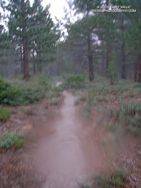
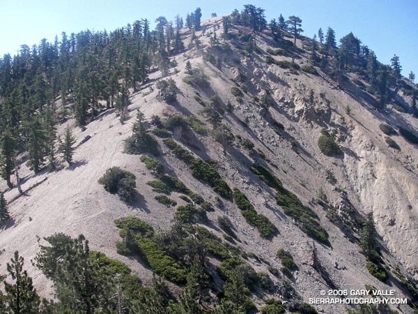
As I near the summit plateau of Sawmill Mountain, erratic gusts of wind tear at the trees. Then suddenly, as if a dam has broken, a deluge of lightning, thunder, rain and hail spills from the sky. It is the most intense rain I have ever experienced. A pounding rain, thick with hail, driven by a downburst of wind and gravity. Torrents of water cascade down the trail. It is ferocious.

Running through the maelstrom across the plateau, ahead I can see the point where the trail drops off the summit, and descends to a saddle. I just have to get there. Lightning flashes, and thunder booms behind me. My feet are numbed and cold, and I wonder how water on the trail can be calf deep.  Reaching the shoulder of the mountain, I start to descend. From time to time I get a glimpse of Mt. Pinos, and I can see a little smudge of blue under the dark clouds over the summit. As I descend toward the saddle, the intensity of the storm seems to be diminishing. There is still lightning, thunder and rain, but for a moment the focus of the storm seems to be shifting elsewhere. I take a deep breath, and debate what I’m going to do about getting over the exposed summit of Mt. Pinos.


Looking back at ridge on Sawmill Mountain from shoulder of Mt. Pinos.
There are still two groups of active cells. The main thunderstorm complex seems to be behind me, toward Mt. Abel; but there is also an active group of cells just north of Mt. Pinos. While I’ve seen no lightning strike the summit of Mt. Pinos, it is almost a certainty. I decide to work up the switchbacks toward the summit, continuing my tactic of minimizing my time in areas that are exposed. The rain has nearly stopped, and I haven’t smelled ozone since on Sawmill Mountain, but some sections of the trail are frighteningly exposed. Working up to the highest point that appears to offer some protection, I pause and listen. The timing may be right. The thunderstorm activity seems to be in a down cycle.

I leave my alcove. In seconds I’ve rounded a rocky rib of the peak, and am suddenly the tallest and most linear object on its bare shoulder. Thunder rumbles off to the north, a reminder I don’t need. Heart pounding, I’ve already pushed the pace as much as the grade, elevation, and my body will allow, and now there is nothing for me to do but run.

It is not a relief to reach the summit. I see a bolt of lightning strike to the northeast, near a radio tower less than a quarter mile away. Partially hidden from view, I can’t tell if the lightning struck the tower, or a ridge beyond. It doesn’t matter. I have to get off the summit.


Mariposa lily (Calochortus invenustus) west of Mt. Pinos.
Running along the road from the observation point, I’m nervous about going in the direction of the relay tower, and the last lightning strike. I know the road will soon turn downhill, but as hard as I am running, I don’t seem to be getting anywhere. Finally, I see, and then round the turn. Another 50 yards, and for the moment I’m safe. A dash across one meadow, and then another, and the main danger is past.

To the east, I see more blue sky, and broken clouds. Continuing to descend, I hear a group of Chickadees chattering in a nearby tree. They sound happy. So am I.

Here’s a Google Earth image and Google Earth KMZ file of a GPS trace of my route.

Epilogue: According to the American Meteorological Society, lightning kills more people per year on average than hurricanes and tornadoes combined. For more information regarding lightning safety, please see the National Weather Service Lightning Safety page. Here’s what the thunderstorm looked like on radar.

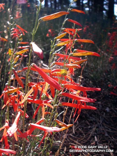
(The title photograph is of a developing cumulonimbus near Mt. Abel. It was taken on a run at Sage Ranch on July, 19, 2006.)

Heat Wave

As I turned into the Vincent Gap parking lot and pulled to a stop, a few sprinkles of rain dotted my windshield. Opening the car door, I wanted to close it again. It was 7:30 in the morning and the temperature was already nearing 70 degrees. It shouldn’t have been a surprise. The previous two days the National Weather Service office had issued an “excessive heat warning” for much of the Los Angeles area, including the lower elevations of the mountains.

Angeles Crest Highway was closed 2.6 miles west of Islip Saddle, so my plan was to do the Islip Saddle – South Fork – Mt. Baden-Powell loop from the Vincent Gap side. (Update May 21, 2009. Angeles Crest Highway has since been re-opened to Islip Saddle, and through to Wrightwood.) This difficult 23 mile loop, and some of its logistical issues, were described in the posting Complications.  The day was really too warm to be doing this route, but with a chance of thunderstorms in the forecast maybe some clouds would help keep temps in check. I’d run at least to Little Jimmy Spring. If it was too hot, I could always head back.

It didn’t take long for the clouds that had spritzed my windshield to move off to the west. Except for a smoky haze from the Sawtooth Fire, mostly clear skies prevailed as I worked up the numerous switchbacks of Mt. Baden-Powell.  Near the summit of of the peak, I paused for a moment to admire the Wally Waldron Tree. At an elevation and in an environment similar to the 4000+ yr. old White Mountain Bristlecone Pines, this gnarled and weather-beaten Limber Pine is estimated to be 1500 years old. Clearly ancient, it has survived wind and weather too extreme to imagine. According to the Forest Service, some Limber Pines in this area may be as much as 2000 years old. Extended longevity doesn’t appear to be limited to Limber and Lodgepole pines; a stunted White Fir near the summit also looks unusually old.

Down from the summit, and back on the Pacific Crest Trail, the running along the ridge was outstanding. Near Mt. Burnham, I stopped to take a few photographs, and watch a bumblebee working through a batch of Grinnell’s Penstemon (Penstemon grinnellii). The throat of this particularly bulbous penstemon perfectly accommodates the bumblebee, and perhaps is an example of a flower adapting to a preferred pollinator. Continuing along the crest, between Throop Peak and Mt. Hawkins, red accents among the rocks marked patches of Bridge’s Penstemon (Penstemon rostriflorus). From time to time, sparse clouds masked the sun, but as I descended toward Windy Gap, the temperature climbed inevitably higher.

One of the pros of doing the loop from Vincent Gap is that it is great to have fresh legs for the exceptional trail running down to Islip Saddle. Except for a short climb over the shoulder of Throop Peak, the running is generally downhill from the summit of Baden-Powell  (9399′), all the way to South Fork Campground (4560′). This is a distance of over 13 miles, with an elevation loss of nearly 5000′. The major con is having to do the lowest elevation segment of the loop, and the climb back to Vincent Gap (6565′), during a warmer time of the day.

Aside from the heat, another concern had been nagging at me. What if the trail was impassable? This wasn’t heat induced paranoia. Last year, several sections of the South Fork trail were buried in small rock slides, and a couple of places where the Manzanita Trail crossed steep erosion gullies were in very bad shape. A Winter had passed, and who knew what recent thunderstorms had done to the trails?

Switchbacking down to Little Jimmy Spring, I had already decided to continue to Islip Saddle. In the battle of “do, or do not” I knew that once at Islip Saddle, “do” would win again. Maybe some clouds would help me on my way…

Epilogue: In sun-baked South Fork canyon, even the downhill was difficult, but the rock slide plagued trail was still passable. Some clouds provided temporary relief at South Fork Campground, but didn’t last. The damage to the Manzanita Trail was worse than last year, but with care I was able to get through. In nearby Valyermo, midday temps reached over 100°F. Here’s a Google Earth image and Google Earth KMZ file of a GPS trace of the route, and a Forest Service diagram of area trails that’s at Vincent Gap.

Pleasant View Ridge

Peak 8248, the highest point on Pleasant View Ridge

The photograph is of peak 8248, the highest point on Pleasant View Ridge, viewed from the saddle northwest of the peak. Located in the San Gabriel Mountains, Pleasant View Ridge extends northwest about 8 miles from  Mt. Williamson to the vicinity of Indian Bill Canyon.

When hikers refer to Pleasant View Ridge, they are usually talking about a 3 mile segment of the ridge that runs from the southeastern summit of Mt. Williamson (8214′) to Burkhart Saddle (6959′). From Mt. Williamson, the ridge follows along a series of 8000’+ summits, then crosses a deep gap to the broad summit of Pallett Mountain (7760’+). From this point, Burkhart Saddle and the Burkhart Trail are another 0.6 of a mile to the west.  There is no maintained trail on the ridge, but over time a use trail has developed and is generally (but not always) distinct. In this photograph of the ridge from the PCT, Pallett Mountain is the peak on the left, in the distance.

Mt. Williamson is in the peculiar situation that the register for the peak is not on the peak labeled “Mt. Williamson” on the Crystal Lake topo. According to the Sierra Club Hundred Peaks Section Peak List, the register is normally located on peak 8244, which is the next peak along the ridge to the northwest. What is even more peculiar, peak 8248, which is a little further on the ridge, is the highest point of all three!

The section of Pleasant View Ridge between Mt. Williamson and Burkhart Saddle is commonly done as part of a 13 mile loop from Eagles Roost. In order to protect critical habitat of the mountain yellow-legged frog, the Forest Service has closed the PCT between Eagle’s Roost and the Burkhart Trail. In addition, Angeles Crest Highway (SR2) is now closed 0.25 mile west of Eagles Roost. (Update May 27, 2007. Angeles Crest Highway has since been re-opened to Islip Saddle. It was open to Islip Saddle on May 27, 2007, but closed beyond this point. It looked like the road past Islip was being resurfaced.) If the PCT detour suggested by the Forest Service is followed, the loop length is increased to about 14.4 miles, and it is necessary to hike/run a 2.4 mile stretch of Angeles Crest Highway. Done this way, the route has an elevation gain and loss of 4000′ or so.

I usually like to do the loop in the counter-clockwise direction, and that’s what I did on this day. It’s nice to get a big chunk of elevation gain done in the morning while it’s cool, and then have a net elevation loss doing the ridge. Also, except for a few downed trees, the running is outstanding from Burkhart Saddle down to Little Rock Creek. Some Western Columbine (Aquilegia formosa) was blooming along Little Rock Creek.

Here is a Google Earth image and Google Earth KMZ file of a GPS trace of the loop with the PCT detour through Buckhorn Campground. The ridge parallels the San Andreas Fault zone, whose linear features can be seen in the valley below. This Google Earth image shows the approximate position of the fault zone in relation to Pleasant View Ridge loop. It also shows the section of Pleasant View Ridge northwest of Burkhart Saddle.

For more information regarding the PCT detour see the News section of the Angeles National Forest web site.

Updated May 5, 2008. Added elevation profile.

Google search: $g(Pleasant View Ridge), $g(Mt. Williamson), $g(Pallet Mountain), $g(Burkart Trail), $g(trail running), $g(mountain yellow-legged frog), $g(PCT), $g(Pacific Crest Trail), $g(San Gabriel Mountains)

Related post: Peaks Along Pleasant View Ridge