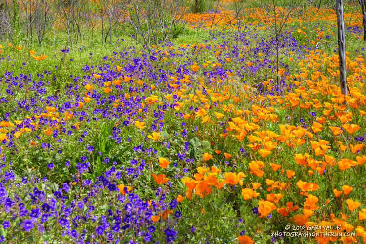
Hundreds of Parry’s Phacelia and California Poppy wildflowers form a multi-hued carpet of purple and orange along the Old Boney Trail in Pt. Mugu State Park.
From the post Wildflowers, a Waterfall, and Recovering from the Woolsey Fire.

Hundreds of Parry’s Phacelia and California Poppy wildflowers form a multi-hued carpet of purple and orange along the Old Boney Trail in Pt. Mugu State Park.
From the post Wildflowers, a Waterfall, and Recovering from the Woolsey Fire.
When I left the house to drive over to Ahmanson Ranch, the temperature in West Hills was 92 °F. It had been five months since it was that warm.
It’s been my experience that the first hot weather of Spring is often associated with an uptick of snake sightings. Over the past seven days or so, I’d seen a very young rattlesnake and a couple of small gopher snakes, but so far, that was it. With the warm weather, I thought I might see a snake on my run today, I just didn’t expect it to be in this manner.
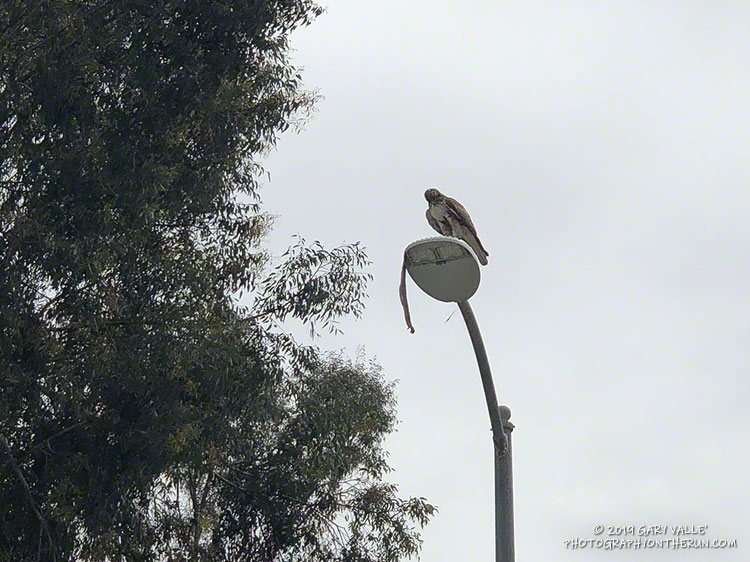
Lost in thought, I was just about to the entrance of Upper Las Virgenes Canyon Open Space Preserve (aka Ahmanson Ranch) when I was startled by a large red-tailed hawk flying from right to left directly in front of me. Something long was dangling from its talons.
I stopped and watched as the raptor, fumbling with a large snake, awkwardly flew onto the top of a street light. The snake was dangling precariously from the light, and the bird seemed to be having a little trouble holding it.
The snake looked relatively heavy-bodied, and at the time I thought it might be a rattlesnake. That brought to mind a story of a hawk somehow dropping a rattlesnake into a car. However improbable, I didn’t want to approach the hawk and frighten it. I have enough problems with rattlesnakes on the ground and don’t need them falling from the sky.
I got what photos I could with my phone and headed out for a run.
You know how it is when you’ve seen a snake — anything sinuous on the trail sets off the brain’s snake alert. During my run I saw a couple of stick snakes, but no real ones. Finishing my run, I pressed the Start/Stop button on my watch and started walking across the parking lot.
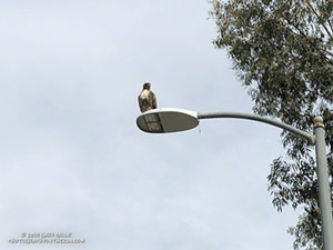
What? I squinted my eyes… Was the hawk still perched on the street light? No way, more than an hour had passed!
Continuing across the parking lot, I could see the hawk was still there, but where was the snake?
Cautiously, I approached the light post. I didn’t want to agitate the hawk or stumble onto an upset rattlesnake.
Sometime during my run, the hawk had dropped the snake — a gopher snake — and was waiting to retrieve it. It lay upside down on the street — sans its head. Rattlesnake or not, the hawk had removed the dangerous bit first.
I’ll be curious to see if the snake is still in the street tomorrow.
Update April 11, 2019. The following day (Tuesday) no trace of the snake remained, but the red-tailed hawk was still there — perched on an adjacent street light. On Wednesday the bird was gone.
The sun had not yet risen and the poppies along Danielson Road were still tightly furled against the morning’s chill. The purl of Upper Sycamore Creek resonated in the canyon below — a wonderful tone that in recent years has too often been squelched by drought.
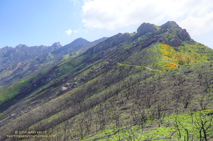
I was running to the Old Boney Trail and the start of the ridge that follows along Boney Mountain’s western escarpment to the massif’s huge summit plateau. Several of the Santa Monica Mountains highest peaks are on this plateau, including the range’s highest peak, Sandstone Peak.
In December I’d climbed this route to check the impact of the Woolsey Fire on the area. From the top of the ridge I’d been disheartened by what I saw. Tri Peaks and Sandstone Peak and much of the top of the Boney Mountain massif were a blackened, barren mess.
Now, three months later, I was headed back to Boney Mountain and would continue to Sandstone Peak for the first time since the fire.
Here are a few photos taken along the way.
Related post: After the Woolsey Fire: Boney Mountain and Pt. Mugu State Park
Parked in a turnout on Mulholland Hwy, I finished putting on sunscreen and then pushed the Start/Stop button on my watch to dial in the GPS and pair my HRM. Outside, it was a chilly 43 degrees. Sunrise was nearing and the strengthening March sun was forecast to push temps well into the 70s.
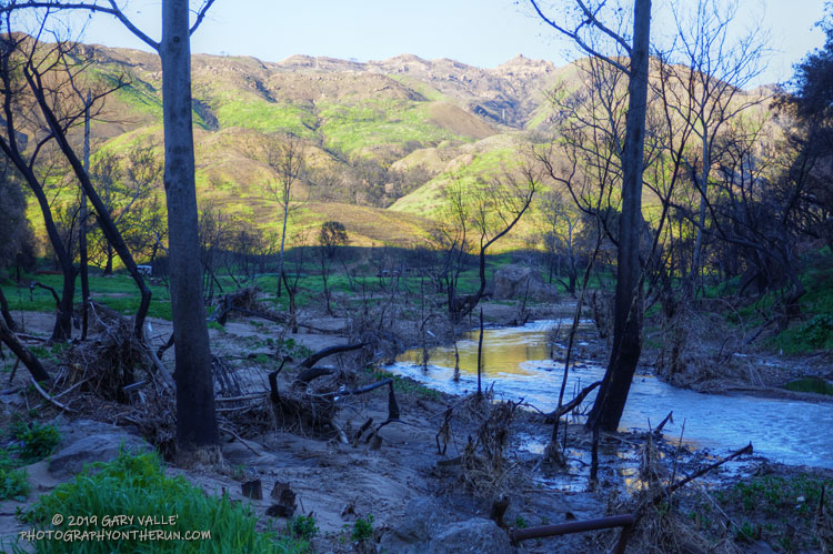
In the aftermath of Woolsey Fire, I’d returned to Malibu Creek State Park to see the wildflowers; gauge the response of the creek to heavy Winter rains; check on the health of the redwoods along the Forest Trail, and assess the ongoing recovery of the burned chaparral.
Today’s run of the Bulldog Loop would be a follow-up to two runs in the park in December 2018, which found a fire-ravaged landscape just beginning the long process of recovery.
Here are a few photos taken along the way.
Some related posts: After the Woolsey Fire: Bulldog Loop, After the Woolsey Fire: Malibu Creek State Park Redwoods, M*A*S*H Site and Bulldog Climb
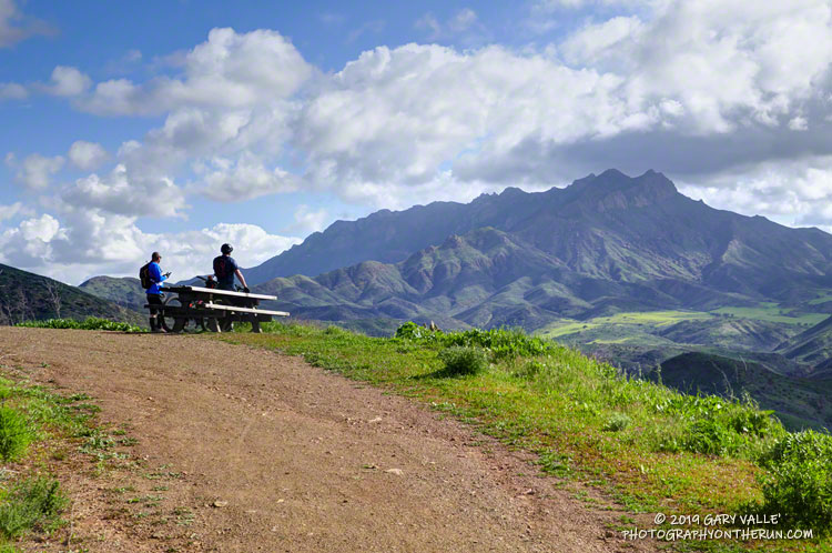
The Ray Miller Trailhead in Pt. Mugu State Park marks the western end of the Backbone Trail, a 68-mile scenic trail along the spine of the Santa Monica Mountains. The Ray Miller Trail’s long, winding descent into La Jolla Canyon is a favorite of runners and hikers, and a fitting end to those traversing the BBT from east to west.
My run this morning was to the Ray Miller Trailhead (and back) from Satwiwa, starting at the Wendy Drive trailhead in Newbury Park. The Wendy Drive Trailhead is very popular and is the starting point for many good runs, hikes and rides. To get an idea of the route options, see the detailed trail maps on the Pt. Mugu State Park page of VenturaCountryTrails.org.
Today I was looking to do a longer run, so didn’t take the usual route. On the way down Big Sycamore Canyon, I skipped the turns at Wood Canyon (Hell Hill), Wood Canyon Vista Trail (BBT) and Fireline Trail and at Overlook Fire Road, some eight miles into the run, finally headed uphill.
The top of the Ray Miller Trail is a stout 2.5 -mile climb from the bottom of Overlook Fire Road. Along the way there were excellent views of Sycamore Canyon, Serrano Valley and Boney Mountain.
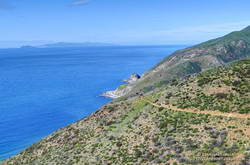
About a half-mile down the Ray Miller Trail there is a popular overlook of the coast. The day was clear and there were stunning views of the Pacific and the Channel Islands. Brushed by whispers of wind, the cerulean blue Pacific filled my view for much of the descent to the parking lot.
It was an odd feeling to run down to the parking lot with runners who were cheerfully finishing their morning run, knowing that I had many more miles to go. After a quick stop at the water spigot, I turned, and sighed, and took the first steps back up the hill and toward Satwiwa.
Here are a few photos taken along the way.
Related post: Ray Miller Training Run
For the last couple of days of January, all of February, and the first third of March, the temperature at Downtown Los Angeles (USC) and many other Los Angeles area locations did not reach 70 °F!
Will have to think of days like today when it’s 100 degrees and I’m picking foxtails out of my socks and shoes!