Category Archives: trails|malibu creek state park

Reagan Ranch Bobcat

Bobcat at Reagan Ranch, Malibu Creek State Park

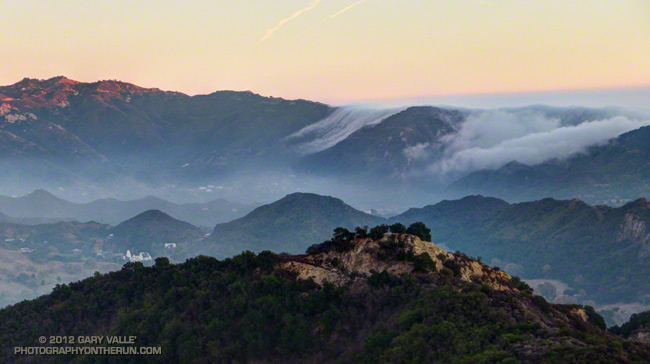
My rambling New Year’s run at Malibu Creek State Park had begun on the Cistern Trail. I thought I might run to the base of the Bulldog climb and then back on Crags Road to the main parking area. From there maybe I’d do the Phantom Trail loop or run over to Tapia Park and then back to the Lookout Trail.

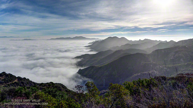
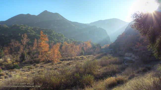
The route really didn’t matter. It was a classic Southern California Winter afternoon — cool, but not cold, with a mix of clouds and sun. Grasslands were green with December’s rain, and the low sun cast a golden hue over the rocks, oaks and chaparral.

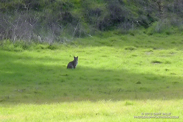
I was running west on the Yearling Trail on the Reagan Ranch property when I spotted a blocky form sitting in a shadow at the edge of a field. About 100 yards away, its profile was accentuated by a backdrop of bright green. Too small to be a mountain lion, too large to be a domestic cat, the wrong shape and behavior to be a coyote, it had to be a bobcat.

Bobcats can be very bold. Last year while warming up for a race at Crystal Cove State Park, I rounded a corner and 50 yards away a bobcat was sauntering down the road. I continued at an easy jog up the road and the bobcat continued walking down the road toward me.  I expected it to dart into the bushes, but it just kept walking toward me.

When we were about 20 feet apart, it casually stepped to the edge of the road, near some brush. I slowly approached and then stopped. The cat was five short feet away, with her back to me and head turned toward me. I was astonished to be so close, but a little unnerved by the animals brazen behavior. After what seemed like minutes, but was probably only 10-15 seconds, we both continued on our way.

The Reagan Ranch bobcat wasn’t nearly as cooperative. I snapped a couple of photos at max zoom (about 90mm) and then as I took a couple of steps in the cat’s direction it loped up the hill and into the oaks.

Some related posts:
Hawk, Bobcat and Rabbit
Coyote Tag

Vertical Relief

The crest of the Santa Monica Mountains east of Castro Peak

The crest of the Santa Monica Mountains east of Castro Peak stands out in bold relief above a tumultuous ocean of low clouds and fog.

From this morning’s run of the Bulldog loop in Malibu Creek State Park.

Some related posts: Bulldog Loop or Saddle Peak Out & Back?, Malibu Creek State Park Scenic Loop

Autumn Color – Southern California Style

Sycamore trees along Malibu Creek

Because of our warmer Mediterranean climate with dry Summers and (sometimes) wet Winters, many of Southern California’s lower elevation native trees and shrubs benefit from retaining their leaves in Winter and are not deciduous.


Those native trees that are deciduous don’t usually grow in dense stands or show their fall colors in a dramatic fashion.

Some of the Southern California trees found at low elevation that are deciduous are valley oak, sycamore, willow, cottonwood, ash, alder, elderberry and walnut.

From last Sunday’s run in Malibu Creek State Park.

Urban Highlands

View west from the Phantom Trail in Malibu Creek State Park

The view west from the Phantom Trail in Malibu Creek State Park to the Boney Mountain massif a few minutes after sunset.

The highest point in the Santa Monica Mountain Range, Sandstone Peak (3111′), is the triangular-shaped peak on the skyline on the right-center of the photograph.

Most of the Santa Monica Mountain Range is part of the Santa Monica Mountains National Recreation Area. Comprised of more than 150,000 acres and 500 miles of trails, the SMMNRA is the largest urban national park in the United States.

From Sunday’s run in Malibu Creek State Park.

Some related posts: No Plan Required, Malibu Creek State Park Scenic Loop, Large Poison Oak Leaves

Marine Layer Flow

The marine layer spills over the crest of the Santa Monica Mountains

The marine layer spills over the crest of the Santa Monica Mountains between Saddle Peak and Malibu Canyon.

From this evening’s run on the Phantom Trail and other trails in Malibu Creek State Park.

Related post: Saddle Peak from the Phantom Trail

Tapia Spur Trail Being Modified to Accommodate Multi-Use

Excavator on the Tapia Spur Trail

In addition to some melting white stuff that looked like snow and a mountain lion sighting, another surprise on my run last Sunday is that the Tapia Spur Trail is being reworked to better accommodate multiple user groups.


A little more than a mile in length, the Tapia Spur Trail connects Tapia Park to the group campground parking area in Malibu Creek State Park. This provides a linkage between the Backbone Trail and MCSP’s main trailhead and parking area, enabling a variety of hikes and rides, including the popular 14.5 mile Bulldog loop.

Modifications include restoring the trail tread, brush maintenance, swale crossings, smoothing the grade, changing the trail alignment to improve sight distance and grading, adding pinch points to slow cyclists, adding areas of retreat, and other changes. Here’s an aerial overview of the work being done (PDF) and a description of project (PDF).

According to Craig Sap, District Superintendent of the Angeles District of California State Parks, the work is expected to be completed during the first week of May. The trail remains open during the project.