Category Archives: weather|southern california

Mt. Wilson Rim Trail – Kenyon Devore Trail Loop

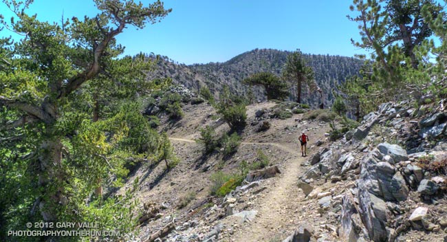
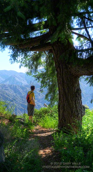
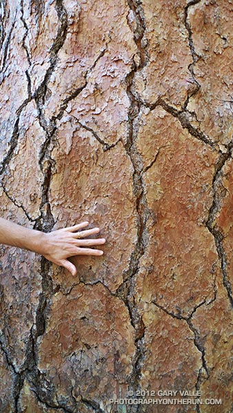
Big cone Douglas-fir on the Rim Trail near Mt. Wilson

Brett was down for Father’s Day weekend and one of the things we wanted to do was get in a couple of good trail runs. He’s heard me talk (a lot) about the Mt. Disappointment 50K and how it ends. Basically you run 27 hilly miles with over 3600′ of elevation gain, THEN finish the race by doing a 5 mile, 2650′ climb from West Fork up the Gabrielino & Kenyon Devore Trails to the top of Mt. Wilson.

This final climb tells the 50K tale. If you’ve trained well and run a good race a middle-of-the-pack runner might gain 15-20 minutes on this leg. If not, you could easily lose an hour or more. In any case you put everything you have left into this climb. An elevation profile and some stats for Kenyon Devore are included in the post Hitting the (Big) Hills of Southern California.

There are several ways to incorporate Kenyon Devore into a loop, but I could only think of two that didn’t involve running on Mt. Wilson Road. One option was a 22 mile/5000’gain loop from Shortcut Saddle to Mt. Wilson and back. That wasn’t going to happen because just five days before I’d run the Holcomb Valley 33 Mile race. Instead we opted to start on top of Mt. Wilson and use the Rim Trail, Gabrielino Trail and Rincon – Red Box Road to get to West Fork. This would pare down the loop to a manageable 12 miles and 3000′ of gain.


Other than a “few” gnats, a lot of poison oak and some Turricula (Poodle-dog bush), the Rim Trail was in good shape and the running excellent. Once away from the observatory complex the trail has an adventurous, backcounty feel. The trail was in good enough condition that Brett enjoyed running it in the KomodoSport LS.

The day was going to be a scorcher and I was glad that much of the Rim Trail was on the shaded, north side of the crest. The Gabrielino Trail and Rincon – Red Box Road were also relatively cool and in the shade. With no race clock ticking away, we stopped at West Fork and ate some blueberries and PB&J. So far the route had been down, down, down; but in a few minutes it was going to go up, up, up.
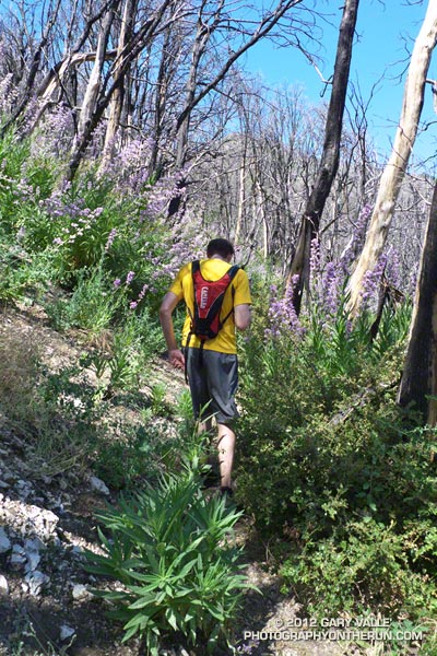


One of the surprises of the day was how much the Turricula (Poodle-dog bush) had grown along the Gabrielino and lower Kenyon Devore Trails since I had been here in early March. A rain gauge near here (Opids Camp) recorded nearly seven inches of precipitation from March 25 to April 26. This appears to have promoted the growth of the Turricula. In a very dry rain season the rain and snow had been much needed. It rejuvenated the streams and vegetation, and the area looked much as it would if the seasonal rainfall had been normal.

The Turricula could not be avoided in some places, but that will be remedied in a couple of weeks when Gary Hilliard’s Mt. Disappointment Endurance Run volunteer trailwork group works on this section of the Gabrielino Trail and the Kenyon Devore Trail.

Update June 21, 2012. Although my contact with Turricula on this run was very limited, I did have a mild reaction, mainly on my arms. There was very slight inflammation and the “prickly” itching that is characteristic of Turricula. The itching became noticeable about a day after exposure and persisted for 4-5 days. Although mild, the reaction was stronger than occurred following several similar encounters last year. One difference was the exposure to poison oak on the Rim Trail earlier in the run. It’s possible that there was a cross reaction. This was observed in animal testing, but not in (limited) human tests. However, my reaction following this latest encounter was much, much milder than my first bout of Turricula, which resulted from wading through large patches of the young Poodle-dog plants on miles of overgrown trail. That first very strong response may have also involved a cross reaction with poison oak.
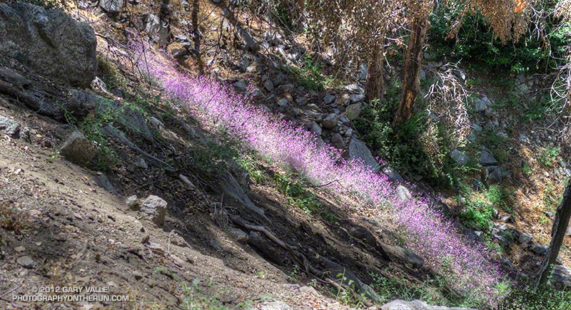


With the Summer Solstice approaching and the Sun so high, the temperature difference between sunny and shaded sections of trail was remarkable. About the time we were on Kenyon Devore the Clear Creek RAWS recorded a fuel temperature — the temperature of a wood dowel in direct sun — at a scorching 104°F. Brett did well on the climb and could have zoomed ahead. I had not recovered from Holcomb and struggled a bit on the exposed and steep sections of trail. Higher on the trail there was a breeze and more shade and that helped. It also helped pouring water over my head at the creek crossing!

It was great to show Brett Kenyon Devore, and what better way to sharpen the appetite for one of his superbly prepared dinners!
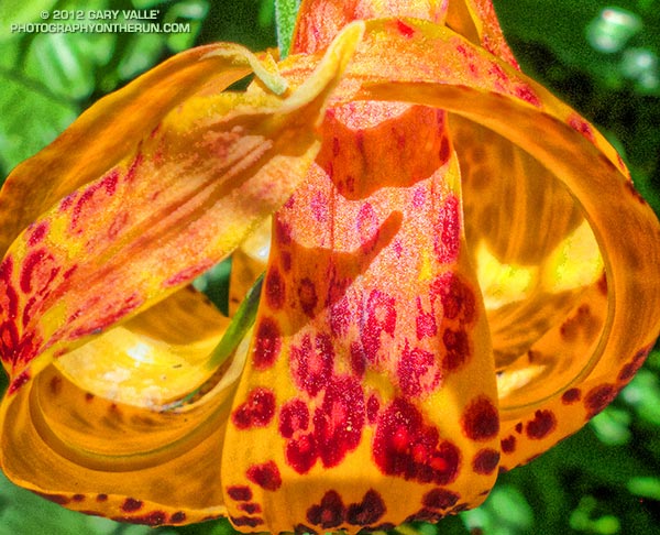


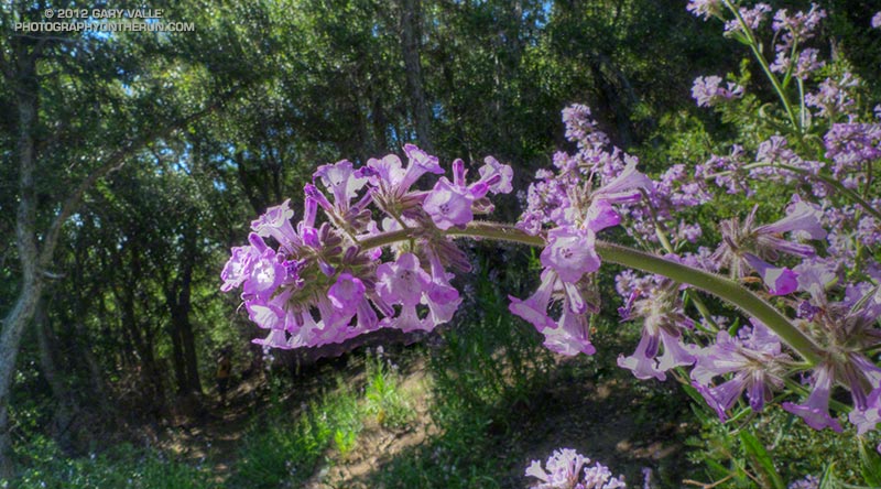
Humboldt Lily


Turricula (Poodle-dog Bush)


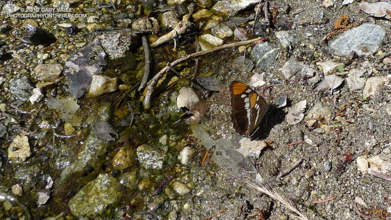
California Sister

Raining Rime

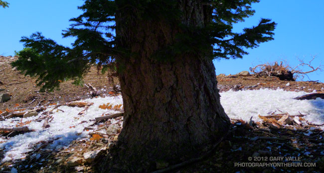
Fallen rime around a white fir

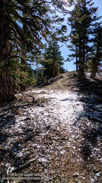
As I ran across the ice my footfalls made a loud crunch, crunch, crunch. Nearby a barrage of rime cascaded from a white fir. Friday’s cold system had rimed the trees along the crest, and now the ice was thawing, shedding from the branches and creating a patchwork of white beneath the trees. The ice wasn’t dense but I still didn’t want a large chunk falling on my head!

The cutoff upper level low that moved into Southern California Friday really cooled things down. The Big Pines RAWS (6917′) recorded an overnight low of 26°F Friday night. It was even colder in the Sierra. A snow sensor at 11,400′ in the Kern River headwaters recorded an overnight low of 12°F. Most of yesterday the temperature at Big Pines was in the 40s.


I was running on one of the most scenic segments of trail in the mountains of Southern California — the Pacific Crest Trail between Mt. Hawkins and Mt. Baden-Powell. There are three trail runs I like to do that include this stretch: Inspiration Point to Islip Saddle on the PCT, the Islip Saddle – South Fork – Baden-Powell Loop, and the route I was doing today, the Out and Back to Mt. Baden-Powell from Islip Saddle.

Warmer weather was forecast today, but this morning it had been cool and blustery at Islip Saddle. The temperature in the sun-warmed — but windy — parking lot had been around 43°F. In the shade of Mt. Islip at the start of the run the temperature felt like it was in the 30s. It had taken a while to warm up chugging up the first long hill.

It was the first time this season I’d been on this stretch of trail and I wondered if any well-shaded patches of snow had managed to survive on the north side of the crest near Mt. Baden-Powell. I doubted it. The Mt. Waterman ski area never opened this year, and there had already been several periods of warm weather. There would probably be some remnants of snow on the north side of Mt. Baldy.


It was PCT season. Islip Saddle is at about the 386 mile mark on the Pacific Crest Trail and PCTers hiking the trail from the Mexican border to the Canadian border usually do this section of trail sometime in May. There were a number of PCTers on the trail, including a couple of guys that appeared to be fast-packing the PCT. Their packs looked light, and they were really booking on the downhill west of Mt. Hawkins. (For well done, downloadable PDF maps of the PCT — with notes — check out Halfmile’s Pacific Crest Trail Maps and GPS Information.)

Although chilly at the start, the weather was near perfect for running and I had expected to see at least a couple of groups of runners training for the AC100. There were only about six or seven long run weekends remaining before this hundred miler. I did see one AC100 runner — twice. He was on day two of a three day Memorial Day training stint that would total some 90 miles. Now that is serious training!

The Color of April Rain

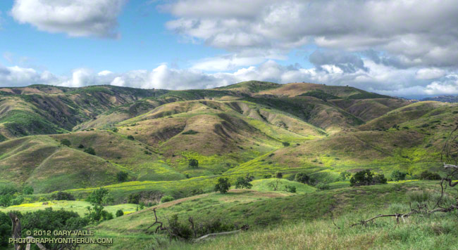
Clearing rainstorm at Ahmanson Ranch

Usually April isn’t a particularly wet month in Southern California. Normal April rainfall at Downtown Los Angeles (USC) runs less than one inch —  0.91 inch by 1981-2010 standards.

Wednesday night into Thursday the third rainstorm of the month produced 0.49 inch of rain at Downtown Los Angeles. This increased April’s rainfall total to 1.71 inches and the Los Angeles water year total to 8.68 inches. That puts us at about 60% of normal rainfall for the water year.

The photograph is from a spectacular trail run yesterday afternoon at Ahmanson Ranch, about 25 miles WNW of Downtown.

After the Station Fire: Wildflowers Along the Gabrielino Trail

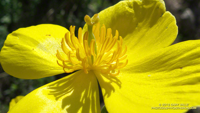
Bush poppy (Dendromecon rigida)

The bright yellow flower above is bush poppy (Dendromecon rigida). A fire follower, it’s blooming extensively in the recovering chaparral along the Gabrielino Trail between Red Box and Switzer Picnic area.

March snow and rain seem to have helped this Spring’s wildflower bloom. Since March 1 the Remote Automated Weather Station (RAWS) at nearby Clear Creek has recorded 6.5 inches of rain and NWS data shows Opids Camp has recorded 6.64 inches of rain. More rain and snow is forecast in the mountains this week.

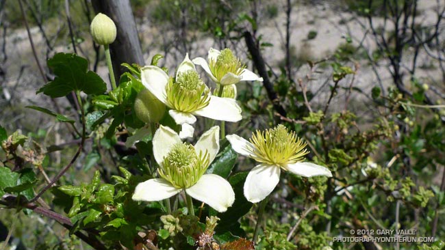
Here are a few additional wildflower photos from this morning’s run in the Station Fire burn area:


Baby Blue Eyes


Chaparral Clematis


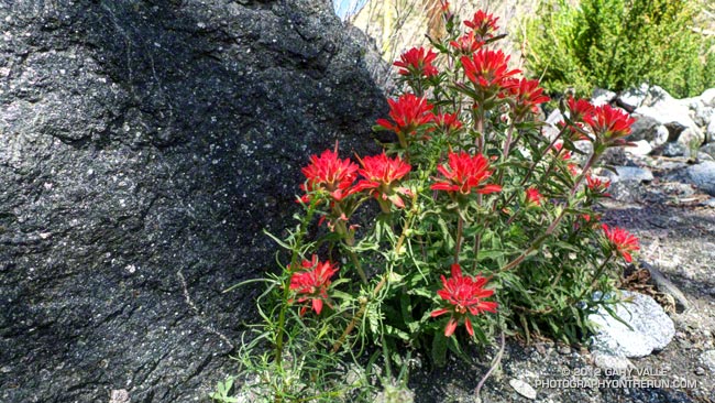
Wavy-leaved Paintbrush

Perfect Weather for the 2012 XTERRA Black Mountain 15K

When the starter yelled “GO!” at the beginning of the XTERRA Black Mountain 15K I wondered if it was raining yet in the San Fernando Valley. I was not looking forward to driving home on the 405 in pouring rain. But I’d worry about that later. Here at Black Mountain Regional Park, a little north of San Diego, the weather was about as good as it gets for running.

Heavy rain was forecast later in the day and you could tell it was on the way. High clouds muted the morning sun, and a layer of threatening-looking clouds lurked on the northwestern horizon. It was cool — but not cold. After the first quarter mile I was glad I was running in short sleeves.

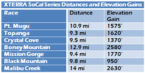
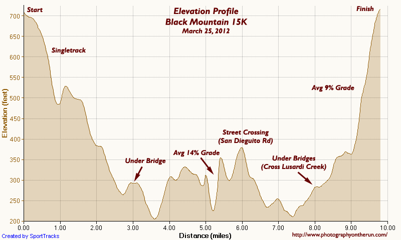
XTERRA SoCal Trail Run Series Distances and Elevation GainsAn email from the race organizers described the 15K course as “fairly flat” with “twists, turns and some minor hills.” I’d checked out the course profile on the trailrace.com and except for a not so minor hill at the end, the course did look pretty flat. Lots of downhill at the start, a couple of “minor” climbs in the middle of the course, and about an 8% climb over the last mile or so. A friend warned me about the hills around mile 5, so I wasn’t caught totally off guard by the steep climbs on the power line service road.
At just under a 1000′ of elevation gain, Black Mountain is the least hilly of the XTERRA SoCal Trail Run Series. But in a series noted for its climbs, flat is a relative term. To the left are the distances and elevation gains for the Series courses calculated using SportTracks* based on Garmin GPS tracks from the 2012 races, except for Malibu which is from 2011.


Here’s a more detailed Black Mountain 15K elevation profile with some notes added. Imagine running this course at an average pace of just over 6:30 min/mile! That’s what overall winner Paul Fraire did, cranking through the 9.8 mile course in 1:03:48.6. Heather Fuhr, Women’s winner and 4th overall, finished in 1:05:36.5, averaging 6:42 min/mile!

Like all the XTERRA SoCal Trail Run Series courses, the Black Mountain course was fun! There were a variety of trails and terrain, and some other interesting elements. And it’s the only race in the series that ends with a challenging climb! I really enjoyed the course.

*SportTracks elevation data smoothing set to 55. Elevations corrected using pkan’s Elevation Correction Plugin and NED 1/3 arc second DEMs.

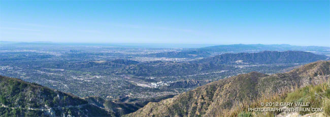
Los Angeles Basin from the Upper Bear Canyon Trail

Los Angeles Basin from the Upper Bear Canyon Trail

The offshore winds that warmed temperatures on Sunday — setting several high temperature records for the date — also produced spectacular visibility in the Los Angeles area.

Here’s a larger version of the view of the Los Angeles Basin from the Upper Bear Canyon Trail. You can see much of the Greater Los Angeles area, out to Catalina, and all the way to Boney Mountain in Newbury Park.

From Sunday’s loop through Bear Canyon.