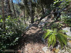
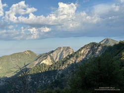
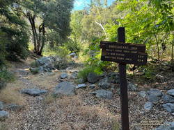
Above are thumbnails of a few photos from the 16-mile out-and-back trail run to Mt. Baden-Powell from the Islip Saddle Trailhead. Click on an image for a larger photo and more information.
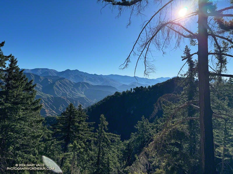
Almost two months had passed since I’d been on the PCT between Islip Saddle and Mt. Baden-Powell. Not a lot changed in the routine of the city in those seven weeks. The street sweeper still came by on Wednesday mornings, the trash was picked up each Friday, and the neighborhood looked pretty much the same as it did at the end of June.
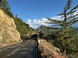
Angeles Crest Highway was still closed between Islip Saddle and Vincent Gap. Gone was the noise of vehicles on the road below, replaced by the sound of the wind in the trees and the occasional outburst of a Clark’s nutcracker.
At the saddle near Mt. Hawkins, I stopped to photograph the stump of the Mt. Hawkins lightning tree. Perhaps weakened by one or more lightning strikes, this Jeffrey pine lost its crown during the Winter of 2019-2020. Now without bark, it’s easy to see that lightning followed the spiral grain of the tree. This tree has a right-hand spiral grain. When viewed from above, it is twisted counterclockwise.
It was windy and cool at higher elevation. The National Weather Service’s Wind Chill Temperature formula doesn’t apply to temperatures over 50°F, but with bare arms and legs, it can be surprisingly chilly when there is a strong wind and the temperature is in the 60s. Had I not been pushing the pace, I would have needed to pull the sleeves and shell from my pack.
Here is an interactive, high resolution, 3D terrain view of the out and back from Islip Saddle to Mt. Baden-Powell. An alternative start at the Windy Gap Trailhead in the Crystal Lake Recreation Area is also shown. Starting at this trailhead adds about 800′ of elevation gain. The map can be zoomed, tilted, rotated, and panned using the navigation control on the right. Track and placename locations are approximate and subject to errors. Poor weather and other conditions may make this route unsuitable for this activity.
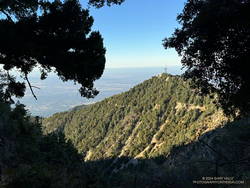
It was great to be back on the Rim Trail! One of the most underappreciated trails in Angeles National Forest, the 3.6 mile trail was closed in October 2020 because of the Bobcat Fire. It finally reopened in June of this year (2024).
Mt. Harvard from near the start of the Rim Trail.
This morning’s run had started at the top of the Kenyon Devore Trail from the same turnout on Mt. Wilson Circle Road as two weeks before. This time, instead of running down Mt. Wilson Road, I had descended a short distance on the Kenyon Devore Trail and turned right (east) on a half-mile long trail that connects to the main Mt. Wilson parking lot. From there I followed the “Authorized Vehicles Only” road toward the observatory about a quarter-mile to the signed start of the Rim Trail. Interpretive signs along the road note some of the area’s plants and trees.
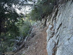
On the way down the Rim Trail, I’d debated which route to take from Newcomb Pass. One option was to run over to Newcomb Saddle and take Rincon-Redbox Road to West Fork. Another was to follow the Gabrielino Trail to Devore Camp and then West Fork. The single-track route through Devore Camp is a more interesting option and is usually my choice.
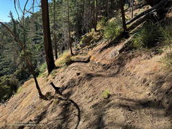
Trailwork on the Rim Trail near Newcomb Pass.
As I neared Newcomb Pass, I was surprised to see recent trailwork on the isolated stretch of trail. This was a hopeful sign the Gabrielino Trail between Newcomb Pass and Devore Camp might be in decent shape.
At Newcomb Pass, all signs of any trailwork ended. I looked at the first few overgrown yards of the trail connecting to Newcomb Saddle and thought, “I’ll give the Gabrielino Trail a try.” I could see an ill-defined path where the Gabrielino Trail should go and tried to follow it. No go. A lower path also appeared to be a dead end.
I enjoy the challenge of following little-used trails, but today was more interested in running than bushwhacking. Retracing my steps, I returned to the trail connecting to Newcomb Saddle.
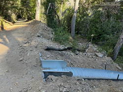
Newly installed downslope drain blocking access to the Gabrielino Trail
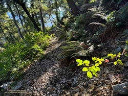
It wasn’t as bad as I initially thought. The trail was a bit overgrown, but was on an old roadbed and pretty easy to follow. (Later, I discovered I had a bite from a larval tick, which I’m sure I picked up in the Newcomb Pass area.)
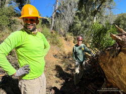
Jose and Gary cleaning debris underneath a log on the Gabrielino Trail near West Fork.
Running down Rincon-Redbox Road and lost in thought, I was somewhat startled to see a red truck round a bend. I was even more surprised when it turned out to be race director and trailmaster Gary Hilliard. Gary and Jose were out the weekend before the AC100 trying to chase down a couple of logs — one reported to be blocking access to the Newcomb Saddle aid station and another on the Gabrielino Trail “a half-mile from West Fork.”
I’ve had the privilege of running in all of Gary’s ANFTR/Mt. Disappointment races. No one works harder or is more dedicated to the trails of Angeles National Forest and trail running. I didn’t recall a log blocking the road, but it would only take Gary a few minutes to drive up to the aid station and be sure. With cruise control on and lost in thought, I continued running down to West Fork.
I’d been here two weeks before. The Rim Trail – Newcomb Saddle – Kenyon Devore Loop is the mirror image of the Mt. Wilson – Red Box – Kenyon Devore Loop. Two weeks ago it was around 10 degrees warmer and humid. I’d bonked on the climb, and wasn’t looking to repeat that experience today.
This morning – except for a couple of rattlesnakes – the run from West Fork couldn’t have gone better! I even jogged some of the less steep sections of the Kenyon Devore Trail!
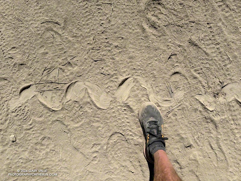
This is the largest Southern Pacific Rattlesnake track I’ve seen in 20+ years of running at Upper Las Virgenes Canyon Open Space Preserve (Ahmanson Ranch) — or anywhere else.
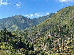
The ANFTR courses follow Rincon-Red Box Road down this rugged canyon to West Fork.
Update October 2, 2024. I ran the ANFTR 25K Course on Sunday and the cuttings on the Mt. Disappointment/Bill Riley Trail had been removed. The trail was clear and back to normal!
As I drove east on the 210 Freeway, a long bolt of lightning erupted from high in the clouds and pierced the valley below. The thunderstorm near Mt. Lukens looked spectacular. It was backlit by the rising sun, and intermittent lightning flashed against its dark gray clouds.
Theoretically, I was headed to Mt. Wilson. It was July. It was hot. It was time to get on the ANFTR/Mt. Disappointment race course! But was that going to be a good idea? A slight chance of a thunderstorm was forecast for the afternoon and already there was an active storm right in front of me.
Clouds over Mt. Lowe (left), Mt. Markham, Occidental Peak, and San Gabriel Peak.
The Angeles National Forest Trail Races (aka Mt. Disappointment) is a popular event usually run in the heat of Summer after the Fourth of July. Because of the pandemic, Bobcat Fire, and trail and road closures, the race has been on hiatus since 2020, but a new race date appears to be in the works!
Another ragged bolt flashed horizontally across the clouds. The cell looked isolated and appeared to be moving to the north. I decided to take a chance and bet that the morning storm was a quirk. Still, it suggested a real possibility of a thunderstorm later in the day.
About the time I passed Trail Canyon on Big Tujunga Canyon Road, it started to rain, and the rain continued much of the way to Red Box. The activity was actually more extensive than the cell near Mt. Lukens — a band of thunderstorms had swept through the San Gabriel Mountains between Mt. Lukens and Mt. Wilson.
Running down still wet Mt. Wilson Road following a morning thunderstorm.
Mt. Wilson Road was still wet as I started down the first leg of the ANFTR/Mt. Disappointment 60K/50K/25K courses. If you have to run on pavement, running downhill on super-scenic Mt. Wilson Road after a thunderstorm is about as good as it gets! The cleansed atmosphere and vivid smells in the wake of the storm were remarkable — as were the views down into the canyon of the West Fork San Gabriel River.
This morning, I was doing the 25K course, but all the distances follow the same route to Red Box. They start by running down Mt. Wilson Road to Eaton Saddle and then following Mt. Lowe Fire Road through Mueller Tunnel to Markham Saddle and the San Gabriel Peak Trail. The San Gabriel Peak Trail leads up to the Mt. Disappointment service road and, surprisingly, the high point of the 60K/50K/25K courses. This stretch of service road is higher than the start/finish on Mt. Wilson!
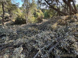
Cuttings from a forest-thinning project blocking the Mt. Disappointment/Bill Riley Trail.
Even if you have run a trail many, many times — and think you’re familiar with it — sooner or later, you’re going to encounter something you didn’t expect. From the Mt. Disappointment service road, the ANFTR/Mt. Disappointment courses turn onto the Mt. Disappointment/Bill Riley Trail. After the first couple of switchbacks, there were an increasing number of cut limbs on the trail. Initially, the cuttings were not much of an issue, but became worse as I continued down the trail.
Partway down, I encountered two very upset hikers who had lost the trail. They had just decided to leave the trail and hike on the service road. They cautioned me that the section where they had problems was just below. They weren’t kidding. I’ve done this trail innumerable times and at one point also had difficulty locating it. I had to wade through an expanse of cuttings to stay on the trail.
I’ve been on trails impacted by forest thinning projects before. The crews that worked on those projects at least made an effort to keep the trails clear. No such attempt was made here — the cuttings were left where they fell, and if that was on the trail, too bad!
It was a relief to get off the Mt. Disappointment/Bill Riley Trail and down to Mt. Wilson Road and Red Box.
Update October 2, 2024. I ran the ANFTR 25K Course on Sunday and the cuttings on the Mt. Disappointment/Bill Riley Trail had been removed. The trail was clear and back to normal!
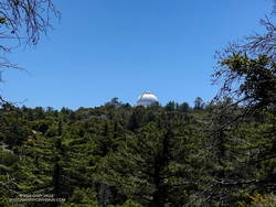
The towers on Mt. Wilson – where the car is parked – from Rincon-Redbox Road.
Unlike last year, Rincon-Red Box Road was in great shape. It was so well-graded that a Prius might have been able to drive down to West Fork. Much of the 5.5 miles down to West Fork are in full sun, so the temperature has a substantial impact. In the 2019 ANFTR/Mt. Disappointment 50K, the thermometer on my pack read about 80 degrees. In the 2017 50K, the temp on the same stretch was about 100 degrees. Today, it was around 90.
Whatever the temperature, there are excellent views down the West Fork and of the Mt. Wilson area. The towers on Mt. Wilson always look tantalizingly close, and the climb up Strayns Canyon doesn’t look that bad. (Ha!) Like last year, there were four or five creek-like crossings of the West Fork San Gabriel River.
The area around the spring at West Fork was a bit overgrown, but a trampled path through the grass below the cistern led to the outflow pipe. I refilled my hydration pack and drank my fill before setting off on the Gabrielino Trail. With the temperature in the sun at West Fork around 95, I should have spent more time at the spring cooling down.
Gabrielino Trail sign at West Fork.
It’s only about 1.6 miles from the spring to where the Kenyon Devore Trail forks left off the Gabrielino Trail, but it often seems longer. Probably because I’m anticipating the turnoff and don’t want to miss it. This morning, it was also the hottest stretch on the course, with the temperature in the sun topping out at around 100 degrees.
Based on some recent runs, I expected the Poodle-dog bush on this stretch to be a problem, but most of the Poodle-dog bush had been trimmed or was wilting. It wasn’t the only thing that was wilting. Shortly after turning off the Gabrielino Trail and onto the Kenyon Devore Trail, the combination of heat and humidity hit me like the proverbial brick. I had to back off the pace.
Not long after that, I was startled by a runner coming up behind me. It turned out to be another runner from the West San Fernando Valley! Charlie was training for UTMB and putting in a tough 27-mile, 8700′ gain day. We had a great conversation about races, running, and adventures in the mountains. Despite the heat, he was moving well and soon disappeared up the trail.
It’s about a half-mile to the top of the Kenyon Devore Trail!
As I worked up the final half-mile of trail, I could see only a couple of isolated build-ups of cumulus clouds. One was over the desert and the other was to the east near San Gorgonio. The sky over Mt. Wilson was mostly clear.

 Above are thumbnails of a few photos from the 16-mile out-and-back trail run to Mt. Baden-Powell from the Islip Saddle Trailhead. Click on an image for a larger photo and more information.