Fog, Flowers and an Ingenious Spider on the Trippet Ranch Loop

Ingenuity meets Opportunity. Photography by Gary Valle.
Ingenuity meets Opportunity

In their forecast discussion for today, the NWS Los Angeles Oxnard commented, “A long-lasting and extreme heatwave will continue across the region, and especially the interior…” The high temperature was expected to range from 105 to 115 across the interior valleys, mountains and deserts.

Indian pink, golden yarrow, and California everlasting along the Garapito Trail.
Indian pink, golden yarrow, and California everlasting.

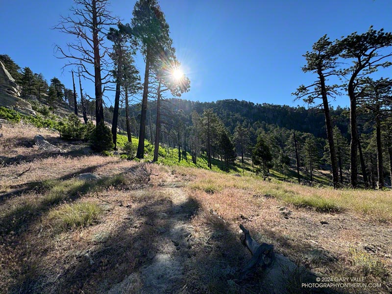
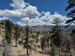
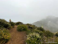
I was doing the Trippet Ranch Loop from the Top of Reseda. The highs on the San Fernando Valley side of the Santa Monica Mountains were expected to be in the 90s. But keep in mind that’s essentially the temperature in the shade. In full sun, the temperature could be 10 to 15 degrees higher. When I reached the Hub, at 7:00 in the morning the in-the-sun temperature was already around 90 degrees.

Nearer the coast, temps were expected to be a little cooler. From the Hub, I could see why. A shallow marine layer had developed along the coast. A couple of miles later, as I neared Trippet Ranch, I descended into a bank of wonderfully cool fog. It wouldn’t last, but I enjoyed the coolness as I continued down to Trippet Ranch and around to the Musch Trail.

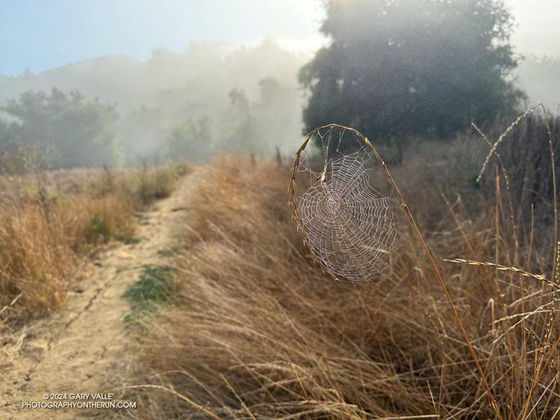
I hadn’t run very far on the Musch Trail when I came across a remarkable spider web. The spider had ingeniously bowed a flexible stalk of tall grass to build its web. This solution avoided having to span the web between two stalks. I also wondered if the added tension would make the web more efficient.

At Musch Camp, I topped off my water bottle and then continued working up the trail. Near a still-seeping vernal creek, a speckled-orange Humboldt lily bloomed brightly in a patch of poison oak.

Plummer's mariposa lily along the Garapito Trail. (thumbnail)
Plummer’s mariposa lily along the Garapito Trail

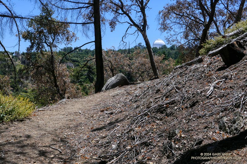
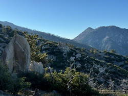
From the camp, the Musch Trail climbs about 400′, in a bit over a mile, to the junction of Eagle Rock and Eagle Springs Fire Roads. A left turn here leads past Eagle Rock to the top of the Garapito Trail.

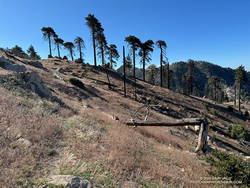
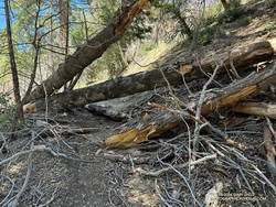
Other than the Bent Arrow Trail—which remains closed—the Garapito Trail is the “End of Reseda” trail most impacted by our back-to-back wet rain seasons. At times, washouts, debris flows, slides, fallen trees, and vigorously growing chaparral plants have made the trail nearly impassable. The Santa Monica Mountains Task Force worked tirelessly over the Winter to restore the trail.

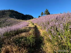
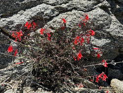
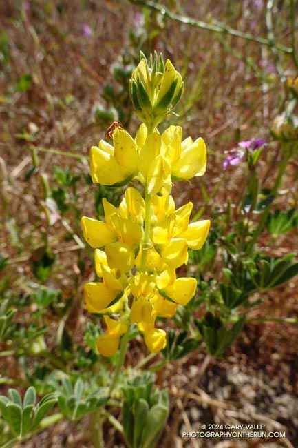
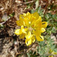
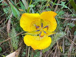
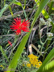
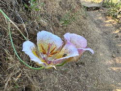
Of course, the rain that caused all the problems on the Garapito Trail has also resulted in numerous wildflowers along that trail. Today, some of the most prominent were scarlet larkspur, scarlet monkeyflower, Indian pink, and Plummer’s mariposa lily. And, Garapito Creek was still trickling in July!

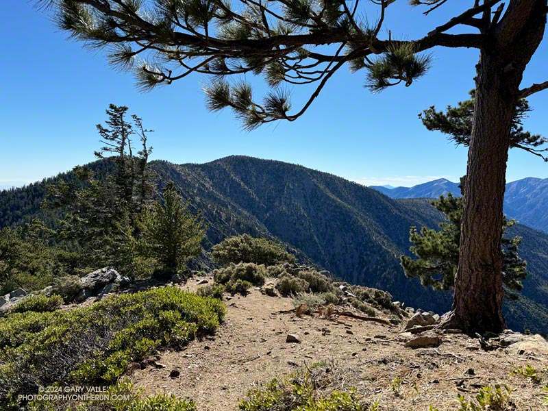
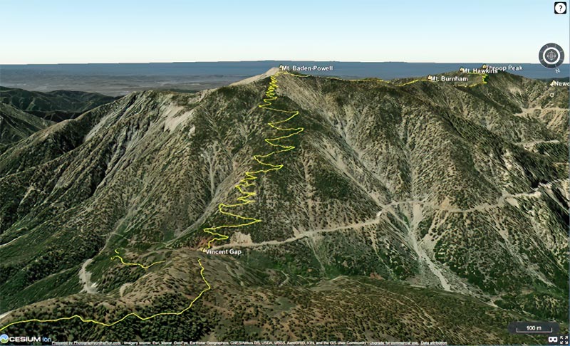
This high-resolution, interactive, 3-D terrain view shows the Trippet Ranch Loop (yellow). The track of the closed Bent Arrow Trail is shown in red.

Some related posts:
Trippet Ranch Loop, Musch and Garapito Trails – February 2024
Trippet Ranch Loop Plus Temescal Peak and Temescal Lookout
Fogbow Near the Top of Hell Hill in Pt. Mugu State Park

Out and Back Trail Run from Islip Saddle to Mt. Baden-Powell – July 2024 Update

Mt. Baden-Powell from the PCT near Throop Peak.

Update July 22, 2024. The Poodle-dog bush along the PCT near Islip Saddle has been cleared by Gary Hilliard and the AC 100 Trail Team!

When I reached the summit of Mt. Baden-Powell (9,399′), it was empty, save an opportunistic raven who was evaluating the chances that the Larabar I was eating might fall to the ground.

On top, the heat of the strong Summer sun was offset by a cooling breeze. There was still a few thin ribbons of snow in the chutes on Mt. Baldy. With the excellent visibility, San Jacinto Peak could be seen in the notch between Mt. Baldy and Dawson Peak, and San Gorgonio Mountain was sharply visible to the left of Pine Mountain.

Poodle-dog bush (Eriodictyon parryi) along the PCT just east of Islip Saddle. (thumbnail)
Poodle-dog bush along the PCT just east of Islip Saddle.

Other than a few people at Little Jimmy hike-in camp, I saw no one on the way up from Islip Saddle. A quarter-mile from the trailhead, there was an astonishing display of Poodle-dog bush along the PCT. In 2011, when a large part of Angeles National Forest reopened following the Station Fire, I developed an extensive rash after bushwhacking through Poodle-dog on overgrown trails. After that experience I’ve been more careful around the plant, and haven’t had a bad case since.

Trees were across the trail in a few places. Most were fairly easy to bypass, but a couple were “inconvenient,” such as this big log, about 0.75 mile east of Windy Gap.

Bright red beaked penstemon (Penstemon rostriflorus) along the PCT above Windy Gap. (thumbnail)
Bright red beaked penstemon along the PCT above Windy Gap

As I worked up the switchbacks above the log, to the southwest I could see the observatory and towers on Mt. Wilson. As a result of the damage to Chantry Flat in the Bobcat Fire, Mt. Wilson was on the Angeles Crest 100 Mile course last year, and will be again this year. As the raven flies, Mt. Wilson was only about 16 miles away, but for someone running the AC100, the miles along its challenging course would total well over 50!

For several years I’ve been following the regrowth of conifers in four places along the PCT that were burned in the 2002 Curve Fire. What has been underscored in my informal study is a) trees take a long time to regrow, and b) frequent fires in an area are particularly devastating. Stand #1 (1.5 miles east of Islip Saddle on the PCT) was recovering nicely from the 2002 Curve Fire when it was burned in the 2020 Bobcat Fire. This comparison shows the result. The other three stands continue to recover well, with south-facing Stand #4, west of Throop Peak, growing particularly vigorously.

View WNW along Mt. Baden-Powell's west ridge. (thumbnail)
Limber pine (left) along Mt. Baden-Powell’s west ridge.

Ascending the final 400′ of gain on Baden-Powell’s west ridge, I was surprised to see a couple of small patches of snow remained on the north side of the ridge. The snowpack here was nowhere near as big as in 2023, but it was still pleasing to see that a little of the white stuff survived until July.

No out and back to Baden-Powell is complete without a quick stop at Little Jimmy Spring. Today, the water from spring was so cold it was painful to hold my hand in the water flowing from the pipe!

Some related posts:
It’s Mid-July And There Is Still Snow in Los Angeles County!
A Cool and Breezy Out and Back Trail Run from Islip Saddle to Mt. Baden-Powell
Contact Dermatitis from Eriodictyon parryi – Poodle-dog Bush
Regrowth of Trees Along the PCT Following the 2002 Curve Fire

The Ups and Downs of the Angeles Crest 100 Mile Run


The white dome of Mt. Wilson Observatory from near the top of the Kenyon Devore Trail.

First published on June 30, 2015. Updated July 8, 2024.

August 3rd  runners from near and far gather in a small parking lot in Wrightwood, California, to start the Angeles Crest 100 Mile Endurance Run (AC100). Begun in 1986, the AC100 is one of the original five 100-mile U.S. endurance races. It has endured fires, floods, the Covid-19 pandemic, and changing trail restrictions.

There’s a tradition of running grueling endurance races in the San Gabriel Mountains. The Big Pines Trail Marathon was one of the first organized mountain ultramarathons in the U.S. First run in August 1934, its course used some of the same trails that AC100 runners enjoy today.

The AC100 is not like a road marathon. It is an entirely different kind of running event and an entirely different kind of running experience. The 2024 L.A. Marathon had about 25,000 participants. About 1/100th of that number — around 250 runners — are expected to start the AC100.

Sunrise from Blue Ridge during the 2015 Angeles Crest 100.
Sunrise from Blue Ridge during the 2015 AC100.

For many, one of the primary reasons for running the AC100 is to be fully immersed in the beauty and majesty of the San Gabriel Mountains. Runners start at 5:00 a.m., ascend the Acorn Trail, and as the sun rises, find themselves above 8000′, reveling in the spectacular views from Blue Ridge.

Even at this early stage of the race, the field is already becoming dispersed. By the time runners reach the first checkpoint, nine miles into the run, there is an hour spread between the first and last runner. Unlike a road marathon, much of the time a runner in the AC100 will be alone.

This year’s course returns to a point-to-point format, ending in Altadena. Because of damage to the Chantry Flat area by the Bobcat Fire, runners will bypass Chantry and ascend Mt. Wilson using the grueling Kenyon-Devore Trail, returning to the traditional course at the Mt. Wilson Toll Road above Idlehour.

As a result of this frequent storms the past two Winters, many trails have been damaged or blocked by trees and debris. Ultrarunners not only spend many hours enjoying the trails in our local mountains but also do hours of trailwork that helps keep trails open and usable for everyone.

This elevation profile for the 2024 AC100 course was created in SportTracks from a GPX file provided by the event organizers. The elevation profile was corrected using 3DEP 1-meter Lidar-based DEMs. A conservative elevation data smoothing setting was used, resulting in an estimated cumulative gain of about 17,890′ and loss of 22,550′. The actual gain and loss are probably a bit more. Placemark locations, mileages, and elevation gains and losses are approximate. The elevation profile can be downloaded from the Course Overview page on the AC100 website.

Estimated Angeles Crest 100 Mile Elevation Profile (link)
Click to download from AC100 Course Overview page.

In addition, here is an interactive, high resolution, 3D-terrain map of the 2024 Angeles Crest 100 Mile Race. It is based on the course GPX file downloaded from the AC100 website. The view is initially zoomed in on the climb up Mt. Baden-Powell. To change the view, use the control on the upper right side of the screen. Track and placename locations are approximate and subject to errors.

Click to view 2024 AC100 course with high resolution, photographic 3D terrain.

Here is another high resolution view of the Shortcut Saddle – Red Box – Mt. Wilson section of the AC100 course.

See the AC100 website for official information and details.

Hot Weather on the Three Points Loop

Approaching Waterman Meadow on the Three Points - Mt. Waterman Trail.
Approaching Waterman Meadow on the Three Points Loop around Mt. Waterman.

When Angeles Crest Highway opened between Upper Big Tujunga Road and Islip Saddle last Fall, I jumped on the chance to do the Three Points loop around Mt. Waterman. When in good condition and with good weather, the 20+ mile loop is one of my favorites. That day, the trail conditions could have been better.

Twin Peaks from the Three Points - Mt. Waterman Trail, about 1.5 miles from Three Points. (thumbnail)
Twin Peaks from the Three Points – Mt. Waterman Trail, about 1.5 miles from Three Points.

Turn the clock forward to this Spring, and once again, road closures were limiting access to Three Points. Angeles Crest Highway was still closed between Red Box and Upper Big Tujunga Canyon Road, and the alternate route — Upper Big Tujunga Canyon Road — was “Only Open To Contractors, Residents, & Emergency Vehicles.” Recently, the Los Angeles County Road Closures website updated the status of Upper Big Tujunga Canyon Road to “Access Limited, Expect Delays.”

An easy-to-follow stretch of the Three Points - Mt. Waterman Trail. (thumbnail)
An easy-to-follow stretch of the Three Points – Mt. Waterman Trail.

Excited to get back on the Three Points Loop, on Sunday I found myself motoring up Upper Big Tujunga Canyon Road, headed for the Three Points Trailhead. There were no problems or delays getting to Angeles Crest Highway, and I pulled into the Three Points parking lot at about 6:30 a.m.

Beardtongue penstemon accommodates the bulbous shape of its pollinator -- bumblebees. (thumbnail)
Beardtongue penstemon accommodates the bulbous shape of its pollinator — bumblebees.

Having done the Three Points Loop many times and in a variety of conditions, I didn’t think much about the difficulties on the loop in November. Like others that relish the outdoors, my brain is very good at shaping memories so as to emphasize the positive and downplay — or outright ignore — the negative.

I’d checked the weather — a Heat Advisory had been issued for the San Gabriel Mountains, and there was a chance of thunderstorms from a dissipating tropical storm. A key part of the loop, Cooper Canyon, has a rep for being hot. Much of the PCT on that stretch is on sparsely-forested, south-facing slopes. My thought was that maybe there would be enough clouds to take the edge off the heat.

Downed trees across the PCT in Cooper Canyon. (thumbnail)
Downed trees across the PCT in Cooper Canyon.

Nope! The in the sun temperature in Cooper Canyon was around 100 degrees. The good news was Buckhorn Campground was open and my favorite water faucet had plenty of water. Plus, the creek in Cooper Canyon was running, so I could cool off and supplement my water.

The trail conditions were virtually identical to those last November, but with heat added. The Three Points — Mt. Waterman Trail was a bit overgrown, and there were many downed trees across the trail. In November there was a particularly inconvenient tree blocking the PCT on the north side of the creek, just west of the Burkhart Trail junction, and it was still there today.

Postcard clouds belie the hot weather on the PCT in Cooper Canyon. (thumbnail)
Postcard clouds belie the hot weather on the PCT in Cooper Canyon.

There seemed to be more Poodle-dog bush than back in November, or maybe it was easier to spot because it was blooming. The big winner among the multitude of wildflowers was beardtongue penstemon, which was blooming profusely on some of the slopes burned in the Bobcat Fire. Other wildflowers I saw along the trail included bigleaf lupine, little paintbrush, scarlet monkeyflower, narrow-leaved lotus, golden yarrow, gilia, wallflower, and red columbine.

Because of the trail conditions, heat, and altitude, the Three Points Loop today was more difficult than the 50K I ran two weeks ago!

This high resolution, interactive, 3-D terrain view shows the Three Points Loop (yellow) along with a couple of options (red). The side trip to the summit of Mt. Waterman adds about 1.75 miles to the run.

Some related posts:
Three Points Loop Following the Reopening of Angeles Crest Highway
Cool Weather, Old Trees, Grape Soda Lupine and a Restored Trail
Three Points Loop Adventure – July 2020

Yellow Valley Lupine in Upper Las Virgenes Canyon Open Space Preserve (Ahmanson Ranch)

Yellow valley lupine (Lupinus microcarpus) in Upper Las Virgenes Canyon Open Space Preserve (Ahmanson Ranch)
Valley lupine

An unusual amount of annual precipitation not only increases plant populations and growth, it can spawn the growth of plants not usually seen in an area.

On a recent run at Ahmanson, a glimpse of bright yellow along the trail caught my eye. I stopped to take a look and was surprised to find it was a yellow lupine — a variety of valley lupine (Lupinus microcarpus) not usually seen at Ahmanson Ranch.

Radially symmetric whorls of valley lupine flowers. (thumbnail)
Radially symmetric whorls of valley lupine flowers. Click for larger image.

The last two Rain Years have been exceptionally wet in the Los Angeles area. The result at Ahmanson Ranch has been pronounced, with two seasons of growth, out-of-season wildflowers, and unusually large populations of Spring wildflowers. It’s Summer, and upper Las Virgenes Creek still has flowing water.

Valley lupine is native to California, but in this case may be an escapee from a garden, its seed having hitch-hiked a ride to Ahmanson Ranch.

Some related posts:
Ahmanson Ranch and Las Virgenes Creek After Six Days of Rain
East Las Virgenes Canyon After a Seventh Day of Rain
A Second Spring at Ahmanson Ranch
Looking For Local Impacts of Tropical Storm Hilary

Cool Temps, Soggy Shoes, and Fast Times at the Malibu Canyon Trail Races

One of many stream crossings during the Malibu Canyon Trail Races
One of many stream crossings

In my experience, there are several things you can count on when running in a KHRaces event — a challenging, well-marked course, well-placed and supplied aid stations with helpful volunteers, reliable timing, good food at the finish line, and plenty of portable toilets at the start. That was certainly the case for the 2024 Malibu Canyon Trail Races in Point Mugu State Park.

The 100K, 50M, 50K, and 30K courses used many of the same trails as those in the Ray Miller Trail Races — including the hallmark start and finish on the Ray Miller Trail. The courses were out and back — which means you get to say hi to everyone in your race and be astonished by the speed of the faster runners.

Cloudy, Cool and Humid Weather
Running into the clouds on the Ray Miller Trail, early in the Malibu Canyon 50K. (thumbnail)
Into the clouds on the Ray Miller Trail.

Ten days before the race computer weather models were predicting the possibility of hot weather, but as race day approached the marine layer prevailed, and on June 8th the weather — though a little humid — was cool and cloudy throughout the day. Here are temps and other data on race day from an SCE weather station near the 50K turnaround near the Danielson Multi-Use area.

A few hours into the race, some runners looked like they had been in a rainstorm. For once, I was well-hydrated at the end of a race!

Water Crossings and Wildflowers

The wettest back-to-back rain years (measured at Los Angeles) in 100+ years had a tangible effect on the race, resulting in numerous get-your-feet-wet creek crossings and stunning displays of wildflowers.

Some runners were determined to keep their shoes dry, but most got their feet wet at least a couple of times. Having run with wet shoes most of the Winter, I surrendered to having wet socks and shoes early in the race. Just about every time my socks and shoes started to feel somewhat dry, another crossing would soak them.

I lost count of the stream crossings on the 50K course, but using Google Earth imagery from May 2023, it looks like there were around 12 (times two) crossings in Sycamore Canyon, plus a few more in Wood Canyon.

A stunning yellow mariposa lily along the Guadalasca Trail in Point Mugu State Park. (thumbnail)

My hands were wet most of the race and the only wildflower photo I took was of a striking yellow mariposa lily along the Guadalasca Trail. During a training run on the course in May, I took this photo of wildflowers along the Wood Canyon Vista Trail (Backbone Trail). That was a sunny day!

Fantastic Volunteers

In many ways, volunteers make the race, assisting and encouraging runners in any way they can.

Phenomenal Performances

With the cool weather, there were some very fast times. Scott Traer crushed the 50M in 7:07:43, and Osvaldo Cerda flew through the 50K in 3:52:17! Paul Sinclair successfully defended last year’s first-place finish in the 100K with a time of 10:22:31. In the 100K, Angela Avina was the top woman and placed third overall with a time of 11:08:20. Zac Campbell and Jess Illg were the top man and woman in the 30K.

Wrap-up

My run went about as well as any 50K I’ve done. I had no issues during the race and felt good at the finish line and afterward.

Runners don’t expect a course to be exactly 50K — 31.1 miles — and the distance varies from race to race. The longest “50K” I’ve run was nearly 35 miles long and the shortest about 29 miles. My track for this race was just over 32 miles.

Here is an interactive, 3-D terrain view of my GPS track from the Malibu Canyon 50k. The initial view is zoomed in on the Guadalasca section of the course, but the view is easily changed using the control on the upper right.

All the results can be found on Ultrasignup. PAKSIT PHOTOS did a fantastic job covering the race. Their photos can be found here.

Many thanks to Keira Henninger and KHRaces, all the runners, and especially the volunteers for an excellent race!

Photography and inspiration from running and other adventures in the Open Space and Wilderness areas of California, and beyond. No ads. All content, including photography, is Copyright © 2006-2024 Gary Valle. All Rights Reserved.