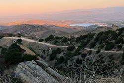
Ahead, the lights of two runners turned this way and that, and behind me more headlamps danced up the canyon. The moon was high in the sky and nearly full. I took advantage of a smooth stretch of fire road, and turned off my headlamp to enjoy running in the surreal light.
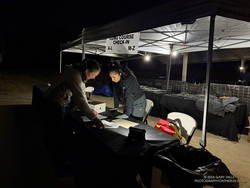
Getting ready to check-in runners at the No Name 50K/15K
I was in Cheeseboro Canyon and a mile or so into the 2024 No Name 50K. Along with several other runners, I had opted for the early start. Partly because there’s something special about running in the hours before dawn, but also because strong Santa Ana winds were forecast, and I wasn’t sure how hot and windy it was going to get. So far, so good. The only wind was a sometimes cool, sometimes warm, down-canyon breeze.
Usually, when I run Cheeseboro Canyon, it’s from the Victory Trailhead at Ahmanson, and I run down the canyon. It was good to be running up the canyon for a change. The Cheeseboro Canyon Trail is a combination of fire road and single track that gains about 500′ over the 4+ miles to the Sheep Corral Trail junction. There are several very short, steep, rocky sections, but most of the trail is straightforward and enjoyable. Because of all the rain the past two years, the trail near Sulfur Springs was a bit muddy. Running by headlamp, I managed to step in the muckiest of the mud.
Dawn from the Sheep Corral Trail.
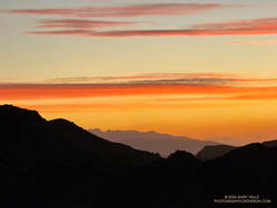
From the top of Cheeseboro, it’s about a mile over to Palo Comado Fire Road on a well-used, up-and-down single track. Just before Palo Camado, I stopped at an overlook to take in the view to the east. San Gabriel Peak and Mt. Wilson were silhouetted in the distance, and a few orange-red clouds preceded the sun.
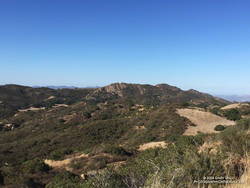
Once on Palo Comado Fire Road, it took about 15 minutes to get up to China Flat. The timing was perfect — the warm light of the new sun highlighting Simi Peak and the greens and golds of the oak grasslands.
Downhill on Albertson Fire Road to Lang Ranch.
The aid station at Albertson Mtwy Fire Road marked the beginning of a 3-mile downhill to Lang Ranch. I put out of mind that we would be coming back up this hill and just enjoyed the descent.
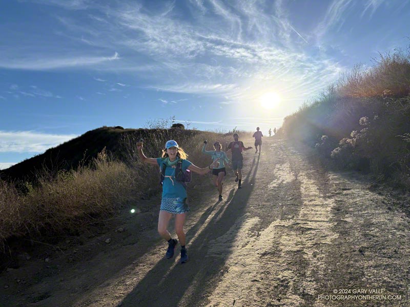
Following a quick stop at the Lang Ranch aid station, I retraced my steps on Albertson Fire Road back to the Alapay/Lang Ranch Ridge Trail and the start of a scenic 3.5-mile keyhole loop. This memorable segment sets the tone from the start, gaining about 500′ in a mile. The route is a variation of the popular “Lang Ranch Loop,” and the support from the hikers on the trail was much appreciated. So was the encouragement from the awesome group of local runners (in the title photo) — each of the three times I passed them. I still hear their cowbell!
After returning to the Lang Ranch Aid Station, I started up Albertson Fire Road a second time. The volunteer at the Alapay/Lang Ranch Ridge Trail checked my bib number, and I began the long climb back to China Flat.
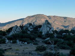
China Flat and Simi Peak from Albertson Mtwy Fire Road. From a training run.
After doing the steep climbs on the Lang Ranch loop, the grade on Albertson didn’t seem so bad. Plus, the weather was cooperating. We were on the second day of a Santa Ana wind event, and I had envisioned running into a 20 mph headwind here. Other than a couple strong gusts, the wind was more of a cooling breeze.
The runner passing me confirmed that the Albertson climb was made for poles — if only I had them. I’d done Albertson on a training run and debated using them for the race. Poles are helpful in a lot of ways, but more efficient uphill propulsion is probably the most important.
After a false summit or two, I eventually reached the aid station at the top of the climb. The smiling volunteers asked me if I needed anything. I told them I was good to go and continued down into China Flat. I could relax for a while. It would be mostly downhill until the aid station in Palo Comado Canyon — about 3.5 miles away.
Palo Comado Canyon Trail/Fire Road below China Flat. From a training run.
Running down Palo Comado from China Flat was a bit like the run down Albertson, except it was 20 degrees warmer. With the low humidity, I reminded myself to stay hydrated and not pound the downhill. The Cheeseboro Ridge section of the course was a few miles ahead, and the last thing I needed was crampy legs.
At the Palo Comado aid station, I grabbed a peanut butter sandwich and headed up the hill. Like the climbs at Lang Ranch, the hill was steep but relatively short. As I started the descent into Cheeseboro Canyon, I looked across to the power lines on Cheeseboro Ridge. There were runners over there, and I wondered how they were doing. I would find out soon enough.
At the Cheeseboro aid station, I filled my Camelbak to the brim, put some chips in a baggie to eat on the run, and started up the fire road toward Cheeseboro Ridge.
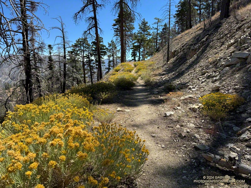
The Cheeseboro Ridge segment of the course follows an SCE powerline service road for about three miles, gaining more than 700′ along the way. On a hot day, it can be very hot, and on a windy day, very windy. There is zero shade. The Cheeseboro Remote Weather Station is passed about a mile up the service road.
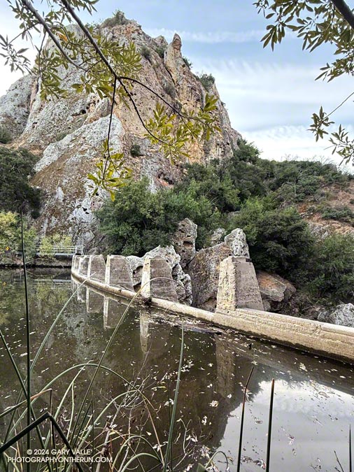
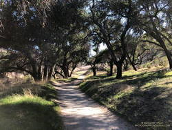
Superb running in Cheeseboro Canyon.
Keeping in mind that the station measures the temperature inside a white, ventilated instrument housing several feet off the ground, the Cheeseboro RAWS midday temp was around 78degF and the wind was 16 mph out of the ENE, gusting to 29 mph. On the fire road, the in-the-sun temp was at least in the mid-80s but didn’t feel too bad.
I was glad to get to the high point of the ridge at the rocky overlook. There were still a couple of small hills to go, but from the viewpoint, it was going to be mostly downhill to the finish.
Many thanks to SoCal Trail, the volunteers, photographers, runners, and everyone involved for a great race!
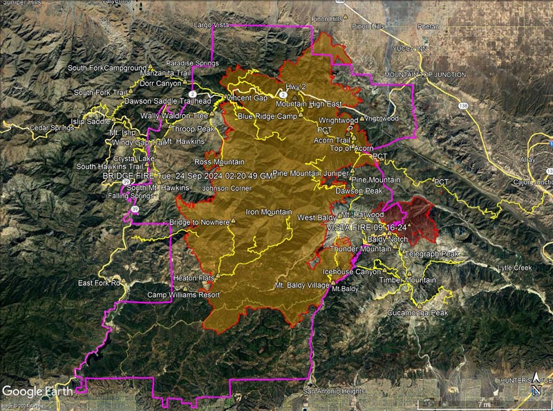
October 18, 2024. Updated approximate Bridge Fire Closure boundary for Forest Order 05-01-24-11.
October 13, 2024. Updated Bridge Fire perimeter. Added the Vista Fire perimeter. Added trails from the National Forest System Trails Feature Layer. Added a “guesstimate” of the Bridge Fire Closure boundary. See below for an explanation.
Multi-year fire closures have become common on the Angeles. Generally, trails and the land affected by trail are is a minuscule percentage of the area burned. Some jurisdictions reopen parklands and open space areas weeks after a fire with no apparent negative impact on the area’s recovery. Is there science to support multi-year closures of trails in fire areas?
In some cases, closures include trails that are outside of the fire’s perimeter and didn’t burn. These closures may make sense in the short term — when there is a plausible threat from the fire, such as the recent flare-up east of South Mt. Hawkins. But many times, these unburned trails remain part of a long term, multi-year closure. Sometimes it seems the trail just happens to be on the wrong side of a section line, road, or other feature that is convenient to use as a closure border.
Trails that were closed in Forest Order 05-01-24-10, but now appear to be open according to Forest Order 05-01-24-11:
Dawson Saddle Trail PCT east of Windy Gap to Vincent Gap
Trails outside of the Bridge Fire and Vista Fire perimeters that remain closed according to Forest Order 05-01-24-11:
Devil’s Backbone Trail Hawkins Ridge Trail South Hawkins Trail
The following summits are within the updated closure area, but did not burn and are accessible via unburned trails. Peaks marked with ** are just inside of the closure boundary:
For those of us passionate about the outdoors, the closure of any trail or peak is a loss. But the long term closure of the most popular trails and peaks in the San Gabriel Mountains without justification would be indefensible. Hopefully, the closure order will be modified when the Forest Service determines the threat from the Bridge Fire is past.
Mt. Pacifico (7124′) from low on the Three Points – Mt. Waterman Trail.
I was back on the Three Points – Mt. Waterman Loop and having a better time of it than in June. The June run had been near the Summer Solstice, with in-the-sun temperatures reaching 100°F. Today’s run was a few days away from the Fall Equinox. Not only was the temperature about 10 degrees cooler, the sun was lower in the sky and less intense.
But much was the same as in June. There was still plenty of whitethorn on the first couple of miles of the Three Points – Mt. Waterman Trail — and a few prickly passages for anyone wearing shorts and short sleeves. Some trailwork had been done higher on the mountain, but a few fallen trees were still on the trail. Most of these were easy to step over, around, under, or through.
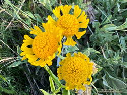
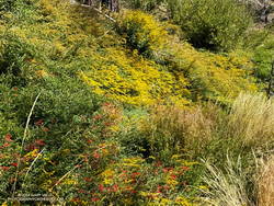
Late season Bigelow’s sneezeweed at Waterman Meadow.
There was very little monsoon rainfall this Summer, but consecutive wet rainy season and a tropical storm had already recharged the seeps and small creeks. The creeks were only slightly lower than in June, and the places that had been wet and muddy in June were still wet and muddy. At Waterman Meadow, a few late-season blooms of sneezeweed beamed yellow in the midst of the greens of the grass and ferns.
The high point of the Three Points – Mt. Waterman Trail is near the junction with the trail to the summit of Waterman and the trail that comes up from Highway 2. It’s at an elevation of about 7686′. Including detours to get around downed trees, the junction is a bit more than 6 miles from Three Points. The junction marks the start of a nearly 2000′ descent over 4.7 miles to the PCT in Cooper Canyon.
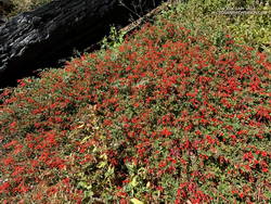
California fuchsia along the Burkhart Trail.
This morning, I encountered no one on the Three Points – Mt. Waterman Trail and only one pair of hikers on the normally busy Mt. Waterman Trail. Buckhorn Campground was nearly empty. I topped off my water at a convenient faucet at the campground and then started down the Burkhart Trail.
The creek in the canyon below the Burkhart Trail happily bubbled and gurgled, its water easily outpacing me as I descended to the PCT. Some work had been done on the trail to help those hiking to Cooper Canyon Falls cross the muddy seeps. Near one seep, a patch of dazzling red California fuchsia contrasted sharply with the coal black of a tree burned in the Bobcat Fire.
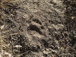
Black bear track.
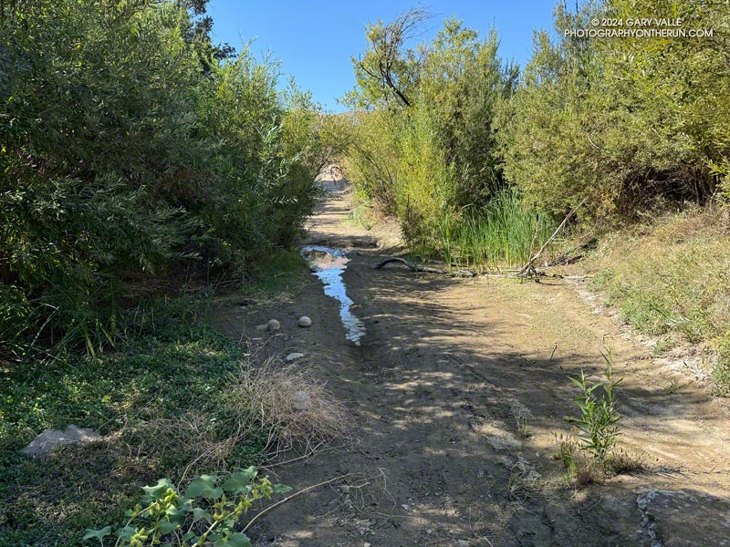
I wouldn’t say the trail has been abandoned, but it’s been quite a while since any trailwork has been done on the PCT between the Burkhart Trail and Cloudburst Summit. A mass of trees is still blocking the trail near the creek crossing at the bottom of Cooper Canyon. As expected following a fire, trees continue to fall on the trail. Parts of the trail along the creek or near seeps are overgrown with “Hey Bear!” willows.
The PCT in Cooper Canyon has been isolated by the 19-year closure to protect the critically endangered mountain yellow-legged frog. In December 2005, Angeles National Forest “temporarily” closed the Williamson Rock climbing area and the PCT between Eagle’s Roost and the Burkhart Trail. This Summer, the Forest Service extended the closure to at least December 31, 2026.
It’s difficult to accept that the Forest Service, conservation groups, and involved agencies have not agreed on a solution. Can’t the short stretch of the PCT that impacts frog habitat be rerouted? Only a few climbs at Williamson Rock directly impact the frog habitat. Does the entire climbing area need to be closed? Can’t bridges, walkways, and other structures be used to protect and even enhance frog habitat? There has to be solution. In 2005, I could not have imagined that 21 years later Williamson Rock would still be closed, and I might not have the opportunity to climb there again.
Goldenrod and California fuchsia along the PCT in Cooper Canyon.
On this run, it wasn’t necessary to stop at Cooper Camp to cool off. Although the temperature was in the 90s on the south-facing slopes traversed by the PCT, there was a bit of a cooling breeze. This and the lower sun angle made it far more pleasant than earlier in the year.
From Cloudburst Summit, it’s a little over five miles of (mostly) downhill to Three Points. Most of the running is on an old road bed. Although it can be tedious — especially when it’s hot — the segment is relatively fast-paced. Depending on the year, there are usually a couple of places to soak a hat and pour water over your head. But, as I learned one hot day, a rattlesnake may take exception to your intrusion!
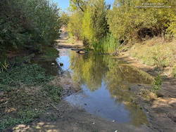
Much-diminished pool on Las Virgenes Creek on September 11, 2024, the day before the 4.7 Malibu earthquake.
It was very odd. After persisting in Upper Las Virgenes Canyon for 18 months, the pool on Las Virgenes Creek had unexpectedly receded.
When I’d run past the pool on September 6, it had been full. Just five days later — the day before the 4.7 Malibu earthquake — it had shrunk to a small puddle.
Pool on Las Virgenes Creek five days after 4.7 Malibu earthquake.
The earthquake occurred on September 12, 2024, at 07:28:21 PDT. That afternoon I ran out to Upper Las Virgenes Canyon and checked the pool again. It was already refilling. Five days later it was nearly back to its normal level.
Was the change in the pool level a precursor to the Malibu earthquake?
The pool is about 11 miles from the earthquake’s epicenter. Water level changes in wells miles from an event have preceded earthquakes similar in size to the Malibu quake. It’s something to wonder about.