Strawberry Peak Circuit

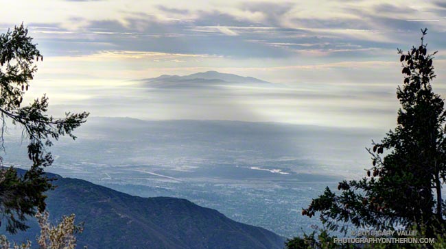
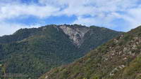
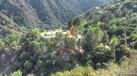
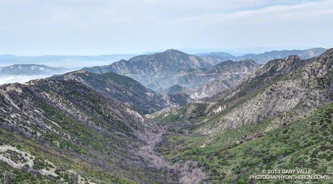
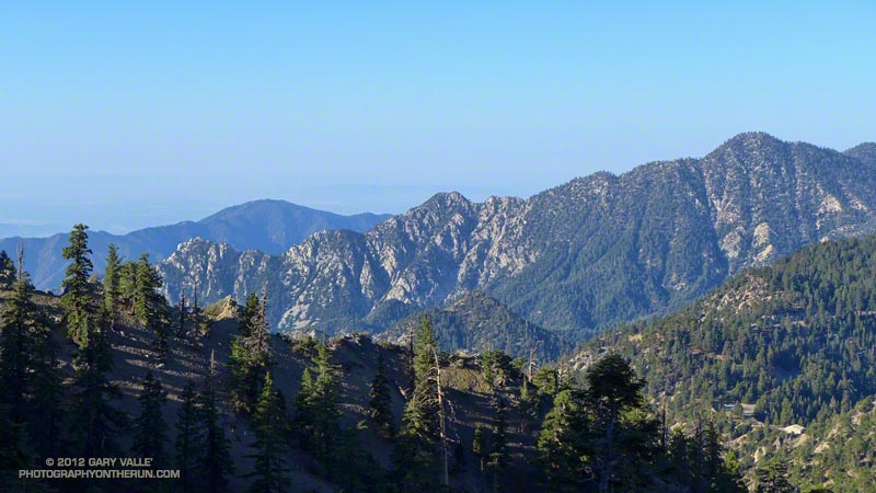
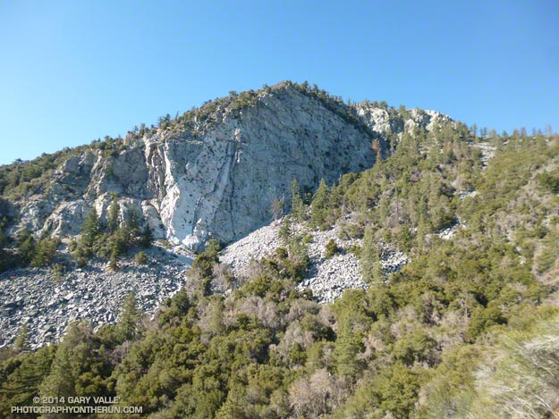
North face Strawberry Peak

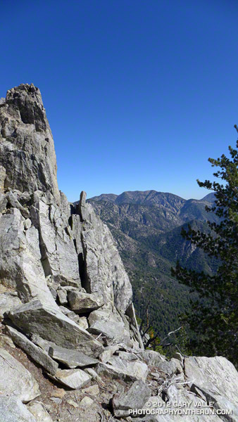
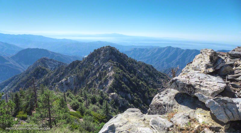
After being closed 4 1/2 years because of the 2009 Station Fire, Strawberry Peak and the trails comprising the Strawberry Peak loop reopened on May 25, 2014. Today, I finally got a chance to get back on the 15+ mile circuit around Strawberry, and was excited to find that much of it was in better shape than before fire.
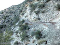
Colby Canyon Trail about 0.25 mile from Josephine Saddle
Colby Canyon Trail near Josephine Saddle

I’d heard that COBRA was instrumental in the restoration of the loop, but that is only part of the story. The preservation and maintenance of trails is now largely a community effort — in this case CORBA, Mount Wilson Bicycling Association, Sierra Club, Los Angeles Conservation Corps, National Forest Foundation, REI, Bellfree Contractors, and the BSA all contributed to the effort.

The loop, which is part of the ANFTR/Mt. Disappointment 50K course, circumnavigates Strawberry Peak. The trails that comprise the loop are Josephine Fire Road, Strawberry Spur Trail, Colby Canyon Trail, Strawberry Peak Trail, Gabrielino Trail, and Nature’s Canteen Trail. The loop can be started at Red Box, Colby Canyo, Switzer’s or Clear Creek. I usually start it at Clear Creek so I can refill my hydration pack from the water faucet at the Haramokngna American Indian Cultural Center at Red Box. (Note: Water might not be available here, especially in winter!)
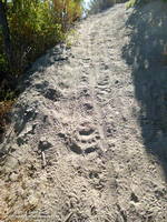
Bear tracks on the Strawberry Peak Trail.
Bear tracks on the Strawberry Peak Trail

Some things to note. The Colby Canyon Trail and the use trail up Strawberry Peak are somewhat hidden from view when you first get to Josephine Saddle. The trails are on the east side of the saddle, and well used. The Gabrielino Trail between Red Box and Switzer’s Picnic area is generally in good shape, but watch out for Poodle-dog bush. The start of Nature’s Canteen Trail is not currently marked. It can be picked up near the top of the paved road that climbs up from Switzer’s, near the telephone/power line poles. It starts on the west side of the road. Most of the trail was overgrown, but it looked like it was being restored, starting at its west end.

I was glad to see that most of the bigcone Douglas-fir on the north side of the peak survived the fire and that Strawberry Potrero was mostly intact. There was a nice set of bear tracks between Strawberry Potrero and the steep section of the Strawberry Peak Trail above the Colby Canyon Trail junction.

Here’s an overview of the Strawberry Peak circuit and an interactive Cesium browser View of the route that can be zoomed, panned, tilted and rotated.

Some related posts: Strawberry Peak Traverse, Blue Skies and Short Sleeves on Strawberry Peak

Mt. Wilson – Newcomb Pass – Chantry Flat Loop

Santiago Peak (Saddleback) from the Rim Trail on Mt. Wilson

As I ran through the scrub oak near the summit of Mt. Wilson, my footfalls and the distant hum of a generator were the only sounds that disrupted the quiet of the early morning. A patchwork of high clouds covered the sky, muting the rising sun and prolonging the dawn-like light.

Suddenly, I caught the movement of something large off to the side on the trail ahead. It took a moment to decipher the scene, but over a second or two the camouflaged bowhunter emerged from the background of oak leaves and limbs. Never turning to look at me, he continued to creep up a game trail toward the observatory grounds.


I wasn’t sure how the bowhunter fit in the array of hunting seasons and regulations, but if the general deer hunting season was open in Angeles National Forest I hoped my bright blue shirt and yellow “rodeo clown” running shoes would make me appear sufficiently unnatural.

Unlike last week, today I had a plan — to run down the Rim Trail from Mt. Wilson to Newcomb Pass, then down the Gabrielino Trail to Chantry Flat and back up to Wilson on the Upper Winter Creek Trail. I had not done this loop and it would give me a chance to do the stretch of the AC100 course between Newcomb Pass and the Mt. Wilson Toll Road.


The Rim Trail is a key part of several Mt. Wilson loops. The trailhead is about a quarter-mile east of the Skyline parking lot along the lower paved road with the nature trail signs. It is an adventurous and scenic trail that switchbacks steeply down the rocky northeast shoulder of Mt. Wilson and then contours over to Newcomb Pass. The trail has many long stretches of outstanding running in a forest of bigcone Douglas-fir and oak.

I’d been on the Rim Trail a few times this year and today was glad to see the poison oak along the trail was leafless and the patches of Poodle-dog bush had been trimmed. It’s harder to spot the poison oak without its “leaves of three” but it seems when it is dormant it is less of an issue.

At Newcomb Pass I turned right (south) onto the Gabrielino Trail, joining the AC100 course and beginning the descent to Sturtevant Camp in Big Santa Anita Canyon. Of all the trails on today’s loop the Gabrielino was the most technical.


In true Fall fashion the temperature on the sun-facing, chaparral-covered upper reaches of Big Santa Anita Canyon contrasted sharply with the forested north-facing slopes traversed by the Rim Trail and along the streams in the depths of the canyon.

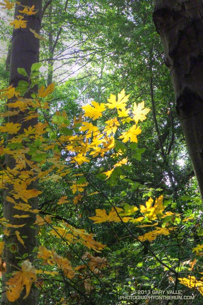
The running between Sturtevant Camp and Roberts Camp was superb. The forests of bigcone Douglas-fir, alder, California bay and bigleaf maple are remarkable and among the most developed in Southern California. The yellows of the bigleaf maples stood out brightly against the greens of the other trees, beacons of Autumn in a mostly evergreen habitat.


The 6 mile, 3100′ climb that starts at the green foot bridge below Chantry Flat and ends at the Mt. Wilson Toll Road is the biggest on the AC100 course. On today’s run it started at a little under the 10 mile point, but during the AC100 comes at about mile 74.

After huffing up the paved road three-quarters of a mile, I refilled my Camelbak at the picnic area at Chantry Flat and continued the loop on the Upper Winter Creek Trail. The uphill on this trail was mostly moderate and runnable, and there is even some downhill to be enjoyed on its descent to the Winter Creek Trail junction near Hoegees.


The climb out on the Winter Creek Trail to Manzanita Ridge is toughest on the loop. Last week I jumped onto the undulating and sunbaked Manzanita Ridge Trail to finish the climb to the Mt. Wilson Trail junction. The “Winton Bypass” extension of the Winter Creek Trail built by Hal Winton and AC100 volunteers is a much better trail and option.

From the turnout near the top of the Kenyon Devore Trail (outside of Skyline Park) the loop worked out to about 17.5 miles, with an elevation gain/loss of about 4500′. Two shorter variations of this loop are possible. At about mile 6.5 the Sturtevant Trail can be taken directly back up to Mt. Wilson or the trail can be used to connect to the Mt. Zion Trail and eventually the Winter Creek Trail near Hoegees.

Some related posts: Mt. Wilson Trail Plus; Bigcone ENSO Prediction, Poodle-dog Bush Blues, and a Surprise on Kenyon Devore; GSU Mt. Wilson CHARA Telescope Array; Mt. Wilson Rim Trail – Kenyon Devore Trail Loop; Twenty-Two Miles and Two Classic Climbs

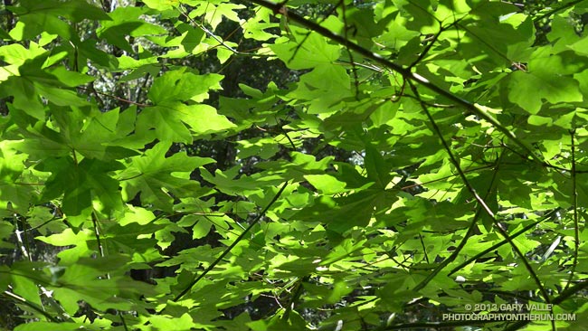
Gabrielino Green

Big leaf maple leaves along the Gabrielino Trail

A soothing panoply of big leaf maple leaves along the Gabrielino Trail between Devore Camp and West Fork.

From last weekend’s Mt. Wilson – Devore Camp – West Fork trail run.

Some related posts: Mill Creek Canyon Maple Leaves, Maple Leaves Along the Ritchey Canyon Trail, Big Leaf Maple Leaves

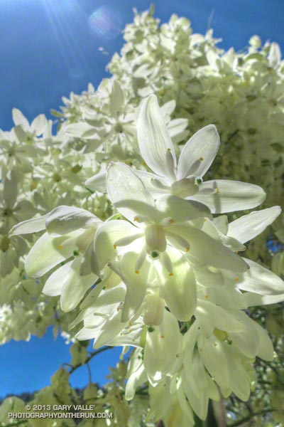
Chaparral Yucca Along the Kenyon Devore Trail

Chaparral Yucca Along the Kenyon Devore Trail

Chaparral yuuca (Hesperoyucca whipplei) at about 4700′ on the Kenyon Devore Trail below Mt. Wilson. The plant was classified as Yucca whipplei for many decades.

From last weekend’s Mt. Wilson – Devore Camp – West Fork loop.

Unwinding from the Backbone Ultra

Bear Canyon
Bear Canyon

Doing a moderate run in the San Gabriels and climbing a few peaks was a great way to unwind from the excitement of doing the 68 mile Backbone Ultra last weekend.

I felt good. I’d run more or less normally in the week following the event — depleted, but without any physical issues. In part that can be attributed to how Coyote Cohorts runs their events. It was basically a long training run in the company of a great bunch of runners and the help of incredible volunteers. Amazing! The long hours of training also really helped, particularly the back-to-back runs following 50Ks and the back-to-back night/day training runs. My shoes — Hoka Mafate 2s — also helped, reducing the impact of all the miles.

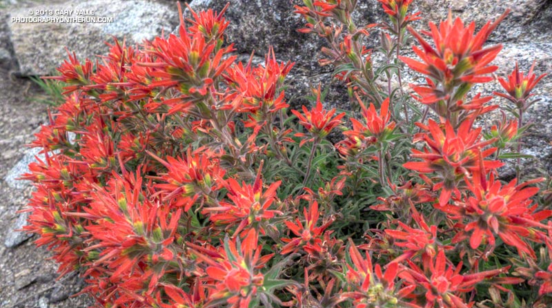
Paintbrush on the San Gabriel Peak Trail near Markham Saddle.
Paintbrush on the San Gabriel Peak Trail

One of the reasons for doing today’s run was to check how Poodle-dog Bush and some other plants are faring in this low rainfall water year. Since July 1 Downtown Los Angeles has recorded only 5.14 inches of rain. Unless we can manage to wring about a half-inch of rain from the heavens before June 30, this water year will go down as the fourth driest since record-keeping began in 1877. The driest water year on record was in 2005-2006 (3.21 inches). Assuming we don’t get that 0.48 inch of rain, three of the four driest water years have occurred since 2000.

Something I noticed on the Backbone run and recent training runs in the Santa Monica Mountains is that plant growth and flowering has been surprisingly robust given the amount of rainfall. This was also the case today on today’s run — the manzanita on the San Gabriel Peak Trail was covered in blossoms and bees, and the nightshade and paintbrush along the trail also seemed to be doing well.

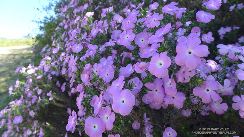
Prickly phlox along Calabasas Peak Mtwy.

What about the Poodle-dog bush, aka Turricula? It looked about the same as last year at this time — just starting to come out of Winter dormancy. Last year we had above average rainfall in April and it really seemed to spur the growth of Poodle-dog bush. This year maybe we’ll see what an extended period of dry weather does to it. Last year some of the Poodle-dog died before the rain in April.

Here’s a short slideshow of a few photos from today’s run in the San Gabriel Mountains, as well as some photos of plants and flowers on recent runs in the Santa Monica Mountains.

Toward Triplet Rocks

Twin Peaks and 'Triplet' ridge from the Mt. Waterman Trail

The prominent ridge extending southeast from Twin Peaks to “Triplet Rocks” can be seen from many points of the Angeles high country. So named because of the triplet of sculpted white granitic monoliths at its summit, the isolated formation is generally considered to be the hardest to reach summit in the San Gabriel Mountains.


Here’s a view of “Triplet” ridge from a run up to Pleasant View Ridge a couple of weeks ago. In the photo Triplet Rocks is the rocky peaklet on the left end of the ridge and Twin Peaks (East) is on the far right. Peak 6834 is the prominent square-topped formation a little left of the midpoint of the ridge.

Today’s loosely formulated plan was to run/hike to the summit of Twin Peaks (east) and then see how far I could get out on the ridge in a reasonable amount of time. At the start of the run I had no idea what a “reasonable amount of time” would be.


It took me about a hour and fifty minutes to reach the east summit of Twin Peaks. On the way there I realized that I should have taken a couple extra bottles of water to stash on the summit. The roughly 60 oz. of water left in my pack wasn’t going to get me very far. I figured I could go about an hour down the ridge and still have enough water to get back and have a little in reserve. The day was windy and dry, but relatively cool. If necessary I could get water at a small spring on the Twin Peaks Trail on the way back.

How far did I make it? In an hour of hiking, scrambling, bouldering, bushwhacking and challenging route-finding, I made it to a rocky ledge  below peak 7120+ and a little before the notch at peak 6834. I guessed it would have taken another 45 minutes to get to the summit of peak 6834. Next time — this wasn’t a place to push it!


I now have a much better idea of what’s going to be required to get to peak 6834 and Triplet Rocks. The north side of the ridge tends to be steep, loose, and at times very eroded. The south side of the ridge tends to be choked with scrub oaks and brush. On the way out I dropped down on the steep north slopes a couple of times; on the way back I tried some improbable lines through brush that (surprisingly) worked out and allowed me to stay more on the crest of the ridge.

It was an unusually busy day on Twin Peaks. On my way down from the peak I encountered several large groups of hikers. When I got back down to the car two tour buses were parked at the trailhead, their drivers patiently waiting for their patrons. Round trip the adventure had taken almost exactly six hours.

Notes:

In the fall of 2010 an experienced hiker doing this ridge became disoriented in rain, snow and whiteout conditions and was reported overdue. Following an air and ground search he was located on the ridge and airlifted to safety. He had notified a relative of his planned route and must have had most of what he needed to get by for the two nights and three days he was out. According to news reports he was in good enough shape to drive home following the rescue.

In April 2021 a hiker who became lost in the Mt. Waterman – Twin Peaks area was found on “Triplet” ridge after spending the night out. The hiker was located with the help of mapping enthusiast who used a photo taken by the hiker to narrow down his location.  The area where he was found was within the Bobcat Fire burn area, and was closed at the time .