Mt. Disappointment 50K 2012 Notes

Mt. Markham

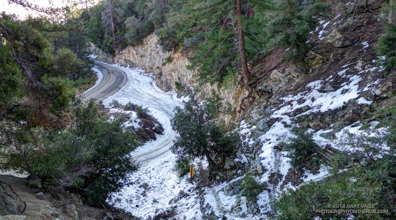
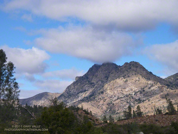
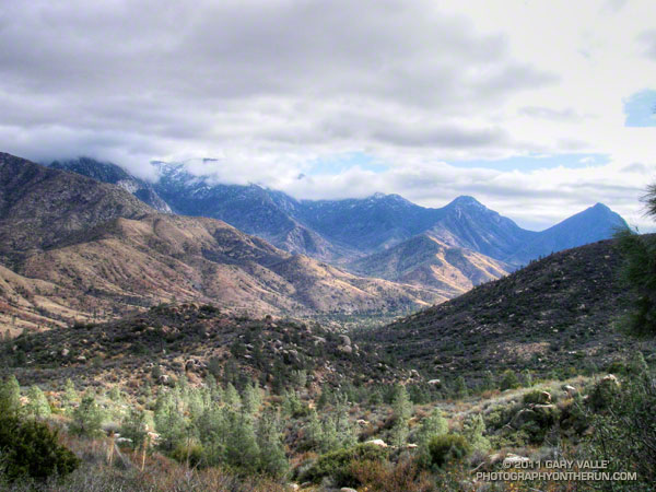
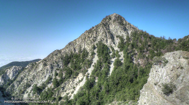
Mt. Markham From Near Mueller Tunnel

Note: The Mt. Disappointment Endurance Run is now the Angeles National Forest Trail Race.

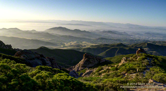
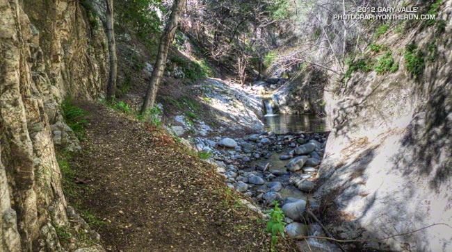
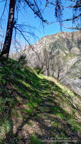
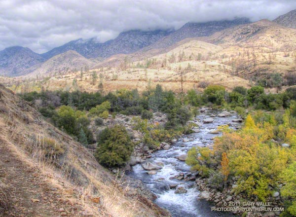
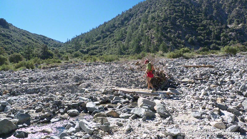
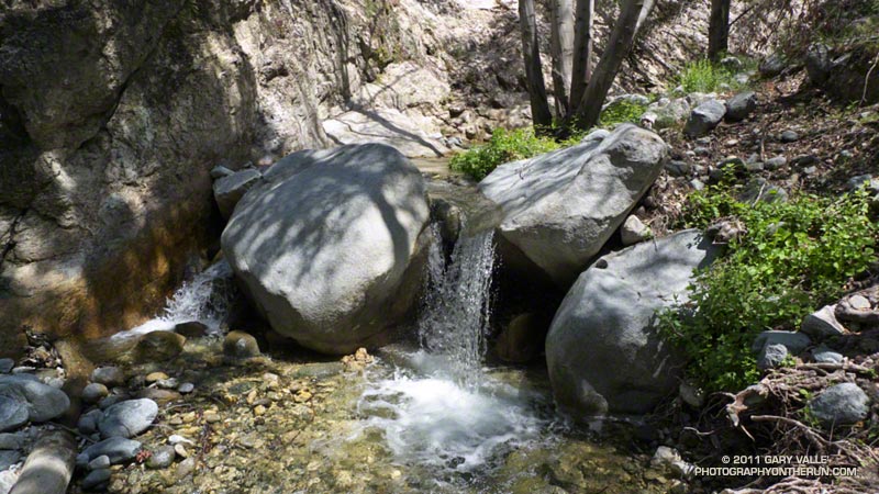
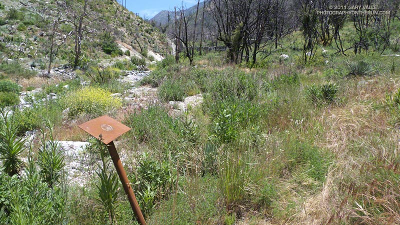
The water felt surprisingly chilly, and for a moment I hesitated before completely immersing myself in the cool, clear water. More a creek than a river this time of year, this crossing of the West Fork San Gabriel River was at mile 17 of the 2012 Mt. Disappointment 50K. At 2760′, it’s the lowest point on the course and marks the beginning of the tough 5.4 mile climb up Edison Road to Shortcut Saddle (4790′).


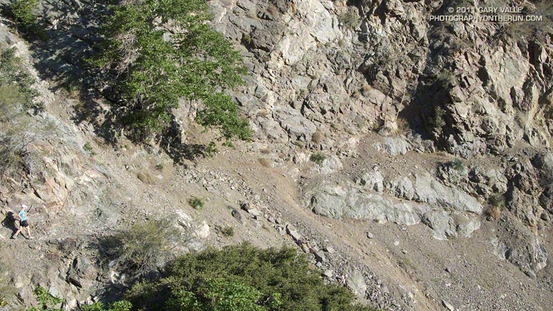
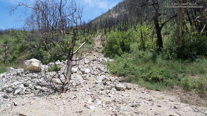
Edison Road (FS Road 2N23) zigzags up an exposed, south-facing chaparral slope. The climb is warm on the coolest of days — today it was going to be torrid. Southern California was locked in the grasp of a record-setting, multi-day heat wave. During the week I’d taken a thermometer on a run and measured a temperature of 107.6°F on a breezy day at Ahmanson Ranch. All week I’d been checking the computer weather models and watching the temps in the San Gabriel Mountains, hoping for a break in the weather. Nada. The day before the race the “in the sun” temps at the Clear Creek RAWS, near the race course, reached a blistering 120°F.

The performance hit from running in the heat is similar to running at higher elevation. Acclimatization helps, but hot weather reduces performance. The following is from Daniels’ Running Formula:

“You can’t perform as well in a distance race in the heat as you can in a cooler environment… As soon as the body starts to heat up, blood is diverted to the skin, where cooling (through evaporation of sweat from the skin’s surface) takes place. A greater portion of the body’s blood volume is at the body’s surface to facilitate cooling, leaving less blood available for carrying oxygen to the exercising muscles. In effect, to prevent overheating, the body reduces the amount of blood available to enhance performance.”


Submerged up to my neck in sublime coolness, I dunked my head. To this point the heat hadn’t been too bad. Much of the first 17 miles had been shaded and tolerable, and I’d been doing everything I could to stay cool. The “not too bad” part was about to end. Most of the next 9 miles would be brutally exposed and facing directly into the sun.

The dip in the pool only took a couple of minutes, but was worth every single second. Even if my shoes were wet and my jelly beans and salt tabs melted gobs of sugar and salt it was worth it!


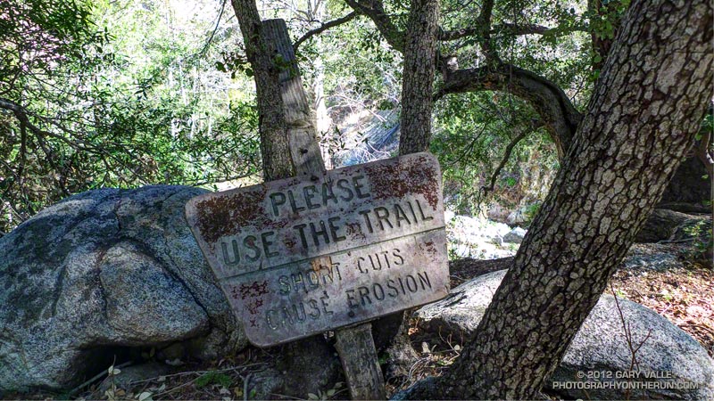
Incredibly, the cooling soak made the Edison climb almost enjoyable. Almost — it still took about 50 minutes to get to the Edison Road aid station and another 50 to get up to Shortcut. At Shortcut the fantastic aid station volunteers filled my Camelbak with Heed and ice, and I ate a couple of big chunks of watermelon (really good watermelon) and drank a little cola. I felt good, but should have been thinking ahead and taken a couple of minutes to really cool down here. The ice water sponges were just sitting there waiting to be used and I passed them by. A little too soon I was on my way, and in a few minutes was jogging down the Silver Moccasin Trail.

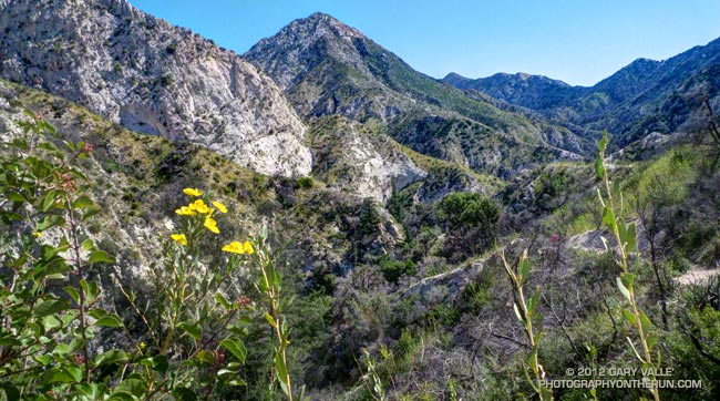
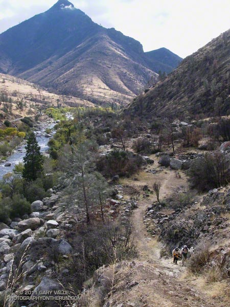
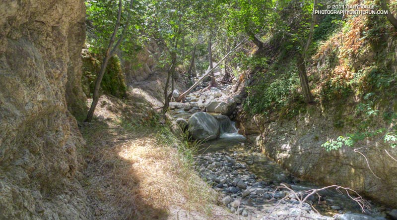
In the extra-strength rays of the noontime sun, the rocky canyon was a solar blast furnace. Temps were well beyond what I had experienced on afternoon runs earlier in the week.  At any instant I thought I might spontaneously combust. I kept watching the runner ahead of me, expecting him to disappear in puff of smoke.  And there wasn’t much relief lower in the canyon. Most of the trees along the creek had been burned in the Station Fire. There was almost no shade, and in the recovering vegetation the humidity (and heat index) was elevated.

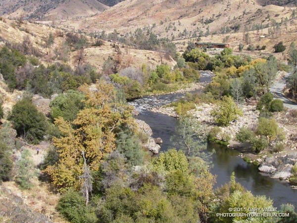
After an interminable time I finally reached West Fork. The pooled water in the W.F. San Gabriel wasn’t as cool as at the lower crossing, but was still refreshing. (The hose from the water tank that Gabor sets up at the aid station was probably cooler and cleaner.) I refilled my Camelbak, and with a cup of cola and ice in hand, headed up the Gabrielino Trail toward Kenyon Devore.


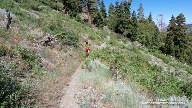
The climb up the Kenyon Devore Trail was — and always is — grueling. Edison Road is tough because some of it is steep and most of it is exposed and hot. KD is tough because most of it is steep, parts of it are hot, and you’ve already done 26+ miles. I took it easy on the Gabrielino Trail, which has some runnable sections, with the hope of being able to maintain a steady pace on KD.

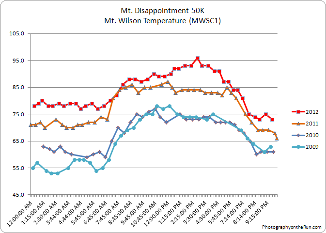
It was warm on the upper part of Kenyon Devore, but at least there was some shade. Last year’s race was unusually hot, but this year’s race was even hotter. This year the temperature (in the shade) on Mt. Wilson hit 86°F a little past 8:00 am and climbed to 96°F by the midafternoon. The temperature (in the shade) at nearby Clear Creek was over 90°F for most of the race, and “in the sun” temps topped out at 116°F!

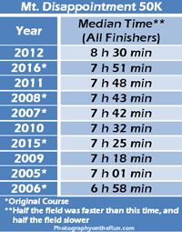
This was my eighth Mt. Disappointment 50K and by far the hottest and most difficult. How difficult? This year’s middle-of-the-pack time — the median time for all the finishers — was 8 hours 30 minutes. This was nearly 45 minutes longer than the median time in 2011, and 90 minutes longer than in 2006.

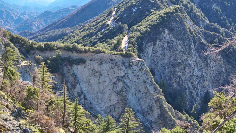
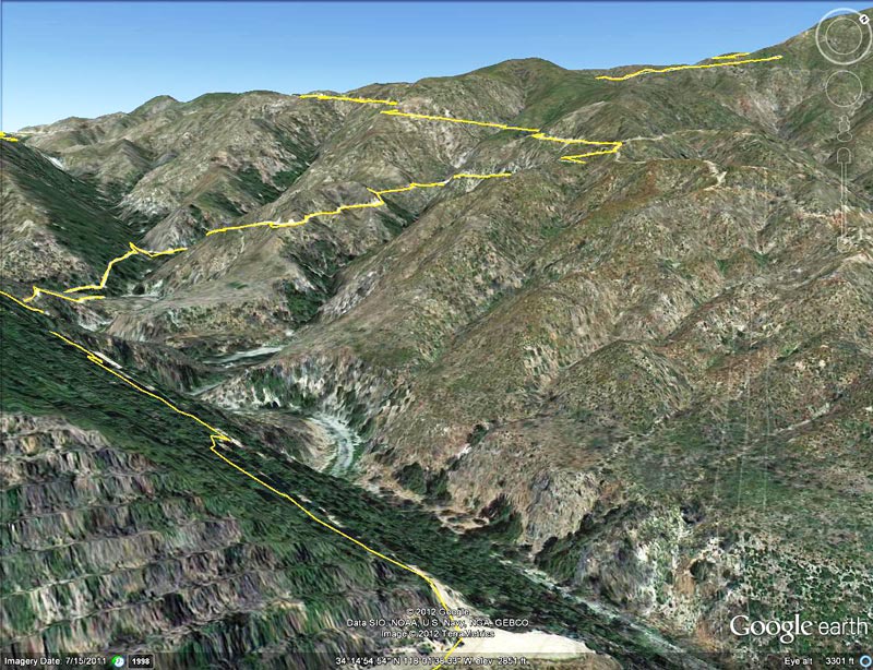
One of the main challenges of the Mt. Disappointment 50K is that it starts and ends on Mt. Wilson — the high point of the course. The original course was run from 2005 to 2008, but because of the Station Fire and Mueller Tunnel closure variations of the original course have been done since 2009. This year Mueller Tunnel reopened and we were able to do the part of the original Mt. Disappointment course that goes from Eaton Saddle up the San Gabriel Peak Trail to the shoulder of Mt. Disappointment and down to Red Box.

In this interactive Cesium browser View of the 2005-2011 courses the 2012 course followed the 2005-2008 (green) course to Red Box and then the 2010 (red) course for the remainder of the race. Checking a few GPS track files with SportTracks and using DEM corrected elevations, it looks like the 2012 course distance and elevation gain/loss were about the same as 2011.

Many thanks to Gary & Pam Hilliard, Fausto & Cindy Rowlan, and all of the Mt. Disappointment 50K Staff, volunteers, HAM radio operators, Sierra Madre SAR personnel, runners, and sponsors that helped to make this event happen! Check out the results and photos on the Mt. Disappointment web site!

Related post: Mt. Disappointment 50K 2011 Notes

Boney Mountain Eclipse Run

Narrative about 2012 solar eclipse

Some things in nature are supposed to be constant. The ground shouldn’t move; a mountain that is here today should be here tomorrow; and if skies are clear and blue, the sun shouldn’t grow mysteriously dim.


Imagine the consternation of our early ancestors, keenly attune to nature, feeling the sun dim and then looking for a cloud they could not find. There is still much of them in us. When the earth shakes or the sun fades, even moderately, we can’t help but react at the most visceral level.

While ee still can’t predict an earthquake with any certainty, we can predict eclipses. Fred Espenak’s NASA Eclipse Web Site includes maps and tables for several millennia of solar and lunar eclipses. Using the web site’s JavaScript Solar Eclipse Explorer you can find the solar eclipses that will be (or have been) visible at a particular location, as well as the type of eclipse, it’s magnitude, and when it will start, end, and reach its maximum. In 2002 I used the Eclipse Web site to plan a trail run to coincide with the June 10 solar eclipse. This afternoon I was doing another eclipse run — the north side loop on Boney Mountain.


Perched on rocky ledge on the western ridge of Boney Mountain, I watched as the light on the landscape became increasingly muted. At the eclipse’s maximum almost 80% of the sun’s area would be obscured and about 85% of its width. The descending veil was tangible. I could not only see it, I could feel it. Even though I understood what was occurring, and that it would not last, ancestral fears were welling up and whispering, “Something is wrong…”


As the time of maximum eclipse approached, bird songs increased as if it was dusk. The wind, which had been blowing in fits and starts began to blow steadily from the west. The temperature dropped another degree or two.

Once the eclipse’s maximum had passed, I continued to work up the ridge, enjoying the extraordinary light. I hoped my wife was getting some good shots of the eclipse in our backyard. Many eclipse viewers are so focused on the sky, they don’t notice the spectacular lensed images projected on the ground and elsewhere by sunlight filtering through trees. The gaps between the leaves of a tree work like a giant pinhole lens, with a focal length of many feet. In the case of the trees in our backyard this produced images of the eclipsed sun 10 inches or more in diameter. Lensed eclipse images were also projected by  sunlight filtering through the chaparral on Boney Mountain.

I topped out on the western ridge around 7:10 and jogged up to the high point between the western and eastern ridges. Across the way three fellow eclipse watchers were on Tri-Peaks, and it sounded like there was a party over on Sandstone Peak. Even with the sun low on the western horizon, you could feel its intensity returning. Only about one-third of the sun was now obscured, and minutes before sunset — about 7:43 — the eclipse would end.


Marine layer haze and long shadows were filling the valleys as I began the second half of my eclipse adventure — running down the eastern ridge and trying to reach the trailhead before it was pitch black. Much of the route was illuminated by the setting sun, and I was able to get past most of the technical running and down to the Danielson cabin site before it became difficult to see. Once on Danielson road the bright western sky provided enough light to run. I made good time down to the creek in Upper Sycamore Canyon and then pushed up the road to Satwiwa. Just enough light remained to run the connecting single track back to the Wendy Drive trailhead.

After the Station Fire: Red Box – Bear Canyon – Gabrielino Loop Revisited

Arroyo Seco downstream of Switzer Falls

Arroyo Seco Downstream of Switzer Falls

By the calendar Spring was still a couple weeks away, but temps near 80 were forecast for the lower elevations of the San Gabriel Mountains and the weather looked ideal for revisiting the Red Box – Bear Canyon – Gabrielino loop in Angeles National Forest. I did this loop last May when the area re-opened following the Station Fire and was curious to see how recovery was progressing, and how much trail use and maintenance had improved the trails.

The difference in 10 months was remarkable. Recovery of the burned areas continues at a steady pace, and trail conditions on much of the loop are not all that different than before the Station Fire. Following are some notes about each segment of the loop.


San Gabriel Peak Trail to Mt. Disappointment Road: This trail segment was not burned in the Station Fire and is in good shape. The weather had been much colder earlier in the week and there was still some snow on the trail from a mid-week storm.


San Gabriel Peak Trail from Mt. Disappointment Road to Mt. Lowe Truck Trail fire road: Thanks to work done by the JPL Trailbuilders this segment was in decent shape last year, and was in even better shape today. It’s rough and rocky in places, and there’s still some Turricula along the trail, but it was very runnable and not unlike it was before the fire. There are excellent views of Mt. Markham, Mt. Lowe, upper Bear Canyon and the rugged terrain along Mt. Lowe Truck Trail fire road.


Mt. Lowe Truck Trail fire road to Upper Bear Canyon Trail: Other than some rock fall here and there, there were no particular issues from a trail running point of view. There are good views of San Gabriel Peak, Mt. Disappointment and Bear Canyon.

Upper Bear Canyon Trail from Mt Lowe fire road to Tom Sloan Saddle*: Excellent condition thanks to recent trail work by the Outdoor Club.

Bear Canyon Trail from Tom Sloan Saddle to cabin site: Use of the trail and low Winter precipitation have improved conditions on this trail segment, but some problem sections remain. A short detour off the trail was necessary about a half-mile from Tom Sloan Saddle.


Cabin site to Bear Canyon Camp: Increased use made it easier to follow the use trail and work down the canyon. The collapse of this unburned oak may not have been related to the fire. Bear Canyon Camp is about halfway through the canyon, above the creek on a bench on the left (when descending). The camp is in great shape, and from its shaded sites it would be hard to tell a fire had ravaged the area. At the edge of the camp is an old Forest Service sign, placed by someone with a sardonic wit.


Bear Canyon Camp to confluence with Arroyo Seco: This segment has seen much more use — as I descended the canyon I encountered four groups and two solo hikers working up the canyon. There were a number of ribbons and ducks marking the way and the use trail is becoming better defined. Although some nice sections of the old trail remain, most of the trail in Bear Canyon was washed out well before the Station Fire. As noted by John Robinson in Trails of the Angeles, “…the old Tom Sloan Trail that once traveled the length of the canyon is in poor shape and you must scramble and boulder-hop much of the way.” This is part of the Bear Canyon experience and hopefully the path won’t become so well-marked that all you have to do is blindly follow the markers.


Arroyo Seco to Gabrielino Trail and Switzer Picnic Area: Very well-used. Its condition is similar to what it was before the Station Fire. I was surprised to see two people on mountain bikes descending the steep section of trail that leads to the Arroyo Seco below Switzer Falls, and then downstream Bear Canyon junction and Royal Gorge. I wondered if they had missed the fork onto the Gabrielino Trail. If they were the mountain bikers that were later rescued at the Paul Little debris dam, and didn’t backtrack to the Gabrielino Trail, they would have had a nightmare of a hike-a-bike through trailless Royal Gorge.


Gabrielino Trail from Switzer Picnic Area to Red Box: Last year the condition of this trail segment was the worst of any trail on the loop. It was washed out in several places. There were downed trees. Some sections were so overgrown it was difficult to follow the trail. In several places I had to literally wade through chest high Turricula. Not so this year. Thanks to the efforts of CORBA and MWBA this trail has nearly been restored to the condition it was in prior to the Station Fire. Other than dealing with the uphills I had no problem running the trail. There’s still a lot of Turricula along the trail, but it is mostly avoidable.

Last year on this loop there was no avoiding the Turricula and I paid the price, its sticky resin coating my arms and legs and resulting in a rash and inflammation. This year I only contracted a couple of small spots of poison oak. This post has more info about Turricula.

There is a long list of volunteer groups that have been working to restore the trails in the Station Fire burn area. Most of the trails in the open areas of the Forest burned in the Station Fire are in fair to good condition, or at least in the same shape they were in before the Station Fire. Some are in better shape than before the fire.

The Forest can be a hazardous place, but there were washouts, rock slides, downed trees, overgrown trails, lost hikers and other incidents BEFORE the Station Fire. Just because an incident occurs in the area burned by the Station Fire doesn’t mean it’s the result of the fire.

Related posts: After the Station Fire: Red Box – Bear Canyon – Gabrielino Loop, After the Station Fire: Ten Miles – Four Peaks

*Tom Sloan appears to be correct spelling, rather than Tom Sloane as printed on some USGS maps. In Trails of the Angeles John Robinson mentions that Tom Sloan Saddle is named after a former district ranger. There’s a quotation from the Arcadia Tribune (1918) on the Forest Lookouts page for Los Angeles County regarding Arcadia Station that refers to “Thomas W. Sloan, chief ranger in the United States Forest Service in this district…”

Whiskey Flat Trail Burger Run 2011

Kern River near the finish of the 2011 Burger Run

The Burger Run is one of those runs that is much more difficult than its 14.5 miles and 2000′ of elevation gain would suggest. For one thing the Whiskey Flat Trail ain’t no namby-pamby city trail. It’s a rustic single track trail in the Southern Sierra that runs along the Kern River from the outskirts of Kernville up to Johnny McNally’s Fairview Lodge and Restaurant — and burger stand.


The trail is single track all of the way, with so many ups and downs you’ll think you’re riding a Magic Mountain roller coaster. It seems around every corner there is another creek or a ravine. The running is varied and technical, ranging from sweet pine-needle-lined stretches of trail to gnarly, V-rutted, overgrown, rocky, sandy, steep sections that test your trail running skill.

For a time it looked like a big low moving down the coast might cause some weather problems, but overnight rain turned to partly cloudy skies race day morning, with near perfect weather for the runners and walkers.

Many thanks to race director Mike Lane, all the volunteers, McNally’s, Indian Wells Brewing Company, and all of the friendly hikers and runners. Proceeds from the race benefit Run 4 A Way, a local non-profit group dedicated to enhancing the fitness and well being of the local youth. Results and finish line photos are posted on Run 4 A Way’s Facebook page.

Here’s an interactive Cesium browser View of the Burger Run course and an elevation profile generated in SportTracks. Following are a few additional photos. Click for a larger image:


Aid Station #1


Sock’em Dog Rapid


Steep Climb


Runner, River & Road


Kern Peaks


Ten Miles In

San Gabriel Mountains Running Adventure

Manzanita Trail below Vincent Gap

Some runs in the San Gabriels are more adventurous than others, and I’d mentioned to Devy that on this run we would likely have to deal with rock slides, washed out sections of trail, an annoying amount of bugs, and warm — if not hot — temperatures. We might even run into a bear. Devy is the owner of Andes Adventures, and having cut his trail running teeth exploring Peru’s Cordilleras Blanca and Huayhuash, his response was “sounds like fun, let’s go!”

The loop is a favorite, combining sections of the High Desert National Recreation Trail and Pacific Crest Trail. The route starts at Islip Saddle (6650′), descends to South Fork Campground (4560′), then climbs all the way back up the summit of Mt. Baden-Powell (9,399′). From Baden-Powell it returns to Islip Saddle on the PCT. It’s 23.5 miles of scenic single track trail with a cumulative elevation gain/loss of around 5700′. Done as part of a normal week of running, and with stops along the way, it usually takes about the same time to do this course as a hilly 50K race.


The South Fork and Manzanita trails are part of the High Desert National Recreation Trail. The 5.25 mile long South Fork Trail descends the rugged canyon of the South Fork of Big Pine Creek. Due to the tortured geology of the area — the San Andreas fault zone is nearby — the trail is in a constant state of change. Each time I’ve run it, its condition has been a bit different. It has many rocky sections, and at various points along the trail it is necessary to cross the debris from small rock slides.

According to the nearby Valyermo RAWS the temperature was around 80 degrees when we rolled into South Fork Campground. Not too bad. It would be near 100 later in the day, and it’s not uncommon for temps to hit the 90’s here by 8:00 or 9:00 in the morning. The (unmarked) Manzanita segment of the High Desert National Recreation Trail starts on the east side of the campground and in about 5.6 miles leads to Vincent Gap (6565′).


The news of the day was the condition of the Manzanita Trail. Sections of this trail have been washed out for several years, and after December’s record-setting rainfall it seemed the trail could only be worse. Surprise, surprise, the trail was mostly repaired! We didn’t even have to use tree roots for handholds!

Vincent Gap is at about mile 11 on the route, and about 2200′ into the 5000′ climb up Baden-Powell from the desert. As you might expect on a nice Summer weekend the PCT up Baden-Powell was very busy. In part because we wanted to save some for the outstanding running between Baden-Powell and Islip, and in part because we couldn’t go any faster, the pace was pretty leisurely going up the peak.

Ah… the water at Little Jimmy Spring… Like last week, still so cold I thought it was going to give me an ice cream headache.

Related post: Islip Saddle – Mt. Baden-Powell South Fork Loop

After the Station Fire: Red Box – Bear Canyon – Gabrielino Loop

Recovering chaparral and bigcone Douglas-fir in Bear Canyon 19 months after the Station Fire

Recovering Chaparral and Bigcone Douglas-fir in Bear Canyon

Most Southern Californians have direct experience with wildfire and its effects. Wildfires are often described as being a “natural part of the ecosystem,” but in Southern California wildfire is anything but natural. Urbanization, land management policies and firefighting practices shape fire frequency, behavior, intensity and effects — often with unexpected and tragic consequences.


According to InciWeb, the Station Fire started on Wednesday August 26th, 2009 at approximately 03:30 p.m. and was fully contained at 7:00 p.m. on Friday, October 16, 2009. Two firefighters were killed in the arson caused blaze, numerous homes and structures were lost, and 160,577 acres burned. The fire was the largest recorded in Angeles National Forest since it was established in 1892 and the 10th largest fire in California since 1933.

In January 2011 the Station Fire Closure was updated and extended to January 2012. At that point, it looked like it might be a long time before any substantial part of the closure area would be opened to the public. But with increasing public pressure to open more of the Forest, Angeles National Forest reopened about half of the Station Fire Closure area earlier this week. Today I did a run/hike in the newly opened area to see first-hand how recovery from the fire, and subsequent debris flows and flash floods, is progressing 19 months after the fire was contained.

The first areas I wanted to check were Bear Canyon, and upper Arroyo Seco from Switzer Falls to Red Box. I’d done loops through these areas in April 2009, a few months before the Station Fire, as well as in March 2007 and November 2005. Because Mueller Tunnel was closed, I couldn’t do the same loop as in 2009, but I could bypass the tunnel using the Mt. Disappointment Trail, and then drop down into Bear Canyon from the Mt. Lowe Truck Trail. From there the loop could be completed by following the Gabrielino Trail from near Switzer Falls, back to Red Box. After checking with the Forest Service that all of the trails were open, the loop was a go!


I’d done all the sections of the loop on previous runs, and was familiar with the trails and terrain. My intent was to follow the routes of pre-existing trails as closely as possible. Just in case, I took a paper map; and as a backup and source of extra info, I loaded my GPS with the track points of the trails. It turned out the GPS did help a couple of times to follow missing or overgrown sections of trail, but there was also more than one instance when blindly following the GPS would have led me in the wrong direction.


At around 7:30 I left an empty Red Box parking lot and started running up the Mt. Wilson road. About 0.4 mile up the road I turned onto the San Gabriel Peak/Mt. Disappointment Trail and began working up toward the saddle between the two peaks. Nearly all of the trail to the saddle was unburned. The robust mix of chaparral and forest towered overhead, and a few minutes later I felt some anguish as I crossed the saddle and entered the burn area.

There was a little more debris than normal on the rocky stretch of the Mt. Disappointment Trail that crosses the west face of San Gabriel Peak, but the trail was mostly runnable, and it didn’t take long to get down to the Mt. Lowe Truck Trail fire road. At Markham Saddle a DANGER sign marked the closure of the road to Mueller Tunnel.


Turning in the opposite direction, I started running down the fire road, and after a short distance, stopped to take photos of the Bear Creek drainage. It looked to be in pretty good condition, considering. The side canyons didn’t have the runnels and debris flows I’d seen in upper Arroyo Seco on the drive up Hwy 2. I’d be getting a closer look at those channels later in the run.


At the hairpin turn west of Mt. Lowe I left the fire road and picked up the trail that leads down the ridge to Tom Sloan Saddle. It had taken about an hour and a quarter to get to this point, and I suppressed an overly optimistic thought that I might reach Red Box by noon or so.

As would be expected with little or no use, two seasons of growth, and a wet winter, sections of the trail were really overgrown. The upper part of the Bear Canyon Trail was also significantly overgrown, and in a couple of places difficult to follow. It helped that animals had used the trail, though their path through the grass was indistinct. Trails are valuable resources that can be lost through prolonged closure and disuse.


Once down to Bear Creek, the character of the canyon was much the same as before the fire. Bear Canyon is one of the more wild and isolated places in the San Gabriel Mountains that can be accessed by trail. Not far beyond the old cabin site, I paused by the creek and absorbed the sounds, smells and scenery of this special place.


The creek was incised in places, and there was other evidence of moderately high flows in the two years since I had been there. Very little remained of the use trail. The remnants of the old Tom Sloan trail are still there, but these are few and far between. There were more fallen trees, and a ton of poison oak. It was time consuming to try and dance around the poison oak, and about halfway through the canyon I gave up trying. Bear Camp appeared to be unscathed, and looked much like it did in 2009.


It took twice as long to work through Bear Canyon as in 2009, and I was happy to get to Bear Creek’s confluence with Arroyo Seco. Except for a couple of fallen trees, it was straightforward getting back to the Gabrielino Trail and to the Switzer Picnic Area. The bridge at the picnic area was littered with flood debris. The high water likely occurred during our record-setting December 2010 rain event.

It was a close call, but no doubt due to the efforts of firefighters, Switzer Picnic Area appeared to have survived almost unscathed. The Forest Service has made a number of improvements to the facilities. According to a Forest Service press release, the picnic area will remain closed until sometime in June, while construction is completed.


The first two miles of the Gabrielino Trail above Switzer really took it on the chin. The fire effects there were very pronounced, and of all the trails in the loop, that segment was the most severely affected. Flash flooding and debris flows have swept the canyon, obliterating sections of trail. The rest is very overgrown. Virtually every tributary canyon is now incised with debris flow runnels, up to several feet deep.


Once away from the canyon bottom and on the old road bed the trail was still overgrown, but was generally in better shape and easier to follow. The last mile to Red Box was nearly in the same condition as before the fire, and the last half-mile (where some trailwork had been done) even better!

In the last decade I’ve followed the recovery and studied aspects of several fires including the 2002 McNally Fire, 2002 Curve Fire, 2003 Simi Fire, 2005 Topanga Fire, 2006 Day Fire, 2007 Corral Fire and 2008 Sesnon Fire.  Even after having observed it many times, I continue to be amazed at the resilience of fire-adapted ecosystems. As long as the fire recurrence interval isn’t too short, nature seems to do a pretty good job of recovery.

Related post: Contact Dermatitis from Turricula parryi – Poodle-dog Bush