Go Figure

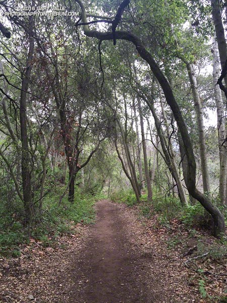
Santa Ynez Canyon Trail. Santa Monica Mountains.

OK, the last few miles of last Saturday’s long run were a bit of a struggle. But the run was also a bit strenuous, so I tried not to read too much into it. The following morning I was up early enjoying the Winter green along the Garapito Trail. That run went well enough, but the weekend left me wondering if my revised training plan was going to work.

The plan for today was to do around 26 miles, but the question was what kind of 26 miles and where? After debating several options I finally settled on a run from Marvin Braude Mulholland Gateway Park at “the end of Reseda.” The route would merge the Will Rogers – Temescal Canyon loop with the Trailer Canyon – Santa Ynez Canyon – Trippet Ranch loop. The term “loop” is used loosely here, just meaning that the run starts and ends in the same place, but isn’t an out & back.

I’d done the loop a couple of years ago and my recollection was that it was around 26 miles with an elevation gain of something over 5000′. It’s a good run to do self-supported since water is usually available at Will Rogers, Temescal Canyon and Trippet Ranch. It can be brutal on a hot day, but that’s true of most lower altitude runs in Southern California.
Rain-soaked prickly phlox (Linanthus californicus)
Rain-soaked Prickly Phlox

Hot temps were not going to be my problem today. Mostly cloudy skies were forecast with very light rain in the morning. The heavier rain was supposed to hold off until around midnight. It had already rained a little when I left for the trailhead, but conditions were supposed to improve during the middle of the day.

Running up to the Hub I had no clue how the run was going to go. I usually don’t until 2-3 hours into a long run. At around two hours I was at Will Rogers and feeling pretty good. At three hours I was nearing the “waterfall” in Temescal Canyon and at four making the turn left down Trailer Canyon.
Cloud-shrouded Green Peak on Temescal Ridge Trail fire road.
Green Peak on Temescal Ridge

Usually the decision to turn down Trailer Canyon is a painful one. You’ve done all that work to get up to Green Peak on Temescal Ridge and now you’re going to run down Trailer Canyon and give it all away? Today, for some reason, losing all that elevation and then having to gain it back again wasn’t a big deal — it was just another part of the course.

The run continued to be uncomplicated until near the rock slabs in Santa Ynez Canyon, when I decided to check the mileage on my Garmin. 20.2 miles… Hmm, that seems a little long… Is it only six miles back to Reseda? I don’t think so…
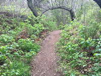
Thriving poison Oak along the Santa Ynez Canyon Trail.
Poison oak on the Santa Ynez Canyon Trail

I still had over a mile to the Trippet Rnach parking lot and from there my usual route back to Reseda on the Musch, Garapito and Bent Arrow Trails would be around 7 miles. I briefly debated shortening the route. The thing is, despite last week’s issues, I felt good and the run was going well. The conditions were perfect, so why not run the route as planned?

As things turned out today’s run was 5 miles longer than last Saturday’s and had about the same elevation gain. Somehow that translated into a 30 minute faster run than last week and legs that weren’t stiff or crampy.

What changed from last week to this week? If only I could figure that out!

Some related posts: Will Rogers – Temescal Loop, Chilly Los Angeles, Clouds, Canyons and Wildflowers, Garapito Trail Runs

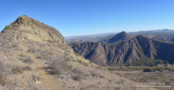
Arroyo Conejo, Wildwood Park and Elliot Mountain

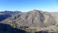
Elliot Mountain with Lizard Head, Mountclef Ridge and Wildwood mesa in the distance

This morning’s run had started on the southern boundary of the Arroyo Conejo Open Space near Amgen in Thousand Oaks. It was 39°F at the beginning of the run and the chill of dawn and brisk north wind made it feel even colder. The plan was to run north on the Arroyo Conejo Trail and connect to the trails in Wildwood Park.

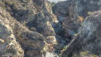
Gorge cut by Arroyo Conejo Creek

Running on automatic, and hoping to warm up quickly, I followed the Arroyo Conejo Trail north along the shoulder of the canyon. Known as “La Barranca” the three mile long canyon extends from the 101 Freeway to Hill Canyon near Santa Rosa Road. Rounding a corner and working up and over a little hill I looked to my right and was astonished to see that in this section of the canyon a deep, vertical-walled gorge had been cut into the residential landscape.

Mountclef Ridge from the Stagecoach Bluff Trail in Wildwood Park.

The wildness of the gorge set the tone for the remainder of the run. Arroyo Conejo, Wildwood Park and the Western Plateau have a scenic, desert southwest character all their own and an extensive trail system. If a bluff, peak or other feature looked interesting, there was generally a way to get to it. I ran along Stagecoach Bluff, then to Lizard Head, and then over to the Canyon Overlook Trail and down to the Conejo Canyons Bridge at the Hill Canyon trailhead.

Hill Canyon and Elliot Mountain from the Canyon Overlook Trail.

After running up Hill Canyon, I was once again headed uphill, this time on the Western Plateau Trail. I’d caught a glimpse of some mountain bikers high on the bluff above and couldn’t resist continuing. I had more than 10 miles in and was planning to go back through Wildwood Park. Each mile added now would add two miles to my growing round trip total.

Box Canyon and Mountclef Ridge from the Canyon Overlook Trail

That’s the difficult thing about doing an exploratory run — deciding where to turn around. You HAVE to see what’s around each corner and what the view is like from the top of every hill. You can’t turn around just anywhere, and I was looking for the right place.

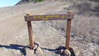
Turning onto the Outlaw/Gnome Trail, in a few minutes I reached the top of the rock outcrop where I’d seen the mountain bikers.  But it wasn’t the top of the climb, and it definitely wasn’t the right spot to turn around. A bit higher I could see a sign silhouetted on the skyline and was curious to see what it said.

Trail to Elliot Mountain in the Western Plateau area near Hill Canyon
Trail to Elliot Mountain

The sign read “Elliot Mountain Trail.” How could I turn around now? Continuing east, a newly cut trail with a bench en route led to the top of the peak. Recently named in honor of Burt Elliot, “a tireless volunteer, open space advocate and champion of trails,” the peak was the perfect place to spend a few minutes enjoying the great view and then start my circuitous trip back to the car.

For trail maps and more information see the Conejo Open Space Foundation web site.

The title photograph is Elliot Mountain with Lizard Head, Mountclef Ridge and Wildwood mesa in the distance.

Longer Late Afternoon Runs

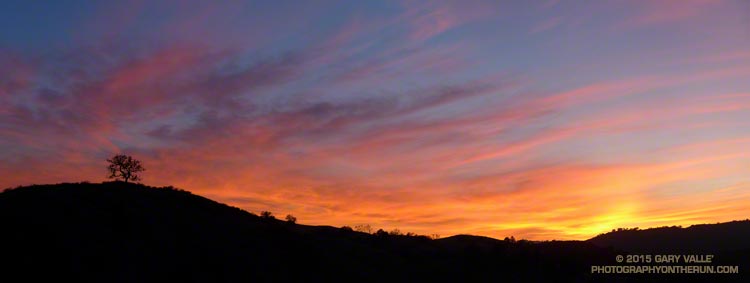
Sunset in open space area near Los Angeles

If you are a late afternoon runner and live in the Los Angeles area (or similar latitude), beginning December 11 the sunset time computed by the U.S. Naval Observatory increases from 4:44 PST to 4:45 PST. By the end of December sunset will be about 10 minutes later than today. It isn’t until July 5, 2016 that the computed sunset time begins to decrease.

Waiting for Rain: El Nino and the 2015-16 Southern California Rainfall Year

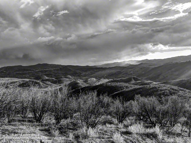
Thunderstorm over the Santa Monica Mountains

Due in part to El Nino and the Madden-Julian Oscillation (MJO) Southern California jump-started the 2015-16 rain season with above average rainfall in July and September.

Last year the NWS changed the WATER Year to October 1 – September 30, but the RAINFALL Year remains July 1 – June 30, as it’s been for decades.

Below is the monthly tabulation of rainfall for Downtown Los Angeles (USC) for the 2015-16 Rainfall Year, along with what is considered normal for the month.

Downtown Los Angeles Rainfall
Month Rainfall Normal
July 0.38 0.01
August T 0.04
September 2.39 0.24
October 0.45 0.66
November 0.01 1.04

So far this rainfall year Downtown Los Angeles (USC) has recorded 3.23 inches. Even with November as dry as it’s been we’re still more than an inch above normal for the rainfall year — about 1.46 inches above normal as of November 25.

Over the next couple of weeks the medium range models and other tools aren’t especially bullish on our chances for a good, soaking rainstorm in Southern California. Longer term guidance suggests an improving chance of precipitation as December progresses, and above average precipitation in January and February. We’ll see!

The title photo is from November 3. It shows a band of thunderstorms that moved southward across the San Fernando Valley and into the Santa Monica Mountains. The band produced cloud to ground lightning strikes and some heavy showers. Saddle Peak is in the distance on the left. The shower activity in the distance on the right is in the area of Kanan Rd. and the 101 Frwy.

July Deluge a Preview of Southern California’s Upcoming Rain Season?

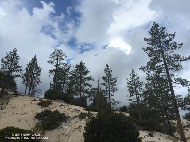
Pines and clouds in the San Gabriel Mountains

It wasn’t so much a surprise that there was thunder or that it was starting to shower again. It was that I was hearing thunder all around me — to the east toward Mt. Waterman and Twin Peaks, to the south toward Mt. Wilson and the San Gabriel Valley, and to the west toward Big Tujunga Canyon and the San Fernando Valley. This was clearly more than an isolated summer build-up. Pockets of showers, some light and some heavy, could be seen in the distance and I wondered just how wet I was going to get.

Mt. Waterman (left) and Twin Peaks from near Mt. Hillyer in the San Gabriel Mountains
Mt. Waterman (left) and Twin Peaks from near Mt. Hillyer

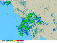
The answer was “pretty wet!” That was on a run in the San Gabriel Mountains on Saturday, and was the result of the first wave of moisture and instability associated with tropical system Dolores and a strong monsoonal flow from Baja. An even stronger surge of moisture followed Sunday afternoon with rain rates exceeding an inch an hour. From 5:15 p.m. to 5:25 p.m. a CBS Radio weather station on Mt. Wilson recorded a half-inch of rain in just 10 minutes!

NEXRAD regional composite radar image for Southern California at 5:00 p.m. Sunday, July 19, 2015.
Composite radar image for Southern California at 5:00 p.m. Sunday

Though the heavy rain created its own problems — including flash floods, debris flows and rock slides — the soaking rains helped quell the Pines Fire near Wrightwood and the North Fire near Cajon Pass. Over the three day period from Saturday to Monday the Big Pines Remote Automated Weather Station (RAWS), near the Pines Fire, recorded 3.12 inches of rain. Several stations in the San Gabriels recorded more than three inches of rain, including Clear Creek and Opids Camp.

Many locations set new records, not only for the date, but for any day in July. Downtown Los Angeles (USC) set rainfall records for the date on Saturday, Sunday and Monday. Downtown Los Angeles recorded 0.36 inch of rain Saturday. This is more rain than any day in any July since recordkeeping began in 1877. That one day of rainfall even broke the monthly record for July in Los Angeles! Prior to this event the wettest July on record was in 1886, when 0.24 inch was recorded.

Strengthening El Nino conditions and the active phase of the Madden-Julian Oscillation contributed to the development of Dolores in the Eastern Pacific, enhancing convection. Anomalously warm SSTs in the tropical and sub-tropical Eastern Pacific also played a role, helping to maintain the strength of Dolores and increasing the amount of water vapor entrained by the system.

This year’s El Nino is very different than last year’s on again, off again event. This year’s El Nino is already established, well-coupled with the atmosphere and growing in strength. It’s firing on all cylinders and at this point it appears the only question is, “How strong will it get?”

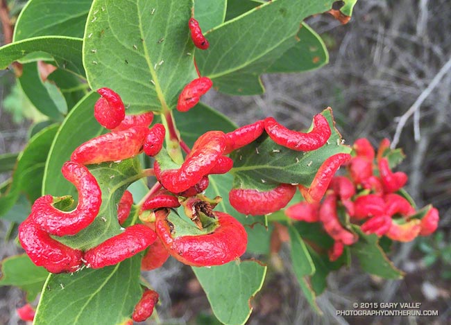
Manzanita Leaf Galls and Aphids

Manzanita Leaf Galls and Aphids

Was running down the Chamberlain segment of the Backbone Trail Saturday, when a flash of bright red on a manzanita bush caught my eye.

Very bizarre, as nature often is. At first glance I thought the bulbous red objects on the manzanita were some kind of larvae, but on closer inspection could see it was a swelling of the leaf. My first thought was some kind of viral infection.

What they turned out to be are aphid induced leaf galls. Galls generally provide a protective habitat and enhanced food source for the inducing species and their tenants.

Related post: Scrub Oak Apple Gall