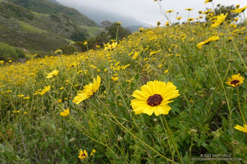
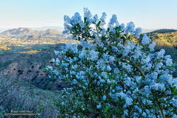
The bush sunflowers (Encelia californica) above are along the Secret Trail in Calabasas. While there have sometimes been showy displays of bush sunflowers along this trail, I don’t recall any quite as prolific as this. There were many other wildflowers as well (slideshow).
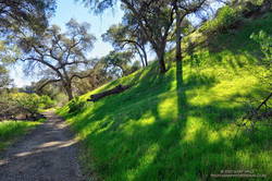
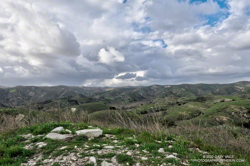
It’s been another bizarre rain year. While California water managers worry about water supplies, chaparral plants in the Santa Monica and Santa Susana Mountains seem quite happy with this season’s rainfall. There is a lot of new growth and plants appear to be playing catchup from last year’s dismal rain season. From the trail it looks more like an above average rain year, rather than the somewhat below normal rain year actually recorded.
Bigcone Douglas-fir along East Canyon Mtwy fire road.
I hadn’t seen a hiker, runner, or mountain biker since turning off East Canyon Mtwy fire road. That was about 2 miles ago. I checked my watch — it read 18 miles. Had I’d made a wrong turn?
Today’s plan was to do the first 25 miles of the Santa Clarita Ultra & Trail Runs 50K. A week ago I’d run the first (blue) and third (yellow) sections of the course, and today’s run would theoretically combine the first (blue) and second (orange) sections.
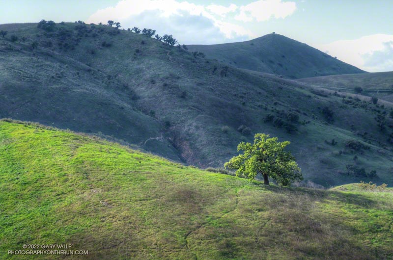
Oat Mountain from the Towsley Canyon Loop Trail
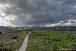
So far, the run had gone well. It had started with an extended version of the popular Towsley Canyon Loop in Ed Tavis Park. After climbing up oil-rich Wiley Canyon to a view point at an elevation of about 2450′, the course descended a series of long switchbacks, and passed through a gap in Towsley Canyon known as the Narrows. A mile down the canyon from the Narrows I’d used segments of the Elder Loop and Taylor Loop trails to run over to Lyon Canyon.
After switching from a bottle to a pack, I’d run on the Old Road over to the East Canyon Trailhead. From there the course followed East Canyon and Sunshine Canyon fire roads to Mission Point. The climb up to Jones Junction gains about 1300′ in 3 miles, then it’s another 1.5 miles over to Mission Point (2771′), the high point on the course.
Green along the Taylor Loop Trail.
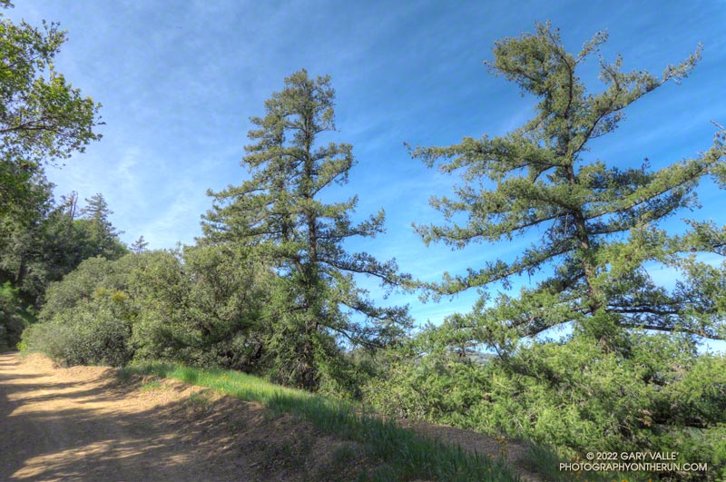
One of the highlights of the run up East Canyon was the very healthy-looking Bigcone Douglas-firs higher on the road. Now relegated to the cooler climes of steep, north-facing mountain slopes, the species used to be far more widespread in Southern California.
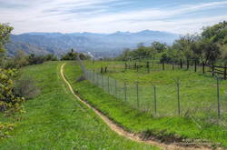
On the way to Mission Point, the views of the San Fernando Valley from the crest were outstanding, and gave a perspective of the Valley I had not seen before. Apart from having to detour along fence lines bordering private property, and continuous gunfire in a section of the canyon that is near a popular gun club, the run to Mission Point was excellent.
Detour around private property on the way to Mission Point.
Returning from Mission Point there was another part of the course I needed to do — an out and back on Weldon Mtwy. Which brings me back to mile 18 of today’s run. After turning off East Canyon Mtwy on what I thought was Weldon Mtwy, I had expected the fire road to loose elevation relatively quickly. But that wasn’t happening.
Instead of running down a canyon, I was running along a ridge — a long ridge. Below and to my right was what looked like a landfill. Below and to my left I could see the Old Road and Santa Clarita. They seemed a long way down.
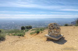
Mission Point, Three Trees and the San Fernando Valley.
There were several ways I could have checked where I was — my watch has maps; my phone had maps; and I had a map in my pack. But I wasn’t in trouble and was already two miles down this road — whatever it was. If I wasn’t on Weldon Mtwy, it would still be a trail I hadn’t done.
After a couple of “I’ll just go a little farther down and see what I can see” episodes, I eventually turned around and headed back up the fire road. When I got back to East Canyon Mtwy, I checked the yellow pole marking the junction of the fire roads — it was marked “WELDON.” Later, I checked my track and found I had turned around a half-mile from the Newhall Pass Trailhead. Now I know.
Overall, I’d enjoyed the course, and decided I would register for the 50K. But registration closed early, and now I see the event has been postponed until November. Oh well, I still got to run in a new area and check out some interesting trails!
Serrano Valley and Canyon had been on my run list for a few weeks. I was curious to see how December’s rainfall had affected Serrano Canyon. Runoff from those storms had (once again) washed out sections pf the Blue Canyon Trail and Upper Sycamore Trail. Had the Serrano Canyon Trail also been damaged?
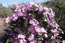
Greenbark Ceanothus along the Old Boney Trail
It was a good day to visit Serrano — I was looking to do a longer run; the weather was perfect; the meadows green; and many wildflowers were in bloom.
There are a couple of ways I like to run to Serrano Valley from the Wendy Drive Trailhead. Both do the initial 1.6 mile, 900′ climb up the Old Boney Trail from Danielson Road. At the top of the climb, one route goes up and over Boney Mountain’s western ridge to the Backbone Trail, and the other continues on the Old Boney Trail. Both routes join at the Chamberlain junction of the Backbone and Old Boney Trails. I’d done the western ridge of Boney Mountain recently, so opted for the Old Boney route.
Prickly phlox along Overlook Fire Road
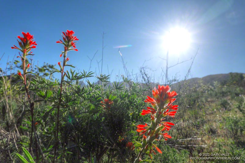
Wildflowers were everywhere. The December rain and February heat wave seems to have encouraged many plants to bloom — among them blue dics, Encelia, clematis, California poppy, greenbark Ceanothus, shooting star, nightshade, paintbrush, poison oak, milkmaids, prickly phlox, hummingbird sage, and larkspur.
Serrano Valley was Spring-green and spectacular. Serrano Creek was gurgling away, and the Serrano Canyon Trail had survived December’s storms. After a pleasant run down Serrano Canyon, I stopped to get some water from the faucet at the junction of the Serrano Canyon Trail and Sycamore Canyon.
A right turn here — up Sycamore Canyon — produces a run of about 20 miles. Today I was looking to do a little more than that, so turned south and ran about a quarter-mile down Sycamore Canyon and picked up the Fireline Trail. This trail gains about 700′ in elevation on its way up to Overlook Fire Road.
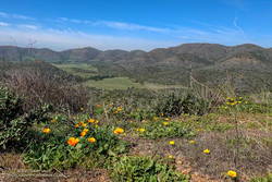
La Jolla Valley from Overlook Fire Road
Overlook Fire Road leads northwest to the top of the Ray Miller Trail. I was feeling good and briefly debated descending to the Ray Miller Trailhead. I did a quick estimate of the mileage. I was at about mile 14. Descending Ray Miller would add about 2.5 miles, and then the run back from the trailhead to Wendy would add another 12 miles. Hmmmm… nearly 29 miles. My legs were way ahead of my brain, and were already continuing up Overlook Fire Road.
I followed the usual route back — Overlook -> Hell Hill -> Wood Canyon -> Two Foxes -> Sycamore Canyon -> Upper Sycamore -> Danielson Road -> Satwiwa. The paved part of Sycamore can be a bit tedious and it helped when I happened upon a couple of friends.
Here is an interactive, 3D terrain view of the GPS track of my route. The map can be zoomed, tilted, rotated, and panned. To change the view, use the control on the upper right side of the screen. Track and placename locations are approximate and subject to errors. Poor weather, and other conditions may make this route unsuitable for this activity.
Revitalized by December’s copious rainfall and temperatures in the mid-80s in February, this valley oak at Ahmanson Ranch has produced a lush crown of new leaves.
(Officially named Upper Las Virgenes Canyon Open Space Preserve, most users refer to the open space area as Ahmanson Ranch, or simply, Ahmanson.)
Yep, that was a rumble of thunder. It was a blustery, Spring-like afternoon and a storm cell had developed a few miles to the WNW of Lasky Mesa.
Before driving over to Ahmanson I’d checked the weather radar and seen cells circulating counterclockwise around a cold upper level low. Most were dissipating as they moved north to south, out over the Valley. The wildcard was that the upper low was moving southward, and the cells might strengthen.
Storm cell WNW of Lasky Mesa.
Again there was a low rumble. The cell didn’t seem any closer, but now I could see additional development to the north and northeast of Ahmanson. I picked up the pace.
There’s nothing like the threat and energy of a thunderstorm to incentivize a runner. All the way back to the trailhead it looked like heck might break loose at any moment.
But it didn’t. It was just starting to rain when I got back to the car, and on the way home the streets were wet. The Cheeseboro RAWS recorded 0.06 inch of rain, as did Downtown Los Angeles (USC).
Even though the Rain and Water Year rainfall totals for Los Angeles are about normal for the date, January and February have seen little rain. Precipitation records for Los Angeles indicate the period January 1 to February 28 will be the fourth driest on record.
The precipitation outlooks for Southern California this March don’t look especially promising, with a typical La Nina precipitation pattern expected for the West Coast.
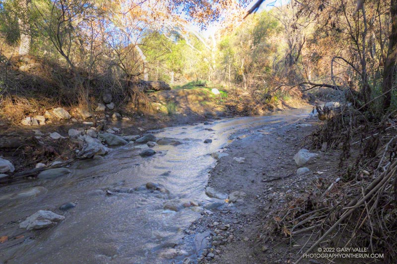
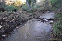
I had just waded down a 50 yard stretch of creek where the Santa Ynez Canyon Trail used to be. Three hikers working up the canyon were trying to find a way past the flooded section without getting their boots wet. That wasn’t going to be easy.
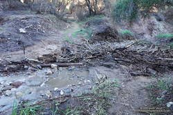
Debris at creek crossing in Santa Ynez Canyon.
I had been doing the same thing higher in the canyon. It was a chilly morning, and I had no great desire to soak my shoes in cold water. The usual rock and limb crossings had worked well until the trail ended in a broad area of flowing creek. Once my shoes were wet, it simplified the process.
That the trail was flooded following several days of rain wasn’t that surprising. What was a surprise is that there hadn’t been higher flows and more damaging flash floods in the canyon.
Creek crossing near the Santa Ynez Canyon Trailhead
Santa Ynez Canyon was the focus of the May 2021 Palisades Fire, and a large part of the drainage was burned to a moonscape. Burned slopes often amplify runoff from heavy rain, producing damaging flash floods and debris flows. While there was clearly high flows in the canyon, the levels were less than what I’ve seen in similar circumstances, in other burn areas. One possibility is that unburned trees and brush along the streambed higher in the canyon had attenuated the flow.
After doing the out and back on the Santa Ynez Canyon Trail, I continued down to Trippet Ranch and then, like last week, returned using the Musch, Garapito, and Bent Arrow Trails.
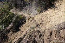
Section of the Bent Arrow Trail damaged by a slide
There were a number small rock slides, sluffs, and sediment flows along the trails and roads. A couple of people were working on clearing the limbs and small trees that had fallen across the Garapito Trail. The collapsed oak at the bottom of the Garapito Trail had settled, and was easier to get through this time.
The trail that really took it on the chin was the Bent Arrow Trail. Several sections of the trail were damaged by slides.
I usually do the Santa Ynez Canyon Trail as part of the Trailer Canyon – Santa Ynez – Trippet Ranch Loop. Tacking on the trail as an out and back addition to the loop was slightly shorter, but had a little more elevation gain/loss.