Category Archives: nature|wildfire

After the Station Fire: Wildflowers Along the Gabrielino Trail

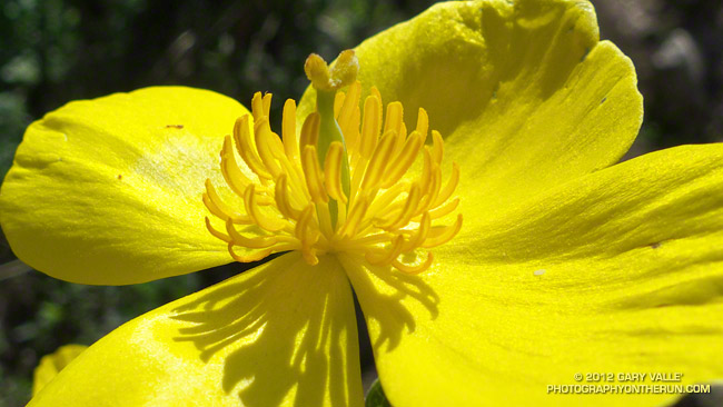
Bush poppy (Dendromecon rigida)

The bright yellow flower above is bush poppy (Dendromecon rigida). A fire follower, it’s blooming extensively in the recovering chaparral along the Gabrielino Trail between Red Box and Switzer Picnic area.

March snow and rain seem to have helped this Spring’s wildflower bloom. Since March 1 the Remote Automated Weather Station (RAWS) at nearby Clear Creek has recorded 6.5 inches of rain and NWS data shows Opids Camp has recorded 6.64 inches of rain. More rain and snow is forecast in the mountains this week.

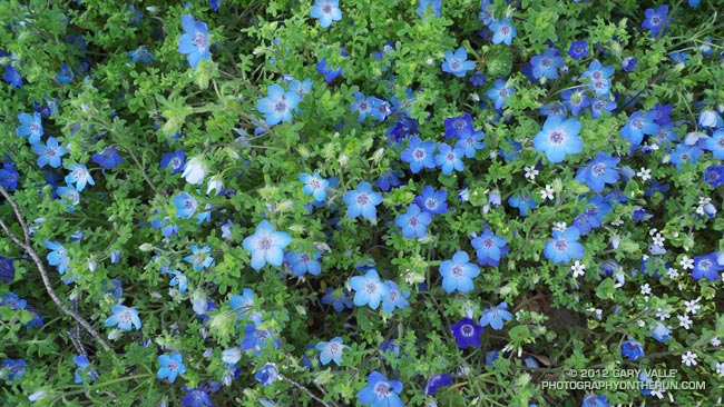
Here are a few additional wildflower photos from this morning’s run in the Station Fire burn area:


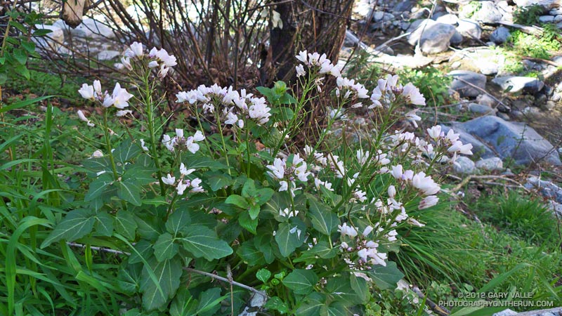
Baby Blue Eyes


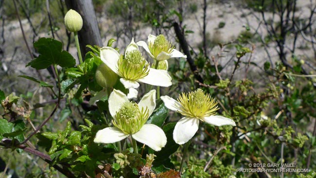
Chaparral Clematis


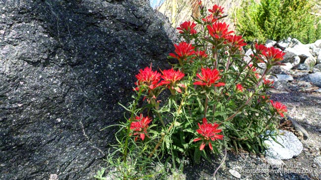
Wavy-leaved Paintbrush

Surprise on the Bulldog Loop

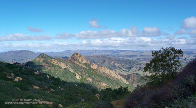
Brents Mountain, Malibu Creek State Park

BIG. That was my first impression when I saw the animal loping across the road. Quite a bit bigger than a coyote or bobcat, with a long black-tipped tail. It was a mountain lion, and it was reacting to me before I’d even seen it. Had I rounded the corner a couple seconds later, I never would have known it was there.


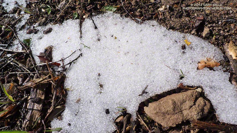
I was on Castro Mtwy fire road, between the top of the Bulldog climb and Corral Canyon Road. Just a few seconds before I’d been kneeling on the ground photographing snow pellets (graupel) along a road cut. I’d just started to run again when I saw the lion. It was 40-50 yards away and crossing the road left to right, diagonally down the road. It seemed interested in avoiding me, and I reinforced this idea by clapping my hands and yelling. It was moving at a speed that fit the situation — faster than a walk or trot, but by no means wasting energy or overly concerned. I watched as, like a ghost, it disappeared into the thick chaparral along the south side of the road.

I didn’t want to overreact. Although we usually don’t see them, anyone that runs in the open space areas of the West has likely been watched by a mountain lion. Attacks are extremely rare and often have extenuating circumstances. Even for someone that spends a lot of time outdoors, there are much higher risks in their lives, such as driving to the trailhead. And there are other risks on the trail. Two of my trail running friends have been run down by startled deer, and I was nearly trampled when I spooked a band of horses grazing in a natural cul-de-sac!

In this particular set of circumstances I didn’t think it would be any more dangerous to continue down the road than to retreat. If the animal was interested in me it wouldn’t matter which direction I went. The Corral Canyon parking area was about a half-mile away, and chances were good there would be hikers there.

But it was going to be unnerving to pass the spot where the lion had gone into the brush. For sure I was not going to run past the spot — as any owner of a cat knows, that can elicit a response. Had I seen a stout stick or branch nearby I would have grabbed it. Not only for defense, but to look bigger.

I jogged down the road a little further and stopped. On max alert and facing the threat, I walked past the point where the lion had entered the brush. Once past this point, I began to walk a little faster, constantly checking the road and brush to the side and behind me. After about 50 yards I transitioned to a slow jog, and sometime after that resumed my normal downhill pace, all the time being very wary of any sound, noise or motion behind me.

One car was parked at Corral Canyon, but its owner was nowhere to be seen. Still on edge, I continued on the Backbone Trail into the rock formations east of the parking area, and then past the rock gateway onto Mesa Peak Mtwy fire road. The farther I got from where I’d seen the lion the better I felt. I really didn’t think the lion was interested in me, but was still glad to have the Corral Canyon parking area between me and the cat.


As I ran along Mesa Peak fire road, I started to calm down. I had just passed the “Morrison” caves and rock spiral and was rounding a corner when, without warning, there was a blur of brown from the left. Three deer bounded across the road just feet away. Put my heart back in my chest!

Deer are very common in Malibu Creek State Park, but I normally see them in the grasslands down in the valley. This morning I’d seen deer tracks going up Bulldog. Whenever I see deer tracks it’s a reminder there might be a mountain lion in the area. That was certainly the case this time!

Related post: Mountain Lion Saga

After the Station Fire: Shortcut – West Fork – Newcomb Saddle Loop

Mt. Wilson area peaks from the Silver Moccasin Trail

Did the “back 25K” of the Mt. Disappointment 50K course this morning, plus a couple of bonus miles on the Gabrielino Trail and the bottom of the Kenyon Devore Trail. Like last Sunday’s run, today’s run was in a part of Angeles National Forest that was closed by the 2009 Station Fire and reopened last May.


This loop was part of the Mt. Disappointment 50M course in 2007, 2008 and 2009, and the 50K course in 2010 and 2011. Today I started the loop at Shortcut Saddle, running down the Silver Moccasin Trail to West Fork, then up to Newcomb Saddle, and then completed the loop by returning to Shortcut on Edison Road. In the 50K, the loop starts at West Fork, but the sequence of trails is the same.

Because of increased foot traffic and our dry Winter, last year’s trailwork on the Silver Moccasin Trail held up well. Most of the trail between Shortcut Saddle and West Fork was in great shape and very runnable. There were a couple of trees across the trail, but these were easy to work under, over or around.


The reason for the side trip on the Gabrielino Trail was to check out the bottom of the Kenyon Devore Trail. This section of trail was severely burned in the Station Fire, then overrun by a debris flow and overgrown by Turricula (Poodle-dog bush). The Mt. Disappointment 50K/50M volunteer trailwork group has worked many hours here, as well as on the rest of the Kenyon Devore Trail, the Valley Forge Trail and the Silver Moccasin Trail. The trail had seen a lot of traffic and was in good shape.

As was the case last week, there was still Turricula along the trails and roads, but for the most part it was easy to avoid.

The last time I’d run up Edison Road was last August during the 2011 Mt. Disappointment 50K. Temps were about 25-30 degrees warmer that day. With the cooler weather I actually enjoyed the climb and was able to run more of it. A lot of work was being done on Edison Road and I chuckled as I passed each “No Loitering” sign posted along the road. I hoped I wouldn’t be doing too much of that in the 2012 Mt. Dis 50K.

After the Station Fire: Red Box – Bear Canyon – Gabrielino Loop Revisited

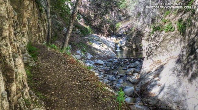
Arroyo Seco downstream of Switzer Falls

Arroyo Seco Downstream of Switzer Falls

By the calendar Spring was still a couple weeks away, but temps near 80 were forecast for the lower elevations of the San Gabriel Mountains and the weather looked ideal for revisiting the Red Box – Bear Canyon – Gabrielino loop in Angeles National Forest. I did this loop last May when the area re-opened following the Station Fire and was curious to see how recovery was progressing, and how much trail use and maintenance had improved the trails.

The difference in 10 months was remarkable. Recovery of the burned areas continues at a steady pace, and trail conditions on much of the loop are not all that different than before the Station Fire. Following are some notes about each segment of the loop.
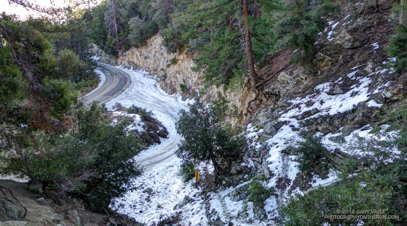


San Gabriel Peak Trail to Mt. Disappointment Road: This trail segment was not burned in the Station Fire and is in good shape. The weather had been much colder earlier in the week and there was still some snow on the trail from a mid-week storm.
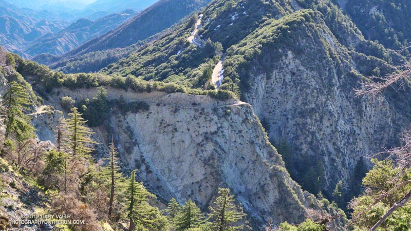


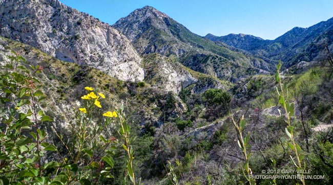
San Gabriel Peak Trail from Mt. Disappointment Road to Mt. Lowe Truck Trail fire road: Thanks to work done by the JPL Trailbuilders this segment was in decent shape last year, and was in even better shape today. It’s rough and rocky in places, and there’s still some Turricula along the trail, but it was very runnable and not unlike it was before the fire. There are excellent views of Mt. Markham, Mt. Lowe, upper Bear Canyon and the rugged terrain along Mt. Lowe Truck Trail fire road.
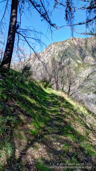


Mt. Lowe Truck Trail fire road to Upper Bear Canyon Trail: Other than some rock fall here and there, there were no particular issues from a trail running point of view. There are good views of San Gabriel Peak, Mt. Disappointment and Bear Canyon.

Upper Bear Canyon Trail from Mt Lowe fire road to Tom Sloan Saddle*: Excellent condition thanks to recent trail work by the Outdoor Club.

Bear Canyon Trail from Tom Sloan Saddle to cabin site: Use of the trail and low Winter precipitation have improved conditions on this trail segment, but some problem sections remain. A short detour off the trail was necessary about a half-mile from Tom Sloan Saddle.
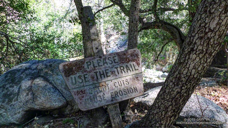


Cabin site to Bear Canyon Camp: Increased use made it easier to follow the use trail and work down the canyon. The collapse of this unburned oak may not have been related to the fire. Bear Canyon Camp is about halfway through the canyon, above the creek on a bench on the left (when descending). The camp is in great shape, and from its shaded sites it would be hard to tell a fire had ravaged the area. At the edge of the camp is an old Forest Service sign, placed by someone with a sardonic wit.


Bear Canyon Camp to confluence with Arroyo Seco: This segment has seen much more use — as I descended the canyon I encountered four groups and two solo hikers working up the canyon. There were a number of ribbons and ducks marking the way and the use trail is becoming better defined. Although some nice sections of the old trail remain, most of the trail in Bear Canyon was washed out well before the Station Fire. As noted by John Robinson in Trails of the Angeles, “…the old Tom Sloan Trail that once traveled the length of the canyon is in poor shape and you must scramble and boulder-hop much of the way.” This is part of the Bear Canyon experience and hopefully the path won’t become so well-marked that all you have to do is blindly follow the markers.


Arroyo Seco to Gabrielino Trail and Switzer Picnic Area: Very well-used. Its condition is similar to what it was before the Station Fire. I was surprised to see two people on mountain bikes descending the steep section of trail that leads to the Arroyo Seco below Switzer Falls, and then downstream Bear Canyon junction and Royal Gorge. I wondered if they had missed the fork onto the Gabrielino Trail. If they were the mountain bikers that were later rescued at the Paul Little debris dam, and didn’t backtrack to the Gabrielino Trail, they would have had a nightmare of a hike-a-bike through trailless Royal Gorge.
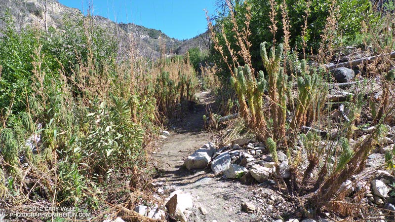


Gabrielino Trail from Switzer Picnic Area to Red Box: Last year the condition of this trail segment was the worst of any trail on the loop. It was washed out in several places. There were downed trees. Some sections were so overgrown it was difficult to follow the trail. In several places I had to literally wade through chest high Turricula. Not so this year. Thanks to the efforts of CORBA and MWBA this trail has nearly been restored to the condition it was in prior to the Station Fire. Other than dealing with the uphills I had no problem running the trail. There’s still a lot of Turricula along the trail, but it is mostly avoidable.

Last year on this loop there was no avoiding the Turricula and I paid the price, its sticky resin coating my arms and legs and resulting in a rash and inflammation. This year I only contracted a couple of small spots of poison oak. This post has more info about Turricula.

There is a long list of volunteer groups that have been working to restore the trails in the Station Fire burn area. Most of the trails in the open areas of the Forest burned in the Station Fire are in fair to good condition, or at least in the same shape they were in before the Station Fire. Some are in better shape than before the fire.

The Forest can be a hazardous place, but there were washouts, rock slides, downed trees, overgrown trails, lost hikers and other incidents BEFORE the Station Fire. Just because an incident occurs in the area burned by the Station Fire doesn’t mean it’s the result of the fire.

Related posts: After the Station Fire: Red Box – Bear Canyon – Gabrielino Loop, After the Station Fire: Ten Miles – Four Peaks

*Tom Sloan appears to be correct spelling, rather than Tom Sloane as printed on some USGS maps. In Trails of the Angeles John Robinson mentions that Tom Sloan Saddle is named after a former district ranger. There’s a quotation from the Arcadia Tribune (1918) on the Forest Lookouts page for Los Angeles County regarding Arcadia Station that refers to “Thomas W. Sloan, chief ranger in the United States Forest Service in this district…”
Coyote Tag II

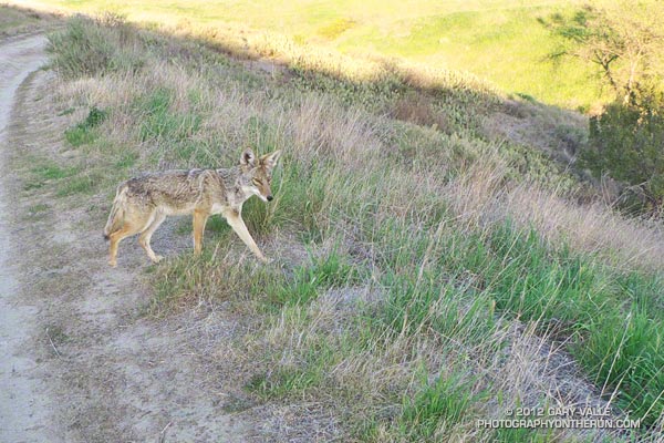
Close encounter with coyote at Ahmanson Ranch.

Last June I had an unusual encounter with a coyote near the end of a run at Ahmanson Ranch (Upper Las Virgenes Canyon Open Space Preserve). For reasons known only to the coyote, the animal behaved like a dog and ran with me a short distance along a dirt road. Not off to the side of the road, or at a distance, but as if on lead and out for a daily jaunt. Today, on the same section of road, I had another odd encounter with a coyote.

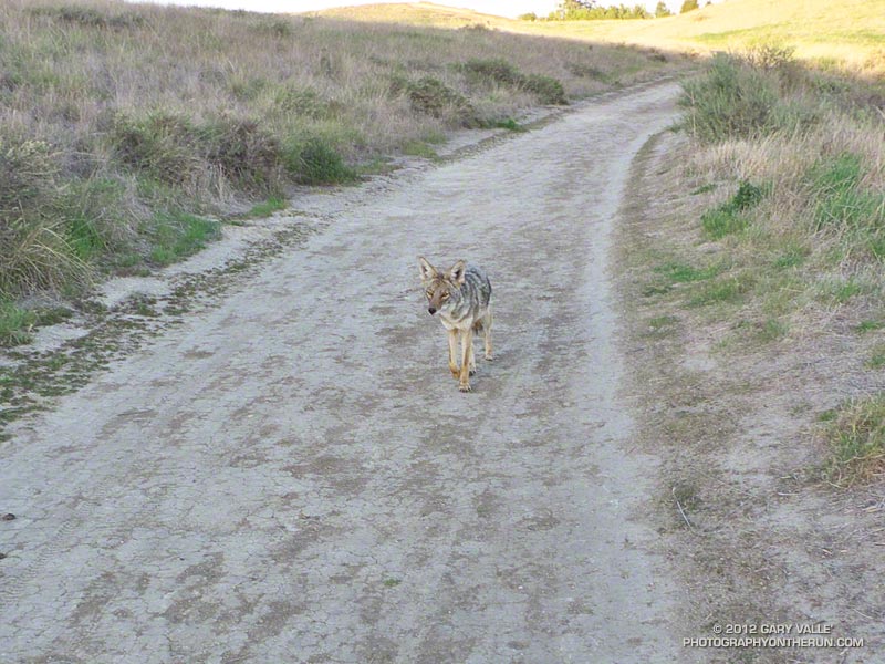
This time I rounded a corner to see a coyote calmly trotting down the middle of the dirt road toward me. No big deal, it would do what a coyote normally does — see me and head for the brush. Except it didn’t. This time it continued to trot in my direction. Fifty, thirty, twenty feet — the gap between us closed. Watching each other intently, we stopped about 12 feet apart.

Brash coyote behavior at Ahmanson Ranch
Coyote walking toward me

For a few moments we stared at each other, my expression no doubt showing the same mix of wariness and curiosity as the coyote’s. In the practiced motion of something wild, the coyote briefly raised its head, sampling scents of its world on the wind. I edged closer — not daring to raise my camera, but taking the occasional photo.

A few more seconds passed, then apparently deciding enough was enough, the animal sauntered into the grass.

Coyotes are opportunists and I’m guessing these close encounters are related to an association of people with food — perhaps discarded food or food intentionally provided. Coyotes also associate people with their pets. Recently I saw a pair of coyotes behaving oddly (also at Ahmanson) and nearby an individual was walking their small dog off lead.

Some related posts: Coyote Tag, Trickster

After the Station Fire: Opportunistic Bumblebee

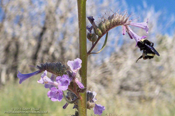
Bumblebee feeding on Turricula (Poodle-dog bush)

This bumblebee is doing its best to hold on and squeeze far enough into a Turricula blossom to slurp some nectar.

Other than rabbitbrush, there are not many food choices for bees in the Southern California mountains in the Fall, so they have to take advantage of what can be found.

Not much Turricula (Poodle-dog bush)* is blooming either, but it has been such a prolific fire-follower that here and there a plant is in flower.

*The taxonomic name for Turricula parryi (Poodle-dog bush) has changed to Eriodictyon parryi. The Jepson Manual: Vascular Plants of California, Second Edition (2012) has returned Turricula to the genus Eriodictyon, as originally described by Gray. According to the Wikipedia entry for Turricula (April 11, 2012), “… molecular phylogenetic analysis carried out by Ferguson (1998) confirms that Turricula should be treated as a separate genus within a clade (Ferguson does not use the term “subfamily”) that includes Eriodictyon, and also the genera Nama and Wigandia; Eriodictyon is the genus to which Turricula is closest in molecular terms, and is its sister taxon.” I use “Turricula” and “Poodle-dog bush” interchangeably as a common name.

From Sunday’s Ten Miles – Four Peaks run in the San Gabriel Mountains.