October 18, 2024. Updated approximate Bridge Fire Closure boundary for Forest Order 05-01-24-11.
October 13, 2024. Updated Bridge Fire perimeter. Added the Vista Fire perimeter. Added trails from the National Forest System Trails Feature Layer. Added a “guesstimate” of the Bridge Fire Closure boundary. See below for an explanation.
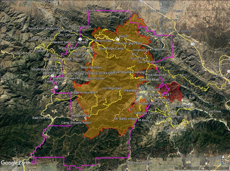
The information in this post may be incorrect or out of date. For official information see the Bridge Fire incident page on Inciweb, the Angeles National Forest updates on Facebook, and the Angeles National Forest website. The perimeters are from the Wildland Fire Interagency Geospatial Services (WFIGS) Group and National Interagency Fire Center (NIFC) website.
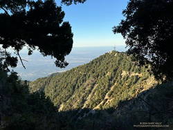
Following are several 3D terrain views of the Bridge Fire perimeter from various perspectives:
– Overview of the Bridge Fire perimeter
– View of the Bridge Fire perimeter zoomed in on the Wrightwood area.
– View of the Bridge Fire perimeter zoomed in on the Mt. Baldy area.
– View of the Bridge Fire perimeter zoomed in on the Mt. Baden-Powell area.
The initial view can be changed using the control on the upper right side of the screen, the CTRL key and your mouse, or touch gestures.
As mentioned above, a guesstimate of the Bridge Fire Closure boundary (magenta) for Forest Order 05-01-24-11 (Oct 17, 2024) is now included in the views. The boundary corresponds closely with the PDF map(s) of the closure published on the Angeles National Forest website. There seems to be at least one discrepancy between the Forest Service maps and order description. In the area of East Fork Road, the order description appears to place the closure boundary one section to the west (dashed line). I contacted the Forest Service for clarification, but have received no reply.
Multi-year fire closures have become common on the Angeles. Generally, trails and the land affected by trail are is a minuscule percentage of the area burned. Some jurisdictions reopen parklands and open space areas weeks after a fire with no apparent negative impact on the area’s recovery. Is there science to support multi-year closures of trails in fire areas?
In some cases, closures include trails that are outside of the fire’s perimeter and didn’t burn. These closures may make sense in the short term — when there is a plausible threat from the fire, such as the recent flare-up east of South Mt. Hawkins. But many times, these unburned trails remain part of a long term, multi-year closure. Sometimes it seems the trail just happens to be on the wrong side of a section line, road, or other feature that is convenient to use as a closure border.
Trails that were closed in Forest Order 05-01-24-10, but now appear to be open according to Forest Order 05-01-24-11:
Dawson Saddle Trail
PCT east of Windy Gap to Vincent Gap
Trails outside of the Bridge Fire and Vista Fire perimeters that remain closed according to Forest Order 05-01-24-11:
Devil’s Backbone Trail
Hawkins Ridge Trail
South Hawkins Trail
The following summits are within the updated closure area, but did not burn and are accessible via unburned trails. Peaks marked with ** are just inside of the closure boundary:
Mt. Baldy
Mt. Baden-Powell**
Mt. Burnham**
Mt. Hawkins**
Throop Peak
Sadie Hawkins
South Mt. Hawkins
For those of us passionate about the outdoors, the closure of any trail or peak is a loss. But the long term closure of the most popular trails and peaks in the San Gabriel Mountains without justification would be indefensible. Hopefully, the closure order will be modified when the Forest Service determines the threat from the Bridge Fire is past.