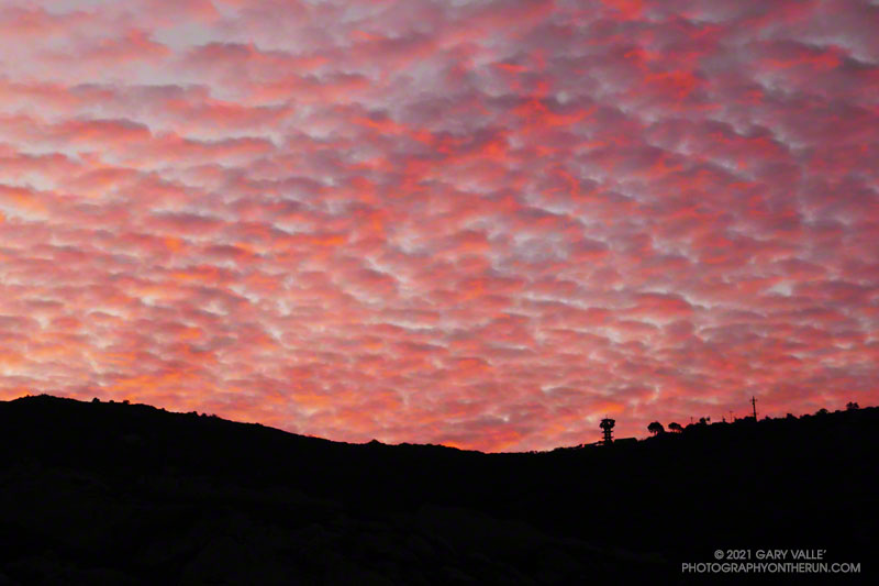
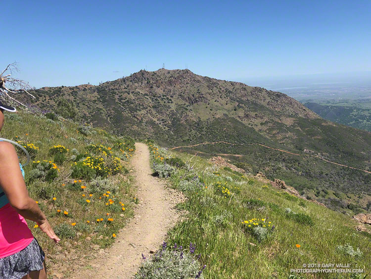
I was running up Calabasas Peak Mtwy fire road trying to get a better view of the eastern sky, but the view in that direction was blocked by a steep hillside. The road turned to the northeast up ahead, and I hoped the best moments of a rapidly-evolving sunrise would not be lost.
A couple of breathless minutes later, I rounded a corner and was rewarded with an unobstructed view of a vivid, pink-red-orange mackerel sky. Focusing on the ridgeline near Topanga tower, I shot several sets of bracketed photos.
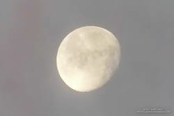
Handheld snapshot of the Moon. Click for larger image and more info.
Excited by the sunrise, I continued up the fire road, scanning my surroundings for another photo. My eye settled on the gibbous moon. High in the sky, it’s bright face was subdued by a thin veil of pinkish-gray cloud. I’d previously experimented with handheld shots of the Moon using my running camera — a Lumix ZS100. Zooming to an equivalent focal length of about 250mm, I held my breath, steadied the camera the best I could, and took a few shots. Here’s one of the images — cropped and sharpened — with enough detail to see craters, maria, and some other lunar features.
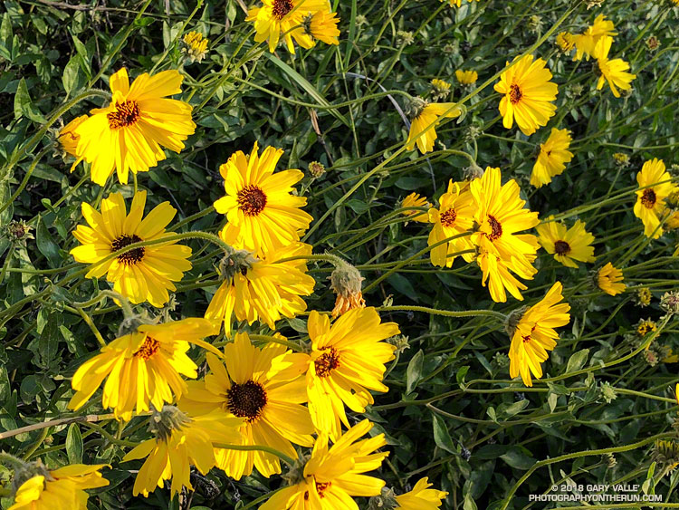
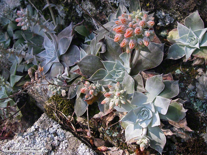
At the bottom of Topanga Lookout Ridge there were several bigberry manzanita bushes covered with flowers. A hummingbird was up before sunrise, buzzing about the blossoms, busily drinking the precious nectar. Although it had rained a couple days before, this rain year there had been little rainfall, and a corresponding scarcity of early season wildflowers.
As I climbed higher on the ridge, the mountains northwest of Los Angeles came into view, white with snow from the recent storm. The snow-covered peaks are south of Mt. Pinos and Frazier Mountain, in the area of San Raphael Peak, McDonald Peak, Sewart Mountain and Snowy Peak.
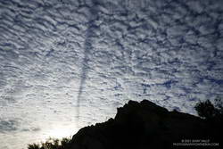
Contrail shadow.
Like snow on a mountain, there is a purity in the form and appearance of clouds. When a long, dark streak appeared across a layer of high clouds, it was hard to miss. In this case, the dark line appears to be the shadow of a contrail of a jet flying above the clouds. At the time LAX was reporting scattered clouds at 19,000′ and 23,000′, with a broken layer of clouds at 28,000′. Given the height of the clouds and orientation of the contrail, it may have been from a flight from San Diego to San Francisco.
Topping out on the ridge, I smiled when I saw the masked couple dancing on the Lookout, and continued west toward Saddle Peak.
As of March 1, Downtown Los Angeles had recorded only 1.99 inches rain over the past eight months. Most of that was recorded in one storm in early January. It was the second driest July 1 – February 28 on record.
Following the January storm, temperatures warmed up and stayed relatively warm for much of the next 30 days. In the West San Fernando Valley the high temperature hit 89 °F at Pierce College on February 4, and was over 80 °F for 12 consecutive days. Some plants (and some rattlesnakes) responded as if it was Spring.
In mid February Winter returned, with cool daytime temperatures and cold nights. There were Frost and Freeze Warnings on several nights.
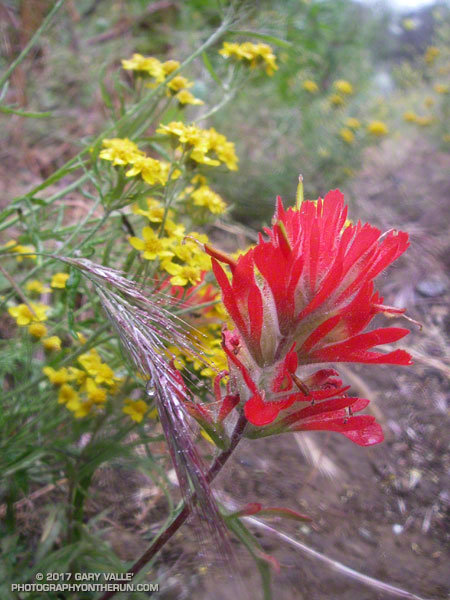
In March the ridiculously resilient ridge of high pressure over the West Coast finally relented, resulting in above normal rainfall. It took awhile, but the March rain and April sun eventually produced an assortment of wildflowers.
Just 48 hours before the start of the Diablo Trails Challenge the temperature on Mt. Diablo’s summit was a chilly 31°F. Gray, wind-driven clouds shrouded the summit, propelled by 20-30 mph winds. Over the 10 days preceding the race, it had rained on four, and Concord had received about two inches of rain.
That’s the thing about Spring weather – a couple of days can make a huge difference. Today – race day – the sun is out, the hills are green and skies blue. Very little mud remains – the trails are in great shape and hills sprinkled with wildflowers. It’s the perfect day for a run on Mt. Diablo!
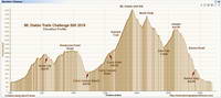
Diablo Trails Challenge 50K Elevation Profile
With around 7000′ of elevation gain/loss, the Diablo Trails Challenge 50K is characterized by its many ups and downs. The core of the 50K course is the 7 mile, 3000′ climb from the Curry Canyon Ranch aid station to Diablo’s main summit. But before you can enjoy this fine ascent, you have to get to Curry Canyon Ranch. And it’s on the other side of the mountain – about 12.5 miles away. Here’s a 3D interactive view of my GPS track of the 50K course.
Along the way there are several get-your-feet-wet creek crossings and many hills. Following along on the map, the course works its way past Wall Point, Artist Point, Knob Point and finally Windy Point. Did I mention the course is hilly?
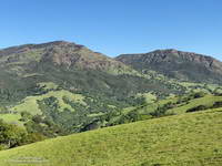
Somewhere around Mile 10 you get the first good view of Mt. Diablo and North Peak. The runner in front of me exclaimed, “Holy guacamole, is that what we are going to climb?” My choice of words were similar, but not quite as polite. Yes indeed, those were the peaks, and they loomed LARGE across the valley.
Mt. Diablo (left) and North Peak
Elevation gained is so easily lost. After gaining about 2500′ on the way to Windy Point, a 1000′ descent leads to the Curry Canyon Ranch Aid Station. The climb of Diablo starts here, but you really don’t feel like you’re on the mountain until you reach South Gate Road and the Curry Point Aid Station, about three miles up the canyon. The grade in Curry Canyon is moderate and I tried to take advantage of that, knowing steeper terrain was ahead.
The Half-Marathoners joined the course at Curry Point — adding their enthusiasm and company – but they were soon headed back down, leaving us to cope with the Summit Trail all on our own.
“Jalapeño chip?,” I asked the runner hiking up the hill next to me. He smiled and said something like, “Maybe next time.” I did what I could to keep from constantly looking up at the summit. I munched on chips, talked to runners and hikers, read the “Trail Through Time” interpretive signs, looked at wildflowers and enjoyed the great views. As long as you keep putting one foot ahead of the other — and maybe smile from time to time – summits will eventually arrive.
Yahoo! The Summit Aid Station! There is almost no wind. In the sun it’s comfortably warm and in the shade comfortably cool. As at the other aid stations, the volunteers are great, helping me to get my hydration pack sorted and get me on my way. After seven miles of uphill, a little downhill is going to feel really good.
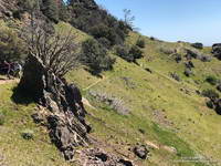
North Peak Trail near Devil’s Pulpit.
The next few miles I’d done before and they are among the most interesting on the course. It helped to be familiar it – especially the notoriously steep section of North Peak Road, just before the summit. Everyone picks a different route. This time I stayed on the left going up and the right going down, and didn’t fall on my butt!
Once past the “slide” it didn’t take long to get down to Prospector’s Gap. I recalled that the running on the Bald Ridge Trail was excellent and wasn’t disappointed. At Meridian Ridge Road we left Bald Ridge and descended into Mitchell Canyon. At Deer Flat Creek, once again the course headed up. I couldn’t recall how long the climb was going to be, but it looked like we were going to have to work over a high ridge to get to the Castle Rock side of the mountain. The ridge turned out to be Moses Rock Ridge and the climb over it fit right in with the other hills on the course. Click, click goes the elevation-gained counter.
Most of the course is a big loop, but to access the peaks and aid stations there are four short out and back sections. You get to know the runners around you on these sections and we’d give each other encouragement as we passed. The runners around me were great and throughout the run we had many good conversations.
Then there was Burma Road. Somewhere around mile 26, I commented to another runner that we were running out of miles and at some point we were going to have to lose a lot of elevation. The Burma Road descent took care of that.
Many thanks to Jasmin and Sam of Brazen Racing for putting together such a superb event! And a BIG thank you to all the volunteers, ham operators, runners, park staff, sponsors and especially the Save Mount Diablo Foundation. I thoroughly enjoyed running on Mt. Diablo!
The north side of San Gorgonio Mountain was closed in June 2015 when the Lake Fire burned approximately 31,359 acres of forest, chaparral, sage, pinyon and Joshua tree habitat at elevations ranging from about 10,700′ to 5350′. As a result of the determined efforts of firefighters, only one residence and some remote outbuildings were lost.
Of the 30,487 acres reviewed by the Burned Area Emergency Response (BAER) team 4,327 acres (14%) were categorized as Unburned; 17,100 acres (56%) as having Low soil burn severity; 8,420 acres (28%) as having Moderate soil burn severity; and 640 acres (2%)with High soil burn severity. (Note that soil burn severity isn’t necessarily synonymous with fire intensity and fire effects such as tree loss.)
I’d been keeping an eye on the Alerts & Notices section of the San Bernardino National Forest web site to see if the Lake Fire closure order would be renewed. I was curious to see the extent and impacts of the Lake Fire and how the area was recovering. Plus, the Dollar Lake – Dry Lake keyhole loop is an outstanding trail run — one of the best in Southern California. In addition to climbing San Gorgonio Mountain (11,499′), it encompasses some of the most scenic areas on the peak.
The area’s trails reopened July 20. The weekend prior to the reopening San Gorgonio Wilderness Association volunteers worked on the South Fork and Dry Lake Trails, clearing a number of large trees, removing debris and other hazards and improving the trail tread.
A week and a half after the opening I pulled into the South Fork parking lot on Jenks Lake Road, excited to get on the trail. There was a slight chance of thunderstorms in the forecast, and I hoped to be off the summit and on my way down by 10:30 or 11:00.
Most of the run is in the San Gorgonio Wilderness and a wilderness permit is required. Check a map, but the general sequence of trails is the South Fork Trail, Dollar Lake Trail, Divide Trail, Summit Trail, Sky High Trail, Dry Lake Trail and then back down the South Fork Trail to the trailhead. This Google Earth image shows the western part of the Lake Fire burn area in relation to San Gorgonio Mountain and some of the area’s trails.
On this particular run I also wanted to check out the Fish Creek Trail and the “use trail” down to Lodgepole Springs and Dry Lake, so rather than continuing down the Dry Lake Trail from Mineshaft Saddle, I turned right (east) and followed the Fish Creek Trail to Fish Creek Saddle.
There were some downed trees and a lot of fire debris on the Fish Creek Trail. Extra care was required and I probably hiked as much of it as I ran. As I worked toward Fish Creek Saddle I could not tell how much of the canyon leading down to Lodgepole Spring had burned. The slopes on the southwest side of Grinnell Mountain had burned and some areas along the Fish Creek Trail had burned as well. Whether I descended to Lodgepole Spring from Fish Creek Saddle or returned to Mineshaft Saddle would be a judgment call.
Arriving at Fish Creek Saddle I was glad to see the forest was intact. The path down to Lodgepole Spring looked promising, but had not been used in some time. As it turned out most of the trees along the path had not burned. In places, runoff from the burned slopes above had resulted in some erosion and small flows of sandy soil. There were also the usual downed trees, but other than being a little challenging to follow, the path was generally OK.
I was nearly off the trail when the “chance of thunderstorms” forecast materialized into threatening gray clouds, a few sprinkles, and a couple of rumbles of thunder.