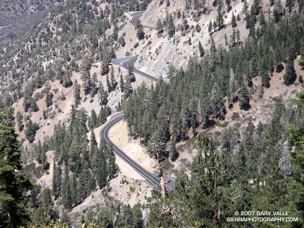
Update May 21, 2009. CalTrans Highway Conditions in California reports Hwy 2 “IS REOPENED FROM ISLIP SADDLE TO 5 MI WEST OF BIG PINES (LOS ANGELES CO) AT 1200 HRS ON 5/20/09.”
Angeles Crest Highway has been closed from Islip Saddle to Vincent Gap since 2005 when runoff, rock slides and avalanches from Winter storms damaged the road.
This section of road is being repaired as part of the larger Angeles Crest Highway (SR-2) Pavement Replacement Project.
Glimpses of the highway from the PCT suggest that much of the closed section has been repaired, resurfaced and re-striped.
With Southern California in the throes of a record dry year, and temps in the valleys topping 100°F, this San Gabriel Mountains course was a good way to get in a long trail run at a cooler, higher elevation and enjoy some mountain scenery. A big plus was that there would be a source of ice cold spring water at the turnaround point.
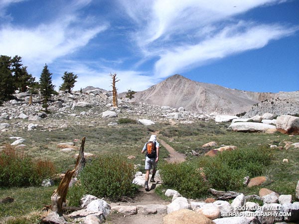
Concerned that another usually dependable water source might already be dry, we started our run from Vincent Gap in the wrong direction, headed downhill on the Mazanita Trail. A couple of drainages and about a mile and a half later we were happy to hear — and then see — a diminished, but still gurgling ribbon of water.
In a couple of weeks, I might do the Islip – South Fork – Vincent Gap – Baden-Powell – Islip loop as part of my training for the Mt. Disappointment 50K. With Lamil Spring likely very low, and the connecting segment of Highway 2 closed, the loop would be difficult to do without this key water source.
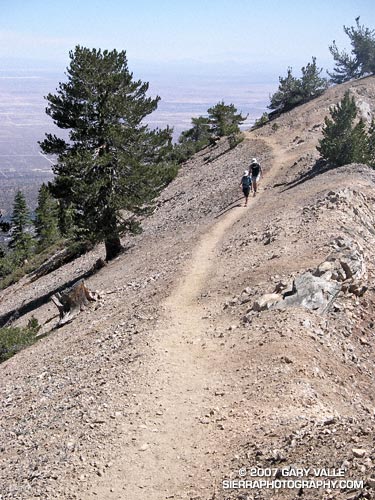
Soon we were back at Vincent Gap and switch-backing up Mt. Baden-Powell. Even though mountain temps had recently been in the 90’s, today the temperature was comfortably cool. That would be the surprise of the day. Ocean-cooled breezes would keep the mercury in check and make the running along the ridge between Baden-Powell and Little Jimmy almost Spring-like.
Including the extra bit at the start, the run worked out to be about 22 miles, with an elevation gain/loss of over 5000 ft.
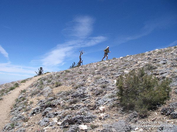
This was my first time back to Mt. Pinos since being caught in a fierce thunderstorm last July. No thunderstorms this time — just wonderful running on the air-conditioned ridge between Mt. Pinos and Mt. Abel.
My route was the same as that described in the post Vincent Tumamait Trail. Here’s a Google Earth image and Google Earth KMZ file of a GPS trace of the route.
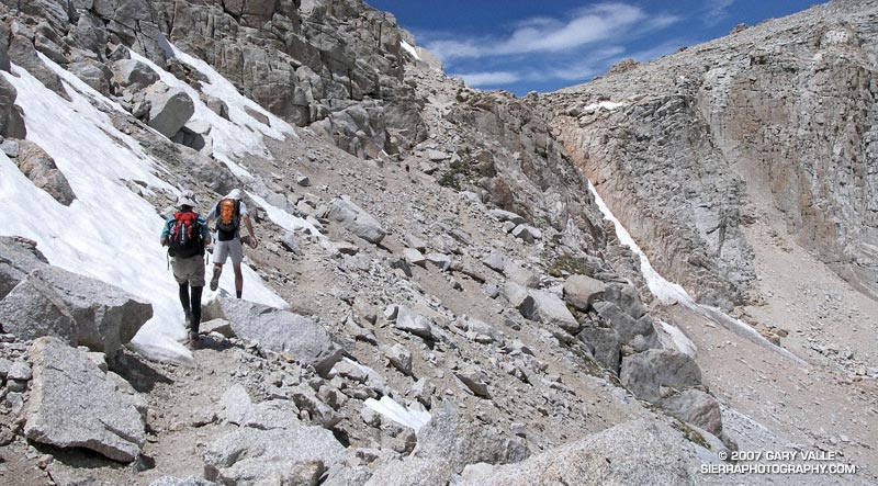
The sky was brightening in the east, and sunrise was approaching when I met Miklos and Krisztina at the Denny’s in Sylmar. We were already wasting light. The plan was to drive from near sea level up to Horseshoe Meadows, at about 10,000′ on the Sierra east side. The hike/run we had in mind was a keyhole loop from the Cottonwood Lakes Trailhead up (old) Army Pass and then down New Army Pass. If we felt OK at the top of Army Pass, we would also do Mt. Langley (14,026′).
The weather forecast looked good. There was a chance of some gusty southwest winds in the afternoon, but temps were warm and there was virtually no chance of T-storms. With a record low Southern Sierra snowpack, there was almost no chance that an ice axe would be required on Army Pass. I was familiar with the route on Langley and down from New Army Pass, and expected to be back to the car well before sunset. But, just in case, the moon was about half full.
Low snow year on Army Pass. June 23, 2007.
In fact, there had been very little snow on Army Pass, or anywhere else. We reached the pass relatively quickly, and decided to continue to Langley. Now, after another hour of hiking, we were above a prominent rock band that extends across Langley’s south face, and making good progress.
I’ve been convinced for some time that pursed-lip breathing helps me at higher altitudes, particularly when I’m not well acclimated. There’s a skill to it. There seems to me an optimum blend of heart rate, respiratory rate, and the amount of resistance created on exhalation. When all these factors are in balance, the breathing technique is almost automatic and effortless, and it really does seem to help. It certainly seemed to be helping me now.
I topped out a few hundred yards west of the summit, and ambled over to the high point of the peak. On a scale of 1 to 10, I felt pretty good — maybe a 7. Making an effort to stay hydrated, consume plenty of calories, and not push the pace too hard seemed to have worked — at least this time.
The view along the crest to Mt. Whitney and the peaks of the Kings-Kern Divide was telling. It was remarkable just how little snow there was at the highest elevations of the Sierra. A week before I had been paddling the Kern River. Now I could see why the flow on the upper Kern was dropping so fast.
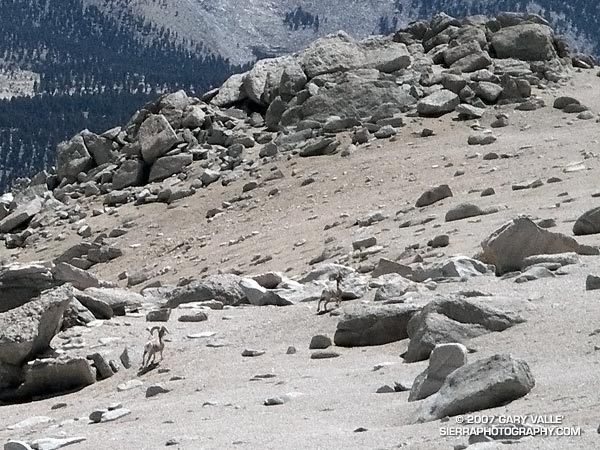
Big horn sheep on the slopes of Mt. Langley. June 23, 2007.
Miklos and Krisztina joined me on the summit, and after taking a few summit photos, we headed down. Screeing down the slopes below the rock band, we were startled when a herd of perhaps 20 big horn sheep rumbled across the slopes below us. They flowed across the rough landscape like quicksilver. Graceful and robust, they moved effortlessly between the rocks and up a small slope. In the moments it took me to react, grab my camera, and turn it on, all but two large rams trailing the group, had disappeared.
Energized by the sight of these fleet-footed animals, we continued down to the saddle at Army Pass, and then up and over New Army Pass. Before sunset we would be back to the car, and before dark, eating dinner at Lone Pine. Before midnight we would be back in L.A. Here’s a Google Earth image and Google Earth KMZ file of a GPS trace of our route.
Note: Going to higher altitudes without properly acclimating can result in very serious, life-threatening illnesses. There is much information available on the Internet regarding altitude sickness and acclimatization. As a starting point see UIAA Medical Commission – Advice and Recommendations and Wikipedia: Altitude sickness.
Runoff from the Upper Kern River is stored in Lake Isabella and then released to the Lower Kern River according to flood control and irrigation requirements. The releases for summertime irrigation normally produce good flows for rafting and kayaking.
Although only a 2.5-3.0 hour drive from Los Angeles, the class IV Miracle to Democrat run on the Lower Kern River is usually remarkably uncrowded. Sure, you’ll probably see a few rafts, but nothing like the log jam of rafts on some other rivers. It’s not unusual to paddle for a couple of hours and not see another group.
On the 11 mile reach between Miracle Hot Springs and the Democrat Day Use Area, there are eight rapids that are rated class III+ or class IV, many class II and class III rapids, and one class V rapid. The class V rapid, Royal Flush, is normally portaged. There are numerous places for kayakers to surf, spin and play along the way. Depending on how much time is spent playing, paddlers may choose to take out at Delonegha, at about the 7 mile point, or continue on the “Big Five” section to Democrat.
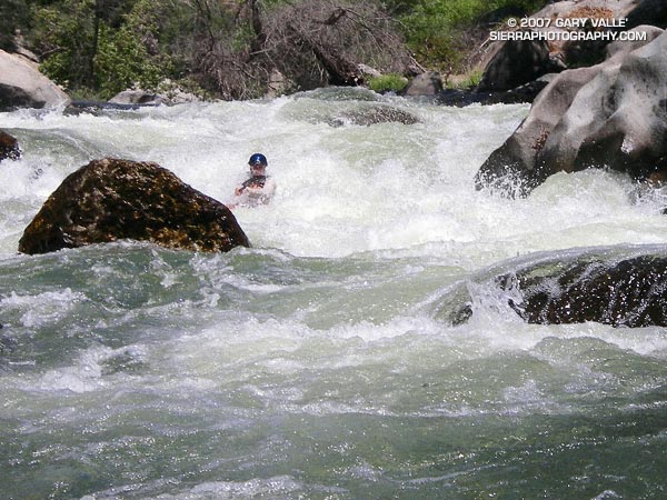
In this post’s photo, the kayaker is paddling the rapid Deadman’s Curve, aka Powerful Possum. This class IV rapid plunges down a big drop with surprising speed into steep waves and pushy diagonals.
Note: It is extremely important to wear a personal flotation device (PFD) when on a river. If you’re not an experienced whitewater kayaker or rafter, contact an outfitter for more information about paddling trips and instruction.