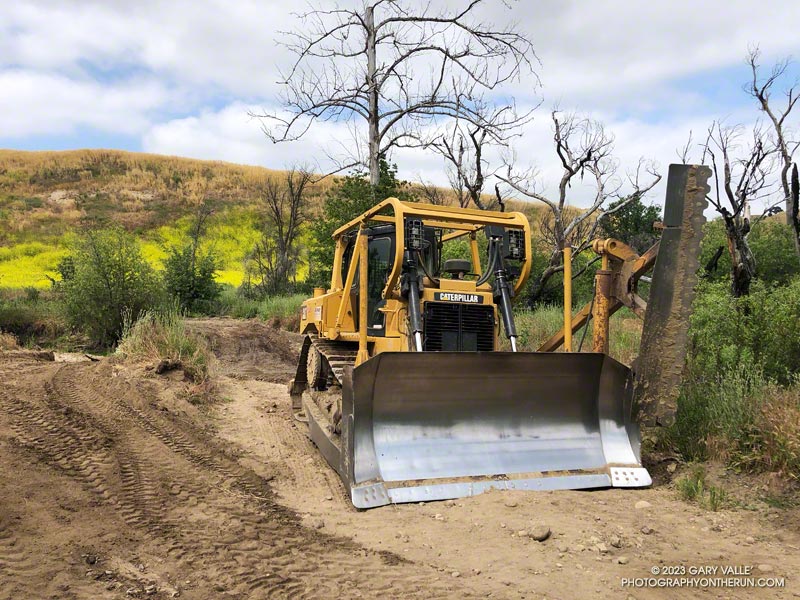
Dirt roads used to service gas pipelines that pass through Ahmanson Ranch have recently been scraped and graded.
Scraped and graded section of East Las Virgenes Canyon Rd about two miles west of the Victory Trailhead.
The work was sorely needed. In the wake of our very wet rain season, in some areas the mustard was 8 feet tall and roads were rutted and damaged.
All of the scraped roads are in the western part of Ahmanson, primarily in and near upper Las Virgenes Canyon. Some very welcome weed-cutting was previously done along the roads in other parts of the open space area.
(Officially named Upper Las Virgenes Canyon Open Space Preserve, most users refer to the open space area as Ahmanson Ranch or simply Ahmanson.)
The seasonal bridge across Malibu Creek is back! No sketchy log to test your balance or thigh-deep water to wade through — just walk across.
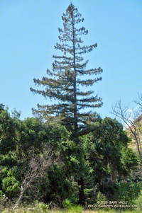
This afternoon I’d returned to Malibu Creek State Park to check on the bridge, count the surviving coast redwoods on the Forest Trail, and see what was happening on the Lost Cabin Trail.
When running the Bulldog Loop a couple of weeks ago, I did a quick check of some of the redwoods on the Forest Trail but skipped the back half of the trail. Today, I crawled through the downed trees blocking the trail and checked the rest of the trees.
I counted seven surviving redwoods. Several of these are multi-tree groups consisting of two or more trees. These family groups were counted as one tree. One of the trees, and perhaps more, was naturally germinated. Most of the trees looked healthy, but appearances can be deceiving.
Coast redwood along the Crags Road Trail
One redwood is just a few feet from the Crags Road Trail. It’s on the right side of the trail, just past the seasonal bridge, when going west on Crags Road toward the M*A*S*H site. The unique conifer is easy to spot among the other trees.
The start of the Lost Cabin Trail is on the left as you enter the M*A*S*H site going west on Crags Road. Like the Forest Trail, it is less used and isolated but has a character all its own. Today, the Lost Cabin Trail was a trove of brightly colored wildflowers.
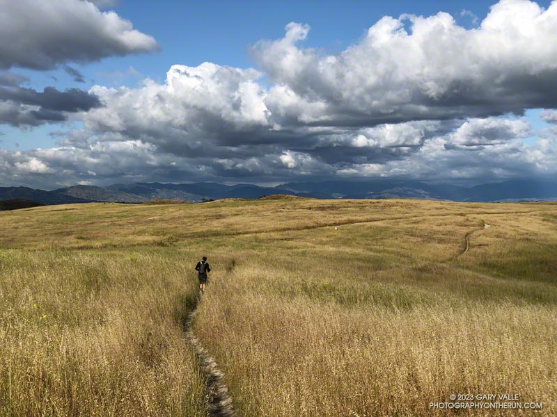
Brett was down for a few days, and as an initial run we did a loop from the Victory Trailhead of Ahmanson Ranch, through part of Las Virgenes Canyon, up onto Lasky Mesa, and then back to the trailhead.
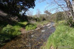
Upper Las Virgenes Creek still flowed. Valley oaks were full with new leaves. The green grasses of the rain season had finally turned, and rare May cumulus clouds were painted on postcard skies.
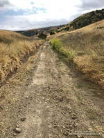
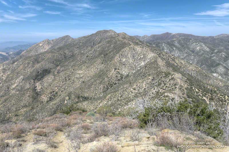
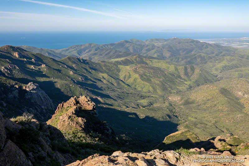
The out and back trail run to Condor Peak (5440’+) and Fox Mountain (5033′) from Vogel Flat is an adventurous 17-mile, lower elevation run in the San Gabriel Mountains.
Exposed stretch of the Condor Peak Trail
When I last did this run (May 2020), portions of the trail below Fox Mountain were washed out and overgrown. Later I learned that this was before the Condor Trail restoration project had been completed. Thanks to the hard work of the Lowlifes Trail Crew the trail has been brought back to life. Today, several groups — including hikers, bikers, and runners — were making their way to Condor Peak.
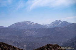
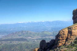
Snow on Mt. Waterman and Twin Peaks from the Condor Peak Trail.
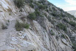
As mentioned in my posts from 2007 and 2020, this adventure is best done when the weather is cool. It can really bake on the south-facing sections of trail. From the Vogel Flat Trailhead on Big Tujunga Canyon Road the trail climbs about 2600′ in 6 miles to reach Fox Divide. Much of this stretch is surprisingly runnable. As with most mountain trails, extra care is required because of steep drop-offs and other hazards.
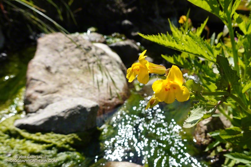
Today, the trail was in the best shape I’ve seen in years. The weather was relatively cool and good for running. As has been the case in other low elevation areas, a colorful assortment of Spring wildflowers were blooming along the trail. With our copious Winter rain, two small streams were crossed on the traverse above Fusier Canyon. It’s hard to say how long they will last.
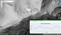
USGS Lidar-based 3DEP 1m contour map of Condor Peak
This time, after climbing Condor Peak, I also climbed Fox Mountain. Although steep, it’s short, and doing Fox only added about 30 minutes to the total time.
Here are a few photos taken along the way. Additional info, photos, and an interactive map with 3D terrain can be found in the following related posts.
The morning was beautiful and sunny. It hadn’t rained for two days, and except for a few contrails, the sky was nearly cloudless.
Earlier in the morning, I’d climbed the Western Ridge of Boney Mountain, then worked my way over Tri Peaks to the Backbone Trail. I’d been on cruise control running down the Chamberlain/Backbone Trail, enjoying the pleasant weather and wide-ranging views.
Hines Peak and other Ventura County Mountains from the Chamberlain segment of the Backbone Trail
Passing a gap in the ridge, I was surprised to see a person on the hillside, a few yards below the trail. It was an odd place to be.
The person was partially hidden by grass and brush, and all I could see was their head and shoulders. They were wearing an odd helmet and were busy working on something that looked like a pack. I didn’t see a mountain bike.
None of it made sense. Was it someone doing the Backbone Trail? Had they slept there overnight? What was with the helmet? Reaching the end of the Chamberlain Trail, I turned right on the Old Boney Trail and continued the descent toward Blue Canyon.
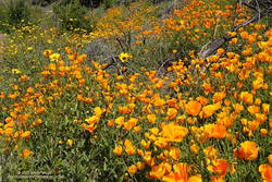
California poppies and bush sunflowers along the Old Boney Trail
Partway down, I heard the clap-clap-clap of helicopter blades approaching the canyon, and that’s when it all fell into place. The mysterious person along the Chamberlain Trail was a SAR crew member.
The helicopter was yellow, probably from the Ventura County Sheriff Search and Rescue Aviation/Medical Team. I’ve seen them in the area a number of times doing exercises.
This wasn’t the first time I’d seen something strange from the Chamberlain Trail. A few years ago, I’d noticed an odd-looking object below the Chamberlain and Old Boney Trails junction. It turned out to be a rescue manikin strapped onto a litter. Practice makes perfect, and exercises help ensure the safety and success of demanding SAR operations.
One of several stream crossings in Blue Canyon.
Farther down the Backbone Trail, there was a striking display of California poppies and bush sunflowers on the hillside above the junction of the Backbone and Old Boney Trails. After photographing the poppies, I returned to the Backbone Trail and entered Blue Canyon. To this point, I’d managed to keep my shoes and socks dry. But that was going to end.
I’d done a similar route in January, partly to see the condition of the Chamberlain, Blue Canyon, and Upper Sycamore Trails. That was the case again today. In the two months since the January run, nearby Circle X has recorded over 13 inches of rain. Not surprisingly, that has resulted in more water in the streams, more wildflowers along the trails, and a bit more eroded and rougher trails.
Runners working up a hill above the Placerita Canyon Rd. aid station. Photo: Paksit Photos
I don’t know why. But for some reason, I had it in my head that the turnaround point for the Placerita Canyon 30K was the halfway point of the course.
I had just passed the third aid station and was climbing a short — but steep — hill. From there, it was at least a couple of miles to the turnaround, and my projected time to that crucial point was adding up to more than I expected.
The thing was, I felt good and was enjoying the race. Everything seemed to be going well. It’s fun to run new trails, and I hadn’t run any of these.
The temp had been near freezing at the start, but the initial steep climb and energetic descent took care of that. The course would continue in this vein as a series of ups and downs on fire roads, single-track trails, and a bridle path. A few of the hills were slow and strenuous, but those were offset by fast-paced running on a mile and a half of bridle path. The longest hill was out of Aid Station #2 — 700 feet of gain over about 1.6 miles.
My confusion about the turnaround point could have been easily remedied by simply checking the mileage on my watch. It’s on the second data screen, and I only had to push a button to see it. But like a small, annoying rock in my shoe, it just didn’t seem to matter that much.
Eventually, somewhere around the Fair Oaks Aid Station, I checked my average pace. It was about at my goal pace. That’s when I realized the halfway point had to be behind me. When I reached the “Turn Back!” sign, I checked the mileage. It was 11.7 miles. A bit more than 6 miles to go. That was better!
As it turns out, the halfway point on the way out had been near Uncle Remi Trail junction. This outstanding single-track trail is a direct route down to Placerita Canyon and would be our route on the way back.
About 40 minutes later, I was running down the flowing turns of the Uncle Remi Trail. It didn’t take long to get to Placerita Canyon Road, and I soon found myself chugging up the last (long) hill. There were a couple of runners ahead of me that I’d been chasing for miles. Although I didn’t catch them, the attempt seemed to shorten the final 1.5-mile climb.
Partway down the subsequent descent, I heard a cheer in the distance as the pair crossed the finish line. A couple of minutes later, I also enjoyed the finish-line applause.
This was the inaugural running of the Placerita Canyon Trail Runs 10K, Half Marathon+, and 30K. As you would expect at a KH Races event, everything was well done – from the marking of the course to the aid station fare. The hills were green, the trails in good shape, and the weather invigorating. All the runners were super-friendly, and the aid station and course volunteers were very helpful. Thank you!