Category Archives: running|adventures

Backbone Ultra 2013

Joey Morrison on top of Eagle Rock during the 2013 Backbone Ultra

Joey “Threw it on the Ground” Morrison, who whole-heartily embraced the spirit of the Backbone games, was momentarily transformed into the iconic coyote runner while on the top of Eagle Rock.

The Coyote Backbone Trail Ultra was a phenomenal experience and a fantastic running event. The work required to pull it off is beyond comprehension. Many thanks to Chris Scott, Howard Cohen, Mike Epler, Gretchen Garrnet, Manley Klassen and everyone that helped make it happen — especially Lynette Brody (California State Parks) and Catharine Beverly Bishop (NPS). Also a BIG thanks to the aid station personnel, the safety crews, the EMTs, the communications staff, the trail sweeps and the huge number of volunteers that contributed to the event. The runners that I met along the way were exceptional people as well as superb athletes. I feel fortunate to have participated.

After Kanan I had to focus on getting from one aid station to the next, and finishing the run!

Here’s  an interactive, 3D terrain view of the 2013 Backbone Trail run from my GPS track.

Comet PanSTARRS and the Crescent Moon

Comet PanSTARRS and the crescent moon from the Simi Hills, near Los Angeles

Did a night training run this evening in the Simi Hills, west of the San Fernando Valley, and combined it with photographing Comet PanSTARRS and the crescent moon with my normal running camera — a Panasonic Lumix LX7.

Since the comet is low on the western horizon and not very bright, it is a difficult object to photograph, and even more difficult to see with the naked eye.

I found a convenient pipe to use as a monopod and took some image sequences using the self-timer. This particular photo is from a single RAW format image shot at f/2.3 for 1 sec at ISO800 at the 35mm equivalent of 90mm.

Here’s a larger version of the image. The soft light on the face of the Moon above the crescent is earthsine — diffuse sunlight reflected from Earth.

The run was also fun. Saw and heard more poorwills and also encountered a mule deer. Didn’t see any coyotes, but certainly heard them.

Related post: Comet Holmes 17/P

Back on the Backbone Trail

La Jolla Valley and Boney Mountain from the east side of Mugu Peak.

What time was it? 1:00 AM? And I was going to get up at what time? 6:00 AM? And do what? Run to Mugu Peak?

It made sense a few days ago. Do a long night training run, sleep for a few hours, then get up and do another long run.

I couldn’t believe it when I woke at 6:15. OK… OK… I’ll give it a shot. Bleary-eyed, I drove to Wendy Drive.

The forecast was for another day of record-breaking highs. By Southern California standards most of the Winter had been cool and sometimes even cold. I was sure that a temperature of 80-something was going to feel more like 90-something.

Most of the first few miles of Sycamore Canyon were downhill, shaded and cool. As I passed the Danielson Multi-Use Area it was weird to think that last night we had turned around just a couple of miles up the Backbone Trail from here. Danielson will be around mile 59 of the ultra. Running in the dark and after many miles of technical single track trail, Sycamore Canyon road will hopefully provide at least a bit of mental relief. One foot in front of the other…

This morning I continued to follow the Backbone Trail down Sycamore Canyon and then up the Wood Canyon Vista Trail to the Overlook fire road. Here the Backbone Trail continues left (south) to the Ray Miller Trail. Today I turned right and at the 4-way intersection a little down the road turned left and headed into La Jolla Valley — one of the “must visit” places in the Santa Monica Mountains. Mugu Peak is on the south side of La Jolla Valley, and stands above the coast at Pt. Mugu.

The title photo was taken from the trail on the east side of Mugu Peak. The eastern part of La Jolla Valley is on the left (above the cactus) and La Jolla Canyon is on the right. Boney Mountain is in the distance. The Chamberlain segment of the Backbone Trail descends from near the high point on the right side of the skyline.


There are several ways to return to Wendy Drive from Mugu Peak and my favorite route is nearly all single track trail. Not today. Today wherever there was a choice I took the one that would have the most shade and water faucets. That meant descending Hell Hill instead of Wood Canyon Vista Trail, and running back up Sycamore Road instead of using the single track trails on the west side of the canyon.

It took a while, but eventually I made it back to the car.

Some related posts: Back to Mugu Peak; Laguna Peak, La Jolla Valley, and the Channel Islands

Night Training for the Backbone Ultra

Moonrise over Los Angeles from the Backbone Trail

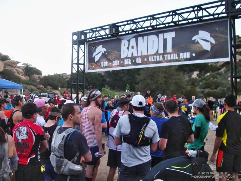
On my list of things to do to prepare for the Backbone Ultra was a night training run on a segment of the Backbone Trail we would be running in the dark.

Tonight was a good night for that training run for a couple of reasons. One was that the weather was going to be phenomenal. Today several record high temps for the date had been broken, including nearby Camarillo at 89 and Oxnard at 84. It would be warmer on tonight’s run than on many of the runs I’d done this Winter. Another was that adjusting for Daylight Savings Time, the moon would rise at about the same time and be in about the same phase as on the day of the event.

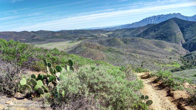
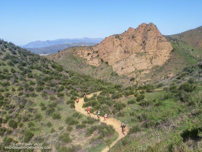
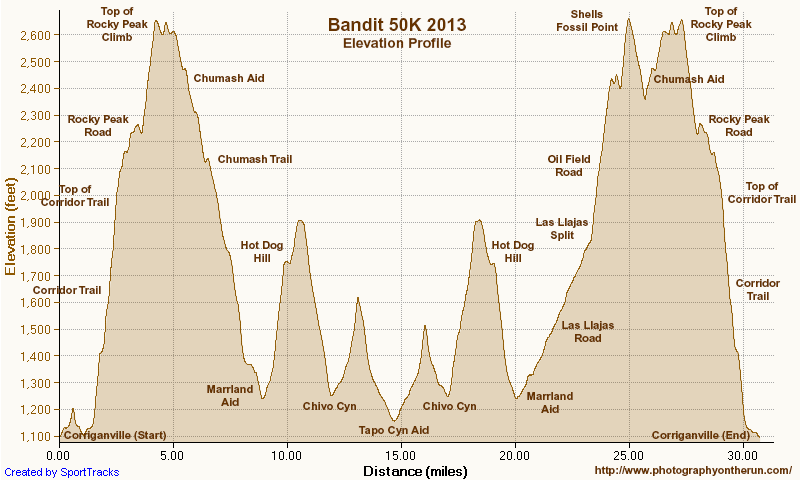
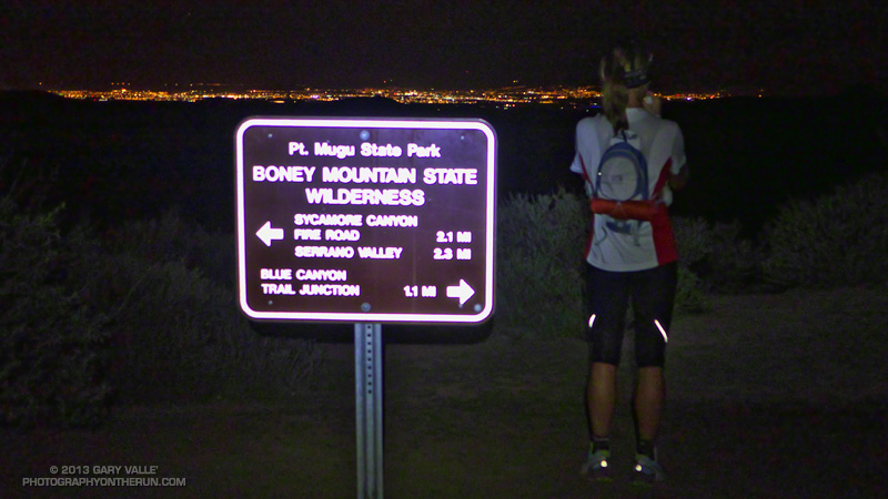
The plan was to do two out and back runs from the Mishe Mokwa trailhead. The Backbone Ultra starts at Will Rogers State Park in Pacific Palisades and ends at Ray Miller Campground, near Pt. Mugu. The Mishe Mokwa trailhead is at about mile 52 of the course. The first run tonight would be on the easier terrain of the Backbone Trail east of Mishe Mokwa; and the second would be a more difficult run past Sandstone Peak and down the Chamberlain Trail.

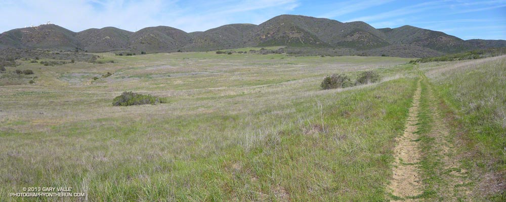
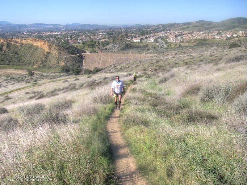
Ann, also training for the Backbone Ultra, joined in on the runs, and as it was beginning to get dark we set off eastbound (toward Etz Meloy) from Mishe Mokwa.


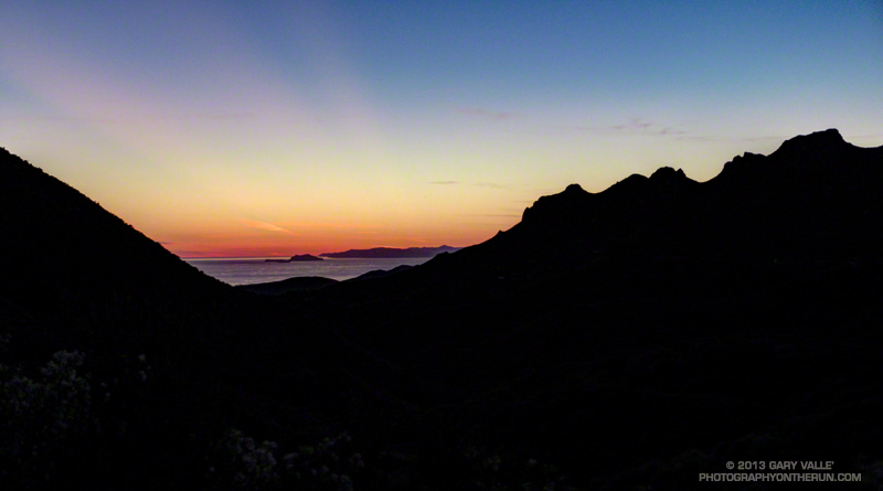
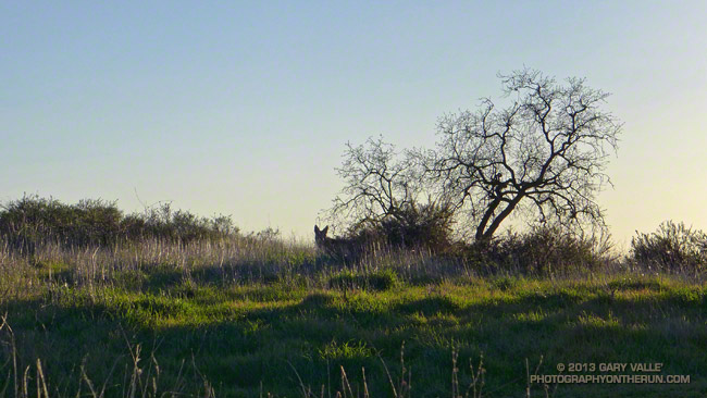
It would be hard to imagine better conditions for running at night; the sky was clear and the temperature in the 70s. Accompanied by a chorus of crickets, poorwills deepened the growing darkness with their enigmatic calls. Sirius, the brightest nighttime star, was to the southeast, behind Orion the hunter, whose sword belt of three stars was easily seen to the south. The planet Jupiter beamed overhead, even brighter than blue-white Sirius, but with a yellowish tint, hinting at the gas giant’s atmosphere of swirling clouds.

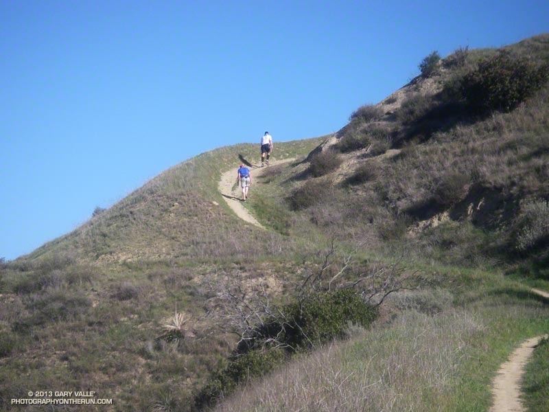
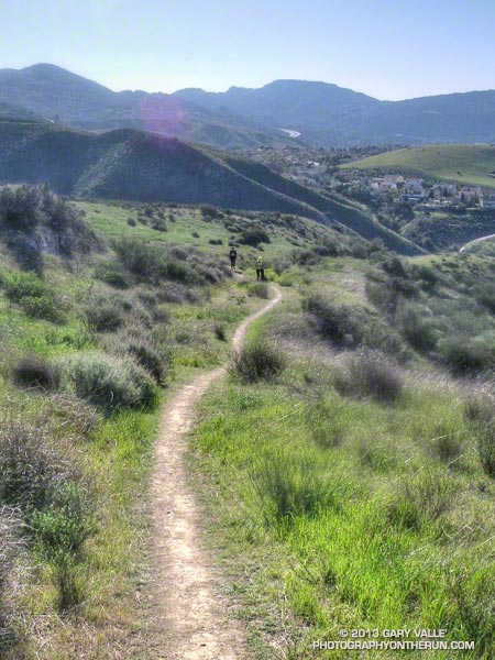
The perspective of terrain and time changes in the dark. You run more by how you feel than what you see ahead. Whether up or down, moderate hills look more moderate and gradual hills seem almost flat. Some runners say time seems to pass more quickly at night, others tell of arduous miles, wrong turns and distant aid stations.

After running an enjoyable three miles eastbound, we retraced our route and returned to Mishe Mokwa. After eating some watermelon, we grabbed our packs and headed up the Backbone Trail toward Sandstone Peak.


This out and back was going to be more difficult than the first, with about 3000′ of gain/loss over a sometimes rocky and technical 12+ miles of trail. With the event coming up in just a few weeks the last thing we wanted to do was something “stoopid.” During the day it relatively easy to check your watch, search pockets for missing jelly beans or salt tabs, eat a fruit bar, look around, and do other things on the run. At night, particularly on a technical trail, a much higher level of attention is required and there are many distractions.

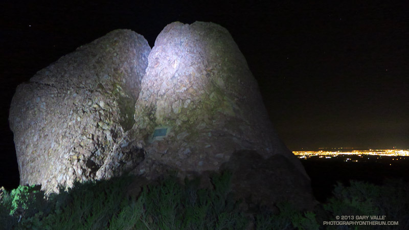
The myriad of stars and the glittering lights along the 101 corridor and out on the Oxnard plain were amazing. Along the trail, manzanita blossoms, shooting stars, Ceanothus, and lichens seemed to almost phosphoresce in the diffuse light of the headlamps. From time to time the sweet fragrance of poison oak, just starting to bloom, would waft up from the canyon and mix with the more earthy scents along the trail.


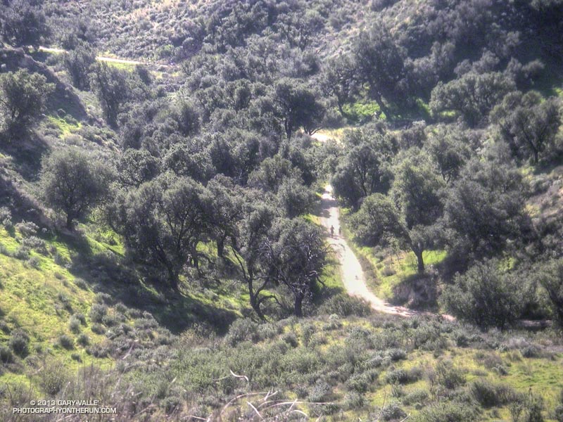
We turned around at the bottom of the Chamberlain Trail, and in a dark-distorted hour were back on the rolling terrain south of Tri Peaks and west of Sandstone Peak. Here the trail follows the drainage of an ephemeral stream. Colder air had collected in the drainage, and the temperature was a chilly 15-20 degrees cooler than the rest of the trail.

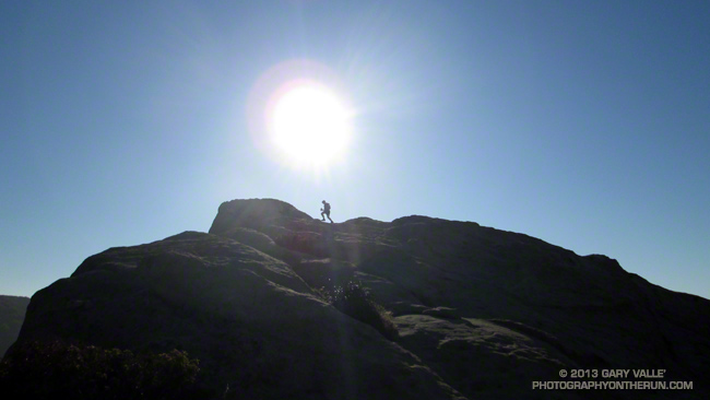
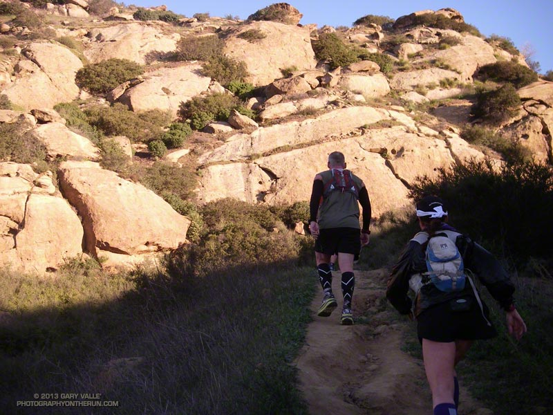
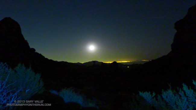
Black in the night, massive rock formations towered above the trail, and the hulk of Sandstone Peak appeared huge and insurmountable. At places along the crest there were stunning views of the moon rising over the lights of the Los Angeles basin and at other vantage points equally sensational views of the Conejo Valley.

In a higher mileage week of a higher mileage month it is a long 2 miles from the top of the climb up the Chamberlain Trail to the start of the downhill that would take us to Mishe Mokwa.

In 29 days and 50-something miles we would be up here again, climbing the Backbone Trail to Sandstone Peak, winding through the rock formations of Boney Mountain, and then descending the Chamberlain Trail. What an experience that would be!

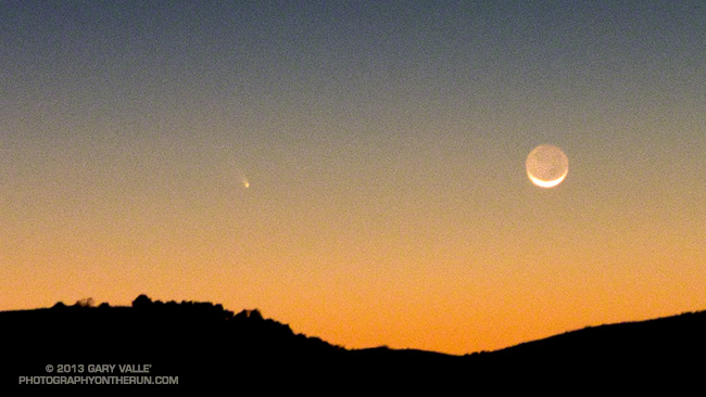
Sun, Moon & Stars and Comet Pan-STARRS.

All sun and moon data is from the U.S. Naval Observatory Astronomical Applications Department. The sunrise time is for Los Angeles and sunset and moonrise times are for Oxnard. There may be small differences in the observed times of sunrise, sunset and moonrise due to a variety of factors.

Sunrise on the first day of the Backbone Ultra — March 30 — will be at 6:43 AM and sunset will be 7:16 PM. At 6:00 AM the orange-appearing star Antares, the Moon, and Saturn will be in the southwest sky, about 27 degrees above the horizon. About 88% of the Moon’s visible disk will be illuminated.

It varies from person to person, but if the sky is clear, there is usually enough light to run on easy terrain for about 30 minutes before sunrise and 30 minutes after sunset. That works out to as much as about 13.5 hours of light for the 6:00 AM start group, 10.75 hours for the 9:00 AM group and 7.75 hours for the noon group.

As on the training run, Sirius, Jupiter, Orion and the Pleiades will be visible early in the evening. Moonrise on the evening of March 30th will be at 11:17 PM. At 2:00 AM the Moon will be about 25 degrees above the horizon in the southeast sky. About 80% of its visible disk will be illuminated. At 4:30 AM the moon is about 35 degrees above the horizon in the southern sky.

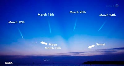
Comet Pan-STARRS probably won’t be visible March 30, but if you happen to be doing an evening training run over the next week or so and have a clear view of the western horizon just after sunset, it may be visible very low on the western horizon. It may be difficult to see in the twilight. For more viewing info check NASA’s Asteroid & Comet Watch and Sky & Telescope’s updates on the comet.

Coyotes Are Curious Creatures

Coyotes Are Curious Creatures

Coyotes are curious creatures. You can be nearly certain if one crosses your path, it will continue for a short distance, stop, turn, and watch you.

Recently I had another interesting coyote encounter. I was running along East Las Virgenes Canyon fire road in growing darkness, hoping to make it back to the Victory trailhead before it was completely dark.

I don’t know if I heard something, but for some reason I stopped running and listened. There was a small gully full of brush to my right that intersected the dirt road. In a moment or two I heard a growing rustling coming up the gully. I was transfixed. It sounded as if some huge animal was coming toward me.

The rustling grew louder and louder and the brush began to shake, showing the progress of the creature. It all happened before I had time to react, and even if I could have reacted I don’t know what I would have done!

All of a sudden one coyote and then another exploded from the brush. The first crossed direcly in from of me in a full gallop and the second took flight, making an impossible flying bound across the road and up the roadcut on the opposite side.

As quickly as they had appeared, they were gone, and the canyon was quiet again.

Some related posts: Coyote Tag, Coyote Tag II

Bandit 50K 2013 Notes

Runners on the Chumash Trail during the Bandit 50K

Bandit 50K Runners Descending the Chumash Trail

If my training goal was to be running on spent legs, I had achieved that goal. I was at mile 22 of the Bandit 50K and trying to run up Las Llajas Canyon. On paper (or LCD display) Las Llajas is a gradual climb, gaining a modest 600 feet in a little more than 3 miles. But on dirt and in reality it is an onerous climb that numbs the mind and makes you mumble to yourself, “Why can’t I run up this thing any faster?”


Since early December I’d been doing extra training to prepare for the Coyote Backbone Trail Ultra at the end of March. Part of the training plan was to combine the Ray Miller 50K and Bandit 50K with other runs to increase the mileage. I had been following the usual training tenants and trying to vary the types of workouts, the mileage and intensity. So far it had all gone well, but the miles were adding up.

Early in the race I’d taken it easy — especially up the insanely steep “Corridor Trail.” But some trail running temptations can’t be resisted and I had pushed the pace going down the Chumash Trail — one of my favorite trails. Even if that was one of the reasons I was struggling a bit going up Las Llajas, it was worth it.

The new out and back from Las Llajas Canyon to Tapo Canyon was so much better than doing the Chumash-Las Llajas loop twice! The running was varied and challenging; plus we were able to marvel at the race leaders, and share the experience with many more runners! Chris Price and several other runners looked strong cranking it up out of Chivo Canyon. Averaging just a little over 8 minute miles, Chris went on to break the Bandit 50K record he set in 2011, doing the new (and longer) course in an amazing 4:10:23!


The weather forecast had looked a bit iffy earlier in the week — iffy hot in this case. But temps had cooled by about 10 degrees in 24 hours, and today the weather was excellent. It was on the warm side on a couple of the climbs, but nowhere near what it can sometimes be on a warm Winter’s day in Southern California.

After an indeterminate time I made it up Las Llajas Canyon to the split and started climbing up the steep oilfield road that connects to Rocky Peak Road. Part way up I was extremely disappointed to see that my Hill Climbing Helper® wasn’t where I left it. This made me even slower going up the hill.

Once the last hard climb to Fossil Point is done it doesn’t take long to get to the Chumash Aid Station. Rolling terrain leads from there to the top of the Rocky Peak grade at about mile 27. From there it is nearly all downhill to the Finish.


More than 450 runners participated in the 5th edition of the Bandit Trail Runs, competing at distances that ranged from 6K up to 50K. Many thanks to the Bandit race committee — Randy, Sarita, Larry, Tommi, Mat and Eric — and all the Bandit volunteers, sponsors and runners.

According to my GPS tracks the 2013 50K course was about 3/4 of a mile longer than the 2011-12 course and had slightly more elevation gain/loss. Here’s an interactive Google Earth Flyover and Elevation Profile of the new 50K course. The flyover is interactive and can be paused and restarted at any point. You can rotate, zoom, and tilt the view. Mileages and locations are approximate and based on my 50K GPS track. The Google Earth plugin is available for most desktop browsers.

Note: The Bandit Trail Runs event is now Rocky Peak Trails.

Here are few additional photos. Click the image for more info and a larger image.


Steep Climb


Corridor Trail


30K Leader


Low on Hot Dog Hill


Working Up Hot Dog Hill


Returning from Tapo

Some related posts: Bandit 50K 2011 Notes, Bandit 30K 2009