Category Archives: trails

Mt. Disappointment 50K 2011 Training Run

Valley Forge Trail (Before scheduled trail work)

Note: The Mt. Disappointment Endurance Run is now the Angeles National Forest Trail Race.

This year the Mt. Disappointment 50K course will be the most difficult to date — 33.1 miles with an elevation gain/loss of 6195′ according to course info. And that isn’t a fanciful elevation gain, exaggerated to hype the race. Ask any Mt. Dis runner, it’s a real number that has left both the experienced and uninitiated crawling up the Kenyon Devore Trail at the end of the race.


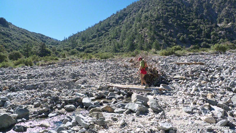
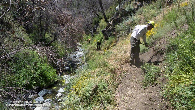
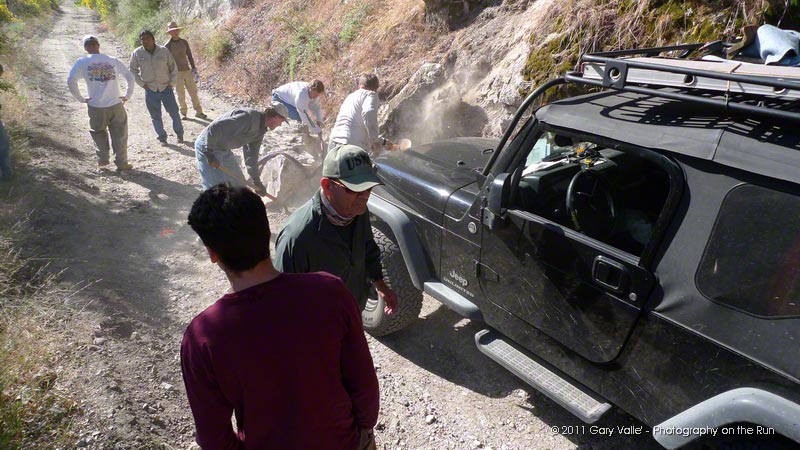
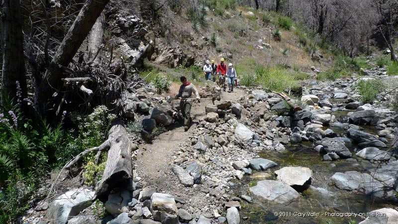
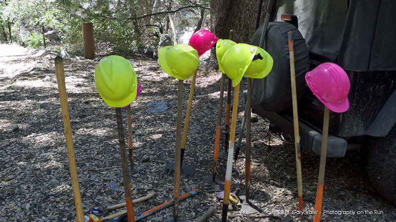
To introduce us to the changes in the 2011 course, Gary & Pam Hilliard and Fausto & Cindy Rowlan arranged today’s training run — complete with course markings and an aid station. Pam and Cindy took care of the aid station at West Fork, and Fausto marked the course. (Thank you!!)


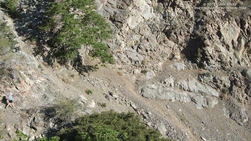
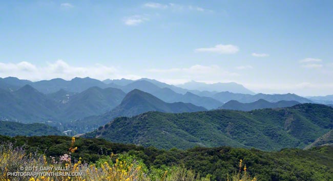
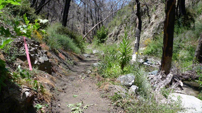
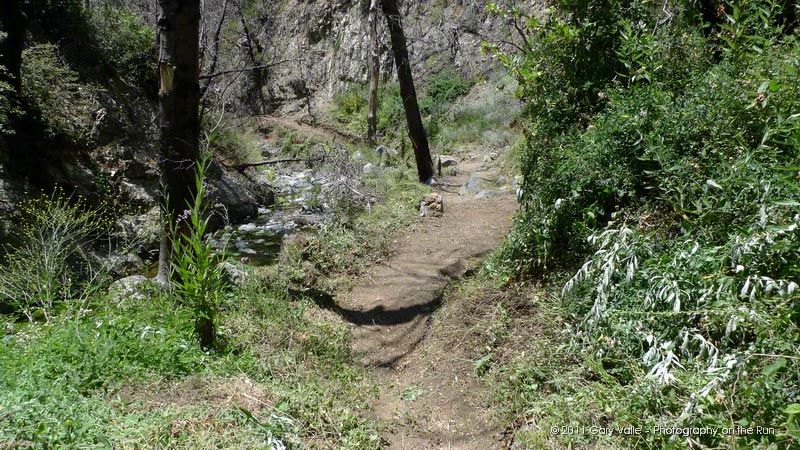
The 50K course is similar to last year’s, but instead of running all the way down to Red Box on the Mt. Wilson Road, at about mile 2.5 it turns right onto the Valley Forge Trail and descends 2.7 miles to the Gabrielino Trail. The course then turns UP canyon and follows the Gabrielino Trail 1.6 miles to Red Box Road. From this point, the 50K course is the same as in 2010. The combination of bonus elevation gain, bonus distance, and additional technical trail could increase times in the middle of the pack by 30-40 minutes or more.


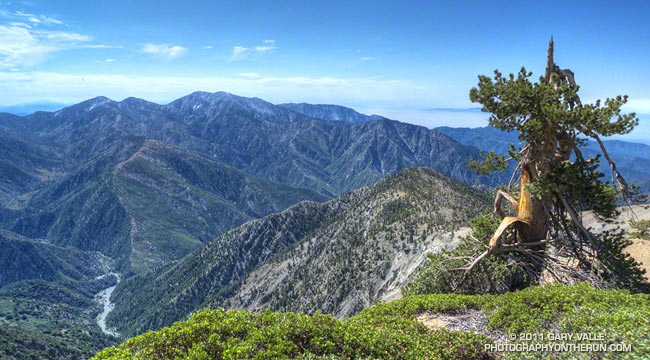
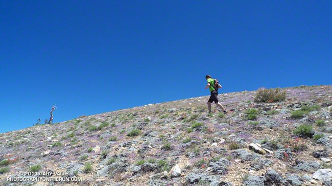
On today’s training run we did the first 11 miles of the 50K course down to West Fork, then followed the last 5 miles of the course up the Gabrielino and Kenyon Devore trails to the top of Mt. Wilson. The training run was a little less than half the length, and a little more than half the elevation gain of the 50K course. Working up Kenyon Devore, even having done it numerous times, I was shaking my head and asking myself, “and how is this going to feel after 29 miles?”

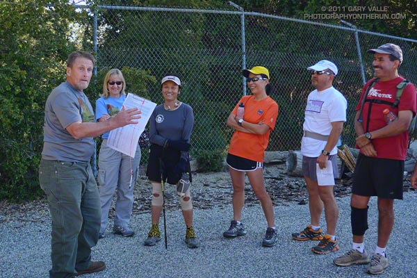
About 30 runners participated, many of them sandwiching the training run between races and other difficult runs. Conversations ranged from whether you need to do long training runs to do ultras, to favorite gels and drinks. But one runner’s story surpassed all others. He was in a wheelchair from age 6 to age 19, had corrective surgery, and since then has run nearly 200 marathons or ultras — including a 50K the weekend before the training run!

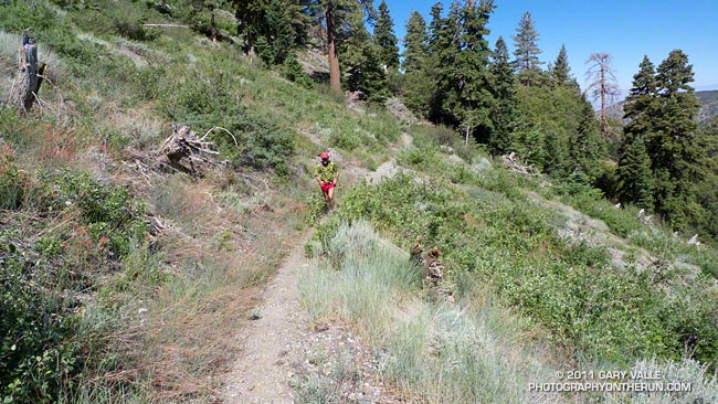
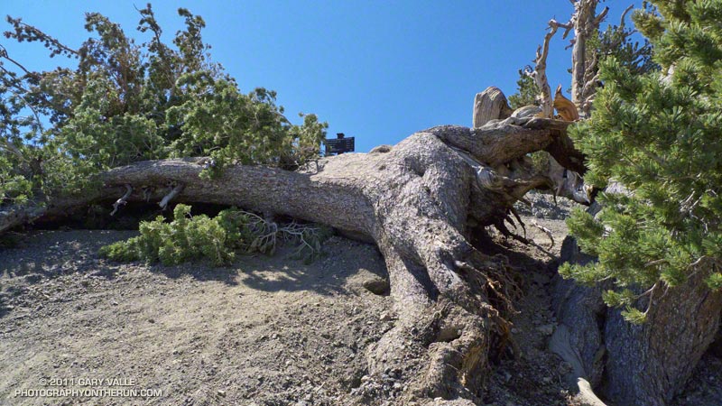
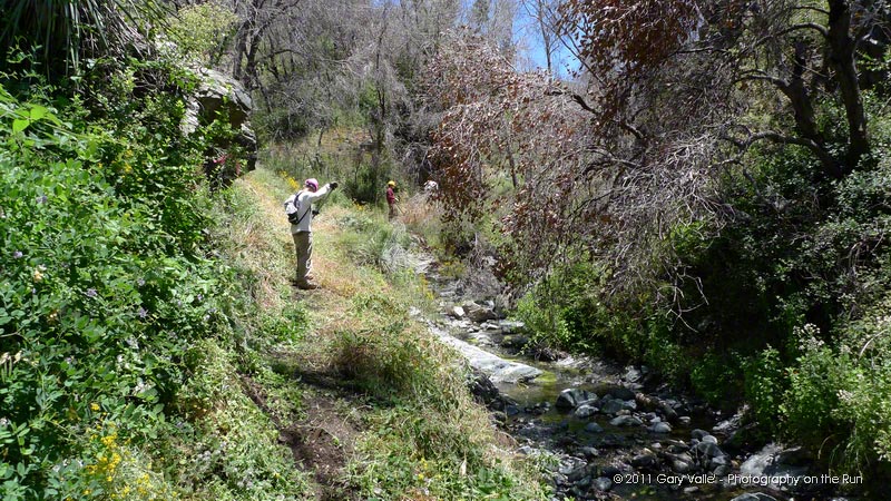
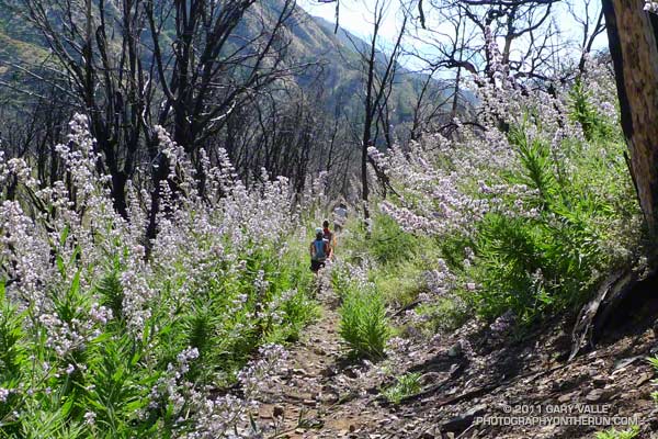
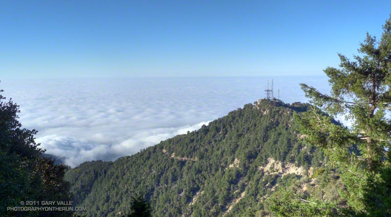
Note: The title photo is of the Valley Forge Trail.

San Gabriel Mountains Running Adventure

Manzanita Trail below Vincent Gap

Some runs in the San Gabriels are more adventurous than others, and I’d mentioned to Devy that on this run we would likely have to deal with rock slides, washed out sections of trail, an annoying amount of bugs, and warm — if not hot — temperatures. We might even run into a bear. Devy is the owner of Andes Adventures, and having cut his trail running teeth exploring Peru’s Cordilleras Blanca and Huayhuash, his response was “sounds like fun, let’s go!”

The loop is a favorite, combining sections of the High Desert National Recreation Trail and Pacific Crest Trail. The route starts at Islip Saddle (6650′), descends to South Fork Campground (4560′), then climbs all the way back up the summit of Mt. Baden-Powell (9,399′). From Baden-Powell it returns to Islip Saddle on the PCT. It’s 23.5 miles of scenic single track trail with a cumulative elevation gain/loss of around 5700′. Done as part of a normal week of running, and with stops along the way, it usually takes about the same time to do this course as a hilly 50K race.


The South Fork and Manzanita trails are part of the High Desert National Recreation Trail. The 5.25 mile long South Fork Trail descends the rugged canyon of the South Fork of Big Pine Creek. Due to the tortured geology of the area — the San Andreas fault zone is nearby — the trail is in a constant state of change. Each time I’ve run it, its condition has been a bit different. It has many rocky sections, and at various points along the trail it is necessary to cross the debris from small rock slides.

According to the nearby Valyermo RAWS the temperature was around 80 degrees when we rolled into South Fork Campground. Not too bad. It would be near 100 later in the day, and it’s not uncommon for temps to hit the 90’s here by 8:00 or 9:00 in the morning. The (unmarked) Manzanita segment of the High Desert National Recreation Trail starts on the east side of the campground and in about 5.6 miles leads to Vincent Gap (6565′).


The news of the day was the condition of the Manzanita Trail. Sections of this trail have been washed out for several years, and after December’s record-setting rainfall it seemed the trail could only be worse. Surprise, surprise, the trail was mostly repaired! We didn’t even have to use tree roots for handholds!

Vincent Gap is at about mile 11 on the route, and about 2200′ into the 5000′ climb up Baden-Powell from the desert. As you might expect on a nice Summer weekend the PCT up Baden-Powell was very busy. In part because we wanted to save some for the outstanding running between Baden-Powell and Islip, and in part because we couldn’t go any faster, the pace was pretty leisurely going up the peak.

Ah… the water at Little Jimmy Spring… Like last week, still so cold I thought it was going to give me an ice cream headache.

Related post: Islip Saddle – Mt. Baden-Powell South Fork Loop

Perils of Winter, Surprises of Summer

Mt. Baldy from Mt. Baden-Powell

Storm-damaged Lodgepole Pine and Mt. Baldy

I was at the turnaround point of an out and back run from Islip Saddle (6650′) to Mt. Baden-Powell (9,399′), and had descended a short distance down the south ridge of Baden-Powell to enjoy the ridge top view. It had been a good run so far. It was windier and cooler than expected, but that was a good thing. Temps in the valleys were forecast to top 100 degrees today.

I’d been surprised to find no snow on Baden-Powell. In good snow years, remnants of snow will typically last until at least the 4th of July. There was a patch here and there last year, and sizeable drifts in 2005. This year a little remained on the north face of Mt. Baldy, but that was it.


Even if no snow remained, there was evidence it had been a tough winter. It looked like an unusually severe ice storm had struck the area. Normally resistant to such damage, a stout lodgepole pine had had two of its limbs ripped from its trunk, peeling away a thick layer of bark and cambium. On the other side of the peak, near the Wally Waldron tree, an apparently healthy limber pine had collapsed.

If I had been surprised to find no snow on Baden-Powell, I was even more surprised to find no one on the summit. That wouldn’t last. A number of hikers were working their way toward the peak from Islip Saddle and Dawson Saddle, and I was sure others were on the way up from Vincent Gap.

After visiting the Wally Waldron tree, and chatting briefly with a hiker, I turned eastward on the PCT — next stop Throop Peak!

Some related posts: Islip Saddle – Mt. Baden-Powell Out & Back, Running Hot & Cold

Air Conditioning

Nearing the summit area of Mt. Pinos

Enjoyed a combination Father’s Day & July 4th visit from Brett over the weekend. Friday we did a fun run at Malibu Creek State Park and today we headed up to Mt. Pinos to get in a cooler, higher altitude run.


In addition to Mt. Pinos (8831′), there are three other peaks along the broad ridge traversed by the Vincent Tumamait Trail — Sawmill Mountain (8818′), Grouse Mountain (8582′), and Mt. Abel/Cerro Noroeste (8280+’). I’ve run past the indistinct path to Grouse Mountain numerous times on the way to Mt. Abel, always commenting “someday I have to check that out.” Finally, today we did.

On the way to Grouse we did the short detour to the top of Sawmill. Since my last visit the Chumash spirit tower on the peak had grown, no doubt from the many fine days and views enjoyed here. This morning the snow-covered mountains of the Southern Sierra could be seen above the haze of the San Joaquin Valley.


The ascent of Grouse was straightforward. Like Sawmill Mountain, it has two nearly equal height summits. We found a small granite crag northeast of the summit and climbed a short steep route on its west face. It had fun technical moves on mostly good holds, but in running shoes you had to pay attention — especially on the downclimb!

On the way back to Mt. Pinos we stopped by Sheep Camp. The short side trip to this idyllic spot is essentially compulsory. It would be easy to spend the afternoon here, listening to the wind in the pines and the gurgling of the spring; smelling the sun-warmed pine needles; and enjoying the greens, yellows, reds and blues of Summer.

I always feel a little twinge of regret when leaving Sheep Camp, but it was a great day to be on the move, and soon we were back on the trail and enjoying that as well.
 
Some related posts: Vincent Tumamait Trail, Atmospheric Dynamics

Phantom Trail: Trade-offs of a Wet Rainy Season

View west toward Boney Mountain from the Phantom Trail

View West Toward Boney Mountain from the Phantom Trail

Following last weekend’s Holcomb Valley 33 and yesterday’s trail work, today I was looking to do something moderate. Without thinking too much about the condition of the Phantom Trail when I was on it a month ago, I decided to do the Phantom loop in Malibu Creek State Park. The eight mile loop is normally a favorite recovery run. The 1000′ of elevation gain/loss is kind to tired legs, and the loop has varied terrain and great scenery.


The first five miles (Cistern, Lookout, Cage Creek, Crags Rd., Grassland and Liberty Canyon trails) are in decent shape, but portions of the Phantom Trail are really overgrown. The growth of the noxious invasive plant milk thistle in the Liberty Canyon area is the worst I’ve seen in years. At one point near Liberty Canyon the spiraling winds of a strong thermal picked up a countless number of the thistle’s plumed seeds and carried them to who-knows-where!


The middle section of the Phantom Trail climbs up a shaded side canyon to a prominent ridge line. It isn’t as overgrown. There is some very healthy poison oak that is sometimes difficult to avoid, but it’s a pretty section of trail with a lot of green and a variety of wildflowers.

Once up on the ridge and for about the last 1.5 miles of the loop, the issue isn’t with an noxious invasive, but with the native plant deerweed. It’s so thick and brushy it’s often difficult to see the trail — or your footfalls, or ruts or rocks, or anything else on the trail.

While I wouldn’t recommend this loop right now as a trail run, it was interesting to see (once again) how our wet rainy season has affected this area.

Some related posts: Invasive Thistle on the Phantom Trail, Milk Thistle Seed Heads

After the Station Fire: Silver Moccasin Trail Work

Trail work on the Silver Moccasin Trail in Shortcut Canyon

If you have fond memories of the rustic running in Shortcut Canyon during last year’s Mt. Disappointment 50K, hold on to those memories because this year you’re going to be running on a bona fide, genuine trail.

Under the direction of trail maintenance guru Gary Hilliard, R.D. of the Angeles National Forest Trail Race (formerly Mt. Disappointment), 19 hard-working volunteers closed the final gap in this badly overgrown and damaged section of the Silver Moccasin Trail. Burned in the 2009 Station Fire, floods ravaged the canyon, and then soil conditions and above average rainfall combined to produce teeming plant growth.

Volunteers recovered most of the original trail, removing fallen limbs and trees, clearing overgrowth and debris, and restoring sections damaged by erosion and flooding. Large patches of stinging nettle, and some turricula (Poodle-dog bush) and poison oak were also removed from the trail.

See the  trail work schedule on the Angeles National Forest Trail Race web site for the remaining trail work dates.

Here are a few additional photographs:


Road Maintenance


Mt Disappointment 50K Volunteers


Turricula Along Restored Trail


Silver Moccasin Trail


Done for the Day


Tools of the Trade

Related post: Trail Work and Tree Rings