Category Archives: trails

Chumash-Hummingbird Loop

Oak, grass, and clouds in Simi Valley, California.

The Chumash and Hummingbird trails are popular trails in the eastern Simi Valley, north of the 118 Freeway. These trails ascend the steep western flank of the Santa Susana Mountains to Rocky Peak fireroad. A scenic loop can be created using these trails and a connection between the Chumash and Hummingbird trailheads down in the valley. There are a few ways to do this, and the loop has proved popular.

The Chumash trailhead is on Flanagan Dr., off of Yosemite, and the Hummingbird trailhead is on Kuehner Dr. just north of the 118 Frwy. Currently, no official trail connects these trailheads. To connect them via city streets (Yosemite, E. Los Angeles Ave., Kuehner) is a long detour on pavement and doesn’t make sense from a trail-running or hiking point of view.

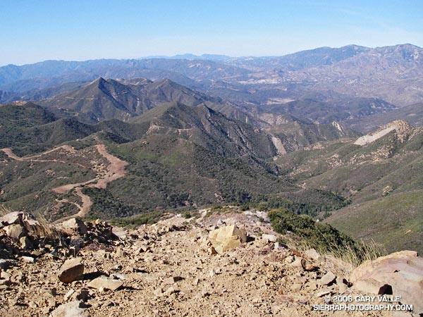
For many years a more direct, unofficial route has been used to connect the two trailheads. Most of the route is on dirt roads through undeveloped property. Using this route the length of the Chumash-Hummingbird loop works out to about 9.2 miles with about 1700′ of elevation gain. It’s an excellent hike, run or ride with great scenery and views.

For a number of years access to the Hummingbird Trail from Kuehner Dr. has been across property that is now being developed. A chain link fence has been in place along Kuehner for some time. Apparently, at the north end of this chain link fence there is a conservation easement that allows access to the Hummingbird Trail  via a corridor adjacent to the (private) Hummingbird Ranch property. It was necessary to use this access easement when I ran this loop last weekend.

The property on the west side of Kuehner is also being developed. As I understand it, Mt. Sinai Dr. will eventually connect to Kuehner and a small parking lot will be built for trail users. Hopefully, some provision will also be made to officially connect the Chumash and Hummingbird trailheads and preserve this scenic loop.

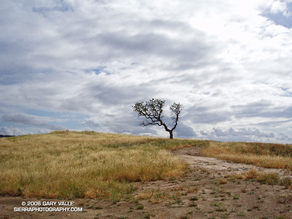
The photograph of the oak is from a run of the loop on April 28, 2005.

Update 12/26/06 – Mike Kuhn, the director of the Rancho Simi Trailblazers, sent me the following information regarding the Hummingbird trail easement:

“At the top of Kuehner Drive is a cul-de-sac at the gate to the Hummingbird’s Nest Ranch. The white plastic fence marks the boundary of the ranch. There is a corridor of land owned by the park district along the white plastic fence down to the creek and hence to the usual crossing of the creek.”

He also said that a trail connection between Chumash and Hummingbird is in the planning stages, and encourages all trail users to be patient while the construction at Kuehner is underway.

Related post: Lower Stagecoach – Hummingbird Loop

Christmas Berry on the Garapito Loop

Photo of the berries of toyon,  Christmas berry (Heteromeles arbutifolia)

A photo of the berries of Toyon (Heteromeles arbutifolia) taken on the Garapito Loop trail run on Thanksgiving Day. Also called Christmas berry, the plant is protected by a California law.

The Garapito Loop is a pleasant 7.5 mile figure eight course that starts at the south end of Reseda Blvd. at Marvin Braude Mulholland Gateway Park, goes up to near Eagle Rock via Fire Road #30 and Eagle Rock Fire Road, and then returns via the Garapito and Bent Arrow Trails. Here’s a Google Earth image of a GPS trace of the route and a 3D, interactive view of a slightly longer variation of the loop that visits Eagle Rock.

Also see: Ferns Along the Garapito Trail

Topatopa Bluff

Fire Break on West Ridge of Topatopa Bluff

Fire Break on West Ridge of Topatopa Bluff

Crossing Sisar Creek, I debated running through the cool water. I had been running non-stop since White Ledge Camp, and had been pushing the downhill. It was a warm day and my feet were hot and my socks damp and gritty — it would feel great to dunk them. But gravity and the nearness of the trailhead pulled me across the gurgling creek and I continued to run.

Looking down Sisar Road I could see a couple of riders on horseback, accompanied by a hiker. As I approached them, I slowed and then walked. They asked me how far I had gone, and I replied, “Topatopa.” The hiker responded that she hadn’t been to the summit since the Day Fire threatened the area, and asked if it was open. I told her that I thought so. I had checked the updated closure map on the Los Padres National Forest web site, and the best I could tell, Topatopa Bluff (peak 6367) was just outside of the closed area.

Earlier, I had run up this road to trail 21W08, the Red Reef Trail, and then followed the recently groomed trail up past White Ledge, to Hines Peak Road.

On the way up the road, the view of the bluff had been deceptive. The highpoint wasn’t atop the the most obvious of the layered cliffs of 50 million year old Matilija sandstone, but was an indistinct summit on the left side of the formation. This Google Earth image gives a good overview of the location of the peak.

Above White Ledge Camp there had been great views of the Ojai Valley, the coast from Pt. Mugu to Ventura, and the Channel Islands. At the point where the Red Reef Trail met Hines Peak Road a large area had been cleared of brush, but had not burned. After running a few tenths of mile east on the road, I had seen hints of a trail switchbacking up through the thick brush on the west ridge of Topatopa Bluff, and left the road.

A fire break had been constructed along the crest of this unburned ridge, more or less on top of the right margin of the trail. Judging from the berms along the break, in addition to hand crews, a dozer had been used to the cut the swath. Given the steepness of the terrain, this must have been class V dozer-driving! Using the remaining segments of the trail as much as possible, I had worked my way up the final 1000′ of elevation and plodded onto the unburned summit.

It was sobering to stand at the edge of the fire area and see the full extent of the 162,702 acre fire. The day was clear, and Mt. Baden-Powell could be seen in the San Gabriel Mountains, some 75 miles to the east. To the east-northeast, past Hines Peak and in the direction of I-5 and Pyramid Lake, the earth had been burned and blackened, and nearly all vegetation appeared to have been consumed.

According to news reports, the month-long fire started on Labor Day near Pyramid Lake, more than 20 miles distant, and was not contained until October 2. Approximately 4600 firefighters from 39 states fought the fire.

Substantial portions of the Sespe and Piru Creek drainages were burned in the fire. Even without considering the effects of the fire, which generally increases runoff, these tributaries of the Santa Clara River have the potential to produce high flows. On January 10, 2005, the USGS gage 11113000 SESPE C NR FILLMORE recorded a peak flow of 85,300 cfs, and the USGS gage U11109600 PIRU CREEK ABOVE LAKE PIRU CA a peak of 40,000 cfs. Smaller creeks that extend into the burn area could also produce higher than normal flows.

In part due to a developing El Niño, an increased probability of higher than average precipitation is projected for Southern California. While an above average amount of precipitation is by no means guaranteed, the wet outlook is no doubt one of many issues being considered by the Day Fire Burned Area Emergency Response team.

Here’s a Google Earth image and a Google Earth KMZ file of a GPS trace of my route.

San Gorgonio High Line

Mt. San Jacinto from the summit of San Gorgonio Mountain

One of the other climbers commented, “It’s almost eerie.” And it was. On the 11,499′ of San Gorgonio Mountain there was not a breath of wind and the temperature was a comfortable 50-something degrees. Wisps of cirrus accentuated the azure sky, and to the southeast San Gorgonio’s ever-present companion, Mt. San Jacinto, stood quietly above Banning Pass.


San Bernardino Peak and the Mt. Baldy area from the summit of East San Bernardino Peak.
A couple of hours before I had been sitting on the summit of East San Bernardino Peak, debating whether to continue my planned trek to San Gorgonio. I was considering running over to San Bernardino Peak instead, and then calling it a day. For sure I couldn’t do both. I didn’t have enough water, and the only nearby water source might be dry.

A month old report from the Water Collector had noted water “barely trickling” out of the pipe at Trailfork Springs. I wasn’t familiar with the spring, and given the pessimistic report probably wouldn’t do the required detour to check it out. So whatever I did, my remaining water would have to do. If I didn’t push too hard, it would get me to San Gorgonio, but probably not over to San Bernardino Peak and then to Gorgonio. (Note: A better late season water source is High Meadow Springs. The springs and camp site is about 1/3 of mile below the Divide Trail, east of Shields Flat. The turn off to the spring is between high point 10500 and Red Rock Flat. On a run of this course in late October 2009 the spring had a good flow.)

The hike up from Momyer had been unrelenting – a gain of 5250′ in elevation over about 7.5 miles. It was kind of like going up the Palm Spring Tram, without the tram. Beyond the turn-off to Alger Camp the character of the trail changed from obvious and well-trodden, to a schizophrenic path that in places was the kind of trail that only the really adventurous enjoy.

There were numerous downed trees, stark evidence of the bark beetle infestation. Although most could be bypassed or clambered over, one recently downed tree required a face in the dirt belly crawl. In other areas the manzanita, chinquapin, and whitethorn were so thick that the trail, though nearly invisible, could not be lost. Upward progress was possible by only one route.


Saddleback (Santiago Peak) from slopes below East San Bernardino Peak.
In counterpoint to these inconveniences were the early morning views of Mill Creek Canyon, idyllic sections of forested trail, Clark’s Nutcrackers and gnarled Lodgepole pines on the high mountain slopes, and outstanding views of Saddleback and Mt. San Jacinto. Near one fallen tree an opportunistic red paintbrush bloomed as if it were Summer. It is better to be positive…

Back on East San Bernardino Peak, I needed to make a decision – San Bernardino Peak or San Gorgonio? Instead I wandered about the peaklets in the area, not really heading in the direction of either peak, but evaluating how I felt and thinking through scenarios… Feel OK… Full moon tonight… Enough water to get to the peak… Water at Vivian Creek… Weather great… Know the route… After a few minutes, I found myself bearing slowly to the east, picking up the Divide Trail and starting to run.


San Gorgonio Mountain from East San Bernardino Peak.
The distance by trail from East San Bernardino Peak to Mt. San Gorgonio is about 8 miles. Virtually all of route is above 10,000′ and along a spectacular mountain divide. The running on this high line is unmatched in Southern California. Once on the Divide Trail and headed in the direction of San Gorgonio there was no thought of turning back. Perhaps the biggest difficulty was resisting the ascent of the many named peaks along the way. Without more water, most of these would have to wait until a another day.


Epilogue: The climb from Momyer (5500′) to East San Bernardino Peak (10,691′) took about 3 hours, and the traverse over to Gorgonio (11,499′) about 2.5 hours. I reached the summit of Gorgonio at about 1:00 p.m, and after running down the Vivian Creek trail, and through Forest Falls, made it back to Momyer at about 4:00 p.m.

The distance to the summit of Gorgonio from Momyer via East San Bernardino Peak is about 15.5 miles, and the total length of the loop is about 26 miles. About 11 miles of the route is above 10,000′ and the total elevation gain and loss is on the order of 7000′. If you include Alto Diablo, there are nine named peaks above 10,000′ along the route. Dobbs Peak is somewhat further from the trail than the others, but rounds out the total to ten. Here is a Google Earth image and Google Earth KMZ file of a GPS trace of the loop.

Note: Mill Creek can be difficult and dangerous to cross.

Related post: San Gorgonio High Line 2009

Google search: $g(trail running), t$(San Gorgonio Mountain)

Room with a View

Tahquitz Peak Historic Fire Lookout

The intimidating canyon rose steeply above me. Towering rock precipices lined the canyon walls, their summits glistening in the morning sun. I was at an elevation of about 2600′ and it was already warm. A little unsteady, and moving slowly at first, I started the ascent. Gaining speed, I passed the first rock face, and after a minute or two, turned to gaze at Palm Springs and the Coachella Valley. In what seems like a matter of minutes, yucca and creosote transitioned to mountain mahogany and juniper, and then to pine and fir. Suddenly my pace slows, there is a bump, a jostle, and a pause. The operator announces, “Welcome to the mountain station of the Palm Springs Tram. The elevation is 8516’…”

Palm Springs Tram
Palm Springs Tram

A 10 minute ride from the desert to the pines on the Palm Springs Tram isn’t a bad way to start a run. A couple of weeks before I had seen Mt. San Jacinto from the North Backbone Trail and it reminded me that I hadn’t done that peak in a while. As the weekend approached it looked like the weather would be perfect for a long mountain run.

Mt. San Jacinto State Park and Wilderness contains a network of over 50 miles of trails, including a segment of the Pacific Crest Trail. The resourceful runner or hiker can put together an adventure ranging from a few miles to 30 miles or more. I hoped to beat the worst of the Sunday going home traffic, so opted for an approximately 20 mile route that would get me back to the tram in the early afternoon.

Stopping at the ranger station in Long Valley, I filled out a wilderness permit. Cool air had pooled in the valley overnight, and the deck of the station was still in shade. The ballpoint pen protested the 40-something degree temperature, but with repeated attempts, I scratched in my destinations: Mt. San Jacinto and Tahquitz Peak.

The summit of Mt. San Jacinto, with Mt. San Gorgonio (11,499') in the distance.
The summit of Mt. San Jacinto, with Mt. San Gorgonio (11,499′) in the distance.

My route would take me to the summit of Mt. San Jacinto (10,834′), back down to the junction at Wellmans Divide, and then continue down to the Pacific Crest Trail. The PCT would be followed through Saddle Junction to the junction with the South Ridge Trail, and then continue on this trail to the historic fire lookout on Tahquitz Peak. I would return to Long Valley via Skunk Cabbage Meadow and Hidden Divide. Here’s a Google Earth image and Google Earth KMZ file of a GPS trace of the route.

The run and the running were outstanding – a blue skies and sunshine kind of day, with Autumn shadows, light winds, pleasant temperatures, and nearly unlimited visibility. Much of route was through spectacular old-growth forests of Jeffrey Pine, Lodgepole Pine and White Fir. The uphills were generally very well graded, with long runnable sections. And the downhills – ah the downhills – some rocky and technical, and some that make you feel as if you’re blazing down the trail on a Star Wars speeder bike.

Tahquitz Peak Historic Fire Lookout.

The lookout on Tahquitz Peak is a can’t miss destination. On the way, there are superb views of Tahquitz and Suicide rocks, and from the summit there are expansive views in nearly all directions. Palomar Mountain can be seen about 30 miles to the south, Saddleback about 50 miles to the west, and Mt. Baldy and its neighbors about 65 miles to the northwest. Much closer are the slopes leading to Jean Peak and the summit area of San Jacinto.

The lookout operated continuously from 1917-1993, and is listed in the National Historic Lookout Register. It reopened in 1998 and is manned by volunteer Fire Lookout Hosts.

Walking up the stairs in the mountain station, I glance at my watch. It’s 2:00 p.m. and the next tram is just about to depart. I’m back to my car and headed down the hill by 2:30, but it’s still not early enough to miss the traffic on I-10.

Related post: Skiing San Jacinto, Autumn Trail Running on Mt. San Jacinto

(Also see Manzanita, Ice and Clouds, The Shovel, and Mt. San Jacinto Summit Hut on SierraPhotography.com.)

Strawberry Peak Traverse

Josephine Peak from the northwest ridge of Strawberry Peak.

When I broke through the top of the stratus layer, bright sun glared from the jagged granitic rocks along the ridge. To the west, Josephine Peak (5558′) was nearly immersed in an ocean of clouds.

The route I was doing was a variation of the Strawberry Peak Circuit described in the posting Spring Growth. Instead of going around the peak on the Colby Trail, this 13-mile loop climbs up and over Strawberry’s summit (6164′), ascending the class 3 northwest ridge, and then rejoins the circuit at Lawlor Saddle. Although a couple of miles shorter than the circuit around the peak, this route has more elevation gain, and the class 2 and class 3 sections of the ridge require careful route-finding.

Class 2, class 3 – what’s that about? Basically, class 1 is hiking, class 2 is easy scrambling where the hands are used for balance, and class 3 is when the scrambling gets serious, and handholds are required. Another element of class 3 climbing is that staying on route can be important. Deviating from an established route may significantly increase the difficulty or hazard. This is certainly the case on the northwest ridge of Strawberry.

Like much of the San Gabriel Mountains, the rocks of Strawberry Peak are old and fractured. Large landslides have originated from the northwest face of the peak. (The Colby Trail passes through the moraine-like debris of one of these slides.) Because of its friable nature, extra care is required when climbing the northwest ridge. Hand or footholds can break, or footing can be lost on a sandy shelf. Or, as described in a story by pioneering aerodynamicist Paul MacCready, the climber can be trapped in a situation where they cannot climb up or down.

The northwest ridge of Strawberry is by far the most frequently climbed class 3 route in the San Gabriel Mountains. Done with care and appropriate skill, the climbing on the ridge can be an enjoyable and unique experience.

On the summit ridge, I admired the steep northwest face of Strawberry Peak as it plunged through the morning shadows to Strawberry Potrero nearly 1500′ below. Did I hear voices down there, or was it just the wind…

Here are a Google Earth image and Google Earth KMZ file of a GPS trace of the route.