Category Archives: pt mugu state park

Looking for Boney Peak

Boney Peak from the Backbone Trail

Along with Sandstone Peak, Tri Peaks, and Exchange Peak, Boney Peak is an officially named peak that is part of the Boney Mountain massif. The peak is located about 0.5 mile southwest of Sandstone Peak and is easily accessed from the Backbone Trail.

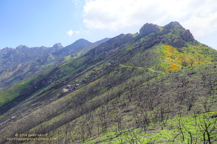
I’d climbed the other peaks in the area, and run past Boney Peak many times, but never scrambled to its summit. Getting to Boney Peak from the Wendy Drive trailhead was pretty much the same as doing Sandstone Peak. I took the “escalator” up the Western Ridge of Boney Mountain to Peak 2935 and then ran over to Tri Peaks. From there, I followed the Tri Peaks Trail to the Backbone Trail, near the Mishe Mokwa Trail junction.

Tri Peaks from the top of Boney Peak

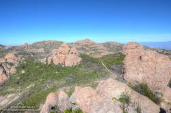
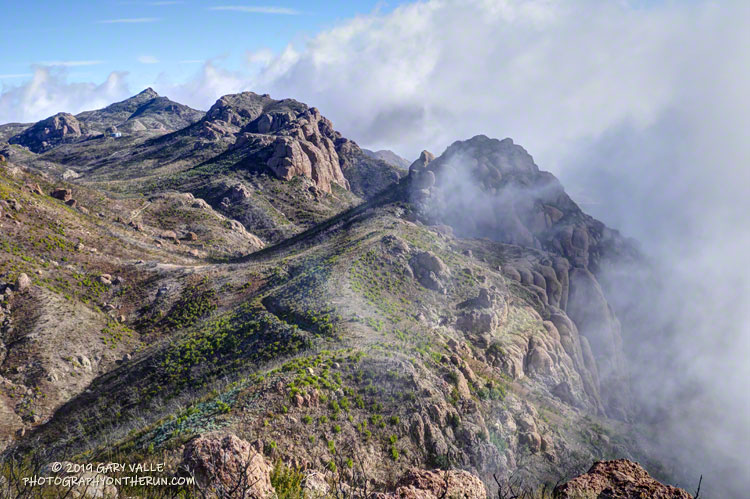
The use trail to the top of Boney Peak leaves the Backbone Trail about a mile from the Tri Peaks/Mishe Mokwa Trail junctions. Other than a little brush, it’s fairly easy to get to the peak’s boulder-strewn summit. There was a red register can stashed in the rocks. (The title photo of Boney Peak was taken where the use trail begins.)

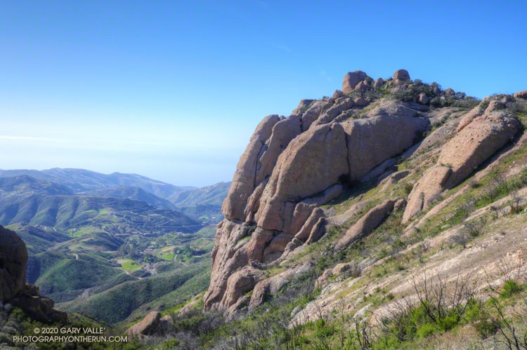
The actual high point of the peak is atop, a large, exposed summit block. Various trip reports describe the easiest route up the summit block as class 3. That seems about right. Although relatively straightforward, the use of handholds is necessary, and a fall would ruin your whole day. Like many such boulders, it is easier to climb up than to climb down, and someone without rock climbing experience could easily find themselves unable or unwilling to climb down.

California poppy blooming along the Chamberlain Trail segment of the Backbone Trail in February
California poppy blooming in February!

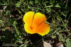
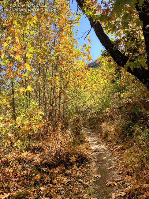
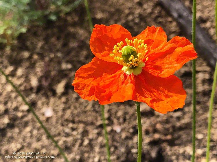
From Boney Peak, I returned to the Backbone Trail and headed west, down the Chamberlain Trail and on to the Danielson Multi-Use area. A few brightly-colored, yellow-orange poppies were already blooming along the trail. The rest of the run was the usual jog up Sycamore Canyon to the Upper Sycamore Trail, and then back to Satwiwa and Wendy Drive.

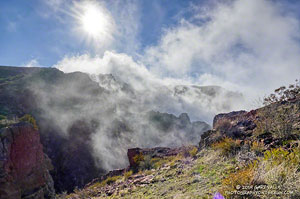
Here’s a 3D Cesium interactive view that shows a GPS track of my route. The view can be zoomed, tilted, rotated, and panned. Placemark and track locations are approximate and subject to errors.

Some related posts: Looking for Boney Mountain, After the Woolsey Fire: Boney Mountain and Pt. Mugu State Park, Boney Mountain’s Western Ridge

Looking for Boney Mountain

The Backbone Trail west of Exchange Peak, in the Boney Mountain Wilderness

If you look at the traditional USGS 7.5 minute Triunfo Pass and Newbury Park topographic maps, BONEY MOUNTAIN refers to the large, mountainous plateau that extends roughly from Peak 2417 on the west; to Peak 2793 on the north; and to Sandstone Peak on the east. However, when people say they are climbing “Boney Mountain,” they are usually referring to a high point north of Tri Peaks, on the northwest corner of the plateau, above Newbury Park. This illustration shows these features.

This high point has an elevation of about 2935′ and is typically reached by ascending the Upper Cabin Trail or Western Ridge route. When climbing to this point, most start at one of the Satwiwa trailheads, such as at Wendy Drive and Potrero Road. The high point is NOT the same as “Boney Peak,” which on recent maps is ascribed to a peak adjacent to Inspiration Point, and has an elevation of about 2825′.

Today’s running adventure ascended the Western Ridge route to point 2935 and then worked over to the Backbone Trail, by way of Tri Peaks. Part of today’s adventure was to investigate a peak near the top of the Chamberlain Trail that is labeled peak 2880 on traditional topo maps, but is labeled “Boney Mountain” on many online, GIS-based maps.

The traditional, hand-crafted USGS 7.5 minute topographic maps were produced from about 1945 to 1992, with map revisions continuing until 2006. These maps are now part of the USGS Historical Topographic Map Collection (HTMC) and still widely used. The intended replacements are the GIS-based “US Topo” maps, first released in 2012. The USGS  topoView application can be used to view historical and current USGS topo maps.

The USGS “US Topo” maps are digitally produced from GIS data. As a result, some features traditionally included in USGS topographic maps — such as trails, landmarks, buildings and recreational features — may not be included. It also appears there have been some issues with geocoding placenames.

The conditions for today’s run were fantastic. Wind-driven clouds condensed along Boney Mountain’s western escarpment, spilling and tumbling over its edge in dramatic fashion.

Clouds spilling over the lip of Boney Mountain's western escarpment.
Clouds spilling over the lip of Boney Mountain’s western escarpment.

As for the other Boney Mountain — Peak 2880 — it was brushy and the rock wasn’t the best, but climbing it did provide some fresh views of the Boney Mountain area. My guess is that the “BONEY MOUNTAIN” label, which described an area on the traditional maps, was treated like a point feature when geocoded. The nearest point happened to be Peak 2880, which speciously became “Boney Mountain.”

In the 2018 edition of the Triunfo Pass US Topo, the Boney Mountain label was moved to Tri Peaks, and the label for Tri Peaks was moved to another, unnamed, peak. In the current online version of the map, the Boney Mountain label and Tri Peaks label are at Tri Peaks. Over time the maps should improve, but until then, I’ll continue to use the traditional 7.5 minute USGS maps, or commercially produced maps that have been field verified.

And what about point 2935 – the high point on the crest that so many people climb? It really deserves a name. Given it overlooks the Danielson Monument and cabin site, maybe something like “Danielson Peak” would be fitting.

Here are a few photos taken on my hike and run.

Some related posts: After the Woolsey Fire: Boney Mountain and Pt. Mugu State Park, An End of Year Boney Mountain Adventure

Fall on the Upper Sycamore Trail

Fall on the Upper Sycamore Trail in Point Mugu State Park

The Upper Sycamore Trail connects Sycamore Canyon Road and Danielson Road in Pt. Mugu State Park.

The scenic single-track trail crosses upper Sycamore Creek several times as it works through the canyon — a canyon cut by the creek along the trace of the Sycamore Fault. About 1.4 miles long, the trail gains approximately 400′ in elevation on it’s way up to Danielson Road.

This morning I’d done part of the Ray Miller 50K course, along with Mugu Peak, and then returned up-canyon on the Two Foxes Trail and Sycamore Canyon Road. With the low sun, the sycamores changing color, and it being just a few days before Thanksgiving, the run through the canyon on the Upper Sycamore Trail was especially enjoyable.

Fire Followers Along the Backbone Trail

Fire poppy (Papaver californicum), a fire follower, along the Backbone Trail west of Sandstone Peak. May 18, 2019.
Fire poppy along the Backbone Trail.

Fire followers are plants that grow in a recently burned area in much larger numbers than before a fire. In some cases the species may rarely have been observed in the area prior to the fire.

A good example of a fire follower is Poodle-dog bush (Eriodictyon parryi), which became widespread in the San Gabriel Mountains following the 2009 Station Fire.

A wet rain season also increases the population of many species. Combine a fire and wet rain season and plant distributions and populations can be dramatically altered.

Large-flowered Phacelia (Phacelia grandiflora), a fire follower, near Tri Peaks. May 18, 2019.
Large-flowered Phacelia near Tri Peaks. Click for larger image.

Yesterday, I did a long run in the Santa Monica Mountains that included several miles of the Backbone Trail between Sandstone Peak and the Danielson Multi-use area in Sycamore Canyon. This area was burned in 2018 Woolsey Fire and there were some stunning displays of fire followers and other wildflowers.

Star lily was one of the earliest fire followers to bloom in the area and remains prevalent, but the champion fire follower at the moment is large-flowered Phacelia. Before the Woolsey Fire it would be unusual to see this plant on this section of the Backbone Trail. Now its purple-blue flowers blanket large areas along the trail.

Although not as numerous as the large-flowered Phacelia, I’ve never seen so many fire poppies along the Backbone Trail. Its orange-red color is striking and stands out sharply against the brown, charcoal-infused soil. Also more abundant this year is the vibrant yellow collarless poppy.

Here is a slideshow of some of the wildflowers seen on the run.

Phacelia and Poppies Along the Old Boney Trail

Parry's Phacelia and California Poppy along the Old Boney Trail in Pt. Mugu State Park.

Hundreds of Parry’s Phacelia and California Poppy wildflowers form a multi-hued carpet of purple and orange along the Old Boney Trail in Pt. Mugu State Park.

From the post Wildflowers, a Waterfall, and Recovering from the Woolsey Fire.

Wildflowers, a Waterfall, and Recovering from the Woolsey Fire

The Chamberlain segment of the Backbone Trail in Pt. Mugu State Park.

The sun had not yet risen and the poppies along Danielson Road were still tightly furled against the morning’s chill. The purl of Upper Sycamore Creek resonated in the canyon below — a wonderful tone that in recent years has too often been squelched by drought.

I was running to the Old Boney Trail and the start of the ridge that follows along Boney Mountain’s western escarpment to the massif’s huge summit plateau. Several of the Santa Monica Mountains highest peaks are on this plateau, including the range’s highest peak, Sandstone Peak.

In December I’d climbed this route to check the impact of the Woolsey Fire on the area. From the top of the ridge I’d been disheartened by what I saw. Tri Peaks and Sandstone Peak and much of the top of the Boney Mountain massif were a blackened, barren mess.

Now, three months later, I was headed back to Boney Mountain and would continue to Sandstone Peak for the first time since the fire.

Here are a few photos taken along the way.

Related post: After the Woolsey Fire: Boney Mountain and Pt. Mugu State Park