Category Archives: pt mugu state park

Looking for Boney Bluff

Boney Bluff from the Backbone Trail

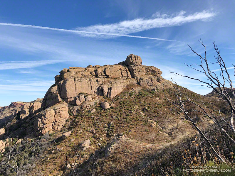
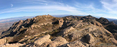
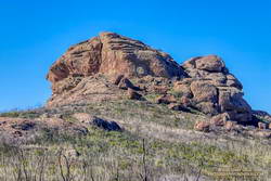
Every time I’ve run the Chamberlain segment of the Backbone Trail, I’ve looked at the intriguing rock formation near the top of the trail and wanted to climb it. Looking a bit like an aircraft carrier that’s run aground on a mountain ridge, it’s one of the most prominent peaks along Boney Mountain’s western escarpment. Named “Boney Bluff” by rock climbers, several sport climbing routes were established on the southeast side of the peak in the early 2000s.

Located just northwest of the junction of the West Tri Peaks Trail and the Backbone Trail, the peak is visible from many points in Pt. Mugu State Park. According to lidar-based 1-meter resolution 3DEP data, its elevation is 2985′, which is slightly higher than the 3DEP elevation of nearby Exchange Peak.

Boney Mountain plateau.
Boney Mountain plateau. Click for larger image.

Boney Bluff is one of many small peaks and rock formations that are found across the Boney Mountain plateau. Comprised of a fused mishmash of volcanic breccia, the rock quality of these formations ranges from very good to quite bad. Seemingly solid handholds or footholds can break, and because of the way the rock erodes, low-angle sections are often littered with granular rocks that can be very slippery.

Boney Bluff from the east.

Having climbed the Western Ridge on Boney Mountain, I approached Boney Bluff from the north, via the Tri Peaks Trail. My route climbed a slope to the east side of the peak, then traversed right to the base of a jumbled face with several oddly eroded ledges. A short, steep crack and grassy ramp provided access to the ledges above. NOTE: There may be a better way to climb the peak. I was trying to do a relatively direct route and avoid bushwhacking. The route is somewhat manky, but worked for me.

Summit block of Boney Bluff
Summit block of Boney Bluff.

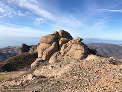
The high point of the peak is on top of a summit block that caps the “island of the carrier.” Many of the formations on Boney Mountain have summit blocks, and these are often the most difficult part of the climb. Rule #1 involving summit blocks: Don’t climb up anything you can’t 100% for sure climb down! This one looked like it might be tricky, but with careful route-finding was pretty straightforward.

Because Boney Bluff is perched on the edge of the Boney Mountain plateau, on a clear day there are outstanding panoramic views of Pt. Mugu State Park and the Boney Mountain area from its summit. Today, the visibility was excellent and Mt. Baldy was visible, 75 miles to the east.

Lidar-based 3DEP Elevation Estimates of Some Boney Mountain Peaks
Lida-based 3DEP elevation contours of Boney Bluff. Click for a larger image.

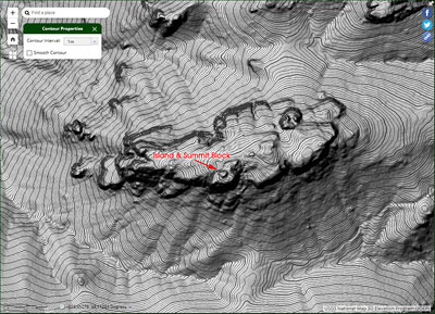
The resolution of the 3DEP Elevation Data is very impressive. While checking the elevation of Boney Bluff, I also noted the 3DEP elevation of several other peaks in the Boney Mountain area. For more info about 3DEP see this U.S.G.S. website.

  • Sandstone Peak 3116′
  • Tri Peaks 3039′
  • Boney Bluff 2985′
  • Boney Crest 2974′ (Accessed via Western Ridge or Cabin Trail)
  • Exchange Peak 2969′
  • Big Dome 2934′
  • Boney Peak 2849′ (Both summits)
  • Inspiration Point 2811′

Some related posts: Looking for Boney Mountain, Looking for Boney Peak

A Windy Run, Walk, Ride, for Wildlife Research

Boney Mountain and Serrano Valley from Overlook Fire Road
Boney Mountain and Serrano Valley from Overlook Fire Road.

The Overlook Fire Road in Pt. Mugu State Park was nearly empty. I’d seen only two hikers between the top of the Fireline Trail and the top of the Wood Canyon Vista Trail. Maybe it was the wind. There had been 20-25 mph wind gusts much of the morning. Along the ridgelines, the gusts were even stronger.

Run, Walk, Ride 2020

I’d picked Pt. Mugu State Park to do a run in support of the Santa Monica Mountains Fund’s Run, Walk, Ride, for Wildlife Research. Many mountain lions have included Pt. Mugu State Park in their home range, including P-1, the patriarch of the mountain lions in the Santa Monica Mountains study.

According to the NPS website, the Santa Monica Mountains National Recreation Area is the world’s largest urban national park. Wildlife in the Park is affected by issues resulting from the proximity of urban and wild areas. Among the problems are poisoning from anticoagulant rodenticides, limited genetic diversity, and vehicular deaths. Only by studying Park wildlife can we better understand and manage these and other issues.

Because water is usually available at several spots in Sycamore Canyon, it’s a great place to do a self-supported ultra-length trail run.

A very windy Pacific and the Ray Miller segment of the Backbone Trail
A very windy Pacific

So far, today’s run had taken me from Wendy Drive in Newbury Park to Serrano Valley via the Old Boney Trail. I’d circled past the old ranch in Serrano Valley and then descended the Serrano Canyon Trail to Sycamore Canyon. A short jog south in Sycamore Canyon put me at the bottom of the Fireline Trail, which I’d followed up to the Overlook fire road.

Next up was a scenic loop in La Jolla Valley. After that, I would work my way back to the Upper Sycamore Trail via Sycamore Canyon. From there, it would only be a few miles back to the Wendy Drive Trailhead.

The Santa Mountain Mountains Trails Council has been hard at work. Even though they can’t currently accept volunteer assistance, it looked like the Old Boney, Serrano Canyon, and Upper Sycamore Trails had been recently maintained.

Some related posts: It’s Raining Mountain Lion Tracks!; Mountain Lion Tracks on Rocky Peak Road; Mountain Lion Saga; Reagan Ranch Bobcat; Hawk, Bobcat and Rabbit

Out and Back Trail Run to Mugu Peak

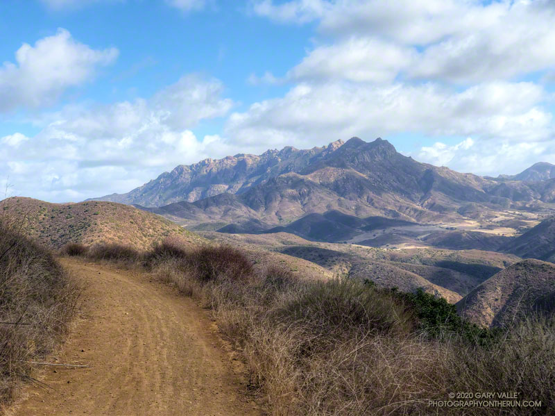
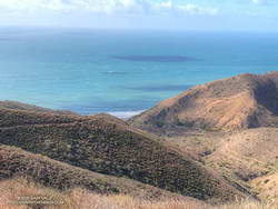
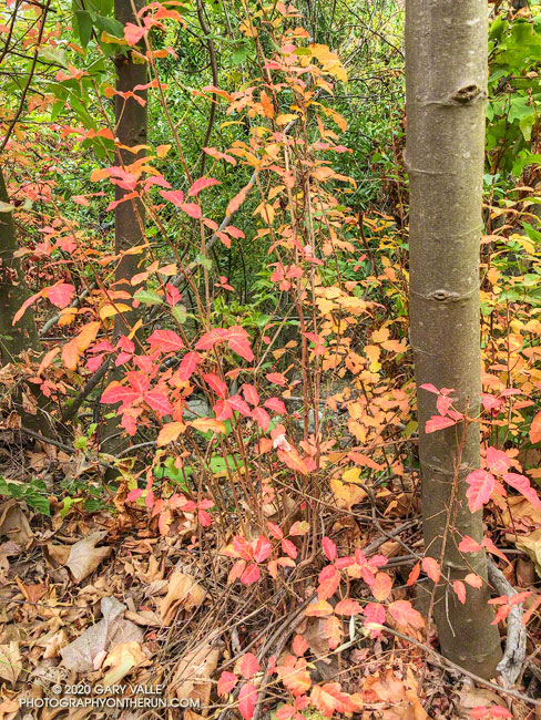
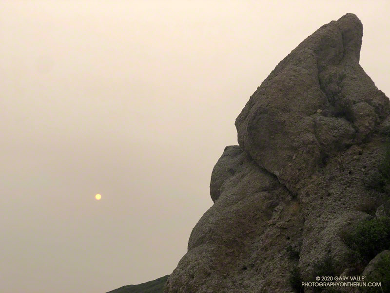
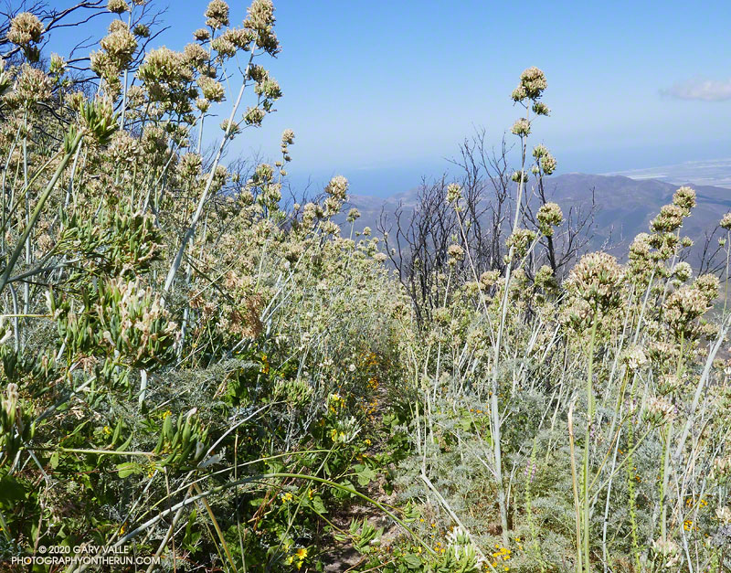
Above are thumbnails of a few photos from a 20-mile out and back trail run to Mugu Peak from the Wendy Drive Trailhead. The run was on October 17, 2020. Click on an image for a larger photo and more information.

There are several ways to get to Mugu Peak from the Wendy Drive Trailhead on Potrero Road. When I do this run I’m usually looking to do a longer, faster-paced run without a huge amount of elevation gain. That translates to running down Big Sycamore Canyon to Wood Ranch Road and then either running up the Backbone Trail or Hell Hill to the “hub,” and from there to La Jolla Valley and Mugu Peak.

Here are archived maps of Rancho Sierra Vista/Satwiwa and Pt. Mugu State Park, originally from the NPS Santa Monica Mountains web site. Also see the Pt. Mugu State Park maps on VenturaCountyTrails.org. Please note that as of October 2020 the lower half of the La Jolla Canyon Trail is still closed.

One of Southern California Edison’s remote weather stations is in Sycamore Canyon, near the Danielson ranch house and multi-use area.

Some related posts: La Jolla Valley & Mugu Peak from Wendy Drive, Wendy Drive – Mugu Peak Challenge, Busy Mugu Peak, Breakaway

Poison Oak Along the Upper Sycamore Trail

reds and yellows of changing poison oak leaves

The soft-hued reds and yellows of these changing poison oak leaves was accentuated by the soft, orange light of a smoky sky.

From Saturday’s adventure run/hike over Boney Mountain to the Backbone Trail in from the Wendy Drive trailhead.

Orange Sun Rising – A Boney Mountain Adventure Run

Smoky view from Boney Mountain's Western Ridge

To the east, the sun rose orange, cast that color by a thick pall of smoke. From the Satwiwa Loop Trail, the view of Boney Mountain were surprisingly clear. As the air pollution sensors in the area had indicated, the air quality appeared to be passable. I hoped it would stay that way for the remainder of the run.

With all the National Forests in California closed through at least September 21, and the smoke from wildfires affecting many areas, I’d been fortunate to find a place where I could get out and stretch my legs.

I was doing a route I had done many times before — a loop incorporating the Western Ridge of Boney Mountain and the Chamberlain segment of the Backbone Trail. I’d last done the loop in June and was curious to see the condition of the Chamberlain Trail and how recovery from the 2018 Woolsey Fire was progressing.

From the top of Peak 2935, it seemed the “smoke front” to the east was slowly creeping closer. The flat, orange light was eerie. Continuing to Tri Peaks, I decided to skip the side trip to Sandstone Peak and followed the west Tri Peaks trail directly to the top of the Chamberlain Trail.

Foot traffic on the Chamberlain Trail had opened it up a bit, but there were still thousands and thousands of stalks of bleeding heart along the trail. The condition of the trail improved somewhat below Chamberlain Rock.

When I’d done the route in June, I’d seen no one until just before the junction of the Chamberlain & Old Boney trails. In June it had been a group of hikers. This time it was another runner, and we exchanged notes about the routes we were doing. Below the junction, I was surprised to find that one of the seeps on the Old Boney Trail was still wet.

After getting some water at the Danielson Multi-Use Area, I continued up Sycamore Canyon, finishing the run on the Upper Sycamore Trail, Danielson Road, and the network of Satwiwa trails.

Here are a few photos taken along the way.

Some related posts: Too Many Flowers on the Chamberlain Trail, Looking for Boney Peak, Looking for Boney Mountain

Too Many Flowers on the Chamberlain Trail

Flower stalks of bleeding heart on the Chamberlain segment of the Backbone Trail

After climbing the western ridge route on Boney Mountain and scrambling over Tri Peaks, I was trying to run down the Chamberlain segment of the Backbone Trail. Usually one of my favorite downhills, the trail was so glutted with the flower stalks of bleeding heart, it made running difficult. Here’s a video snapshot of one short section of trail.

During this second Spring following the Woolsey Fire, bleeding heart has become a predominant fire follower in the Boney Mountain Wilderness. Its rampant growth is reminiscent of the explosion of Poodle-dog bush in the San Gabriel Mountains the second Spring following the 2009 Station Fire.

Plummer's mariposa lily along the Chamberlain segment of the Backbone Trail
Plummer’s mariposa lily

Sticky snapdragon is another fire follower that has become especially prevalent this Spring. It is truly sticky, with rose-purple-colored flowers along a long stalk.

Other wildflowers seen along the way included Humboldt lily, yellow mariposa lily, Plummer’s mariposa lily, slender tarweed, and scarlet larkspur.

Some related posts: Fire Followers Along the Backbone Trail (May 2019); Wildflowers, a Waterfall, and Recovering from the Woolsey Fire (March 2019); Boney Mountain and Pt. Mugu State Park (December 2018)