Category Archives: rocky peak

Caught in a Thunderstorm on Rocky Peak

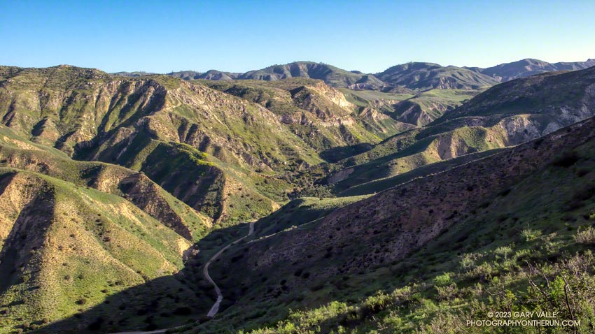
Sun and gathering clouds on Rocky Peak Road before a strong thunderstorm
Sun and gathering clouds on Rocky Peak Road

Rocky Peak Road is an exceptionally popular hiking and biking trail that starts at Santa Susana Pass, on the north side of the 118 Freeway. Regardless of the time of day or weather I ALWAYS see someone on this trail.

The plan for this afternoon’s run was to do an out and back on Rocky Peak Road to the top of the Chumash Trail (3.8 miles) or to Fossil Point (4.8 miles).

Another runner was finishing their workout as I started up the initial steep climb. Glistening in the warm sun, runoff from yesterday’s storm streaked some of the sandstone rocks, and ephemeral streams gurgled in the ravines and gullies.

Thanks to the sandstone geology, the dirt road wasn’t as muddy as most other local trails would be. Although heavily eroded from numerous Winter storms, it was still near the top of my list of places to run during periods of wet weather.

In the aftermath of yesterday’s storm the weather was spectacular. The temperature was warm enough to run in shorts and short-sleeves but still comfortable chugging up Rocky Peak Road’s steep hills. Puffy cumulus clouds filled the sky, creating postcard views at every turn.
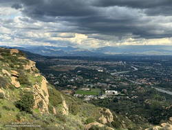
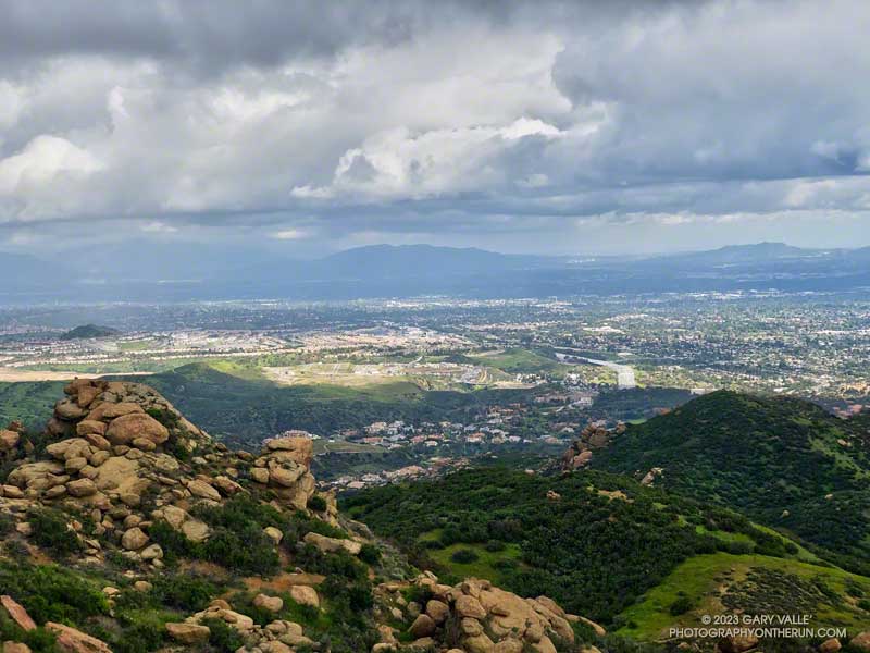
Clouds developing over the San Fernando Valley (thumbnail)
Clouds developing over the San Fernando Valley. Click to enlarge.

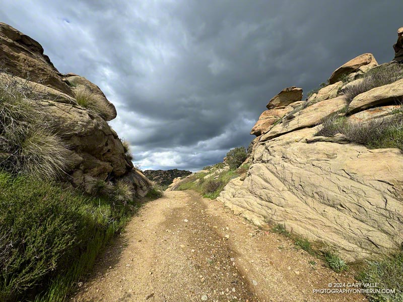
More focused about getting up the hill than any weather concerns, I continued past the top of the Hummingbird Trail and through a gap in the rocks to a section of road with a good view of the San Fernando Valley and San Gabriel Mountains.

I’d been in a situation similar to this several times on Rocky Peak. As a storm moves east from Los Angeles, energy circulating around the low can sometimes result in “back-door” precipitation. In this scenario, clouds build-up over the mountains to the north and then drift over the San Fernando Valley, producing showers — and sometimes — thunderstorms.

But today’s scenario was a bit more complicated. A much larger area, extending east to the San Gabriel Mountains, was rapidly destabilizing. What had been a picturesque sky at the start of the run was now congested and ominous. The question wasn’t so much if it was going to rain, but if a thunderstorm was going to develop.

As I continued up the road, the sky darkened, the temperature cooled, and the wind became more gusty and fitful. A little chilly, I pulled on my arm sleeves. I laughed nervously as I mistook the roar of a passing jet for thunder. That was a jet, right?

When people say they are “doing Rocky Peak,” they are often referring to a high point on Rocky Peak Road that is west of the actual peak and about 2.4 miles from the trailhead. The final climb to this high point is a good one — gaining about 450 feet over three-quarters of a mile.

The road on this stretch is oriented in such a way that the terrain hides the view to the north. I was anxious to get to the top of the hill so I could get a better idea of what the weather was doing. As I worked up the road, I would occasionally feel the cold splash of a raindrop on one leg or the other.
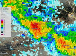
Doppler radar of strong thunderstorm over Rocky Peak (Thumbnail)
Doppler radar of strong thunderstorm over Rocky Peak. Click to enlarge.

Nearing the top, I thought, “I may get wet, but at least there’s been no thunder.” Within seconds of that proclamation, and as I reached the highest point, there was a long, loud, crackling peal of thunder.

One look at the sky and all thoughts of continuing to the Chumash Trail were gone. I turned around and started running down the hill, hoping to avoid the worst of the storm.

First one pea-sized hailstone hit the ground, then another, and then a sleety barrage of rain and hail poured from the sky. Instantly soaked, I shuddered as thunder echoed overhead and cold rain ran down my back. Muddy water flowed in rivulets down the sodden road and I cautioned myself to run fast, but not too fast.

I didn’t expect to outrun the storm, but hoped I might move to a part of it that was less intense. And that’s what happened. As I descended, the deluge gradually diminished. Most of the activity seemed to be behind me and a little to the east.
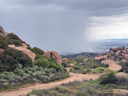
Severe thunderstorm over Porter Ranch - Northridge area (Thumbnail)
Severe thunderstorm moving into the Porter Ranch – Northridge area. Click to enlarge.

By the time I got down to the Hummingbird Trail, it was only sprinkling. The strong cell that had been over Rocky Peak had drifted southeast, and was now over the Porter Ranch – Northridge area.

National Weather Service Doppler Radar tells the story. At the start of the run there were scattered, mostly weak echoes. At 3:06 pm, as I was starting up the last long hill, a cell northwest of Rocky Peak was developing and drifting southeast. Over the next 16 minutes the cell continued to move southeastward and strengthen, and at 3:22 pm was over the Rocky Peak area. I turned around and started down as the cell moved into that area.

The cell over Rocky Peak continued to strengthen, and at 3:39 pm had drifted over the Porter Ranch – Northridge area. At 3:44 pm the NWS issued a Severe Thunderstorm Warning for Western Los Angeles County.

Here are a GOES-18 satellite loop and Doppler Radar loop that show the development and track of the Rocky Peak thunderstorm.

Some related posts:
Rainy Weather Running on Rocky Peak Road
Running Between Raindrops: Chumash Trailhead to Rocky Peak
Thunderstorm

Exploring Las Llajas

Las Llajas Canyon, in the northeast corner of Simi Valley.
Las Llajas Canyon

First published in March 2008.

At times the site of a religious colony, a grit mine, an oil field, and a housing development, Las Llajas Canyon is now part of the Marr Ranch Open Space and Rocky Peak Park. Its oak groves, gurgling stream, varied plants, and unique geology make it a popular place to hike, run or ride.

According to California Place Names, Las Llajas might have originated from a misspelling of the Spanish word “llagas,” which literally means sores or wounds. Perhaps this was a reference to the area’s natural oil seeps. These would have been an important resource for the Chumash and early settlers.

The trailhead for Las Llajas Canyon is on Evening Sky Drive in Simi Valley. From the trailhead, it’s about 3.4 miles up the (mostly) dirt road to a windmill and oak-shaded trail junction. From the junction, a connecting trail crosses the creek and then climbs steeply to Rocky Peak Road. A strenuous 9.2 mile loop — Chumash-Las Llajas Loop — follows this route.

There are also some less-used side trails in Las Llajas Canyon. A use trail on the canyon’s east side starts about 0.4 mile from the trailhead and connects to Rocky Peak Road near the highest point in Rocky Peak Park. A very steep, eroded hill marks the beginning of the route. The trail ends at a large cairn near Rocky Peak Road. Fossiliferous limestone, composed of seashells, is found here. It is similar to that found at Coquina Mine.

The Coquina Mine trail starts about 1.9 mile from the Las LLajas trailhead. It climbs “Tapo Alto Mountain” on the west side of Las Llajas Canyon and appears to follow the route of a dirt road shown in the U.S.G.S. 1941 Santa Susana Quadrangle topo map.

About a half-mile up the trail splits — the Coquina Mine use trail switches back to the right, while a trail connecting to the Marr Ranch Trail continues straight ahead. After the switchback, the Coquina Mine trail traverses across a steep, rocky face that overlooks Las Lajas Canyon and then continues to the top of the peak. As the trail winds up the mountain, there are bits and pieces of rusted mining equipment and abandoned dig sites — signposts of success and failure on the meandering trail of time.

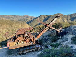
Thumbnail: P&H Model-206 Corduroy Power Shovel. Click for a larger image.
P&H Model-206 Corduroy Power Shovel

At the end of the trail, a few feet from the summit of the peak is a P&H Model-206 Corduroy power shovel. Nearly out of mountain, its bucket is poised to scoop another load of crushed seashell, waiting for its operator to return. Here’s a short video walk around the power shovel.

From P&H Mining Equipment:

“Thank you so much for this extraordinary image of a P&H 206! Our company built Model 206 machines during the 1920s and 1930s. They were offered in shovel configuration, such as the machine you discovered in Southern California, and also in construction crane, dragline, clamshell, pile driver and backhoe options. It is amazing to behold such a well-preserved Model 206. The arid environment must be a factor.”

The 1941 Santa Susana topo map shows two “COQUINA” mines in the area. They are labeled “TAPO COQUINA MINE” and “COQUINA MINE.” The mines are described in the Ventura County section of a 1947 California Journal of Mines and Geology report, “Limestone in California.” From the report:

“During the last 20 years there has been irregular production from deposits of shell limestone on Rancho Simi, north and east of north from Santa Susana. The quarries are on hills 2 1/2 miles apart and 1 to 2 miles from the Los Angeles County line.”

The report goes on to summarize the operation at Coquina Mine:

“In 1929 Tapo Alto Shell & Fertilizer Company leased the deposit and produced limestone until 1935. They dug limestone with a 1/4-cubic-yard gasoline shovel, and screened and crushed it in a plant having a daily capacity of 15 tons. The principal product was poultry grit…”

A more detailed description of the mine’s operation is found in the 1932 REPORT XXVIII OF THE STATE MINERALOGIST:

“Present quarry is 200 feet long by 70 feet wide, with a 40-foot face. Material is handled by gasoline shovel, having a 1/4-yard dipper, into a l 1/2-ton truck which hauls it about 200 feet to the brow of the hill where it is dumped into a chute 300 feet long. This chute empties into a hopper which discharges into the boot of an elevator; to trommel screen, 4-mesh, screenings to bin, thence to elevator and Cottrell vibrating screens ; products to two-compartment bin ; over-size from trommel to rolls and bin. The plant is so arranged that either product can be put on dump by means of a conveyor. Plant is operated by 25-h.p. Fairbanks Morse gas engine. Plant has a daily capacity of about 15 tons. Products are — 8 + 10-mesh for chickens and — 10-mesh for little chicks.”

Some related posts: Chumash-Las Llajas Loop, Not So Flat Las Llajas Canyon

Chumash Rock and Clouds

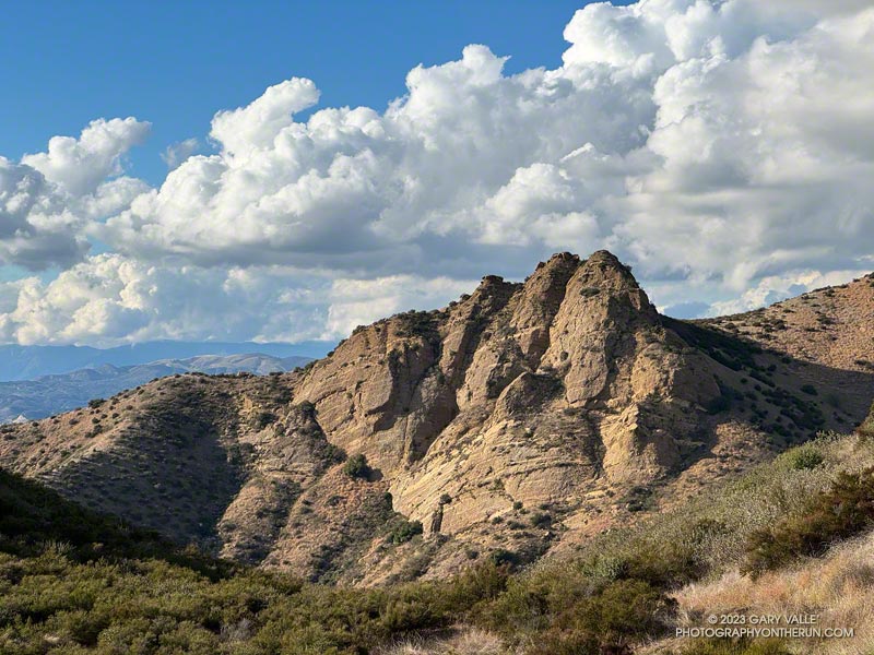
Chumash Rock and Clouds - Photography by Gary Valle'
Chumash Rock and Clouds

“Chumash Rock” is prominent rock formation seen from the Chumash Trail in the eastern Simi Valley.

As I discovered in a January 2006 adventure, it is not an easy rock formation to reach.

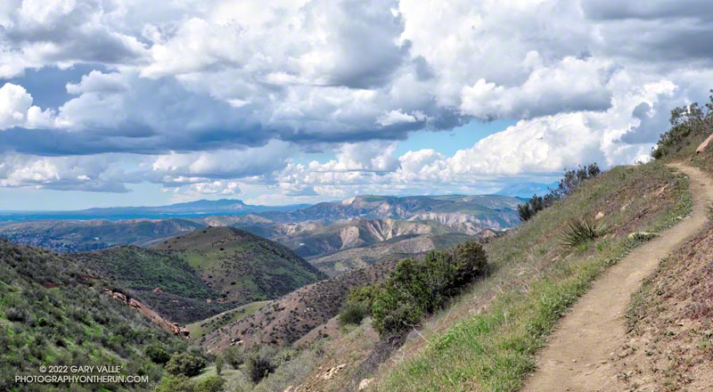
The title photo was taken in mid-November while doing the Chumash – Las Llajas Loop. The clouds over the Ventura County foothills and mountains from the Las Llajas Canyon – Rocky Peak Road connector were just as beautiful.

Yellow Mariposa Lilies Along the Chumash Trail

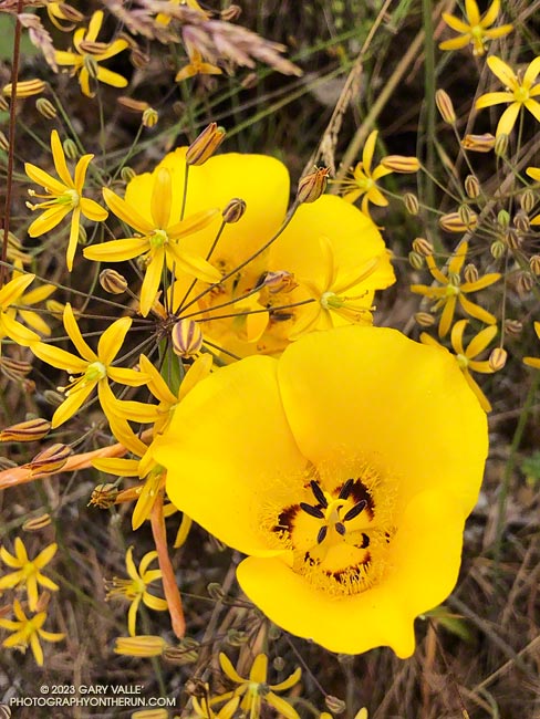
Yellow mariposa lilies along the Chumash Trail in Simi Valley.

The bloom of Yellow Mariposa Lily along the Chumash Trail in Simi Valley has been extraordinary this year. Above, it is pictured with Golden Stars.

Among the multitude of wildflowers blooming along the trail this May were the showy Butterfly Mariposa Lily and intensely blue Parry’s Larkspur.

Relate post: Marr Ranch Wildflowers

Rainy Weather Running on Rocky Peak Road

San Fernando Valley from Rocky Peak Road.

I like splashing through streams as much as anyone does, but today I wanted to try and keep my shoes and socks dry. This Winter that’s been surprisingly hard to do.

Weekdays, I often run from the Victory trailhead at Ahmanson Ranch over to Las Virgenes Canyon and back. But it had rained in the Los Angeles area for four days straight. There was just no question that Ahmanson was going to be wet and muddy, and Las Virgenes Creek would be too wide to jump. I’d have to wade the creek crossings — again.

Paintbrush (Castilleja affinis) along Rocky Peak Road

That’s why this afternoon, I was doing an out-and-back run on Rocky Peak Road from the 118 Frwy trailhead. As a result of the area’s sandstone geology, Rocky Peak Road is usually a pretty good place to run during periods of wet weather. For one thing, there are no creeks to cross. Plus, the rocky and sandy road doesn’t have many areas of “glob on your shoes” mud. It also has excellent views of the San Fernando and Simi Valleys and surrounding mountains.

My turnaround point today was the top of the Chumash Trail, which is a little less than four miles from the Rocky Peak trailhead. I sometimes continue past the Chumash Trail another mile to Fossil Point.

Today, there was one short, muddy stretch that could be mostly avoided and a few large mud puddles I could walk around. At the end of the run I didn’t have to switch shoes to drive home!

Some related posts: A Bear on Rocky Peak Road, Chilly Rocky Peak, Mountain Lion Tracks on Rocky Peak Road, Rocky Peak Vernal Pool

Chumash Trail Out and Back to Rocky Peak Road

A spectacular Spring day on the Chumash Trail in Simi Valley

Originally published June 28, 2008. Updated December 30. 2022.

Without a doubt, the Chumash Trail is one of my favorite short “after work” trail runs. Popular among hikers, mountain bikers, and runners, the Chumash Trail starts on Flanagan Drive in eastern Simi Valley and ascends the convoluted western flank of Rocky Peak Park to Rocky Peak Fire Road. It’s single-track trail all the way, gaining about 1175′ over 2.7 miles.

From a trail runner’s training perspective, it is a nearly ideal short, technical, higher heart rate workout. It has a few tough sections but is generally very runnable. When I’m chugging up the trail, it seems just about the time my heart rate is going to go lactic, the trail will back off or contour. Because I usually run the trail near my aerobic maximum, it’s a great indicator of where I am in my training. Over-training, or any other fitness issue, is usually plainly — and sometimes painfully — evident.

In many ways running down the Chumash Trail is more difficult than running up. It can be very challenging to run down a rocky, technical section of trail with any speed. Running a trail like the Chumash Trail can help develop the skill and strength necessary to do downhills with better technique and more speed.

I don’t think I’ve ever run this trail fresh, but a couple of times a year, when my legs feel good, it’s fun to really push the Chumash Trail up and down. Like most running, there’s a balance — push too hard on the up and there won’t be enough left to push the down.

Here is an interactive, 3D terrain view of the Chumash Trail Out & Back to Rocky Peak Road. The map can be zoomed, tilted, rotated, and panned using the navigation control on the right. Track and placename locations are approximate and subject to errors. Poor weather and other conditions may make this route unsuitable for this activity.

There are several ways to extend the basic out and back. One option is to turn left on Rocky Peak Road and run a mile to “Fossil Point.” Another is to turn right and run 1.6 mile to the Rock Peak overlook.

Some related posts: Chumash Trail Mule Deer, Category Is: Things Found on the Chumash Trail, Chumash Trail Rocks & Snow, Chumash-Las Llajas Loop