Category Archives: trails|san gabriels

Raining Rime

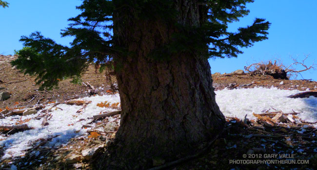
Fallen rime around a white fir

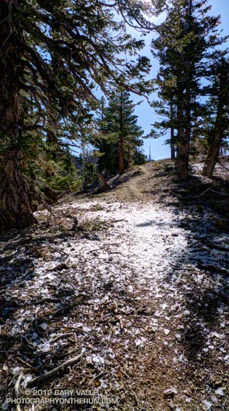
As I ran across the ice my footfalls made a loud crunch, crunch, crunch. Nearby a barrage of rime cascaded from a white fir. Friday’s cold system had rimed the trees along the crest, and now the ice was thawing, shedding from the branches and creating a patchwork of white beneath the trees. The ice wasn’t dense but I still didn’t want a large chunk falling on my head!

The cutoff upper level low that moved into Southern California Friday really cooled things down. The Big Pines RAWS (6917′) recorded an overnight low of 26°F Friday night. It was even colder in the Sierra. A snow sensor at 11,400′ in the Kern River headwaters recorded an overnight low of 12°F. Most of yesterday the temperature at Big Pines was in the 40s.


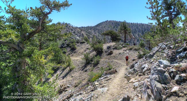
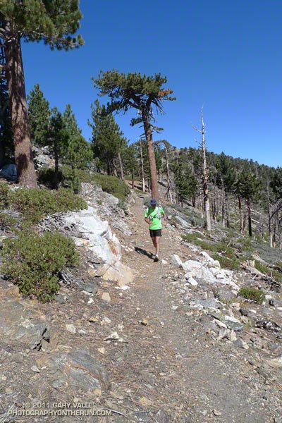
I was running on one of the most scenic segments of trail in the mountains of Southern California — the Pacific Crest Trail between Mt. Hawkins and Mt. Baden-Powell. There are three trail runs I like to do that include this stretch: Inspiration Point to Islip Saddle on the PCT, the Islip Saddle – South Fork – Baden-Powell Loop, and the route I was doing today, the Out and Back to Mt. Baden-Powell from Islip Saddle.

Warmer weather was forecast today, but this morning it had been cool and blustery at Islip Saddle. The temperature in the sun-warmed — but windy — parking lot had been around 43°F. In the shade of Mt. Islip at the start of the run the temperature felt like it was in the 30s. It had taken a while to warm up chugging up the first long hill.

It was the first time this season I’d been on this stretch of trail and I wondered if any well-shaded patches of snow had managed to survive on the north side of the crest near Mt. Baden-Powell. I doubted it. The Mt. Waterman ski area never opened this year, and there had already been several periods of warm weather. There would probably be some remnants of snow on the north side of Mt. Baldy.


It was PCT season. Islip Saddle is at about the 386 mile mark on the Pacific Crest Trail and PCTers hiking the trail from the Mexican border to the Canadian border usually do this section of trail sometime in May. There were a number of PCTers on the trail, including a couple of guys that appeared to be fast-packing the PCT. Their packs looked light, and they were really booking on the downhill west of Mt. Hawkins. (For well done, downloadable PDF maps of the PCT — with notes — check out Halfmile’s Pacific Crest Trail Maps and GPS Information.)

Although chilly at the start, the weather was near perfect for running and I had expected to see at least a couple of groups of runners training for the AC100. There were only about six or seven long run weekends remaining before this hundred miler. I did see one AC100 runner — twice. He was on day two of a three day Memorial Day training stint that would total some 90 miles. Now that is serious training!

After the Station Fire: Wildflowers Along the Gabrielino Trail

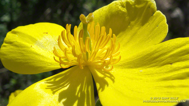
Bush poppy (Dendromecon rigida)

The bright yellow flower above is bush poppy (Dendromecon rigida). A fire follower, it’s blooming extensively in the recovering chaparral along the Gabrielino Trail between Red Box and Switzer Picnic area.

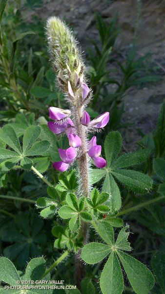
March snow and rain seem to have helped this Spring’s wildflower bloom. Since March 1 the Remote Automated Weather Station (RAWS) at nearby Clear Creek has recorded 6.5 inches of rain and NWS data shows Opids Camp has recorded 6.64 inches of rain. More rain and snow is forecast in the mountains this week.

Here are a few additional wildflower photos from this morning’s run in the Station Fire burn area:


Baby Blue Eyes


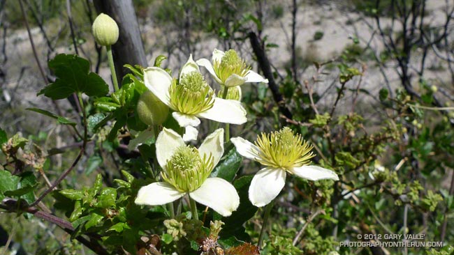
Chaparral Clematis


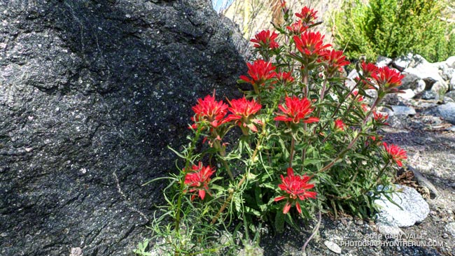
Wavy-leaved Paintbrush

After the Station Fire: Shortcut – West Fork – Newcomb Saddle Loop

Mt. Wilson area peaks from the Silver Moccasin Trail

Did the “back 25K” of the Mt. Disappointment 50K course this morning, plus a couple of bonus miles on the Gabrielino Trail and the bottom of the Kenyon Devore Trail. Like last Sunday’s run, today’s run was in a part of Angeles National Forest that was closed by the 2009 Station Fire and reopened last May.


This loop was part of the Mt. Disappointment 50M course in 2007, 2008 and 2009, and the 50K course in 2010 and 2011. Today I started the loop at Shortcut Saddle, running down the Silver Moccasin Trail to West Fork, then up to Newcomb Saddle, and then completed the loop by returning to Shortcut on Edison Road. In the 50K, the loop starts at West Fork, but the sequence of trails is the same.

Because of increased foot traffic and our dry Winter, last year’s trailwork on the Silver Moccasin Trail held up well. Most of the trail between Shortcut Saddle and West Fork was in great shape and very runnable. There were a couple of trees across the trail, but these were easy to work under, over or around.


The reason for the side trip on the Gabrielino Trail was to check out the bottom of the Kenyon Devore Trail. This section of trail was severely burned in the Station Fire, then overrun by a debris flow and overgrown by Turricula (Poodle-dog bush). The Mt. Disappointment 50K/50M volunteer trailwork group has worked many hours here, as well as on the rest of the Kenyon Devore Trail, the Valley Forge Trail and the Silver Moccasin Trail. The trail had seen a lot of traffic and was in good shape.

As was the case last week, there was still Turricula along the trails and roads, but for the most part it was easy to avoid.

The last time I’d run up Edison Road was last August during the 2011 Mt. Disappointment 50K. Temps were about 25-30 degrees warmer that day. With the cooler weather I actually enjoyed the climb and was able to run more of it. A lot of work was being done on Edison Road and I chuckled as I passed each “No Loitering” sign posted along the road. I hoped I wouldn’t be doing too much of that in the 2012 Mt. Dis 50K.

Los Angeles Basin from the Upper Bear Canyon Trail

Los Angeles Basin from the Upper Bear Canyon Trail

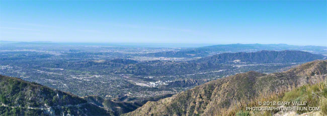
The offshore winds that warmed temperatures on Sunday — setting several high temperature records for the date — also produced spectacular visibility in the Los Angeles area.

Here’s a larger version of the view of the Los Angeles Basin from the Upper Bear Canyon Trail. You can see much of the Greater Los Angeles area, out to Catalina, and all the way to Boney Mountain in Newbury Park.

From Sunday’s loop through Bear Canyon.

After the Station Fire: Red Box – Bear Canyon – Gabrielino Loop Revisited

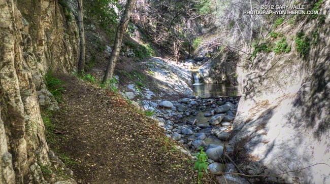
Arroyo Seco downstream of Switzer Falls

Arroyo Seco Downstream of Switzer Falls

By the calendar Spring was still a couple weeks away, but temps near 80 were forecast for the lower elevations of the San Gabriel Mountains and the weather looked ideal for revisiting the Red Box – Bear Canyon – Gabrielino loop in Angeles National Forest. I did this loop last May when the area re-opened following the Station Fire and was curious to see how recovery was progressing, and how much trail use and maintenance had improved the trails.

The difference in 10 months was remarkable. Recovery of the burned areas continues at a steady pace, and trail conditions on much of the loop are not all that different than before the Station Fire. Following are some notes about each segment of the loop.
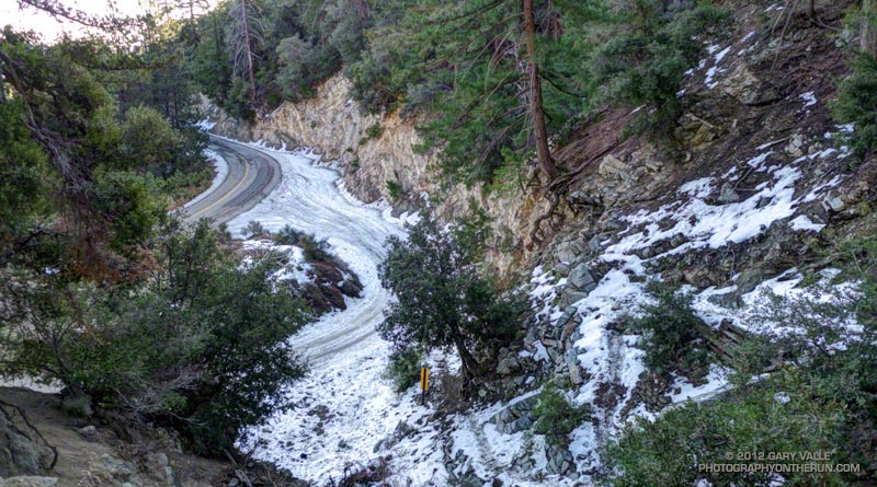


San Gabriel Peak Trail to Mt. Disappointment Road: This trail segment was not burned in the Station Fire and is in good shape. The weather had been much colder earlier in the week and there was still some snow on the trail from a mid-week storm.
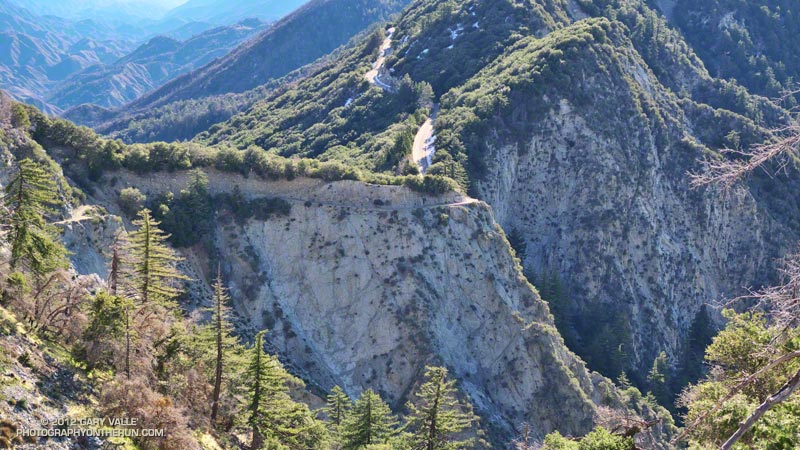


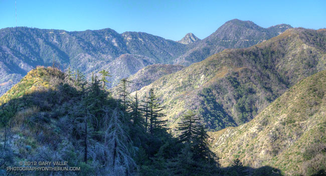
San Gabriel Peak Trail from Mt. Disappointment Road to Mt. Lowe Truck Trail fire road: Thanks to work done by the JPL Trailbuilders this segment was in decent shape last year, and was in even better shape today. It’s rough and rocky in places, and there’s still some Turricula along the trail, but it was very runnable and not unlike it was before the fire. There are excellent views of Mt. Markham, Mt. Lowe, upper Bear Canyon and the rugged terrain along Mt. Lowe Truck Trail fire road.
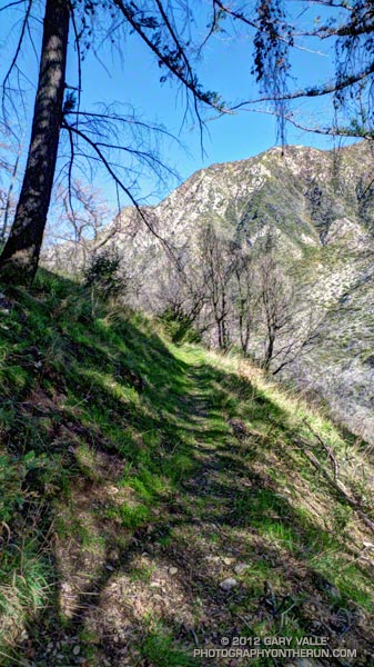


Mt. Lowe Truck Trail fire road to Upper Bear Canyon Trail: Other than some rock fall here and there, there were no particular issues from a trail running point of view. There are good views of San Gabriel Peak, Mt. Disappointment and Bear Canyon.

Upper Bear Canyon Trail from Mt Lowe fire road to Tom Sloan Saddle*: Excellent condition thanks to recent trail work by the Outdoor Club.

Bear Canyon Trail from Tom Sloan Saddle to cabin site: Use of the trail and low Winter precipitation have improved conditions on this trail segment, but some problem sections remain. A short detour off the trail was necessary about a half-mile from Tom Sloan Saddle.
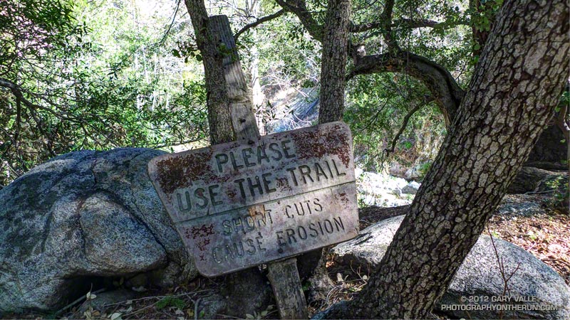


Cabin site to Bear Canyon Camp: Increased use made it easier to follow the use trail and work down the canyon. The collapse of this unburned oak may not have been related to the fire. Bear Canyon Camp is about halfway through the canyon, above the creek on a bench on the left (when descending). The camp is in great shape, and from its shaded sites it would be hard to tell a fire had ravaged the area. At the edge of the camp is an old Forest Service sign, placed by someone with a sardonic wit.
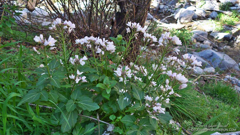


Bear Canyon Camp to confluence with Arroyo Seco: This segment has seen much more use — as I descended the canyon I encountered four groups and two solo hikers working up the canyon. There were a number of ribbons and ducks marking the way and the use trail is becoming better defined. Although some nice sections of the old trail remain, most of the trail in Bear Canyon was washed out well before the Station Fire. As noted by John Robinson in Trails of the Angeles, “…the old Tom Sloan Trail that once traveled the length of the canyon is in poor shape and you must scramble and boulder-hop much of the way.” This is part of the Bear Canyon experience and hopefully the path won’t become so well-marked that all you have to do is blindly follow the markers.
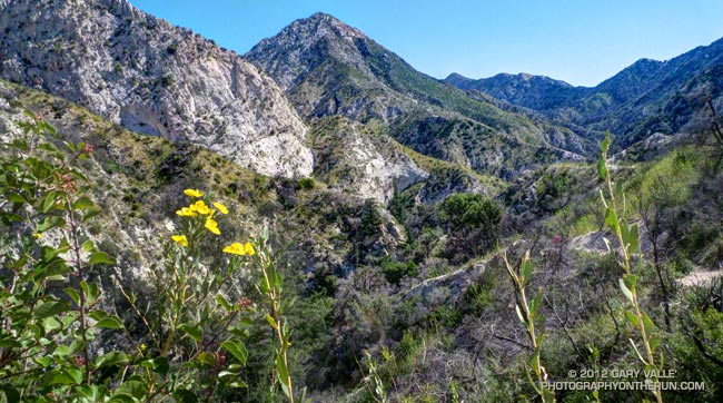


Arroyo Seco to Gabrielino Trail and Switzer Picnic Area: Very well-used. Its condition is similar to what it was before the Station Fire. I was surprised to see two people on mountain bikes descending the steep section of trail that leads to the Arroyo Seco below Switzer Falls, and then downstream Bear Canyon junction and Royal Gorge. I wondered if they had missed the fork onto the Gabrielino Trail. If they were the mountain bikers that were later rescued at the Paul Little debris dam, and didn’t backtrack to the Gabrielino Trail, they would have had a nightmare of a hike-a-bike through trailless Royal Gorge.
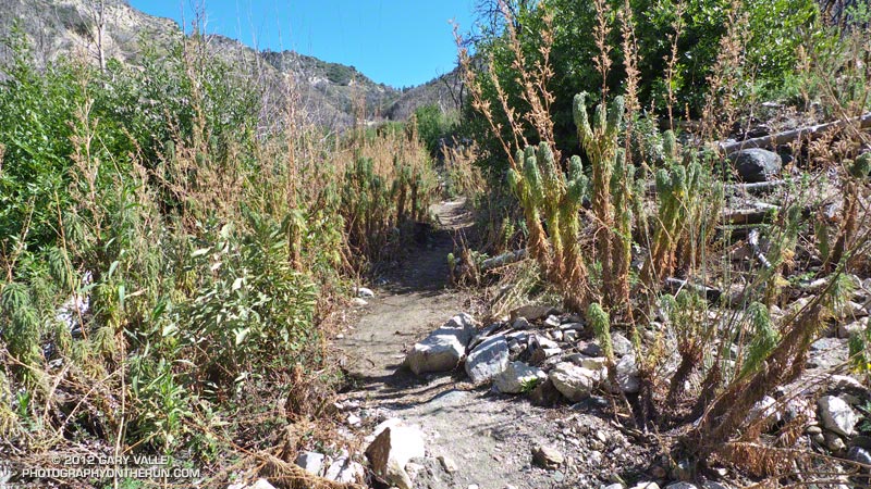


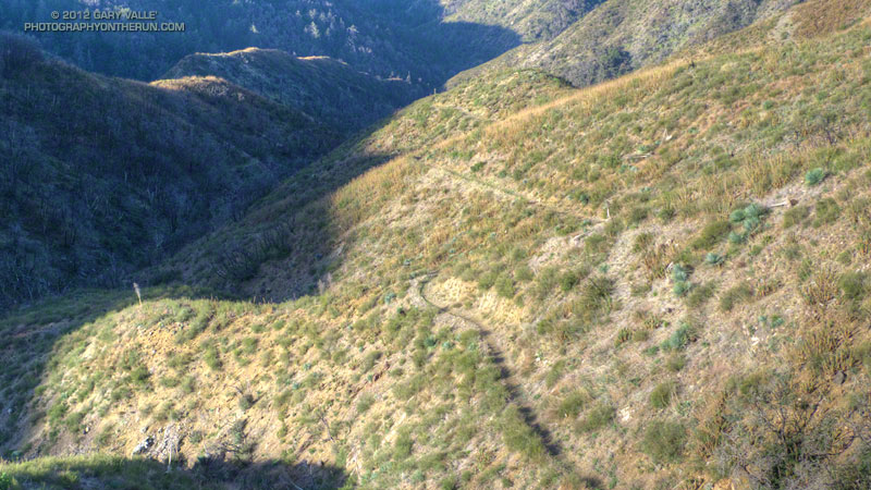
Gabrielino Trail from Switzer Picnic Area to Red Box: Last year the condition of this trail segment was the worst of any trail on the loop. It was washed out in several places. There were downed trees. Some sections were so overgrown it was difficult to follow the trail. In several places I had to literally wade through chest high Turricula. Not so this year. Thanks to the efforts of CORBA and MWBA this trail has nearly been restored to the condition it was in prior to the Station Fire. Other than dealing with the uphills I had no problem running the trail. There’s still a lot of Turricula along the trail, but it is mostly avoidable.

Last year on this loop there was no avoiding the Turricula and I paid the price, its sticky resin coating my arms and legs and resulting in a rash and inflammation. This year I only contracted a couple of small spots of poison oak. This post has more info about Turricula.

There is a long list of volunteer groups that have been working to restore the trails in the Station Fire burn area. Most of the trails in the open areas of the Forest burned in the Station Fire are in fair to good condition, or at least in the same shape they were in before the Station Fire. Some are in better shape than before the fire.

The Forest can be a hazardous place, but there were washouts, rock slides, downed trees, overgrown trails, lost hikers and other incidents BEFORE the Station Fire. Just because an incident occurs in the area burned by the Station Fire doesn’t mean it’s the result of the fire.

Related posts: After the Station Fire: Red Box – Bear Canyon – Gabrielino Loop, After the Station Fire: Ten Miles – Four Peaks

*Tom Sloan appears to be correct spelling, rather than Tom Sloane as printed on some USGS maps. In Trails of the Angeles John Robinson mentions that Tom Sloan Saddle is named after a former district ranger. There’s a quotation from the Arcadia Tribune (1918) on the Forest Lookouts page for Los Angeles County regarding Arcadia Station that refers to “Thomas W. Sloan, chief ranger in the United States Forest Service in this district…”
Inspiration Point to Islip Saddle Trail Run

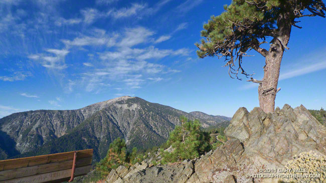
Mt. Baden-Powell from Inspiration Point

The viewpoint above is a few hundred yards up the Pacific Crest Trail from Angeles Crest Highway at Inspiration Point. Craig and I had paused near the start of our trail run from Inspiration Point to Islip Saddle to check out the view. 


The mountain across the way is Mt. Baden-Powell (9,399′).  Three miles away as the bird flies, our earthbound route along Blue Ridge, down to Vincent Gap, and then up the forty-something switchbacks to the top of the peak would total around nine miles. From the top of the peak it would be about eight miles to Islip Saddle.

Zooming in on the peak, the white arrow marks the location of the Wally Waldron Limber Pine. For more than a millennia this grand tree has stood high on this mountain, resisting the strongest of winds and the most perfect of storms. Not all are so durable. A limber pine feet away from the Wally Waldron tree was toppled in a storm last Winter.

Given the short-sleeve weather, the most unexpected discovery on today’s run was ice under the trees just up the ridge from the Wally Waldron tree. The ice had been deposited on the trees a few days before, when an unseasonably strong storm set a new rainfall record for the date in Los Angeles.

The running on the PCT between Mt. Baden-Powell and Islip Saddle was outstanding and the views superb. Along the way we did the short climb to the top of Throop Peak, checked out the Mt. Hawkins Lightning Tree, and enjoyed the cold spring water at Little Jimmy Spring.

Some related posts: Perils of Winter, Surprises of Summer; Wally Waldron Limber Pine; PCT from Inspiration Point to Islip Saddle