Category Archives: trails|san gabriels

Cooper Canyon Cascade & Falls

Cooper Canyon Cascade and Falls

From today’s out and back run from Cloudburst Summit (7018′) to Burkhart Saddle (6959′) in the San Gabriel Mountains, near Los Angeles.

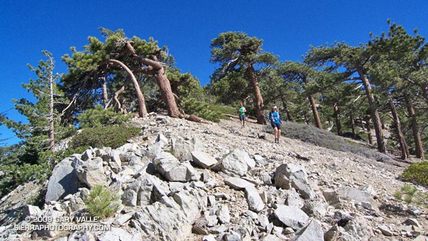
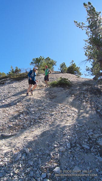
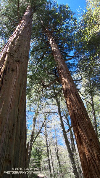
The running was excellent, and except for a few fallen trees the trails were in good shape. Thanks to the runoff from a good Winter’s snowpack there was plenty of water in Little Rock Creek, and even the smaller side streams were flowing. Most of the snow below 7000′ was history, but there was still a lot of white on the north facing slopes at the higher elevations.


Incense Cedars in Cooper Canyon
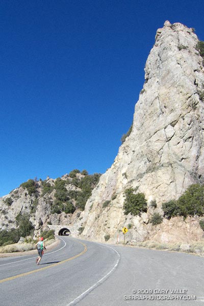
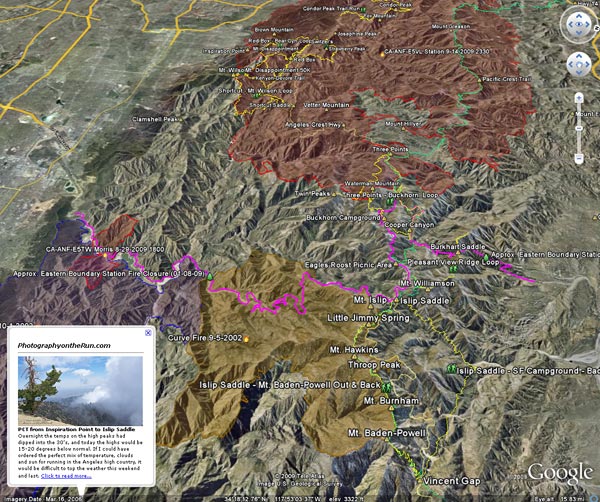
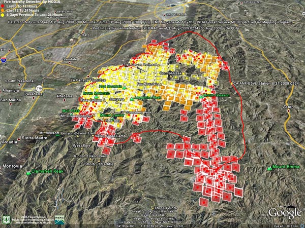
The trailhead for this run is on Highway 2 at the boundary of the area closed by the Station Fire Recovery Order. The run follows the southbound Pacific Crest Trail, and northbound Burkhart Trail, which define the eastern boundary of the closure area north of Highway 2.

Update May 29, 2010. Angeles National Forest has issued Forest Order 01-10-02 redefining the Station Fire closure area. The southbound Pacific Crest Trail, and northbound Burkhart Trail no longer define the boundary. See the Angeles National Forest web site and this May 29, 2010 post for more info.

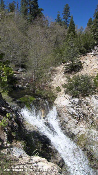
From Cloudburst Summit, the southbound PCT winds down into Cooper Canyon, and eventually joins the Burkhart Trail, just west of Cooper Canyon Falls. In about a quarter-mile, the trail crosses Little Rock Creek. Here, the northbound Burkhart Trail forks left from the (closed) PCT, and continues 3.75 miles to Burkhart Saddle.

Here is a video snapshot of Cooper Canyon Cascade and Falls.

Note: The PCT northbound has been rerouted at Islip Saddle. See the Pacific Crest Trail Association web site for more info. Also, the PCT trail segment between the Burkhart Trail and Eagle’s Roost is within the area closed by the Williamson Rock Closure Order.

Some related posts: Cooper Canyon Falls, Cool Running in Southern California, Pleasant View Ridge Snow

Mountain Solitude

Descending from Pallett Mountain on Pleasant View Ridge, in the San Gabriel Mountains.

It was a little eerie. There wasn’t so much as an animal track or old bootprint on the trail ahead. The path was perfectly smooth, and I felt a bit guilty as my running shoes left their patterned tracks under foot. Lynn, Frank, and I were working up the Pacific Crest Trail on the west side of Mt. Williamson in the San Gabriel Mountains, near Los Angeles. As we switchbacked up the trail, the mountain seemed to sigh, happy to have enjoyed at least a few days of solitude.


Angeles Crest Highway
Closed in early September by the Station Fire, this part of Angeles National Forest did not burn. It reopened in October, but is difficult to access because of the continuing closure of Angeles Crest Highway. To get to this point, we had run from the Antelope Valley side of the mountains. First up the South Fork Trail to Islip Saddle, and then along Angeles Crest Highway, through the tunnels, to the PCT near Kratka Ridge. A steep climb up the PCT put us where we were now — nearing the summit of the usually busy peak.

Of course that was part of the fun of trail running. By the time we reached the summit of Mt. Williamson, we would have gained about 3600′ of elevation, and would be a little more than half way through our 21 mile run. From Williamson’s summit we would head west along Pleasant View Ridge, and then descend the Burkhart Trail to Devil’s Punchbowl. The ups and downs along Pleasant View Ridge, and the “minor” climb out from Cruthers Creek, would add another 1500′ or so of elevation gain.


Big horn sheep track
The run up the rugged South Fork trail had been interesting. Low on the trail we had picked up the blocky hoof prints of what was probably a large bighorn sheep. Intent on the tracks, and telling stories of Tom Brown and the Pine Barrens, we almost didn’t notice two deer hunters hiking up the trail ahead of us. Another mile or two up the trail we heard something large moving through the brush, and were surprised to see  a sizable black bear bounding down a slope. I wondered if it might be the sire of the cubs we had seen on this trail earlier in the year. A little higher still, we found a beautifully colored California mountain kingsnake, warming itself in a patch of morning sun.

Those encounters had been a couple of hours before. Now we were just below Williamson’s summit ridge. Reaching the crest, we ran the few remaining yards to its eastern summit. The visibility was stunning. To the south, we could see the thin ribbons of Catalina Island and San Clemente Island, more than 75 miles distant. To the east, Mt. San Jacinto loomed above the shoulder of Mt. Islip. To the north an indistinct line of white floated above the horizon. Was it the Sierra?


The 3 mile traverse of Pleasant View Ridge between Mt. Williamson and Burkhart Saddle was strenuous, but spectacular. The path along the ridge was also untrodden, and it wasn’t until Pallett Mountain that we noticed the first footprints. From Pallett Mountain the route dropped more than 3000′ — much of it excellent running on the Burkhart Trail. It wasn’t until mile 20, when we turned off the High Desert National Recreation Trail and started the mile descent to the Devil’s Punchbowl parking lot, that we finally encountered another person — a runner, jogging up the hill.

Here’s a Cesium browser View of a GPS trace (yellow) of the point to point route, and an elevation profile generated by SportTracks. Using the High Desert Recreation Trail as a connector (red trace in the Google Earth view), the route could be extended to a loop.

Some related posts: Peaks Along Pleasant View Ridge, Pleasant View Ridge Snow

Interactive Google Earth View of the Area Burned by the Station Fire


Click for an interactive view using Google Earth plug-in.

Update May 29, 2010. Angeles National Forest has issued Forest Order 01-10-02 redefining the Station Fire closure area. See the Angeles National Forest website and this May 29, 2010 post for more info.

Updated October 7, 2009. Added Sheep Fire Perimeter from GEOMAC and the approximate eastern boundary of the Station Fire Closure Area.

Here’s an interactive Cesium browser View of the approximate areas burned by the Station (2009), Sheep (2009), Morris (2009), Curve (2002), and Williams (2002) fires. The Station, Sheep, and Morris fire perimeters are from the GEOMAC website, and the Curve and Williams perimeters are from the CDF/FRAP website.

The magenta line is the approximate eastern boundary of the Station Fire Closure Area as derived from Angeles National Forest Order No. 01-08-09, Exhibit A and Exhibit B. Please refer to the most current Forest Orders and Exhibits for official information. (See note above, this boundary no longer applies.)

GPS traces of some trail runs inside and outside the Station Fire area have been added, along with links to related photos and stories on PhotographyontheRun.com. Click on the green hiker icon to access the link.

The view also includes a partial track of the Pacific Crest Trail (2009 ver. 1) from the Pacific Crest National Scenic Trail website.

Some placenames have also been added –the locations should be considered approximate.

Related post: Station Fire MODIS Fire Detections

The Run Down After the Run to the Top

Runners Descending the Devil's Backbone on Mt. Baldy

Runners Descending the Devil’s Backbone on Mt. Baldy

It’s a lot more fun working with gravity, than against it! For many runners, the run down from the summit of Mt. Baldy is as much a part of the Run to the Top experience as the race up.

Grueling sections of trail are effortlessly retraced, and there is more of an opportunity to enjoy the Devil’s Backbone, and other spectacular sections of trail. Those needing more mileage skip the chair lift ride down from the Notch, and continue down the service road, following the route of the race.

Related post: Mt. Baldy Run to the Top 2009

Mt. Baldy Run to the Top 2009

Finish line of the Mt. Baldy Run to the Top.

The weather for the 44th edition of the Mt. Baldy Run to the Top was nearly identical to last year, with clear blue skies and temps in the 50’s.


Station Fire from Mt. Baldy.
The Station Fire could be seen from the top of Mt. Baldy, but with the wind from the southwest, the smoke was blowing elsewhere.

This challenging mountain run gains about 3800 feet over 7 miles, starting at the bottom of the Mt. Baldy ski lift parking lot and ending on the summit of 10,064′ Mt. Baldy. Here’s a Cesium browser View of a GPS trace of the course.

This year the men’s overall winner was Jonathan Toker in a time of 1:12:11, and the women’s overall winner was Hannah Valenzuela in a time of 1:26:03. For all of the results see the Run to the Top web site. Many thanks to the race organizers, volunteers, USFS, Mt Baldy Ski Lifts and the Mt. Baldy Fire Department for a great race!

Related post: Mt. Baldy Run to the Top 2007

Station Fire MODIS Fire Detections

See links below for most recent image

Also see: Interactive Google Earth View of the Area Burned by the Station Fire.

Updated 09/09/09 11:00 a.m. Added GEOMAC perimeter dated September 9, 2009 2:00 a.m. to MODIS 1km fire detections as of September 9, 2009 at 6:00 a.m. PDT.

These Google Earth images of MODIS 1km fire detections gives a general idea of the extent of Station Fire. Includes most recent fire perimeter available from GEOMAC at the time the graphic was created:

September 9, 2009 at 6:00 a.m. PDT

September 8, 2009 at 6:00 a.m. PDTSeptember 7, 2009 at 4:00 a.m. PDTSeptember 6, 2009 at 6:00 a.m. PDT

September 5, 2009 at 6:00 a.m. PDT – September 4, 2009 at 6:00 a.m. PDTSeptember 3, 2009 at 6:00 a.m. PDT

September 2, 2009 at 7:00 a.m. PDTSeptember 1, 2009 at 6:00 a.m. PDTAugust 31, 2009 at 6:00 a.m. PDT

Fire detection KML files were generated by the USDA Forest Service MODIS Active Fire Mapping Program. Some additional place names have been added — locations are approximate.

PLEASE NOTE THE FOLLOWING IMPORTANT INFORMATION FROM THE KML FILES:

CONUS MODIS 1km Fire Detections

This KML displays the MODIS fire detections at a spatial resolution of 1km for the past 12 hours, 12-24 hours and the previous 6 day period. Each 1km MODIS fire detection is depicted as a point representing the centroid of the 1km pixel where the fire is detected. The 1km footprint of the MODIS pixel for each detection is also displayed.

KML file generated by the USDA Forest Service MODIS Active Fire Mapping Program. Please see //activefiremaps.fs.fed.us for additional fire mapping products and information.

Disclaimer: Although these data have been used by the USDA Forest Service, the USDA Forest Service shall not be held liable for improper or incorrect use of the data described and/or contained herein. The information contained in these data is dynamic and is continually updated. It is the responsibility of the data user to use the data appropriately and consistent within the limitations of geospatial data in general and these data in particular. Using the data for other than their intended purpose may yield inaccurate or misleading results. The USDA Forest Service gives no warranty, expressed or implied, as to the accuracy, reliability, or completeness of these data. Although these data have been processed successfully on a computer system at the USDA Forest Service, no warranty expressed or implied is made regarding the utility of the data on another system or for general or scientific purposes, nor shall the act of distribution constitute any such warranty. This disclaimer applies both to individual use of the data and aggregate use with other data. The USDA Forest Service reserves the right to correct, update or modify this data and related materials without notification.