Category Archives: trails|san gabriels

Mt. Disappointment 50K 2010 Notes

Mt. Disappointment 50K 2010

Note: The Mt. Disappointment Endurance Run is now the Angeles National Forest Trail Race.

The most remarkable thing about this year’s Mt. Disappointment Endurance run is that there was a 2010 race. The Station Fire and heavy Winter rains decimated the San Gabriel Mountains. Without the hard work and dedication of Gary & Pam Hilliard and a host of volunteers the 6th edition of the race never would have happened.


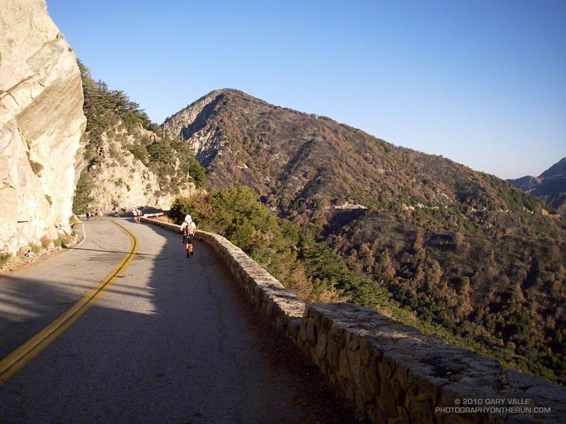
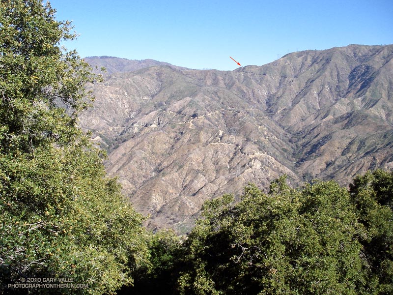
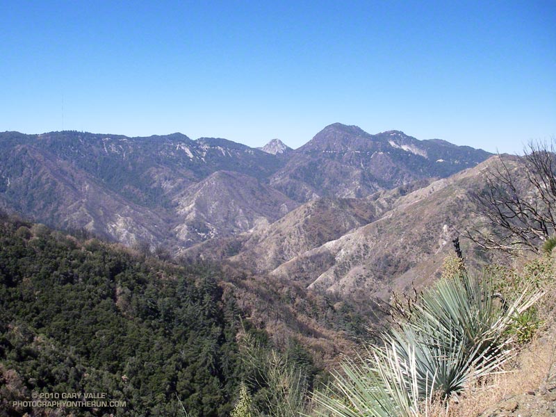
There were some changes in the course. After descending from Mt. Wilson to Red Box, the 50K course normally goes down to Clear Creek Station, circuits Strawberry Peak, and then returns to Red Box. Not this year. The Colby Canyon and Strawberry Trails were particularly hard hit by rock slides and washouts, and could not be used.  Instead, after running down to Red Box, we hung a right and continued down Red Box Road to the West Fork aid station. Usually done after mile 20, it was great to run this segment while it was still cool, and I had some life left in my legs.

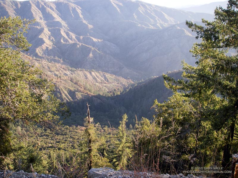
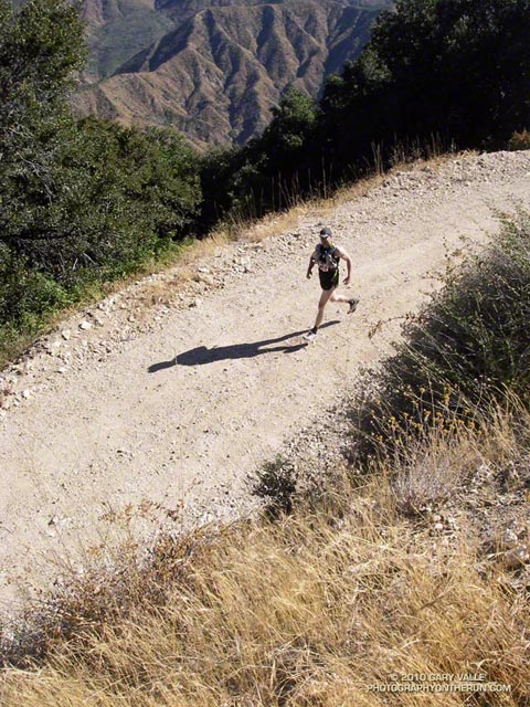
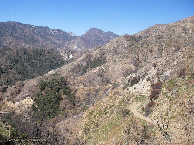
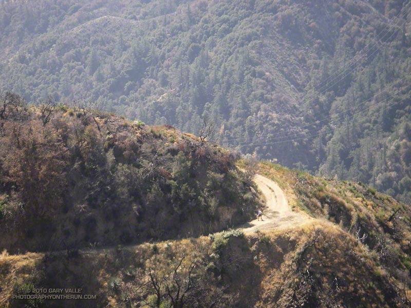
At West Fork, after ten miles of downhill and losing 2600′ in elevation, the infamous 16 mile Shortcut loop begins. Usually part of the Mt. Dis 50 mile course, the Shortcut loop is best known for it’s scorching 5.6 mile, 2000′ climb up Edison Road to Shortcut Saddle. It’s one of those climbs that doesn’t look that bad on paper, but a topo map doesn’t show the sun beating down on your head mile, after mile, after mile. Fortunately, the weather was kind. The high on Mt. Wilson only reached 73 degrees — several degrees cooler than the usual temperature for this race.


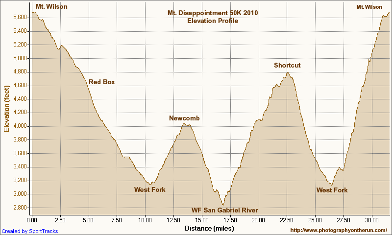
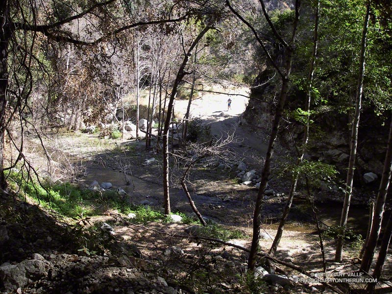
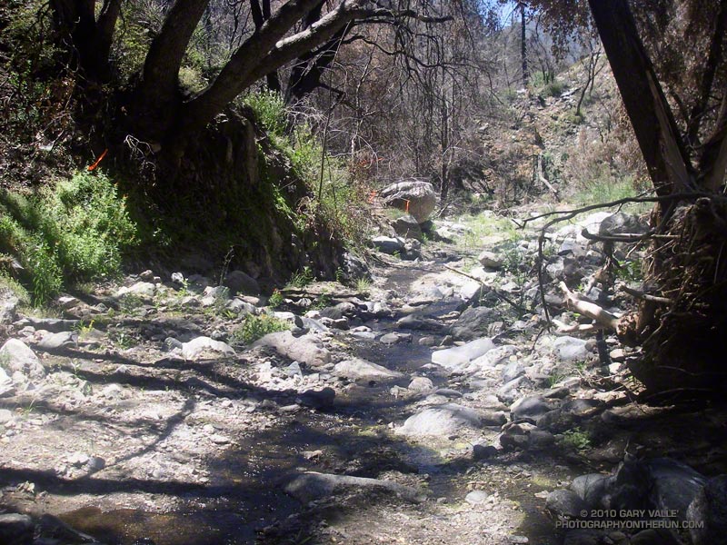
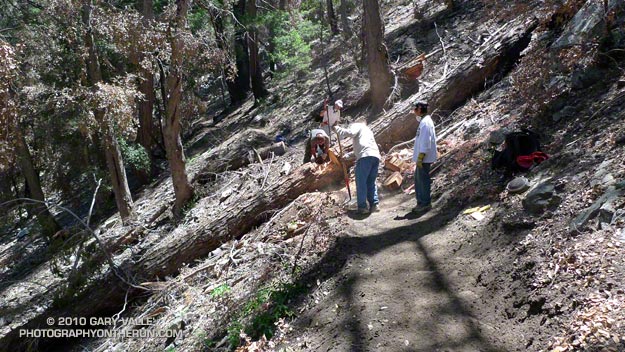
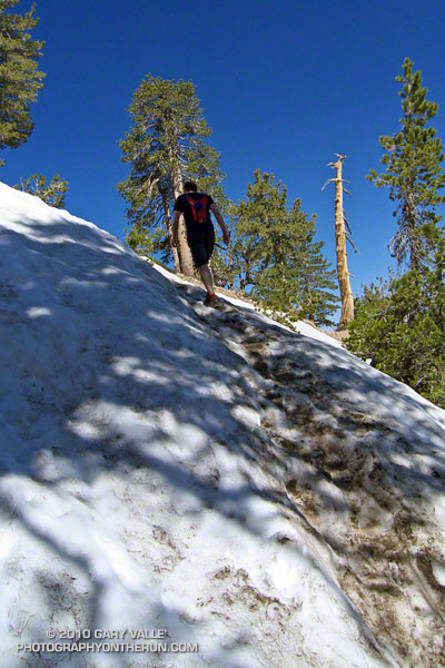
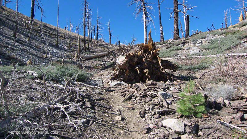
Wow, the Edison climb and the Kenyon Devore climb all in one 50K! But what are two classic climbs without a tough descent in between? The Silver Moccasin Trail between Shortcut and West Fork was obliterated by slides, debris flows and flash flooding. Hours and hours of work were done on the trail to make it passable. In the lower half of the canyon, flooding and debris flows widened the streambed, making it difficult to connect the remnants of old trail into a recognizable path. The challenge wasn’t staying on the course, it was very well marked, but trying to pick the best route through a maze of sand, stream, cobble, and bits and pieces of the old trail.

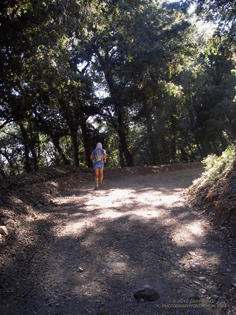
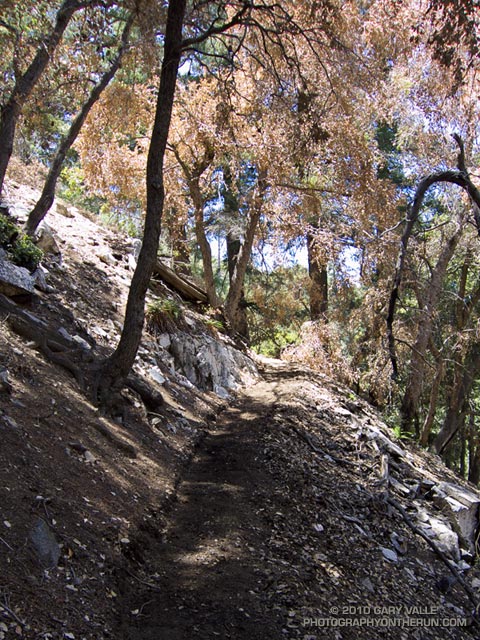
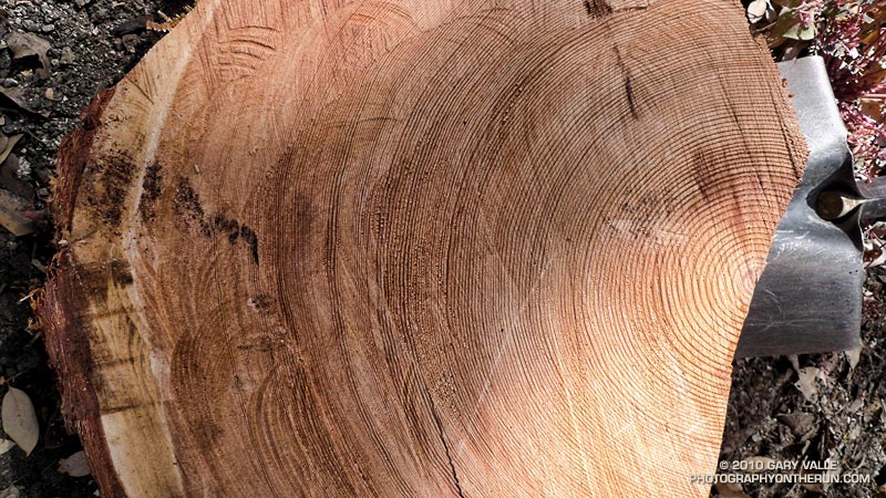
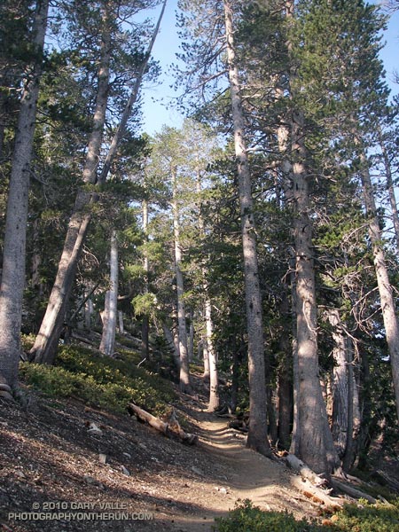
Then came the Kenyon Devore climb.  After doing 10 miles of fast-paced downhill, the Edison climb, and the Silver Moccasin rock dance, the ascent of Kenyon Devore was not easy! But it never is! There were a couple of newly fallen trees to clamber over, and some other challenges, but all-in-all it was the same classic climb.


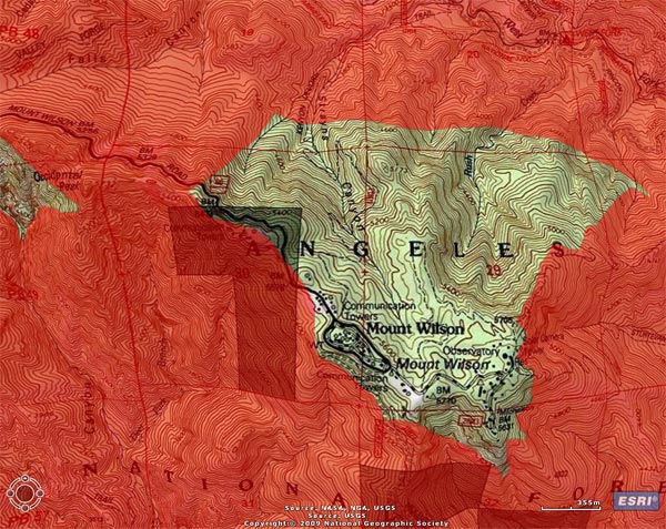
To borrow an old rock climbing quip, an endurance run “ain’t no weenie roast,” and this year the Mt. Disappointment 50K was just a bit  more of a challenge. Here’s an elevation profile, and a Cesium browser View of a GPS trace of the course. In SportTracks my trace of the course worked out to about 31.6 miles. This is a mile or so shorter than the web site mileage because Mueller Tunnel was closed and we skipped the Mt. Disappointment section. The mileages in the Google Earth view are from my trace of the course, and may not be accurate.

Congrats to the overall Men’s and Women’s winners Patrick Sweeny (4:40:46) and Sada Crawford (5:28:17). Patrick ran the race in Vibram Five Finger KSO Trek’s. Check out all the results on the Mt. Disappointment web site!

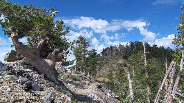
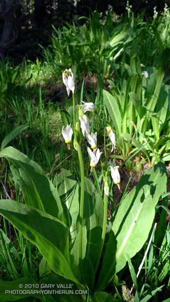
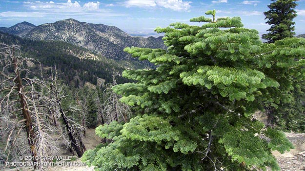
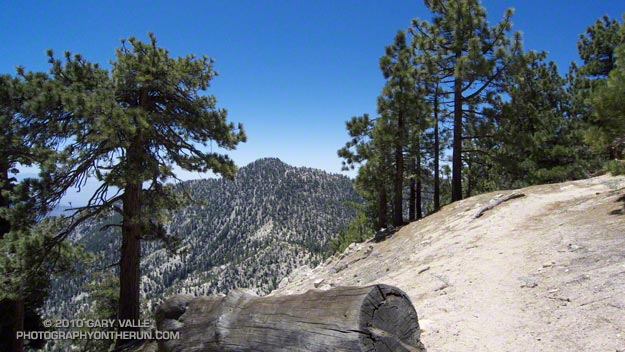
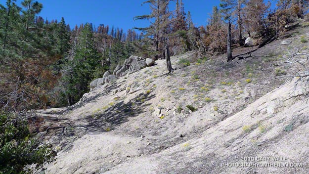
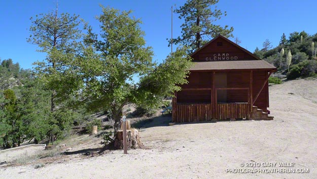
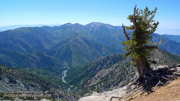
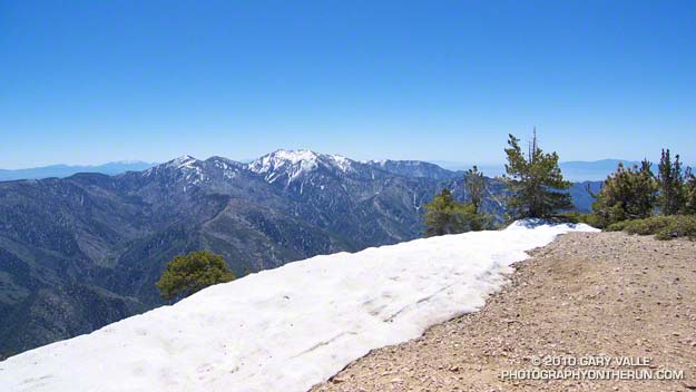
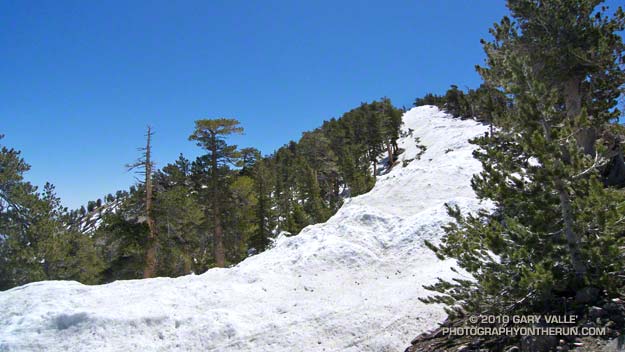
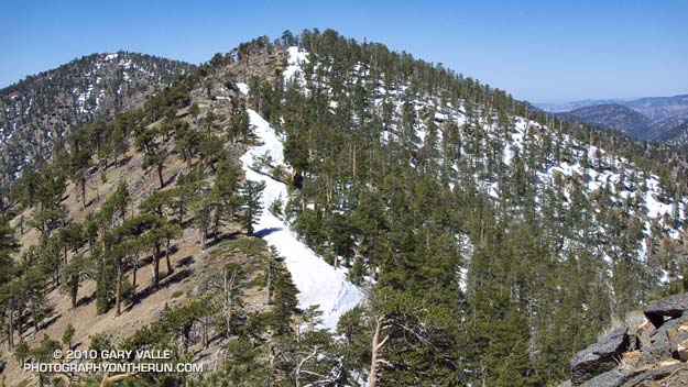
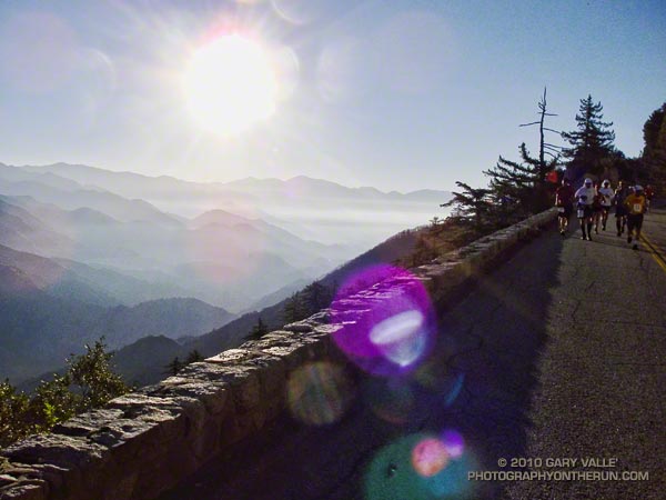
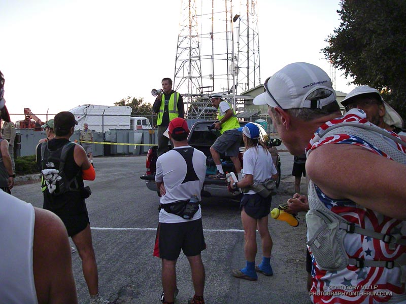
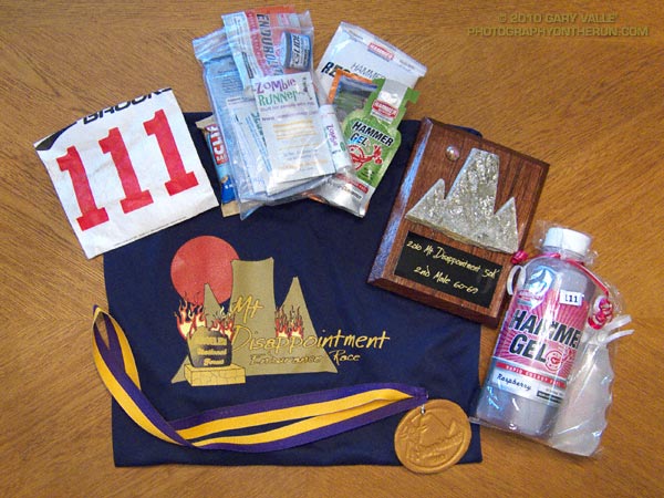
Here are a few photos. Click for a larger image and description:


La Nina Looming

Pacific Crest Trail Near Mt. Burnham

Pacific Crest Trail Near Mt. Burnham, in the San Gabriel Mountains

At an elevation of 9000′ the weather was sensational. Skies were partly cloudy, accentuating the terrain, and hinting of a thunderstorm later in the day. I was on the Pacific Crest Trail between Mt. Burnham and Mt. Baden-Powell, about 8 miles into a 18 mile run in the San Gabriel Mountains.


Remarkably, there was still a small patch of snow along the trail. According to seasonal summaries in Your Guide to Snowfall, the 2009-2010 season in Southern California was the best since the big Winter of 2004-2005. But it wasn’t necessary to check the snow history to know the snowfall had been above average. All that was needed was to look around, and the mountains told the story.

The remnants of snow were only part of the tale. Broken and downed trees told of strong Winter winds, and the stalks of red snow plant of a cool Spring. Now springs flowed freely and once dry seeps were damp and green. Wildflowers bloomed in profusion. Squat bumblebees waddled from flower to flower, and hummingbirds darted from patch to patch of scarlet bugler.


It had been a good Winter. Sugar pines were heavy with pine cones, and new growth decorated the limbs of the white firs. The growth of tree seedlings in the Curve Fire burn area seemed to have accelerated, and the protracted process of forest replacement was underway.

Southern California’s erratic weather demands that plants and trees be opportunistic. In time they have learned that an El Nino Winter is often followed by one that is dry, and La Nina looms.

Three Points to Waterman Mountain, the Long Way

Twin Peaks (East) from the Mt. Waterman Trail

Twin Peaks (East) from the Mt. Waterman Trail

Today was the first chance I had had to run the recently reopened stretch of the Pacific Crest Trail between Three Points and Cloudburst Summit. Originally within the Station Fire closure area, this segment of trail was reopened when the size of the closure area was reduced in late May. In addition to checking this section of the PCT, I also wanted to see the condition of the forest and trail at the current closure boundary near Mt. Waterman.


Pacific Crest Trail about a mile east of Three Points
Between Three Points and Cloudburst Summit, the PCT generally parallels Angeles Crest Highway (Hwy 2), and crosses the highway several times. In general, the burn severity along the trail appeared to match the burn severity depicted in the NASA Ikhana BAER image and Angeles National Forest BAER Station Fire Soil Burn Severity Map. In the first two miles some trees were lost, but much of the forest in the immediate vicinity of the trail did not appear to be severely burned.


That was not the case about a half mile west of Camp Glenwood, where the PCT crosses Hwy 2 and climbs up a hill. Here the burn severity was much higher, and most of the trees were killed. The trail was in good shape and it didn’t take long to get through this section and back into the unburned forest. Remarkably, Camp Glenwood was unscathed.

The remaining 3 miles to Cloudburst Summit were not burned. Some trail work had been done on this stretch, as well as down in Cooper Canyon. As always, the running through Cooper Canyon was superb. At the PCT’s junction with the Burkhart Trail, I turned right and climbed up to Buckhorn Campground, and then followed the camp entrance road up to Hwy 2.  From here it was a short jog west to the Mt. Waterman Trail.

Most of the forest of Jeffrey pine and incense cedar on the east side of Mt. Waterman was outside of the fire area, and it wasn’t until near the junction with trail 10W04, that some damage from the fire could be seen. It looked like spot fires had run up the mountain, burning primarily in the understory. The north face of Twin Peaks, across from Mt. Waterman, appeared to be unaffected by the fire.

It is unclear why the Forest Service chose to define the updated Station Fire closure area (Forest Order No. 01-10-02) so that the trail to Twin Peaks remains closed. Based on the Forest Service’s own BAER report, the burn severity down to Twin Peaks Saddle is generally categorized as low to very low/unburned, and the north face of Twin Peaks is outside of the burn area.

Some related posts: Cooper Canyon Cascade & Falls, Mt. Wilson Area Peaks From Twin Peaks

Trail Work and Tree Rings

Trail work on the Kenyon Devore Trail after the Station Fire.

Last year’s Station Fire, and the Winter storms that followed, combined to damage many miles of trail in the San Gabriel Mountains. Among the volunteers working hard to restore the trails are runners that will doing the Mt. Disappointment 50K and Angeles Crest 100 mile endurance runs later this Summer.

Gary Hilliard, trail maestro and R.D. of the Mt. Disappointment runs, dedicates an astonishing amount of time to the task of preserving trails — encouraging and organizing volunteers, surveying trails, and doing the down and dirty work of maintenance and restoration. If it’s a Summer Saturday, chances are good you’ll find him in Angeles National Forest, working with a group of runners to make a trail better.


Today’s trail was the Kenyon DeVore Trail on the north side of Mt. Wilson. Originally a part of the Rattlesnake Trail, the trail was renamed in tribute to the Forest Service patrolman, hydrographer, and Angeles National Forest volunteer, Kenyon DeVore. The trail is the toughest part of infamous final leg of the Mt. Disappointment 50K and 50 mile courses, climbing about 2300′ in 3.6 miles.

There was plenty to do on the Kenyon DeVore Trail, and Gary divided us into three groups. One group was given the job of restoring a long stretch of trail that had been obliterated by debris flows, and another group was assigned the chore of clearing a rock slide. Our group’s task was removing several trees that had fallen across the trail, and working on the trail along the way.


The largest of the trees blocking the trail was a sizable bigcone Douglas-fir. At the point where it was cut, the diameter of the trunk was about 26″-28″. For its size, the tree was surprisingly old. A rough count of the rings from a contrast enhanced photo gives an approximate age of 310 years. The age was not cross dated, but appeared reasonable when compared to a standard tree ring chronology.

The cut sections of the tree had no obvious fire scars. The CDF/FRAP Fire History Database indicated that, prior to the Station Fire, a large part of the canyon in which the tree was located had no reported fire history.

When we were done, about two-thirds of the Kenyon Devore Trail had been restored. No worries about the other third, Gary has trailwork scheduled most weekends through the end of July.

Father’s Day Out & Back to Mt. Baden-Powell

Snow on the PCT below the summit of Mt. Baden-Powell.

Brett was down for Father’s Day, and today we hiked/ran Mt. Baden-Powell (9399′). Baden-Powell is one of the most popular peaks in the San Gabriel Mountains, and several of my favorite trail runs visit its summit.


Lodgepole pine forest
The trail from Vincent Gap switchbacks up through an old-growth forest of Jeffrey pine, sugar pine, white fir and lodgepole pine. There are some impressive trees. The Wally Waldron Limber Pine, near the summit, is estimated to be 1500 years old, and some limber pines in the area are thought to be even older.

Today, the weather was perfect for pushing the pace. Along the trail fresh green growth could be seen on limb tips of the white firs, and yellow wallflower, red paintbrush, and blue larkspur added a mix of color to the understory.

Not far from the trailhead we had seen fresh Vibram FiveFinger (VFF) tracks headed up the trail, and we were talking about the minimalist shoe. Today Brett was in conventional shoes, but on his home trails about half his runs are in VFFs. He was recounting how the specialists doing a video gait analysis had been blown away when he switched from regular running shoes to VFFs.

I had asked Brett how many miles he had logged on his VFFs, but before he could answer, our conversation was interrupted by a loud shout of “25!” from somewhere on the trail above. A couple of minutes later, and a bit closer, there was another shout of “24!”

Named after the founder of the scouting movement, Mt. Baden-Powell is the culminating point of the scout’s Silver Moccasin Trail. Most summer weekends you’ll find one or more youth groups on their way to the summit of Mt. Baden-Powell. This enthusiastic group was counting down and calling out the 38, 40 or 41 switchbacks (depending on the reference) on the way to the summit.

One of the more interesting hikers on the trail was a hard looking Royal Marine veteran that was thru-hiking the Pacific Crest Trail. Hoping to minimize snow issues on the high Sierra passes, he was a little behind the main wave of PCTers. He had stopped at Lamal Spring to fill some water bottles, and told of hellish temperatures in the desert.


Mt. Baldy from Mt. Baden-Powell
Here the temps had been nowhere near triple digits, but a considerable amount of snow had melted in three weeks since I had last been on the peak. Even so, there were still some large patches of snow on the steep slopes north of the summit, and on the north side of the ridge extending west to to Mt. Burnham.

After topping out, we hiked out along the scenic south ridge of the peak. To the southeast, across the mile deep chasm of Vincent Gulch, some ribbons of snow could still be seen on Mt. Baldy’s north face. After a few minutes we returned to the summit, and began the much easier run down the peak. It was a great way to spend Father’s Day!

Some related posts: Running Hot & Cold, Wally Waldron Limber Pine, Bear Cubs on the South Fork Trail, PCT from Inspiration Point to Islip Saddle

Running Hot & Cold

Mt. Baldy from the summit of Mt. Baden-Powell

Mt. Baldy fron the summit of Mt. Baden-Powell

Yesterday, Woodland Hills topped the 90° mark for the first time this year. But somebody forgot to tell the local mountains about the warmup. This morning, I was about a mile into an out and back trail run from Islip Saddle to Mt. Baden-Powell, and with the wind chill, it felt like the temp was in the 40’s.

It was chilly in running shorts, and I debated pulling some warmer clothes from the pack. In addition to a short-sleeve shirt, I did have on a pair of pull-on long sleeves. For the moment that seemed to be enough. Rounding a corner, the trail leveled, and up ahead I could see a hiker headed my way. Based on the time, I figured he was descending from Little Jimmy Campground. We exchanged greetings, and as we passed, he commented, “you know there’s a lot of snow on the trail.”


Snow on the crest near Mt. Baden-Powell
This Spring the weather in California has been dominated by a series of cool troughs, slowing the snow melt and in some cases adding to it. It its May 27th Summary of Snow Water Content, California Cooperative Snow Surveys reported the statewide snowpack at nearly twice the normal amount for the date. Squaw Valley reopened for Memorial Day weekend; and with over 100 inches of snow since April 1, Mammoth Mountain plans to operate through July 4.

On the shaded, north facing slopes of Mt. Islip there was more snow than I’d seen since the Spring of 2005.  It couldn’t be avoided. However, the route was well-traveled, and where there was snow, dirt-covered steps eased the way. I had picked up a short length of downed fir, and it worked OK as a crude ice axe, or if you prefer, a stubby trekking pole. It enabled me to move a little faster, and had the added benefit of keeping my upslope hand out of the snow.


Seedling Jeffrey Pine in ghost forest
It didn’t take long to reach Windy Gap (7588′), and soon I was working up the trail to the gap above Windy Gap. Here the trail winds through a ghost forest of old growth trees, burned in the 2002 Curve Fire. Recovery has been slow, and it was heartening to see a young Jeffrey pine in the midst of all the deadwood. It also gave me a sobering perspective of the time that was going to be required for the recovery of the forests decimated by the Station Fire.

The trail climbs up to the crest of the San Gabriels near peak 8426, about a mile east of Windy Gap. From here it more or less follows the prominent divide all the way to Mt. Baden-Powell (9,399′). It’s the “more or less” part that’s key in a snowy year. The shaded north side of the divide may be completely snowbound, while the crest and south side are snow free. The way the ridgeline is oriented, storm winds create deep bands of snow along and just north of the crest. In places the trail can be buried in several feet of snow.


Snow on the crest east of Mt. Burnham
On the east side of Mt. Hawkins I checked out a tree that had been struck by lightning, and then continued along the ridge. The wind was little more than a breeze now, and the temperature comfortable. I pulled off my running sleeves, and then followed the trail across the warm, south facing slopes of Throop Peak. Sometimes on the trail, and sometimes on the crest, I descended to a saddle and then climbed up and over Mt. Burnham (8997′).

On the summit of Mt. Baden-Powell there was almost no wind. The sun was warm and the air clear. Across Vincent Gulch Mt. Baldy gleamed alpine white, its summit ridges still heavy with corniced snow. Many miles to the east, snow could also be seen on San Gorgonio Mountain, and Mt. San Jacinto. A Clark’s nutcracker complained raucously from the top of a Lodgepole Pine, and I assured the bird that I would be leaving the summit soon.

Some related posts: San Gabriels High Five, Islip Saddle – Mt. Baden-Powell Out & Back