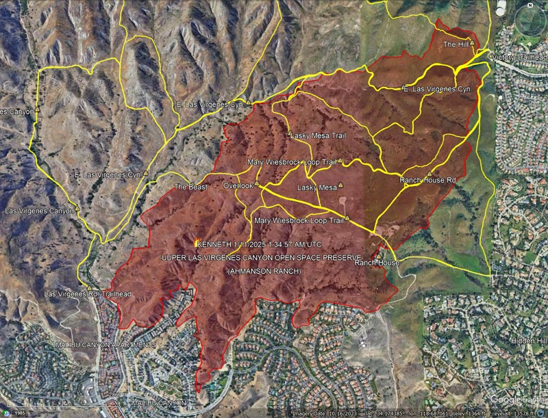
According to the CAL FIRE Kenneth Fire Incident Page, the fire burned 1,052 acres, and was contained on January 12, 2025. The Kenneth Fire is the third significant fire to affect this area in the last 20 years — the other two being the 2005 Topanga Fire and 2018 Woolsey Fire.
At about the time the fire started, a personal weather station near the Victory Trailhead recorded the wind from the ENE at about 11 mph, gusting to 22 mph. At this station, the wind moderated somewhat over the course of the afternoon and early evening, but picked back up overnight.
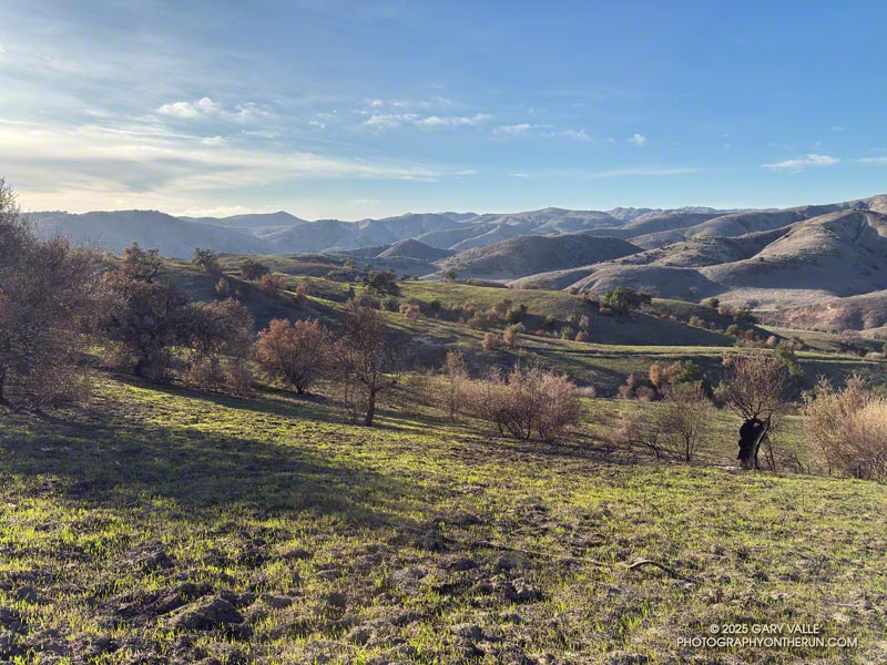
The vegetation within the burn area is oak savanna — a plant community characterized by grassland and scattered oaks. In the case of Ahmanson Ranch the oaks are valley oaks and coast live oaks. The last known blue oak in the Preserve died in the Winter of 2022-23.
Taking into account their respective populations, the percentage of valley oaks destroyed by the Kenneth Fire far exceeded the percentage of coast live oaks. As the climate has warmed, the mortality rate of valley oaks in the southern part of their range has been increasing and their range retreating northward.
Although the wind was not as strong as it was on January 7-8, it was exceptionally dry. Prior to January 2025, Downtown Los Angeles only recorded 0.16 inch or rain for the Rain Year starting July 1 and Water Year beginning October 1. As of January 9, the period July 1, 2024 to January 9, 2025 was tied with 1962-63 as the driest on record.
The information in this post may be incorrect or out of date. For official information, see the Kenneth Fire incident page on the CAL FIRE website. The perimeter is from the Wildland Fire Interagency Geospatial Services (WFIGS) Group and National Interagency Fire Center (NIFC) website. The perimeter shown has a poly_DateCurrent of 1/11/2025 1:34:57 AM UTC.
The Kenneth Fire started Thursday afternoon, January 9, 2025, near the Victory Trailhead of Upper Las Virgenes Canyon Open Space Preserve (Ahmanson Ranch).
The last time Downtown Los Angeles had more than a smattering of rain was mid-April 2024 — more than 250 days ago. To date, the Rain Year beginning July 1, 2024 has been one of the two driest in the 147+ year weather record for Downtown Los Angeles.
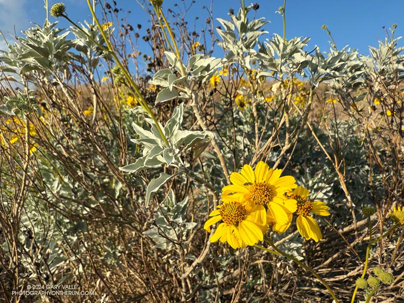
Because of the time of year, and lack of rain, not many wildflowers were blooming along Los Angeles area trails at the end of 2024. One exception was this brittlebush (Encelia farinosa) on the southwest corner of Lasky Mesa in Ahmanson Ranch.
If Los Angeles doesn’t see any rain by January 9 — which appears likely — the period July 1, 2024 to January 9, 2025 will be tied with 1962-63 for the driest on record.
At times the site of a religious colony, a grit mine, an oil field, and a housing development, Las Llajas Canyon is now part of the Marr Ranch Open Space and Rocky Peak Park. Its oak groves, gurgling stream, varied plants, and unique geology make it a popular place to hike, run or ride.
According to California Place Names, Las Llajas might have originated from a misspelling of the Spanish word “llagas,” which literally means sores or wounds. Perhaps this was a reference to the area’s natural oil seeps. These would have been an important resource for the Chumash and early settlers.
The trailhead for Las Llajas Canyon is on Evening Sky Drive in Simi Valley. From the trailhead, it’s about 3.4 miles up the (mostly) dirt road to a windmill and oak-shaded trail junction. From the junction, a connecting trail crosses the creek and then climbs steeply to Rocky Peak Road. A strenuous 9.2 mile loop — Chumash-Las Llajas Loop — follows this route.
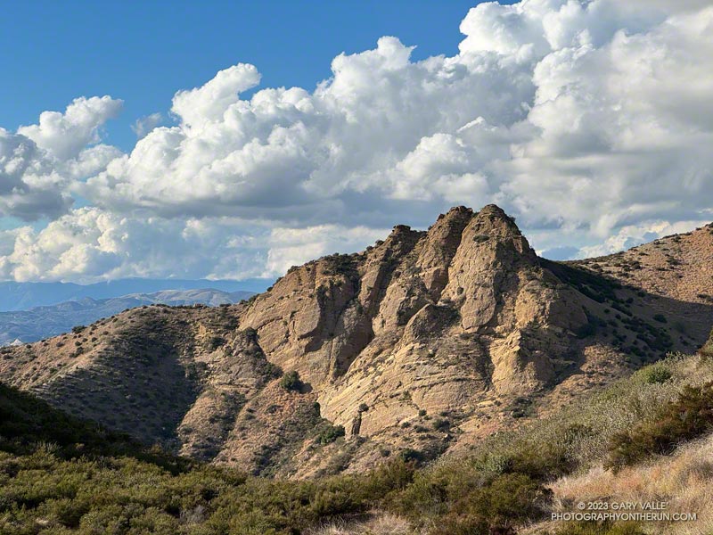
There are also some less-used side trails in Las Llajas Canyon. A use trail on the canyon’s east side starts about 0.4 mile from the trailhead and connects to Rocky Peak Road near the highest point in Rocky Peak Park. A very steep, eroded hill marks the beginning of the route. The trail ends at a large cairn near Rocky Peak Road. Fossiliferous limestone, composed of seashells, is found here. It is similar to that found at Coquina Mine.
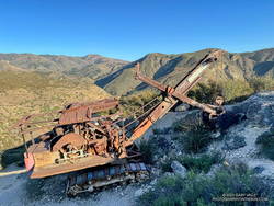
About a half-mile up the trail splits — the Coquina Mine use trail switches back to the right, while a trail connecting to the Marr Ranch Trail continues straight ahead. After the switchback, the Coquina Mine trail traverses across a steep, rocky face that overlooks Las Lajas Canyon and then continues to the top of the peak. As the trail winds up the mountain, there are bits and pieces of rusted mining equipment and abandoned dig sites — signposts of success and failure on the meandering trail of time.
“Thank you so much for this extraordinary image of a P&H 206! Our company built Model 206 machines during the 1920s and 1930s. They were offered in shovel configuration, such as the machine you discovered in Southern California, and also in construction crane, dragline, clamshell, pile driver and backhoe options. It is amazing to behold such a well-preserved Model 206. The arid environment must be a factor.”
“During the last 20 years there has been irregular production from deposits of shell limestone on Rancho Simi, north and east of north from Santa Susana. The quarries are on hills 2 1/2 miles apart and 1 to 2 miles from the Los Angeles County line.”
The report goes on to summarize the operation at Coquina Mine:
“In 1929 Tapo Alto Shell & Fertilizer Company leased the deposit and produced limestone until 1935. They dug limestone with a 1/4-cubic-yard gasoline shovel, and screened and crushed it in a plant having a daily capacity of 15 tons. The principal product was poultry grit…”
“Present quarry is 200 feet long by 70 feet wide, with a 40-foot face. Material is handled by gasoline shovel, having a 1/4-yard dipper, into a l 1/2-ton truck which hauls it about 200 feet to the brow of the hill where it is dumped into a chute 300 feet long. This chute empties into a hopper which discharges into the boot of an elevator; to trommel screen, 4-mesh, screenings to bin, thence to elevator and Cottrell vibrating screens ; products to two-compartment bin ; over-size from trommel to rolls and bin. The plant is so arranged that either product can be put on dump by means of a conveyor. Plant is operated by 25-h.p. Fairbanks Morse gas engine. Plant has a daily capacity of about 15 tons. Products are — 8 + 10-mesh for chickens and — 10-mesh for little chicks.”
Originally published June 28, 2008. Updated December 30. 2022.
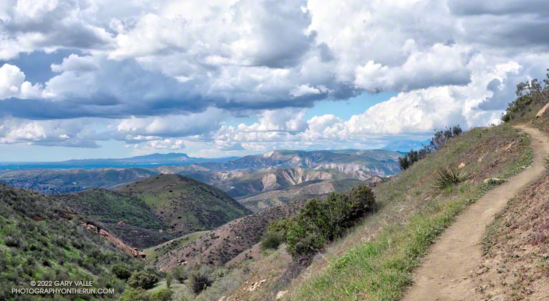
Without a doubt, the Chumash Trail is one of my favorite short “after work” trail runs. Popular among hikers, mountain bikers, and runners, the Chumash Trail starts on Flanagan Drive in eastern Simi Valley and ascends the convoluted western flank of Rocky Peak Park to Rocky Peak Fire Road. It’s single-track trail all the way, gaining about 1175′ over 2.7 miles.
From a trail runner’s training perspective, it is a nearly ideal short, technical, higher heart rate workout. It has a few tough sections but is generally very runnable. When I’m chugging up the trail, it seems just about the time my heart rate is going to go lactic, the trail will back off or contour. Because I usually run the trail near my aerobic maximum, it’s a great indicator of where I am in my training. Over-training, or any other fitness issue, is usually plainly — and sometimes painfully — evident.
In many ways running down the Chumash Trail is more difficult than running up. It can be very challenging to run down a rocky, technical section of trail with any speed. Running a trail like the Chumash Trail can help develop the skill and strength necessary to do downhills with better technique and more speed.
I don’t think I’ve ever run this trail fresh, but a couple of times a year, when my legs feel good, it’s fun to really push the Chumash Trail up and down. Like most running, there’s a balance — push too hard on the up and there won’t be enough left to push the down.
Here is an interactive, 3D terrain view of the Chumash Trail Out & Back to Rocky Peak Road. The map can be zoomed, tilted, rotated, and panned using the navigation control on the right. Track and placename locations are approximate and subject to errors. Poor weather and other conditions may make this route unsuitable for this activity.
There are several ways to extend the basic out and back. One option is to turn left on Rocky Peak Road and run a mile to “Fossil Point.” Another is to turn right and run 1.6 mile to the Rock Peak overlook.