Downtown Los Angeles (USC) ended the Rain Year (July 1, 2021 – June 30, 2022) with 12.40 inches of rain. This is about 87% of the 1991-2020 Climate Normal of 14.25 inches.
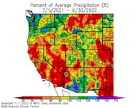
Percent of Average Precipitation Western U.S. July 1, 2021 to June 30, 2022.
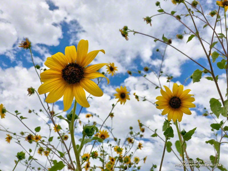
In part because of large amount of rainfall during December — nearly 9.5 inches at Los Angeles — and the meager amount of rain the previous year, the area’s vegetation responded as if there had been above average rainfall. Wildflowers bloomed in abundance and some trails became overgrown.
Looking at the broader picture, much of California, Nevada and western Arizona recorded below average precipitation, exacerbating water supply issues in the Southwest.
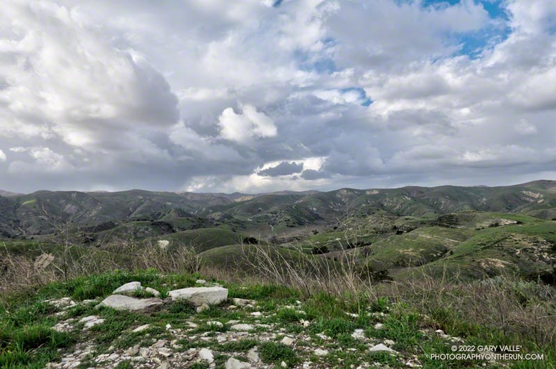
Yep, that was a rumble of thunder. It was a blustery, Spring-like afternoon and a storm cell had developed a few miles to the WNW of Lasky Mesa.
Before driving over to Ahmanson I’d checked the weather radar and seen cells circulating counterclockwise around a cold upper level low. Most were dissipating as they moved north to south, out over the Valley. The wildcard was that the upper low was moving southward, and the cells might strengthen.
Storm cell WNW of Lasky Mesa.
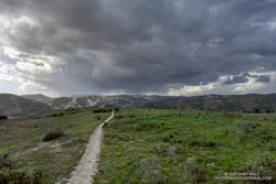
Again there was a low rumble. The cell didn’t seem any closer, but now I could see additional development to the north and northeast of Ahmanson. I picked up the pace.
There’s nothing like the threat and energy of a thunderstorm to incentivize a runner. All the way back to the trailhead it looked like heck might break loose at any moment.
But it didn’t. It was just starting to rain when I got back to the car, and on the way home the streets were wet. The Cheeseboro RAWS recorded 0.06 inch of rain, as did Downtown Los Angeles (USC).
Even though the Rain and Water Year rainfall totals for Los Angeles are about normal for the date, January and February have seen little rain. Precipitation records for Los Angeles indicate the period January 1 to February 28 will be the fourth driest on record.
The precipitation outlooks for Southern California this March don’t look especially promising, with a typical La Nina precipitation pattern expected for the West Coast.
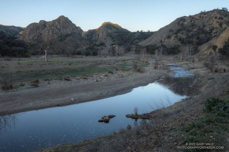
Malibu Creek and Goat Buttes before sunrise. February 6, 2022.
If you’ve done the Bulldog Loop since the first of the year, you’ve no doubt noticed there’s water in Malibu Creek again, and a lot of flood debris along the creek between Century Lake and the M.A.S.H. site. That’s all thanks to the extraordinary amount of rain we had in December. This pile of flood debris is near the old concrete bridge that washed out in the February 2017 flash flood.
This morning it was chilly along this section of creek, so it was worth a little effort to find a way across the creek with a high probability of staying dry. This sketchy log wasn’t one of them, but I found a fairly easy crossing a little upstream. Another runner mentioned there were a couple of planks across the creek just downstream of the old bridge.
Although stream gage data suggests that the peak flow was higher in February 2017, that was the result of one period of very heavy rainfall. In December 2021 there were peaks on three days, corresponding to three periods of rain.
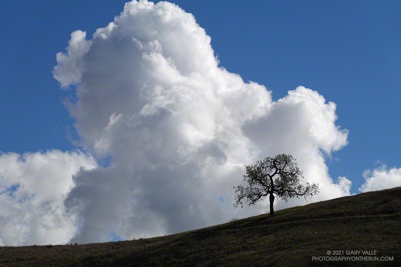
The cumulus cloud towered overhead, its size accentuated by a lone oak on the skyline. An extraordinary series of December rainstorms were finally over. The year 2021 would end with Downtown Los Angeles (USC) having recorded the third highest amount of December rainfall on record.
I was running from the Victory Trailhead of Upper Las Virgenes Canyon Open Space Preserve (aka Ahmanson) to Las Virgenes Canyon. With about 5 inches of rain in the area over the past two days, I was curious to see how upper Las Virgenes Creek was flowing.
When I parked at the Wendy Drive trailhead, there was just enough light to see a wide band of high clouds overhead. That was good news. With a well-advertised storm expected to move through the area the next day, I hadn’t been sure what weather to expect for today’s run.
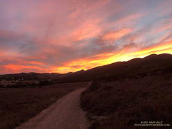
Colorfully illuminated clouds a few minutes before sunrise on the Wendy Connector Trail
The general forecast was for low clouds and fog in the morning, giving way to partly cloudy skies in the afternoon. I was going to be running one of the more scenic trails in the Santa Monica Mountains — the Ray Miller Trail. High clouds and sunshine were a much better option than running in the fog or with gloomy, overcast skies.
Shortly after leaving the trailhead, the band of high clouds became underlit by the reds, oranges and yellows of the rising sun. It was going to be a good run.
The route-finding on this run is relatively straightforward. From the Wendy Drive trailhead on Potrero Road, run over to the Satwiwa Native American Indian Culture Center (see Satwiwa map). From the Culture Center run 4+ miles on Big Sycamore Canyon Road/Trail toward the beach. Some of this is paved.
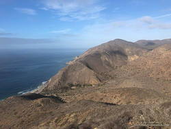
La Jolla Canyon, PCH and Mugu Peak from the Ray Miller Trail
Once past the junction of Sycamore Canyon and Wood Canyon fire roads, take either the Wood Canyon Vista Trail (Backbone Trail) or Fireline Trail up to the Overlook fire road. From the top of the Wood Canyon Vista Trail turn left on Overlook fire road, or from the top of Fireline turn right, and follow the road to the top of the Ray Miller Trail. The Fireline option is about 0.4 miles longer. Here’s a map from the State Park website. Note that the La Jolla Canyon Trail is closed.
The Ray Miller Trail drops about 1000′ over 2.6 scenic miles. There is usually water available at the parking lot at the trailhead. Today the conditions were about as good as they get. The trail was in excellent condition. The temperature was in the mid-70s. The marine layer was holding offshore and a few puffy clouds had formed over the higher peaks.
One of the things about the Ray Miller Trail is that run/hike up it is almost as enjoyable as the run down. It is a very popular, and there are almost always runners and hikers on the trail. Running up a section of trail, I thought I recognized someone going down. It was nine-time Badwater finisher Chris Frost. We talked for a while about trails, running and races.
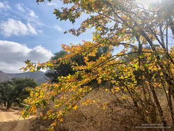
Fall color on a California sycamore along Wood Canyon Fire Road
From Overlook Fire road the route back to Wendy was a familiar one — Hell Hill, Wood Canyon Fire Road, Two Foxes Trail, Big Sycamore Canyon Road, Upper Sycamore Canyon Trail, Danielson Road, and the Satwiwa Loop Trail. Including a short jog over to PCH the run was a little over 24 miles with about 3100′ of elevation gain.
Here’s an interactive, 3D terrain view of the Wendy Drive – Ray Miller Out & Back trail run. The map can be zoomed, tilted, rotated, and panned. To change the view, use the control on the upper right side of the screen. Track and placename locations are approximate and subject to errors. Poor weather, and other conditions may make this route unsuitable for this activity.