La Nina Looming

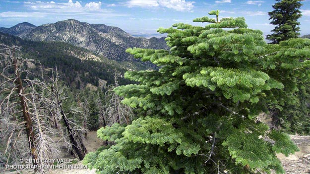
Pacific Crest Trail Near Mt. Burnham

Pacific Crest Trail Near Mt. Burnham, in the San Gabriel Mountains

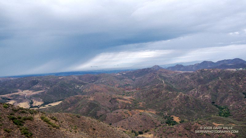
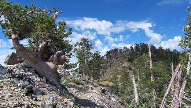
At an elevation of 9000′ the weather was sensational. Skies were partly cloudy, accentuating the terrain, and hinting of a thunderstorm later in the day. I was on the Pacific Crest Trail between Mt. Burnham and Mt. Baden-Powell, about 8 miles into a 18 mile run in the San Gabriel Mountains.


Remarkably, there was still a small patch of snow along the trail. According to seasonal summaries in Your Guide to Snowfall, the 2009-2010 season in Southern California was the best since the big Winter of 2004-2005. But it wasn’t necessary to check the snow history to know the snowfall had been above average. All that was needed was to look around, and the mountains told the story.

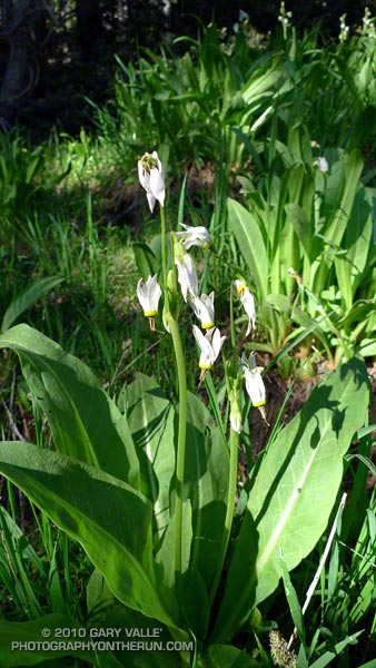
The remnants of snow were only part of the tale. Broken and downed trees told of strong Winter winds, and the stalks of red snow plant of a cool Spring. Now springs flowed freely and once dry seeps were damp and green. Wildflowers bloomed in profusion. Squat bumblebees waddled from flower to flower, and hummingbirds darted from patch to patch of scarlet bugler.


It had been a good Winter. Sugar pines were heavy with pine cones, and new growth decorated the limbs of the white firs. The growth of tree seedlings in the Curve Fire burn area seemed to have accelerated, and the protracted process of forest replacement was underway.

Southern California’s erratic weather demands that plants and trees be opportunistic. In time they have learned that an El Nino Winter is often followed by one that is dry, and La Nina looms.

Summer Returns

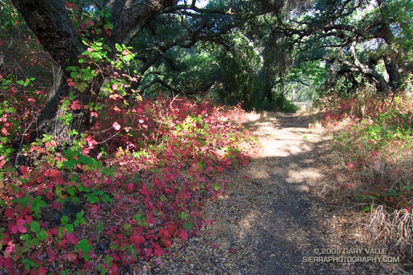
Poison Oak along the Blue Canyon Trail.

Poison Oak Along the Blue Canyon Trail.

Since nearly all my weekday runs are in the afternoon, on Summer weekends I usually like to escape the heat and do a run in the mountains — the higher, the better. But today even the mountains were going to be hot. Hot enough that the National Weather Service had issued an Excessive Heat Warning for a combination of heat and humidity that would “create a dangerous situation in which heat illnesses are likely.”

It would be cooler at the higher elevations of the Sierra, but there was good chance of thunderstorms developing along the crest of the Sierra, as well as most of the higher mountains of Southern California. Considering the options, I finally decided to do an early morning run in Pt. Mugu State Park. If I was going to run in the heat, it might as well be a scenic run close to home. Maybe the weather in the mountains would be better next weekend.
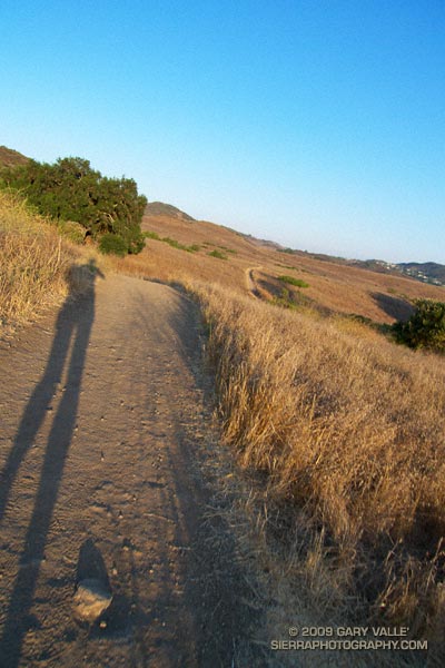

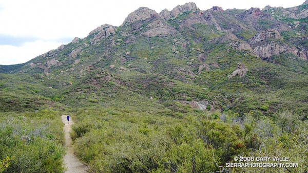
Sunrise on the Satwiwa loop trail.
There are many excellent courses at Pt. Mugu State Park. The course I was doing today is a “backward” variant of the Boney Mountain Half Marathon Course — up the Old Boney Trail, down to the Danielson Multi-use area, up Ranch Center fire road to the Hidden Pond Trail, and then back on the Upper Sycamore Trail. Water is normally available at Danielson Multi-use area and at the start of the Upper Sycamore Trail.

I should have started the run at dawn, but instead ambled along a section of the Satwiwa Loop trail at sunrise. The light was muted and golden, stretching my shadow well out on the trail ahead. Cool trickles of air filled each dip and gully and I wondered how long the temperate conditions would last. Ironically, the last time I had done this course it had been blustery and cold, and there had been snow on the mountains above Ventura. Not today…
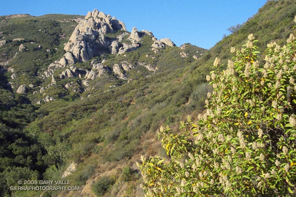

Crags above the Danielson cabin site on Boney Mountain.
It was warm running up the east facing section of the Old Boney Trail, but not yet hot. The crags to the west of the Danielson cabin site, gleamed in the morning sun, and for a brief instant I debated climbing the ridge. The impulse passed, and once over the shoulder of Boney Mountain, I thoroughly enjoyed the (mostly) downhill running through the Boney Mountain Wilderness to the Blue Canyon Trail junction. Cool air draining from the shaded slopes of Boney Mountain kept temps reasonable in the canyon, and the running was good all the way to the Danielson Multi-use area.
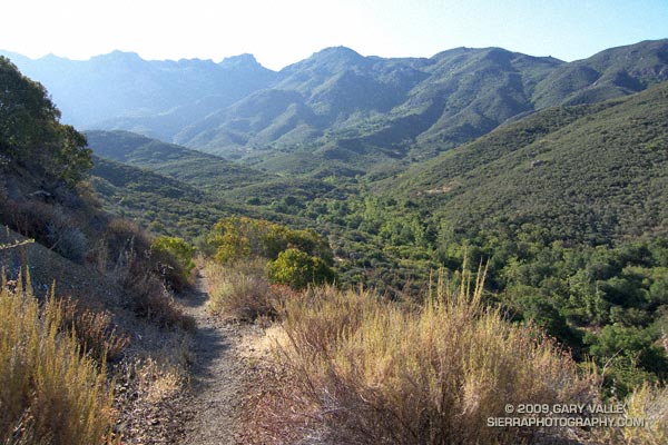

Descending to the Old Boney and Blue Canyon trail junction.
At the Multi-use area there is a choice. The coolest and most direct route to the Upper Sycamore Trail is up shaded (and paved) Sycamore Canyon road. But with the Mt Disappointment race looming, I wanted to get in more time and elevation gain, so opted for the longer, more exposed route up the Ranch Center fire road, and then along the ridge on the Hidden Pond Trail. Yes it was hot, and the humidity was up a bit, but it was still scenic and enjoyable in a “I’m not going to let the heat get to me” kind of way. And I knew a water faucet was waiting for me at the point where the Hidden Pond Trail rejoins Sycamore Canyon road, and the Upper Sycamore Trail continues eastward.

Maybe it was the heat, or maybe the coyote had learned to scavenge food from hikers — whatever the case the coyote ahead of me on the Upper Sycamore trail didn’t seem to be in any particular hurry to get off the trail. Coyotes are an odd sort, very intelligent and adaptable, but in my experience not normally any kind of threat.

Usually they will scurry away from a runner. This coyote wasn’t scurrying anywhere. I picked up the pace and clapped my hands, and eventually the animal grudgingly took cover to the side of the trail. But, as it turns out, only about 4 feet off the trail. This was odd, brazen behavior, and I kept a wary eye as I passed.

The final challenge of the morning was the hot climb up to Satwiwa on the Danielson road from the end of the Upper Sycamore Trail. The hill isn’t long or particularly steep, but it faces directly into the sun. With the heat of the day building, it wasn’t easy.

Overall it was an excellent run that would have been even better with an earlier start. Here’s a Cesium browser View of a GPS trace of the approximately 14.5 mile route.

Related post: Big Sycamore Canyon Circuit
Being There

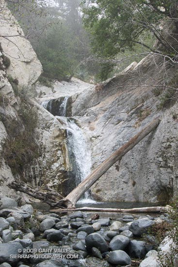
Tiered Falls Downstream of Switzer Falls, in the San Gabriel Mountains

Tiered Falls Downstream of Switzer Falls

I have a passion for the outdoors, exploration, and adventure. I’m always looking for a reason to be outside, and this has inevitably led me to activities such as climbing, kayaking, skiing, hang gliding and running. The common thread in these pursuits isn’t necessarily the challenge, or the adrenalin, or attaining a particular goal, but is the pure joy of being in the mountain environment and relishing what it has to offer.

To feel the sun and imagine the clouds. To listen to the wind on the pines, and the song of a stream. To savor the taste of a wild herb, or the sweet smell of a wildflower. To revel in the purity of untouched snow, or the green of a mountain meadow. To run from a thunderstorm, or feel the relief of a good handhold. Climbing to airy summits. Hiking to heart-pounding passes. Descending “impassable” canyons. Experiencing cold bivouacs and star filled nights. Simply to be there.

The photograph of the tiered falls is from today’s hike to the plunge pool at the bottom of Switzer Falls in the San Gabriel Mountains, near Los Angeles. Gary Gunder and I kayaked the double falls when we paddled Arroyo Seco creek from Switzer Picnic Area to the JPL in Pasadena in 1998.

Related link: Kayaking Arroyo Seco from Switzer Falls to Bear Creek

T-storms and Trail Work

Old Boney Trail in the Boney Mountain Wilderness

When I woke to the rumble of thunder, rain pounding the roof, and wind roaring in the trees, I wondered if a planned run of the Boney Mountain Half Marathon course with John Dale was going to turn into an epic. Radar and satellite imagery showed subtropical moisture streaming in from the southwest, producing bands of showers and thunderstorms. Things don’t always look as bad at the trailhead as they do on weather radar, so I grabbed my gear and headed for Wendy Drive.

The weather looked promising driving through Agoura, but the further west I drove, the more ominous the skies became. Somewhere around Lynn Road KNX announced that the NWS had issued a severe thunderstorm warning for the Santa Clarita area, with cloud to ground lightning, heavy rain, possible damaging winds and dime-sized hail. It was with that thought in mind, and a shower pelting the car, that I pulled into the parking area on Potrero Rd.

If anything, weather is fickle, and sometimes that quirkiness can work for you. There was an area of heavy rain to the west, but the activity appeared to be skirting the area, so we opted to start the run.


Thunderstorm marching northeast from the Santa Barbara Channel across the Oxnard Plain.
There were a few sprinkles as we jogged down the blacktop into Big Sycamore Canyon, and a few more as we did the first easy mile of the Hidden Pond Trail. Down in the canyon it was hard to tell what the weather was doing, but after gaining some elevation we reached a better vantage point. Just a few miles away thunderstorms were being swept northeast from the Santa Barbara Channel, across the Oxnard Plain, and into the Ventura Mountains.

Skies darkened and the shower intensity increased as we ran down Ranch Center Fire Road. The wind was blowing in the fitful gusts that precede a thunderstorm, and it felt as if the sky might fall at any moment. With a slight shift in the track of the thunderstorms we might be running in a deluge, dodging lightning strikes.

But it didn’t shift. Following the shower, the sun broke through the clouds just long enough to add glints to the raindrops dripping from the leaves of sycamores and oaks in Blue Canyon. Under overcast skies, we climbed up the Old Boney Trail and into the Boney Mountain Wilderness.

We had not seen a hiker, runner, or rider since turning onto the Hidden Pond Trail early in the run. So it was a bit of a surprise when we rounded a corner and ran into Ed Reid and several other volunteers with the Santa Monica Mountains Trails Council doing trail maintenance on a section of the Old Boney Trail.

Just about any weekend of the year, dedicated members of the SMMTC will be somewhere in the Santa Monica Mountains, working on a trail. To get a better idea of the amount of work done and the number of trails involved, take a look at this list of recently maintained trails! How many of these have you hiked, run or ridden?

There are several ways to help support SMMTC:

  • Volunteer to do trail maintenance.
  • Join the SMMTC.
  • Make your REI purchases using the REI link on the SMMTC web site. REI will donate a percentage of the purchase to SMMTC.

See the Santa Monica Mountains Trails Council web site for more info.

Some related posts: Boney Mountain Half Marathon, Return to Hidden Pond

Did Lightning Start the 2002 Curve Fire?

Or did the Curve Fire trigger a lightning strike?

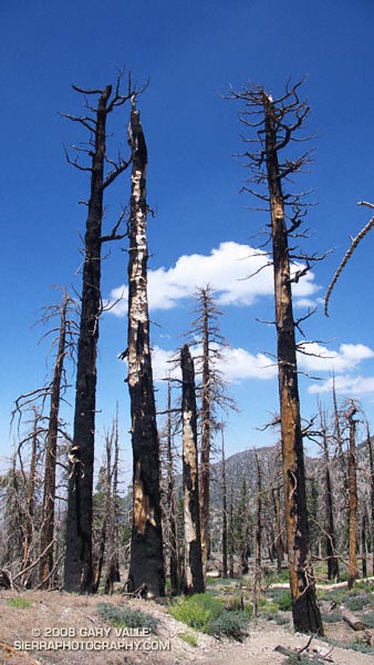
These trees — on a section of the Pacific Crest Trail east of Windy Gap — were burned almost six years ago in the 20,857 acre Curve Fire. According to the Curve Fire Burned Area Emergency Report Implementation Plan, the source of ignition for the devastating fire was “a ritual involving the use of fire (candles) and animal sacrifices.” The fire started the afternoon of September 1, 2002.

However, in the document An Exercise Involving Flash Flood and Lightning Potential Forecasts, an alternative ignition source was suggested — an “out of the blue” lightning strike. Forecasters observed a “single positive lightning strike northeast of the Mount Wilson Observatory” about 1:00 PM PDT (2000Z), near the time the Curve Fire started. According to NWS Lightning Safety Outdoors, such bolts from the blue have been documented to travel more than 25 miles from a thunderstorm cloud.

While there is compelling evidence that the blue sky lightning strike occurred, the time of the strike suggests that it was not the initial source of ignition of the Curve Fire. This UCLA Solar Towercam image is time-stamped at 12:58:58, about the time of the strike. It shows the Curve Fire already underway, with a well-developed smoke column. The photograph also shows the cloud development over the San Gabriel Mountains.

An intriguing question comes to mind. Was the lightning strike a coincidence, or was it somehow triggered by the fire, or the smoke?

According to “Forest Fires: Behavior and Ecological Effects” by Edward A. Johnson, Kiyoko Miyanishi (Academic Press, 2001) large scale lightning detection networks have revealed an association between forest fires and the electrification of thunderstorms. Further, “a shift from negative to positive ground flash prevalence in association with fires and forest fire smoke” has been documented.

So it looks like lightning did not start the Curve Fire, but the Curve Fire may have triggered the positive lightning strike observed by the NWS!

The photograph of trees burned in the Curve Fire is from Sunday’s Islip Saddle – Mt. Baden-Powell South Fork run.

Related post: Explosive Growth of the Lake Fire

Technical papers:

CLOUD-TO-GROUND LIGHTNING DOWNWIND OF THE 2002 HAYMAN FOREST FIRE IN COLORADO

Timothy J. Lang* and Steven A. Rutledge
Colorado State University, Fort Collins, Colorado

Enhanced Positive Cloud-to-Ground Lightning in Thunderstorms Ingesting Smoke from Fires

Walter A. Lyons, Thomas E. Nelson, Earle R. Williams, John A. Cramer, and Tommy R. Turner
Science 2 October 1998 282: 77-80 [DOI: 10.1126/science.282.5386.77] (in Reports)

Islip Saddle – Mt. Baden-Powell South Fork Loop

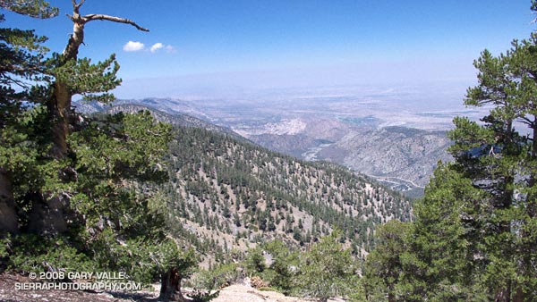
View of the South Fork Big Rock Creek and Devil's Punchbowl from Mt. Baden-Powell.

Maybe it’s because it’s been in the news recently,  but when pondering how to characterize today’s trail run, I couldn’t help but think of the JFK quote, “We do these things not because they are easy but because they are hard…” This loop is arduous, adventurous, and challenging. While the difficulty of this route is one of the things that makes it interesting, it isn’t just the difficulty that makes it appealing.

Part of the appeal is the mix of trails and terrain, and the contrasting environments. The high point of the route is 9,399′ Mt. Baden-Powell. Cool, airy and alpine, it is the home of ancient Lodgepole and Limber pines. The low point of the route is 4,560′ South Fork Campground. On the margin of the Mojave Desert, it is often hot and sometimes torrid. Midday temperatures here can reach well over 100°F. The route encompasses life zones ranging from the Upper Sonoran to the Hudsonian, and passes through a variety of plant communities. The San Andreas Fault Zone runs along the base of the mountains, torturing the area’s rocks, and producing a complex and fascinating geology.


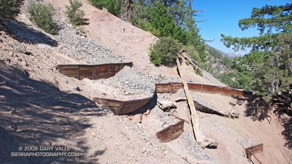
Erosion gulley on the Manzanita Trail.
From Islip Saddle the route descends the South Fork trail to South Fork Campground, then climbs 5000′ on the Manzanita and Pacific Crest trails to the summit of Mt. Baden-Powell. From here it follows the PCT back to Islip Saddle. In general, the part of the route that is on the PCT — above Hwy 2 — is well marked and maintained. However, on the South Fork and Manzanita trails — below Hwy 2 — you are on your own.

There are rock slides on the South Fork trail, and there are steep, washed out erosion gullies on the Manzanita trail. Recent thunderstorms have further damaged the eroded sections of the Manzanita Trail. In addition, the Manzanita trail crosses boulder-strewn washes that can make the trail difficult to follow. It is not a trail I would want to be on when there is heavy rainfall. The South Fork and Manzanita trails are part of the High Desert National Recreation Trail.

Google Earth images and KMZ files, and more info about the loop can be found in the posts Complications, Wally Waldron Limber Pine, and Heat Wave.