Miwok Wanderings

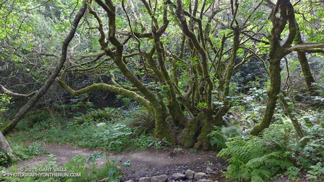
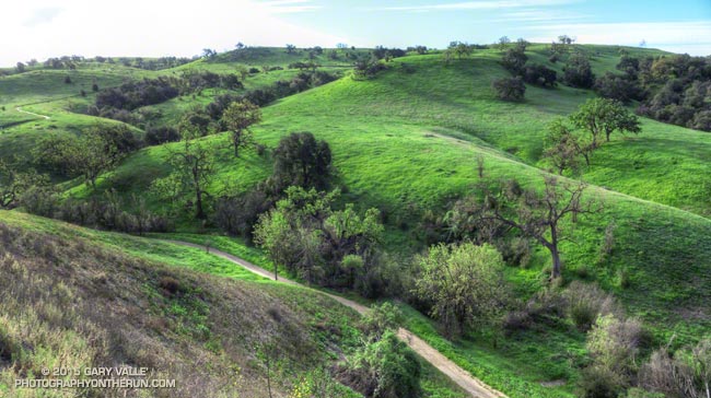
Greenery along the Redwood Creek Trail

The sign read “Middle Green Gulch Trail” but didn’t indicate if the trail went to Muir Beach. I was on the Coyote Ridge Trail and about 12 miles into a running adventure that had started in the Marina District of San Francisco, crossed the Golden Gate Bridge, and then entered the runner’s Wonderland of the Marin Headlands.

My destination was the Bootjack parking area in Mt. Tamalpais State Park. There are many ways to run to Bootjack from San Francisco, but the game I had decided to play was to pick up the Miwok 100K course at the juncture of the Coastal and SCA Trails and run the course in reverse to Pan Toll. From Pan Toll Bootjack was just a few minutes away.
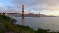
Broken clouds and early morning light on the Golden Gate Bridge
Golden Gate Bridge

It had gone well so far. The bridge and bay had been spectacular in the broken clouds and early morning light. There had been a bit of a headwind running along Crissy Field, but once across the bridge the wind and temperature had moderated and the weather had become nearly ideal for trail running.
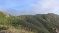
Working up the Coastal Trail to the SCA Trail junction
Working up the Coastal Trail

The Coastal, SCA and Alta Trails had been well-signed, so it had been straightforward to get to the the Alta-Bobcat Trail junction. This nefarious juncture is marked with a skull and crossbones on the Miwok 100K map. Here I’d briefly tried to follow the Miwok course in reverse, but bailed and used the more obvious Bobcat Trail to get to the Marincello Trail. Back on route, it had been an enjoyable mile and a half descent to Tennessee Valley.

After chugging up the Miwok Trail from Tennessee Valley, I’d stopped at an unmarked trail and was trying to determine if the single-track was the “Miwok Connector.” I’d only been pondering the question for a minute when some runners happened by and confirmed that it was.
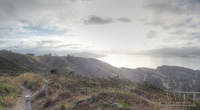
San Francisco Bay, Alcatraz & Angel Island from the SCA Trail

That had been about 20 minutes ago. Now I was trying to get down to Muir Beach and still trying to do the Miwok course in reverse. In my somewhat hastily created cheat-sheet the trail I needed to descend was labeled the “? Trail” which wasn’t a big help. It became one of those, “I’ll just run down to that next corner, where I can get a better view” kind of descents. Corner followed corner, and I soon found myself most of the way down the trail and still up-canyon from Muir Beach.

What was worrisome was that there was a farm in the canyon and it looked like I would have to run through the farm to get to Muir Beach. The trail had to go to a trailhead somewhere. Hopefully somewhere without snarling dogs and shotguns.

I needn’t have worried, I was on the correct route. The farm was Green Gulch Farm Zen Center, a Buddhist practice center. The forest service-style trail sign on the farm’s gate, and some fresh mountain bike tracks, suggested it was OK to pass through, and I was soon on my way to Muir Beach.
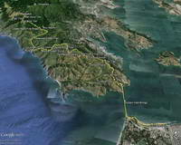
Google Earth image overview of my route.
Route Overview

At Muir Beach I wandered around a bit and happened on a Western States 100 runner who gave me directions to the Redwood Creek Trail and also where I could get some water if I needed it. The Redwood Creek Trail was lush, green, and somewhat overgrown, but easy to follow. The stinging nettle mixed in with poison oak ensured that I would pay attention to the plants along the trail.

The Redwood Creek Trail ends at Muir Woods Road near the bottom of the Deer Park Fire Road. The fire road (and Dipsea Trail) border Muir Woods National Monument and cross through the northwest corner of the monument near the top of the climb to Pan Toll. Whether going up or down, or on or off the Dipsea Trail, it is outstanding running through a classic redwood forest.

At Pan Toll I crossed the Panoramic Hwy, picked up the Matt Davis Trail and was soon sitting in the sun at the Bootjack parking area.

Some related posts: Golden Gate Bridge Run, Tamalpais Trail Run, Marin Headlands: Bobcat – Miwok Loop

About

About Photography on the Run

WARNING: Please read this IMPORTANT NOTICE!

Contents Copyright © 1995-2024 by Gary Valle’. All Rights Reserved Worldwide. Please inquire about licensing of images, publication quality image files, exhibition quality prints, backdrops and murals. Please use this Information Request Form.

My passion for the outdoors, photography and exploration began in the parks and pine woods of the South. Drawn by curiosity, I would wander the woods and fields, exploring creeks and following game trails, reveling in the richness of the Georgia countryside. When my father accepted a job in California, we were greeted by eye-watering smog and the Bel-Air fire. It seemed to be far from the promised Shangri-la. But in 1964 a summer vacation hike to a snowbound, partially frozen lake in the High Sierra revealed a wonderland, and hooked me forever.

A few years later I started to run, climb, and ski — and also started to study photography. From Ansel Adams Basic Photo Series to Kodak Technical Notes, I consumed all I could on the subject. I marveled at the art of Alfred Stieglitz, the magical compositions of Henri Cartier-Bresson, and the powerful images of W. Eugene Smith. The elegance and expertise of the prints of Ansel Adams were stunning, the Pathos of Diane Arbus images unsettling, and the sensitivity in the work of Paul Sands an inspiration. I spent many, many hours in the darkroom.

Editors seem to like my work, and early on a number of my images were published. One of those editors was William Kemsley, Jr., the founder of Backpacker magazine. He recognized the spontaneous “point & shoot” nature of my photography and gave me an opportunity to present it. Since then my work has been published in a modest number of magazines, books and other publications — but whether I’m shooting with a big SLR, or an ultra-compact camera, I’m still a “react & shoot” photographer.

Most of the photographs here have been taken with small digital and film cameras. Some of the cameras used include the Olympus XA, Contax TVS III, Nikon Coolpix, Olympus Verve, Pentax Optio WPi, iPhone, Panasonic Lumix LX2, LX3, LX7 & ZS100,  Sony Alpha a6000 and RX100 VII.  Occasionally, I will also carry a digital or film SLR on a run. Most have been taken on self-supported trail runs, ranging in length from about 5 to 30 miles. Many of the runs have been in the open space and wilderness areas of Southern California and the Sierra.

A long run may take several hours. It is minimalist photography in the sense that there are significant constraints on the equipment and process. Ounces and minutes count. Out in the middle of nowhere, with your water running low, and a couple of hours to sunset, there may not be much time to wait for the wind to stop, or the light to change.

Other than simple post processing, most of the images are full frame and unaltered. A few of the images have had some kind of minor alteration that does not bear on the essential content of the image. Some images have been composited from an array of images — in a digital world this is no different than changing to a wide angle lens.

I am a realist and usually attempt to reproduce images as seen, without artificially manipulating color or content. In the field, I (almost) never add, remove or rearrange the actual physical elements of an image. I prefer to shoot a scene as I find it.

For me the essence of photography is found in the spontaneous recognition of that “some-thing” that can be recorded and communicated. Most of my photography is spontaneous, but this does not mean it is indiscriminate. It reflects my experiences and explorations. It is what I see and what I feel. Without emotion photography is merely an exercise and not an art.

Photography on the Run may occasionally share some photography and other content with my legacy galleries and web sites on SierraPhotography.com:

Teneiya Gallery • Split Rock Gallery • Off the Wall • Coyote Oak Journal

Tahquitz Rock Climbing Notes • Southern California Weathernotes • Southern California Creeking

My photography has been published by Backpacker, Popular Photography, Rock & Ice, Sierra Club Books, Fortune 500 companies and in various other books, magazines, newspapers, and web sites. If you wish to contact me, or provide feedback, please use this  Information Request Form.

Contents Copyright © 1995-2024 by Gary Valle’. All Rights Reserved Worldwide. Please inquire about licensing of images, publication quality image files, exhibition quality prints, backdrops
and murals. I’ve produced image files for printing photo walls with widths up to 30 feet.

I have a large selection of rights-managed microstock images with an emphasis on the outdoors, nature, fitness, climbing, kayaking, trail running, the Sierra, and Southern California.

Photography on the Run can also be accessed using the URL http://www.natureontherun.com.

Gary Valle

2007 Continue reading About

Ahmanson 12K Preview

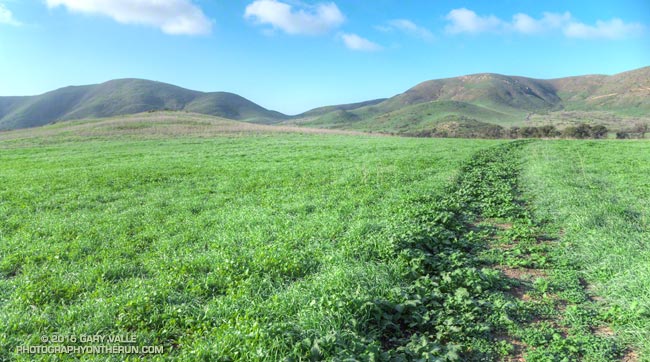
East Las Virgenes Canyon, Ahmanson Ranch

Race director Nancy Shura-Dervin picked a great year, and as it looks now, a great weekend for the inaugural running of the Ahmanson 12K Trails event.

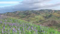
The hills are lush and green; wildflowers are in bloom; valley oaks are sprouting fresh green leaves; and it’s looking like race day may be one of those “gotta run” kind of days.


According to today’s NWS forecast the area will see dry and warmer weather beginning Tuesday and continuing through race day. While there could be a remnant puddle here or there, four days will be plenty of time for the dirt roads to (mostly) dry out. The Cheeseboro RAWS automated weather station can be used to get an idea of the current weather in the vicinity of the race course.

Over the past 10 years I’ve logged approximately 6000 miles at Ahmanson Ranch (now Upper Las Virgenes Canyon Open Space Preserve) and the loop Nancy has selected for the course is a variation of a favorite.


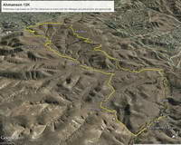
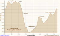
Here’s a Google Earth overview of the 12K course and a preliminary elevation-corrected profile generated in SportTracks. The course is about 7.4 miles long with an elevation gain of about 740 feet. (Note: The loop is run in the clockwise direction.)


Lasky Mesa has long been used to shoot movies, television, commercials, music videos, and even Internet games. Its wildland character and expansive views bely its urban location. For a few weeks one summer the Mission Impossible III bridge was a Lasky Mesa landmark. The aesthetically-shaped valley oak at the west end of Lasky Mesa is a favorite of production companies and I’ve spotted it in more than one commercial.

The Ahmanson 12K should be an outstanding event on an excellent course in conditions we haven’t seen at Ahmanson in several years.

For more information and photos see the Trail Run Events web site and the Upper Las Virgenes Canyon Open Space Preserve web site.

Some related posts: 10th Anniversary of the Acquisition of Ahmanson Ranch, Coyote Tag, It Was So Muddy That…, Ahmanson Ranch Trail Runs

Just Me and the Meadowlarks

La Jolla Valley from Mugu Peak

I had to stop running and take it all in. Soaked by recent rains, La Jolla Valley was renewed and green. To my right a meadowlark warbled its silvery call, and in the distance at first one and then another bird followed in song.

Isolated for weeks by the closure of Pacific Coast Highway and Pt. Mugu State Park, the La Jolla Loop Trail was trackless and in places overgrown. Wet with dew, the mustard choking the trail had soaked my shoes and socks.

Sprinkled among the greens were whites, purples, pinks, reds and yellows of the first stage of a wildflower explosion. A sweet scent drifted on the breeze. Running in the valley was like running in a remote and seldom-visited wilderness.


There had been much to see on the run from Wendy Drive. Before the Park closed in December I had surveyed the aftermath of the December 12 flash floods in Sycamore Canyon, Blue Canyon and Upper Sycamore Canyon. One of the reasons for today’s run was to see what had happened in this part of the Park.

Wood Canyon parallels Sycamore Canyon and is probably its largest tributary. Based on the height of the debris piled against the trees, the flash flood that roared down Wood Canyon must have been astounding! Looking down the stream course reminded me of flash floods I’d seen on creeks and streams during the El Nino’s of 1997-98 and 2004-2005.


Bowl-shaped La Jolla Valley is an independent drainage, separate from Sycamore and Wood Canyons and their tributaries. It acts like a huge rain collector and funnels all the runoff down deeply cut La Jolla Canyon to the ocean. In La Jolla Valley all the creeks were scoured by the flash flooding and the small footbridge west of the group campground was washed out. The vernal stock pool on the Loop Trail above La Jolla Canyon was once again full.


It’s no surprise that the December flash floods washed out the trail in La Jolla Canyon. I can’t think of a steeper and more narrow canyon in the park.  The flow must have been phenomenal! The La Jolla Canyon Trail is closed and barricaded at its juncture with the Loop Trail. Here are archived maps of Rancho Sierra Vista/Satwiwa and Pt. Mugu State Park originally from the NPS Santa Monica Mountains web site. Also see the Pt. Mugu State Park maps on VenturaCountyTrails.org.

In recent years the drought has dramatically reduced the number and variety of wildflowers blooming in the Santa Monica Mountains. Not so this year. Since October 1 Camarillo Airport has recorded 7.0 inches of rain, which is about 92% of normal. Last year over the same period only 0.84 inch had been recorded.


Many species are already blooming and many more will be blooming soon. On today’s run I saw shooting stars, encelia, lupine, nightshade, monkeyflower, paintbrush, California poppy, bladder pod, wild hyacinth, phacelia, wishbone bush and more. A small patch of chocolate lilies were in bloom along the eastern segment of the Loop Trail.

La Jolla Valley and Mugu Peak can be busy places, but today it was just me and the meadowlarks.

Update February 3, 2015. According to the Ventura Star six miles of Pacific Coast Highway from Las Posas Road to the Sycamore Cove Day-use Area reopened today providing access to Pt. Mugu State Park from the south. Note that the La Jolla Canyon Trail is still closed and likely to be for some time.

Some related posts: Pt. Mugu State Park Debris Flows and Flash Floods, Wendy Drive – Mugu Peak Challenge, Laguna Peak, La Jolla Valley, and the Channel Islands

Leona Divide 50 Mile 2014

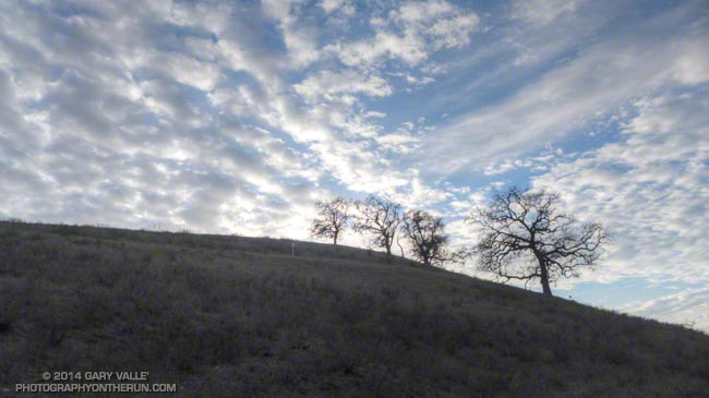
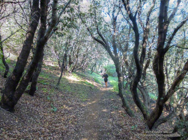
Running through oaks on the PCT during the Leona Divide 50 mile ultrarun.

Last June when she heard the news that the Powerhouse Fire was burning in the Leona Divide area of Angeles National Forest ultra RD Keira Henninger must have shaken her head. Just a couple of weeks before the Springs Fire had burned a large part of her Ray Miller 50M/50K course in Pt. Mugu State Park — now the Leona Divide 50M/50K course was on fire.

Some organizers might have just canceled these events outright, but applying the expertise and persistence that makes her a successful ultrarunner and race director Keira put together alternatives that were every bit as enjoyable, challenging and well-organized as the original events. The Ray Miller 50/50 was transformed into the highly regarded Sean O’Brien 50/50 and the Leona Divide 50/50 course was rerouted.


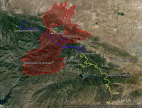
Then just two weeks before the event the Leona Divide courses had to be rerouted a second time because of an unexpected change in the Powerhouse Fire closure area. Not only were the 50M and 50K routes changed, the starting point for the race was changed from Lake Hughes to Green Valley. Here’s an overview of the Leona Divide area that shows this year’s course (yellow), last year’s course (purple), and the perimeter of the Powerhouse Fire (red). Note that the Powerhouse Fire closure area (as of April 25, 2014) is much larger than the area burned by the fire.

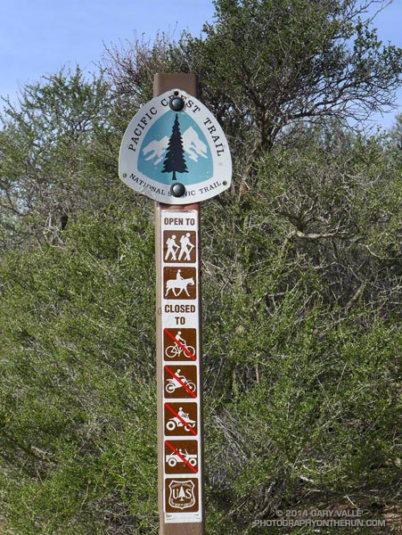
If you didn’t know its history, the 2014 Leona Divide 50/50 was so well organized you might have thought it always started in Green Valley. This year all but a few miles of the 50M and 50K courses were run on the Pacific Crest Trail. Here’s an overview of the 2014 course and an interactive Cesium browser View that can be zoomed, panned, tilted and rotated.


An elevation profile for the 50 mile course was created in SportTracks. Elevations were corrected using NED 1/3 arc second DEMs. Using a conservative smoothing setting (55) the elevation gain/loss for the 2014 course was estimated be around 8500′ and for the 2013 course around 7500′. According to the GPS tracks the 2014 course was about 0.5 mile longer than the 2013 course.

The weather for the race could not have been more different than the torrid conditions experienced last year. The NWS issued a winter weather advisory for the Los Angeles County mountains Friday evening that extended into Saturday. Just before the start of the race my car’s thermometer read 37 degrees. It had rained overnight and a few miles into the race, small patches of melting snow were mixed in with the purple chia along the trail. Temps were cool all day, ranging from from the low 40s up into the 50s. Winds were blustery, but were generally less than the 25-35 mph that had been expected.

All things considered, the weather was great for running. If you had any doubt the role heat acclimatization can play in finishing an ultra, you need only compare this year’s six DNFs in the 50 mile to last year’s 42!


My favorite part of the course was the “last minute” addition from Bouquet Canyon to Aqua Dulce. I previewed this segment last week, and in today’s cool, blue sky – puffy cloud conditions it was outstanding. Because I HAD to make the cut-offs, I didn’t take many photos, but here are a few photos taken along the way.

Many thanks to Keira Henninger, the numerous volunteers, the community of Green Valley, the Pacific Crest Trail Association and the Mojave Ranger District for helping to make this event happen. Congratulations to Jay Bonthius, the overall winner in his first 50 mile race, and Kami Semick who took first among the women and placed 10th overall. In the 50K Eric Lynch just edged Chris Glibert for the win in the Mens division and Margaret Nelsen was first in the Women’s division. For more info, photos and all the results see the Leona Divide 50/50 web site and Facebook page.

Some related posts: Up and Over Sierra Pelona Ridge, Back on Leona Divide