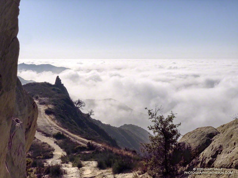
Marine layer clouds from the Backbone Trail at “Mammoth Pass.”
The Bulldog Loop, without any extras, is a little over 14 miles long, with an elevation gain of about 2700′.
While doing the Phantom Loop last week, I was reminded that a good way to extend the Bulldog Loop is to combine it with the Phantom Loop. This produces a run of about 19 miles, with an elevation gain of around 3650′.
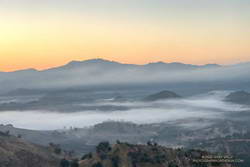
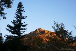
Early morning view of Saddle Peak from the Cistern Trail
This weekend I was looking to do something a little longer. With the National Forests in Southern California still closed, the usual high country options weren’t available. The temperature forecast looked warm, but not crazy hot, so it was a good day to do this run.
The Cistern/Phantom Trailhead on Mulholland Highway is a convenient place to start and end the loop. Later in the run, water is usually available from a faucet and fountains adjacent to the restrooms at the main MCSP parking lot. If doing the loop counterclockwise from the Cistern Trailhead, the restrooms and water are about 14 miles into the run.
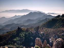
Santa Monica Mountains from the top of the Bulldog climb.
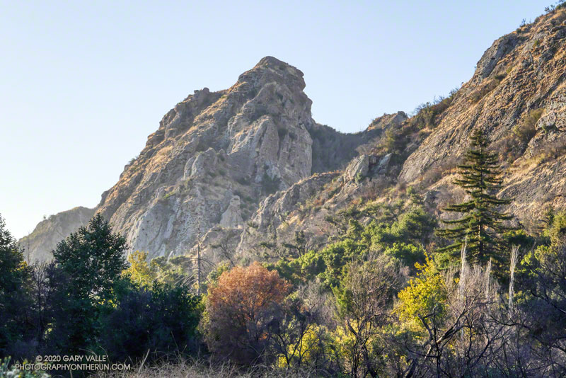
The main attraction is still the Bulldog climb. From Crags Road to Castro Mtwy, the Bulldog Mtwy gains about 1730′ over about 3.4 miles. From the MCSP parking lot to the high point on the Phantom Trail, the route gains a bit more than 1000′ over 4.7 miles.
A coast redwood stands above the other trees near Century Lake.
It was a chilly 45°F as I crossed algae-covered Malibu Creek on a foot-worn log. Following a brutally hot Summer with temps in the West San Fernando Valley reaching 121°F, the chill of the cold air felt especially good.
The plan was to do the Phantom Loop, but first, I was going to run over to the Forest Trail. The side trip was not only to check on the coast redwoods along the trail but to enjoy the calm beauty of the area. To say 2020 has been unsettling is like saying a rattlesnake bite is a little annoying — and the year isn’t over yet.
Coast redwood near the Forest Trail and Crags Road junction
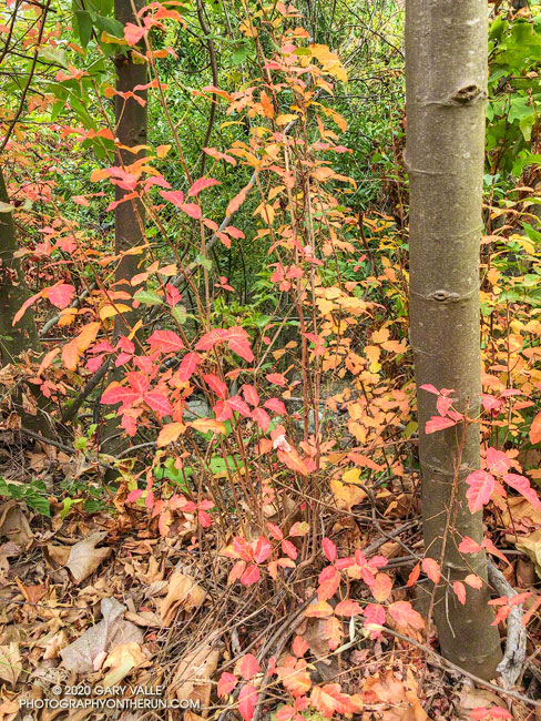
Continuing along the Forest Trail toward Century Lake, I counted four healthy-appearing redwoods and two struggling trees. Redwoods sometimes grow in a group of two or more trees, and these were counted as a single “tree.” Near the end of the trail is a naturally-germinated redwood that has grown to about 5.5 inches in diameter. Remarkably, this young tree survived the 2011-2015 drought and the 2018 Woolsey Fire, and appears healthy!
I had just finished photographing the young tree when a Cooper’s or Sharp-shinned Hawk flew from a nearby oak and through the trees along the trail. It landed on the limb of an oak ahead of me but was in deep shade. In a much-enlarged image, the bird looks like a Sharp-shinned Hawk, but distinguishing the two species can be challenging.
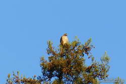
Red-tailed hawk atop a coast redwood.
A few yards down the trail, a much larger raptor — a Red-tailed hawk — was perched at the top of the tallest redwood. The huge bird had its wings pulled back to expose more of its body to the warming sun. It looked like a giant penguin sitting atop a tree. As I approached, it began to preen its feathers, comfortable with its lofty position.
With a sigh, I left the Forest Trail behind and returned to Malibu Creek. This time I crossed the creek on a plank near the washed-out bridge. This was a more direct route than the fallen tree upstream but only worked because the creek was low. At the crossing, a passing runner asked if he was on the Bulldog Loop. I assured him he was and was a little envious that he was getting to experience that excellent run for the first time.
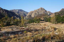
Morning view of Goat Butte and stream course of Malibu Creek
As usual, Crags Road and the High Road were busy thoroughfares. The easy running under the sprawling coast live oaks was pleasant, and the morning view of Malibu Creek and Goat Buttes outstanding.
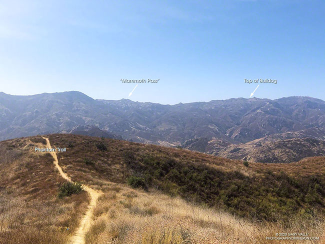
In a few minutes, I’d reached Mulholland Highway and then followed the Grasslands Trail to the Liberty Canyon Trail. From Liberty Canyon, the Phantom Trail gains about 750′ in elevation over about 1.5 miles to a high point and ridgeline with excellent views of Saddleback Peak, Las Virgenes Canyon, Brents Mountain, Goat Buttes, Castro Peak, Ladyface, and Boney Mountain.
The air quality this morning hadn’t been too bad. From up on the ridge, I could see there was far less smoke to the west of Las Virgenes Canyon than to the east. Yesterday, I’d done a run in the eastern Santa Monica Mountains and had to cut the run short because of smoke. That wasn’t a problem today, and the run had been a good one.
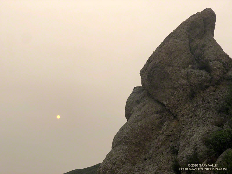
To the east, the sun rose orange, cast that color by a thick pall of smoke. From the Satwiwa Loop Trail, the view of Boney Mountain were surprisingly clear. As the air pollution sensors in the area had indicated, the air quality appeared to be passable. I hoped it would stay that way for the remainder of the run.
With all the National Forests in California closed through at least September 21, and the smoke from wildfires affecting many areas, I’d been fortunate to find a place where I could get out and stretch my legs.
I was doing a route I had done many times before — a loop incorporating the Western Ridge of Boney Mountain and the Chamberlain segment of the Backbone Trail. I’d last done the loop in June and was curious to see the condition of the Chamberlain Trail and how recovery from the 2018 Woolsey Fire was progressing.
From the top of Peak 2935, it seemed the “smoke front” to the east was slowly creeping closer. The flat, orange light was eerie. Continuing to Tri Peaks, I decided to skip the side trip to Sandstone Peak and followed the west Tri Peaks trail directly to the top of the Chamberlain Trail.
Foot traffic on the Chamberlain Trail had opened it up a bit, but there were still thousands and thousands of stalks of bleeding heart along the trail. The condition of the trail improved somewhat below Chamberlain Rock.
When I’d done the route in June, I’d seen no one until just before the junction of the Chamberlain & Old Boney trails. In June it had been a group of hikers. This time it was another runner, and we exchanged notes about the routes we were doing. Below the junction, I was surprised to find that one of the seeps on the Old Boney Trail was still wet.
After getting some water at the Danielson Multi-Use Area, I continued up Sycamore Canyon, finishing the run on the Upper Sycamore Trail, Danielson Road, and the network of Satwiwa trails.
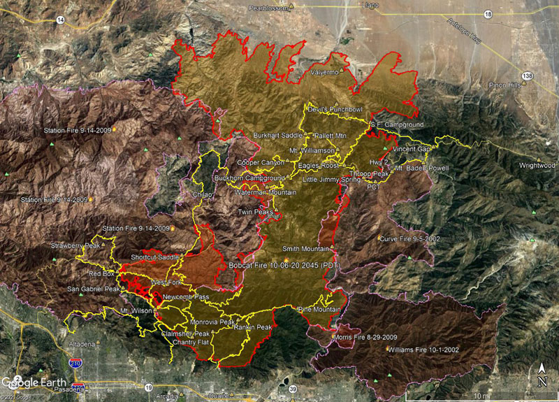
Here’s a Google Earth image of a Bobcat Fire perimeter from the National Interagency Fire Center (NIFC). The area inside the Bobcat perimeter is transparent yellow. Where the Bobcat perimeter overlaps older fire perimeters, the area appears transparent orange. The image acquisition timestamp of the Bobcat perimeter is 10/6/2020 2045 (PDT) .
Also included are adjacent perimeters for the 2002 Curve Fire, 2002 Williams Fire, 2009 Morris Fire and 2009 Station Fire. Some trails in Angeles National Forest are also shown as yellow tracks. All map data are approximate.
Angeles National Forest has partially reopened and issued Bobcat Fire Closure Order 05-01-20-08. The maps included in the Closure Order PDF are low resolution and poor quality. CalTopo has created an unofficial, but much more useful map, based on Closure Order.