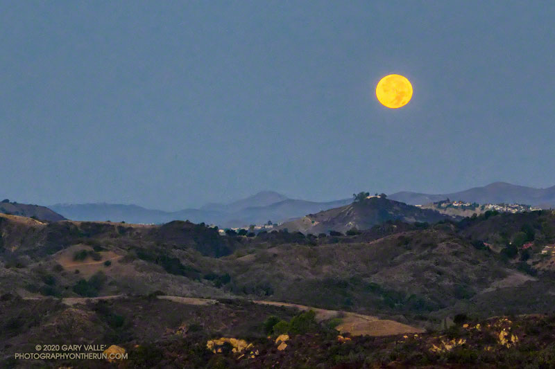
Halloween’s full Moon is the second full Moon of the month, giving it the distinction of being a “Blue Moon.” The next Blue Moon won’t occur until Aug 31, 2023.
The title photo of the setting Moon was taken a few minutes before sunrise on Halloween, from Fire Road 30 & dirt Mulholland, in the Santa Monica Mountains.
I was doing an out and back trail run from the “Top of Reseda” to somewhere on Rogers Road segment of the Backbone Trail. With about three hours and one bottle of water available, “somewhere” turned out to be the Lone Oak above Will Rogers State Park.
Including short side trips to Cathedral Rocks and Temescal Peak, the roundtrip totaled about 14.5 miles of enjoyable trail running.
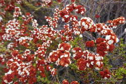
The afternoon was full of Fall. Oak leaves danced in a cool breeze, their shadows producing a familiar speckled pattern of shadow and sun, shadow and sun.
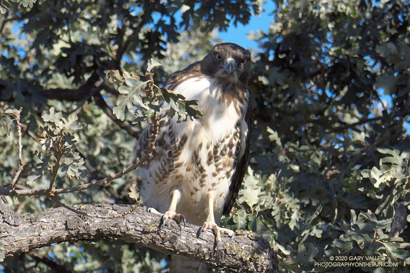
I was running northeast along the margin of Lasky Mesa in Upper Las VIrgenes Canyon Open Space Preserve, enjoying the Fall weather and smoke-free sky. I’d just passed a valley oak along the dirt road, when a thought bubbled up from my subconscious and asked, “Did you see what I saw in that tree?”
I stopped, turned around, and walked the few steps back to the oak tree.
Just feet from the road, partially camouflaged by oak leaves and shadows, was a red-tailed hawk. It seemed surprised, if not indignant, to have been discovered. I was equally astonished to have seen the bird.
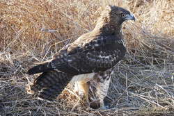
Red-tailed hawk with its prey – a small mouse.
The pattern of its plumage now made perfect sense. The hawk had been nearly invisible while feet away and in plain sight. I took one more photo, and then left the bird to its reverie.
I smiled as I ran down the road, and wondered if this was the same hawk that had buzzed me in Red-tailed Hawk Encounter.
Update November 14, 2020. Was near the spot where the encounter described above occurred and photographed a red-tailed hawk with a small rodent it had just killed. Since it’s in the same area, it may be the same bird.
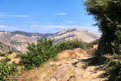
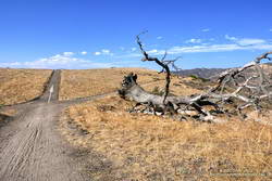
Above are thumbnails of a few photos from a 20-mile out and back trail run to Mugu Peak from the Wendy Drive Trailhead. The run was on October 17, 2020. Click on an image for a larger photo and more information.
There are several ways to get to Mugu Peak from the Wendy Drive Trailhead on Potrero Road. When I do this run I’m usually looking to do a longer, faster-paced run without a huge amount of elevation gain. That translates to running down Big Sycamore Canyon to Wood Ranch Road and then either running up the Backbone Trail or Hell Hill to the “hub,” and from there to La Jolla Valley and Mugu Peak.
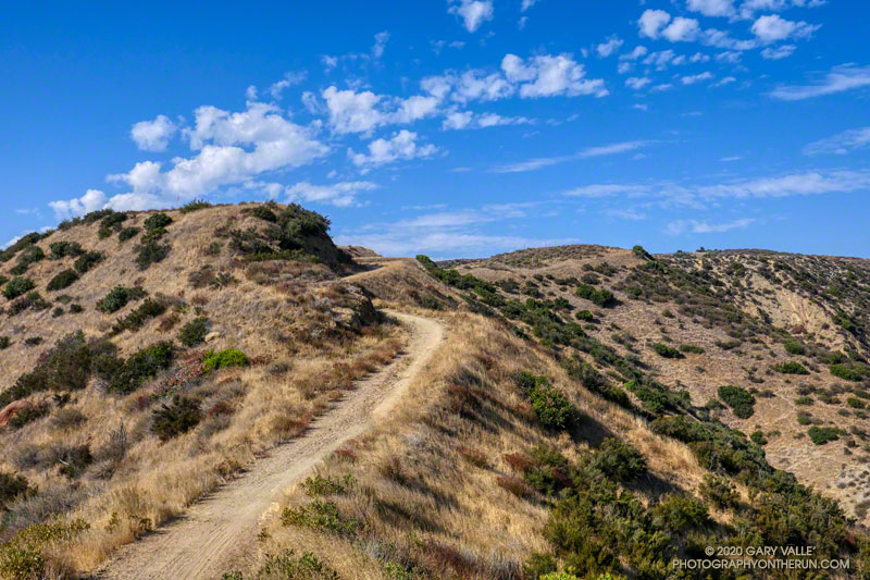
Rocky Peak Fire Road between the Chumash Trail and Fossil Point
Update of a post from December 30, 2006.
The Chumash-Las Llajas Loop is a scenic 9.3 mile trail run in the eastern Simi Valley. Run counterclockwise, it combines a strenuous climb on a single-track trail and fire road with a fast-paced 4-mile downhill on a dirt road. The cumulative elevation gain/loss on the loop is about 1600′.
Nearing the top of the Chumash Trail
I like to do the loop starting at the Las Llajas Canyon trailhead on Evening Sky Drive. A short jog up Evening Sky Dr., then across a field, and you’re on your way up the Chumash Trail. From this point, it’s an approximately 1000′ climb over 2.7 miles of rocky trail to Rocky Peak fire road.
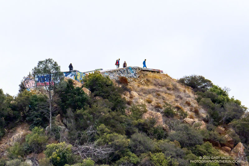
After turning left (north) on Rocky Peak fire road, a short downhill is followed by three-quarters of a mile of climbing to “Fossil Point.” A short detour off the main fire road leads to a cairn marking the high point. From here there is a panoramic view of Oat Mountain, San Fernando Valley, San Gabriel Mountains, Santa Monica Mountains, Simi Valley, Boney Mountain, Channel Islands, and Ventura Mountains.
Exposures of fossil shells are found near the high point. According to the area’s Dibblee geology map, these may have been deposited in shallow marine lagoons a couple million years ago.
From the high point, the loop continues north on Rocky Peak Road. At first, it descends steeply, then climbs to a hilltop with a few valley oaks. Partway up the hill, a roadcut reveals the long roots of the chamise plants on the hillside.
Road connecting Rocky Peak Road to Las Llajas Canyon.
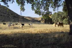
Some of the wildlife, and not-so-wild animals, I’ve encountered on the loop include rattlesnakes and other snakes, deer, longhorn cattle, roadrunners, and a kangaroo rat. Although others have seen mountain lions in the area, I’ve only photographed their tracks.
The loop ends with a short, steep climb up a paved road. At the top of the hill, turn left to return to the trailhead.
Explore the scenery and terrain on the Chumash-Las Llajas Loop trail run using our high resolution, interactive, 3D viewer. The imagery is so detailed, it’s almost like being there! To change the view, use the control on the upper right side of the screen, the CTRL key and your mouse, or touch gestures. Track and placename locations are approximate and subject to errors. Poor weather, and other conditions may make this route unsuitable for this activity. (It is also possible to start the loop at the Chumash Trail trailhead at the end of Flanagan Dr.)
The title photo is a section of Rocky Peak fire road between the top of the Chumash Trail and Fossil Point. It is from a run on October 6, 2020.

 Above are thumbnails of a few photos from a 20-mile out and back trail run to Mugu Peak from the Wendy Drive Trailhead. The run was on October 17, 2020. Click on an image for a larger photo and more information.