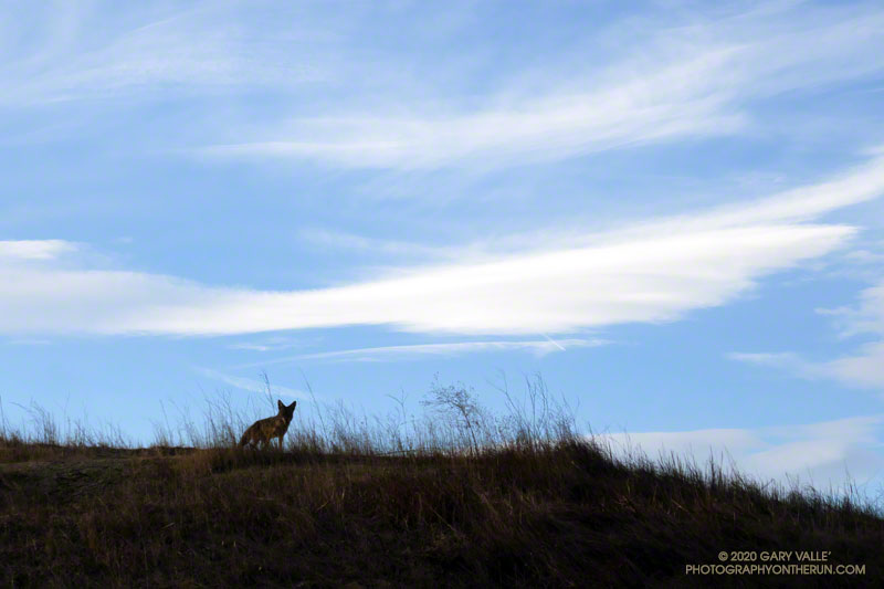
This afternoon I was running down a single-track trail at Upper Las Virgenes Canyon Open Space Preserve (Ahmanson Ranch), when I noticed a coyote on a parallel track across a small ravine. From time to time I would stop and watch the coyote, and from time to time it would pause and watch me. After a few minutes, it went its way, and I went mine.
Earlier in the run I’d been in the same area when a coyote, running at full speed, came blasting down a single-track trail. It turned into the brush about 30 yards in front of me. I’d seen similar behavior once before when one coyote was chasing another. In this case a hiker followed the coyote down the trail. In my experience, it usually take more than a simple encounter with a hiker to panic a coyote.
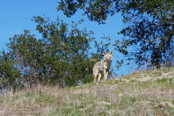
Another curious coyote. Click for a larger image.
Update February 18, 2021. The coyote pictured on the right was in the same area as the coyote in the title photo. When I first encountered the coyote, it had just crossed the trail and was below me. For some reason it reversed its course and climbed to a viewpoint above me, and watched as I ran up the trail. After a few moments it ran back down hill, retracing its original course across the trail. It was one of the most well-conditioned coyotes I’ve seen out at Upper Las Virgenes Canyon Open Space Preserve (Ahmanson Ranch).
I have had a couple of unusual encounters with coyotes out at Ahmanson. One time, a coyote decided to run with me, as if on a leash.
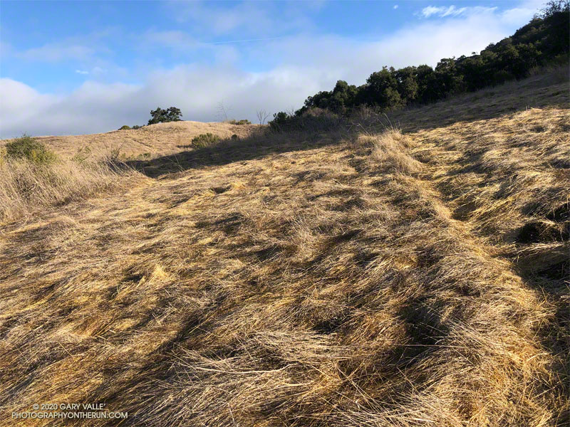
From the top of the hill, the blue-sky view extended all the way to Saddle Peak and the Pacific. The gray-green chaparral was brittle and dry, and the grasslands sun-bleached. Rain was in the forecast, but for months, little had fallen. It was the day after Christmas, and I was near the northern border of Upper Las Virgenes Canyon Open Space Preserve. Fourteen years ago, nearly to the day, I had run to the same hill. That rain year had also been dry, and the area had looked much the same.
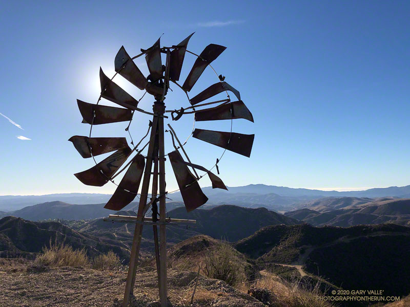
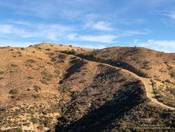
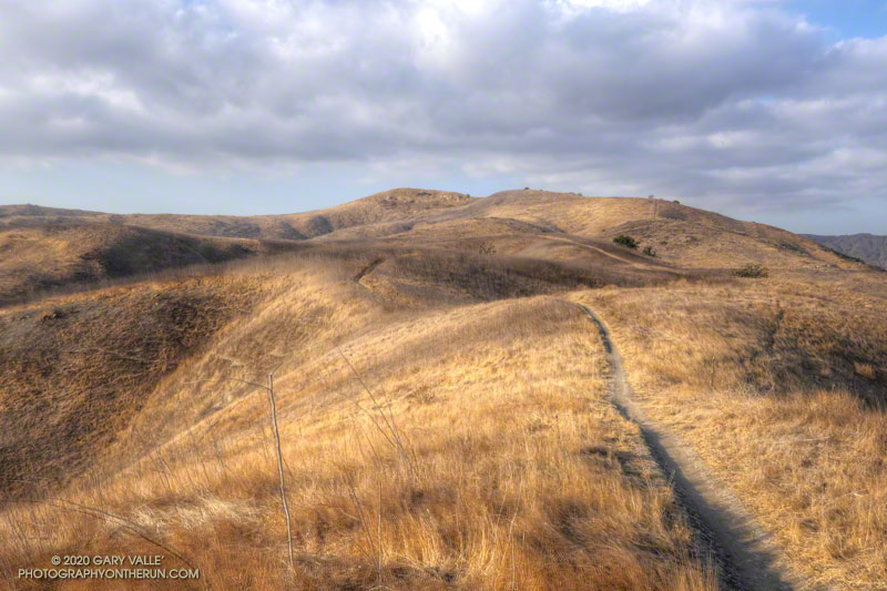
Steep fire road to “windmill hill.”
Today’s run had started at dawn at the Victory Trailhead. It had been cold in the canyons for the first few miles — in the low 30s — but eventually temps had warmed. I had run west in East Las Virgenes Canyon, taken a connector trail to Las Virgenes Canyon, and then run north on the Upper Las Virgenes Canyon fire road past Bell Canyon to “windmill hill.”
The hill is labeled with an elevation of 2124′ on the 1967 Calabasas topo map. The top of an old windmill has been placed on its summit. The windmill wasn’t there in 2006, and I wondered if it was from the infamous Runkle Canyon well. From the top of windmill hill I could see the high point of Upper Las Virgenes Canyon Open Space Preserve, a quarter-mile or so to the northeast.
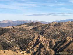
High point of Upper Las Virgenes Canyon Open Space Preserve
Located at its northeastern corner, the point with the highest elevation in the Preserve is a hilltop that’s just south of “hill 2160” on the Calabasas quad. Marked by a prominent pine tree, hill 2160 is on Santa Susana Field Laboratory property. It overlooks an area of the SSFL where a partial meltdown of an experimental reactor occurred in 1959.
Leaving windmill hill behind, I ran east down the hill, and then north along the fire road toward Albertson Mtwy. I was still debating whether to do the side trip to the Preserve’s high point. There was no path or trail to the high point, and the upper part of the slope was thick with brush. After running past the hill and nearly to Albertson Mtwy, curiosity finally got the better of me. I turned around and ran back to a place on the fire road where I could access the high point.
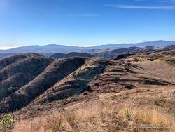
View south from the high point of Upper Las Virgenes Canyon Open Space Preserve
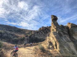
The side trip to the high point and back took about 20 minutes. After returning to the fire road, I continued down to the junction with Albertson Mtwy, turned left, and followed it west to a junction with an Edison powerline service road. This road meanders south through a rugged canyon, and then climbs up and over a prominent ridge with some spectacular sandstone rock formations.
Mountain bikers in the backcountry of Upper Las Virgenes Canyon Open Space Preserve
After topping out on the ridge, the service road descends to the junction of the Sheep Corral and Cheeseboro Ridge Trails. Today, I followed the Cheeseboro Ridge Trail south to the Las Virgenes – Cheeseboro connector. Once back in Upper Las Virgenes Canyon, I retraced my route from earlier in the day back to the Victory Trailhead.
The hill marked with an elevation of 1842′ on the USGS 7.5 minute Calabasas quadrangle appears to be the highest point of the portion of the Ahmanson Ranch property that was going to be developed.
I usually start the 2+ mile trail run to the peak by ascending the Hill Climb Trail — a short, steep hill a little west of the kiosk at the Victory Trailhead. A less steep trail can be found a little farther to the west.
Once at the top of this initial 120′ high hill, I try to run — without walking — all the way to the ridgeline just west of the peak. Whether I walk or not, it’s a fun run with excellent views of the area.
From the ridgeline at the top of the single-track trail, there is usually some sort of a use trail to the top of the peak. The location and clarity of the path varies from year to year. The area can be very overgrown. It’s worth taking the time to find and stay on a use trail. Earlier this December, I encountered a rattlesnake while trying to follow an old route through the brush.
Note: The Ahmanson Ranch project property and Upper Las Virgenes Canyon Open Space were combined to create Upper Las Virgenes Canyon Open Space Preserve.
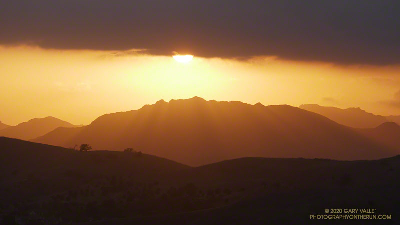
The photograph of Ladyface and the setting sun was taken from Lasky Mesa during an afternoon run in Upper Las Virgenes Canyon Open Space Preserve (Ahmanson Ranch).