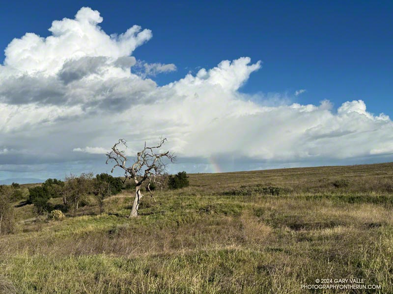
Related post: Chasing Rainbows at Ahmanson Ranch

Not all trails will have a smooth tread, good footing, trimmed vegetation, trail signs and other luxuries. What you see is what you get, and sometimes what you get is not perfect.
That was the case on last May’s run to the Serrano Valley from Wendy Drive. A long stretch of the Old Boney Trail was all but impassable. The trail was badly overgrown, the day foggy and gray, and everything was dripping wet.
But there is just something about immersing yourself in the good and not-so-good that nature offers. It’s part of what nature is. The splendid display of wildflowers seen on that run was a result of the rainy season that produced the overgrown trail.
Curious to see how that section of trail had changed in seven months, this morning I was back on the Old Boney Trail and on my way to Serrano Valley. It had rained around 4 inches during the week, and I expected the mud to be like glue and creek crossings wet.
Use of the trail had improved its condition. There were still some overgrown sections but most of the time I could see my feet, as well as the ruts and rocks on the trail. It was muddy in the usual places but the globs of mud on my shoes didn’t reach dinner plate proportions.
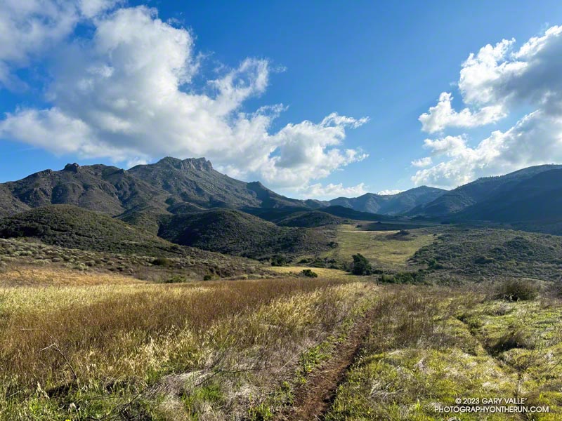
In the wake of the storm, the weather was exhilarating. Postcard clouds decorated the crest of Boney Mountain and a cool breeze filtered through the canyons. Despite all the rain, Serrano Creek was flowing at a modest level, and I emerged from Serrano Canyon with dry shoes.
It was a day for a longer run, and when I reached Sycamore Canyon fire road, I turned left (south) and continued down the canyon to the Fireline Trail. Going up the Fireline Trail to Overlook Fire Road extended the run and expanded the views. A right turn on Overlook Fire Road lead to the top of the Ray Miller Trail, and from there to the Hub. These junctions offer additional opportunities for extending the run.
Today, I ran down Hell Hill, over to the Two Foxes Trail via Wood Canyon Fire Road, then picked up Sycamore Canyon Fire Road near the Danielson Multi-Use Area and followed it to the Upper Sycamore Trail, Danielson Road, and Satwiwa. This interactive, 3D terrain view shows the route.
Some related posts:
– A Really Overgrown Trail, Thirty Creek Crossings, and Thousands of Wildflowers
– Old Boney to Serrano Valley, Plus Fireline and Overlook
– Serrano Valley from Wendy Drive
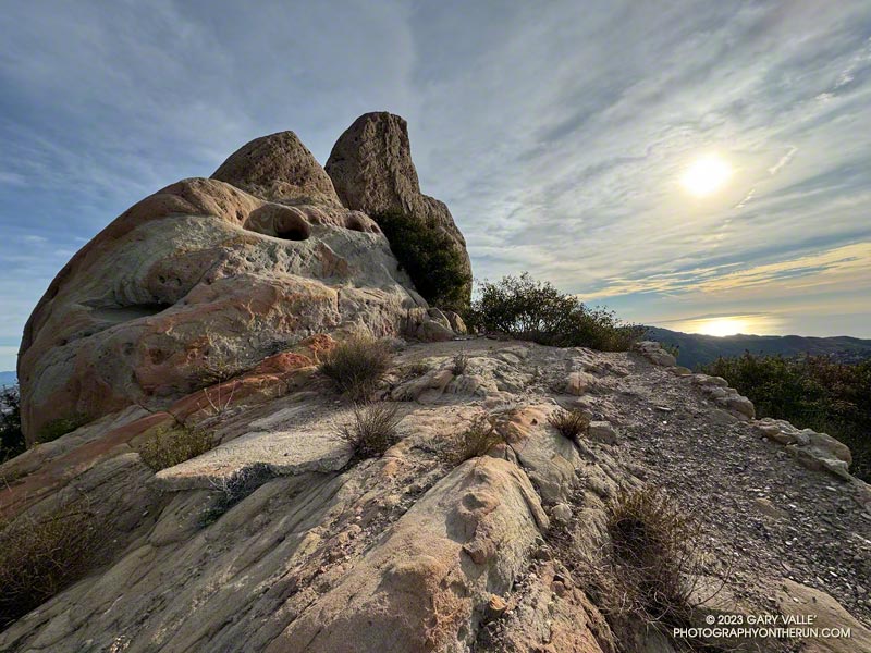
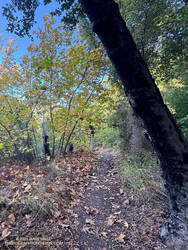
The photograph above was taken a few steps off the Backbone Trail, between the Corral Canyon Trailhead and Mesa Peak Motorway fire road. Also in the area was a set of table and chairs that might be used for an ocean-view card game or a lunch break.
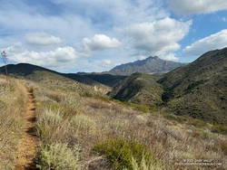
These scenes were about halfway through a variation of the Bulldog Loop that starts/ends at the Cistern Trailhead on Mulholland Highway. The route follows the Cistern, Lookout, and Cage Creek Trails down to the Crags Road Trail, just east of where it crosses Malibu Creek.
A permanent bridge used to span the creek, but after being washed out several times in Winter floods, a “seasonal” bridge was put in place. The seasonal bridge is removed when there is a threat of flooding, such as during the rainy season.
This morning, the temperature in the canyon was in the mid-thirties. That was cool enough that I didn’t want to get wet, and I hoped the removal of the bridge had been delayed. But several days of rain were in the forecast, and as I neared the creek, I could see the bridge now lay alongside trail.
A log spanned the creek where the bridge once stood. Using a suitable stick as a hiking pole, it was easy to cross the log, stay dry, and continue the loop.
Some related posts:
Best Trailhead to Start the Bulldog Loop?
Bulldog Loop Plus the Phantom Loop
After the Woolsey Fire: Bulldog Loop
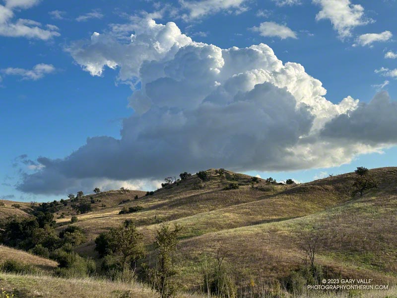
On my way to upper Las Virgenes Canyon from the Victory Trailhead of Ahmanson Ranch, I had to stop running and marvel at the intricacy and beauty of this cumulus cloud.
The cloud developed as another weak trough was passing through Southern California. For a few weeks the long-range outlooks have been advertising a change to a wetter weather pattern, but the expected transition keeps being delayed.
More posts from the category Nature & Clouds.
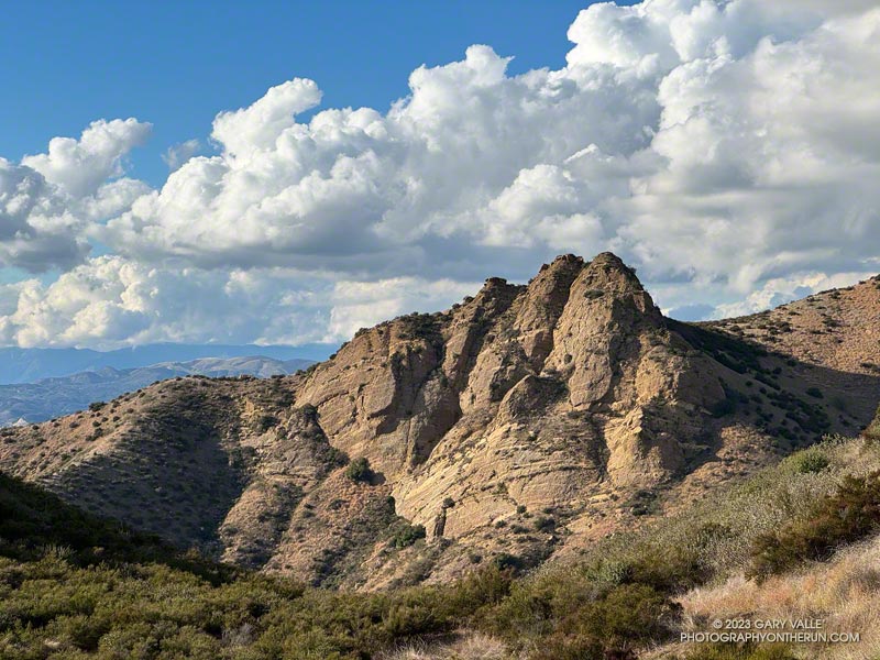
“Chumash Rock” is prominent rock formation seen from the Chumash Trail in the eastern Simi Valley.
As I discovered in a January 2006 adventure, it is not an easy rock formation to reach.
The title photo was taken in mid-November while doing the Chumash – Las Llajas Loop. The clouds over the Ventura County foothills and mountains from the Las Llajas Canyon – Rocky Peak Road connector were just as beautiful.
The clouds were associated with a front that stalled to the north of Los Angeles, resulting in some surprising and substantial rainfall totals in Santa Barbara and San Luis Obispo Counties. No measurable rain was reported in Los Angeles County by the NWS.
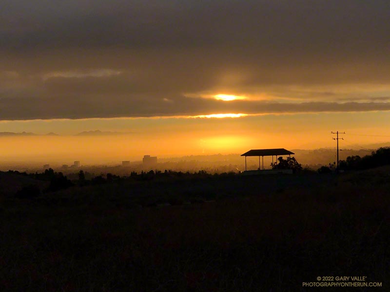
From an early morning run at Ahmanson Ranch (Upper Las Virgenes Canyon Open Space Preserve) on September 20th.
Related post: Monsoon Clouds and Valley Oak at Sunrise on Lasky Mesa