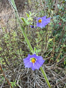
As I worked up the Old Boney Trail, I looked for anything blooming. The empty seed pods from last year’s bigpod Ceanothus bloom were still present on many plants, but not a flower was in sight.
Lack of rain will do that. Although today’s run was after Southern California finally received some rain, the first few months of the rain season had been ridiculously dry. From July 1, 2024, to January 24,2025, Downtown Los Angeles recorded only 0.16 inch of rain — tying 1962-1963 for the driest start to the Rain Year on record.
Purple nightshade – just about the only early bloomer on 20+ miles of trail.
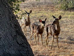
Very early in the run, I came across some disturbing tracks on the Old Boney Trail. I first saw them on Danielson Road, and they continued on Old Boney all the way to Blue Canyon. From the tracks, I could see they powered directly up the hills and sped through the straightaways.
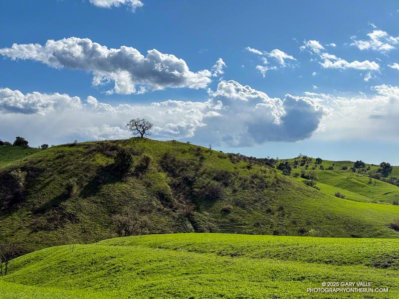
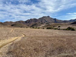
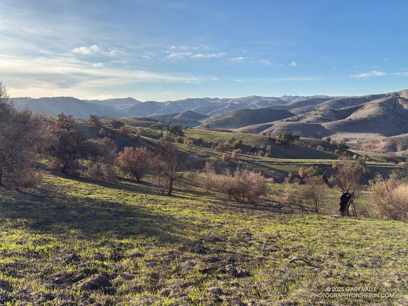
Usually, when I do the long climb out of Upper Sycamore on the Old Boney Trail, it’s to do the Western Ridge (Mountaineer’s Route) on Boney Mountain. This morning, the combination of crags, clouds, and early morning light on Boney Mountain looked especially inviting. I almost turned up the use trail that ascends the ridge. Resisting the impulse, I continued on the Old Boney Trail — past the Fossil, Blue Canyon, and Chamberlain Trails — to the Serrano Valley Trail and Serrano Valley.
Serrano Valley – February 2025
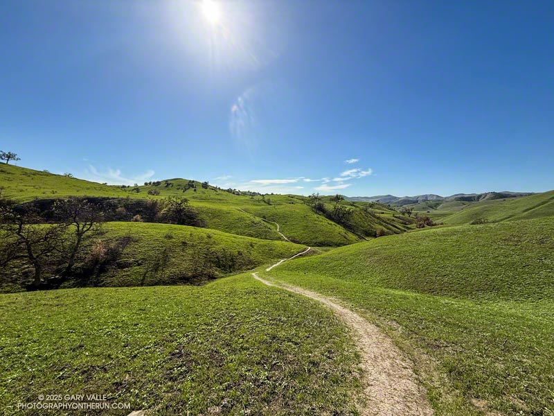
It had been over a year since I’d been to Serrano Valley. It is one of the prettiest spots in the Santa Monica Mountains. It has a “big sky” feel that I always enjoy. When combined with a run down Serrano Canyon, the experience is exceptional.
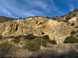
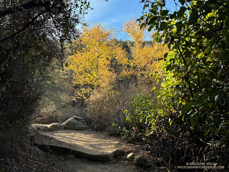
One of the interesting things to see in Serrano Canyon is a large landslide scar on the north side of the canyon, about a half-mile from Sycamore Canyon. The trail goes over the foot of the slide. Some boulders near the trail contain fossils, similar to those found on the Fossil Trail.
As the landslide scar came into view, something had changed — there was a “new” rockslide in the middle of the old landslide scar. When I stopped to take a photo, I could hear rocks and debris trickling down the slope. This suggested the slide was still active and might be very recent. When did it happen?
New rockslide on an old landslide scar in Serrano Canyon.
The last time I’d photographed the landslide scar was in February 2022. At that time, this new rockslide hadn’t occurred. I also checked Google Earth. The most recent Google Earth imagery of the landslide scar was from April 21, 2023. It didn’t show the rockslide. Then I checked Sentinel 2 satellite imagery, but that wasn’t high enough resolution to determine the date of the rockslide. High resolution imagery of a relatively small, non-urban area would be required, and it would need to have been taken after April 21, 2023.
After failing to find a suitable image using various services that provide free or low cost imagery, I contacted the Vexcel Data Program. They were kind enough to provide an answer — the new rockslide was not in imagery from September 23, 2023, but was present in an image from October 12, 2023.
The new rockslide occurred about 16 months ago, a month or two after Tropical Storm Hilary passed through Southern California. For the 24-hour period ending at noon on August 21, 2023, the weather station at nearby Circle X Ranch recorded about 3.9 inches of rain.
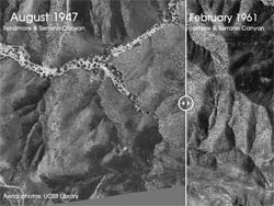
While searching for imagery of the landslide scar, I stumbled onto UCSB Library’s collection of aerial photography. It contains more than 2.5 million images dating back to the 1920s. Curious to see the quality of the photos, I picked a 1:12,000 scale image from November 1936 that was more or less centered on the landslide scar. The quality of the image is excellent — but where was the landslide? I had assumed the Serrano Canyon Landslide to be an ancient feature. How old is it?
Serrano Canyon before the landslide (1947) compared to after (1961). Click!
Continuing down Serrano Canyon, I stopped at Sycamore Canyon to get some water and decide where I was headed next. Option A was to turn south on Sycamore Canyon Road, go up the Fireline Trail to Overlook Fire Road, and then return to Wendy Drive via Hell Hill, Wood Canyon, Two Foxes, Sycamore Canyon, and Upper Sycamore. Including what I’d already done, that would be about 24 miles. Option B was to turn north on Sycamore Canyon Road and go directly to the Two Foxes Trail, etc. That would be about 20 miles.
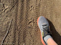
Mountain lion tracks along Sycamore Canyon Fire Road
Today, I opted for Option B. That turned out to be an exciting choice. Just before the turn onto Wood Canyon, there was a sequence of mountain lion tracks along the east side of Sycamore Canyon Road. To better show its size, I superimposed the track on top of my shoe. The shoe is about 4.5 inches wide at the center of the track. There were also deer tracks along the road.
Here is a high resolution, interactive, 3D terrain view of the Old Boney – Serrano Valley Loop from Wendy Drive. Two options are shown. The map can be zoomed, tilted, rotated, and panned. To change the view, use the control on the upper right side of the screen. Track and placename locations are approximate and subject to errors. Poor weather, and other conditions may make this route unsuitable for this activity.
According to the CAL FIRE Kenneth Fire Incident Page, the fire burned 1,052 acres, and was contained on January 12, 2025. The Kenneth Fire is the third significant fire to affect this area in the last 20 years — the other two being the 2005 Topanga Fire and 2018 Woolsey Fire.
At about the time the fire started, a personal weather station near the Victory Trailhead recorded the wind from the ENE at about 11 mph, gusting to 22 mph. At this station, the wind moderated somewhat over the course of the afternoon and early evening, but picked back up overnight.
The vegetation within the burn area is oak savanna — a plant community characterized by grassland and scattered oaks. In the case of Ahmanson Ranch the oaks are valley oaks and coast live oaks. The last known blue oak in the Preserve died in the Winter of 2022-23.
Taking into account their respective populations, the percentage of valley oaks destroyed by the Kenneth Fire far exceeded the percentage of coast live oaks. As the climate has warmed, the mortality rate of valley oaks in the southern part of their range has been increasing and their range retreating northward.
Although the wind was not as strong as it was on January 7-8, it was exceptionally dry. Prior to January 2025, Downtown Los Angeles only recorded 0.16 inch or rain for the Rain Year starting July 1 and Water Year beginning October 1. As of January 9, the period July 1, 2024 to January 9, 2025 was tied with 1962-63 as the driest on record.
The Sunday before the start of the Palisades Fire, I ran the Trippet Ranch Loop from the Top of Reseda. Yet another weak cold front had brushed Southern California, producing little precipitation. The weather was nearly perfect for the run — breezy at times, with moderate temperatures and some high clouds.
The NWS Los Angeles/Oxnard office was already expressing concern about a potentially dangerous wind event early in the week. In an Area Forecast Discussion midday Sunday, they warned, “..STRONG AND DAMAGING WINDS AND HIGH FIRE DANGER LIKELY FOR PORTIONS OF VENTURA AND LOS ANGELES COUNTIES…” Of course, few of us could envision the staggering devastation that would ensue in the week ahead.
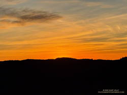
Sunrise from Fire Road #30, near the beginning of the Trippet Ranch Loop from the Top of Reseda.
The eastern horizon glowed orange as I ran down Fire Road #30 from dirt Mulholland. If I could have seen a few days into the future, the road would have been filled with firefighters and equipment battling to halt the Palisades Fire’s westward progress. The road was empty this morning, save the scurrying towhees and raucous scrub jays.
At the Hub, I stopped to take a photo of Eagle Rock. Bush poppy, a prolific fire follower, covered much of the area between the Hub and Eagle Rock. This burned in the 2021 Palisades Fire. The hazy view extended past Eagle Rock to Calabasas Peak and Boney Mountain.
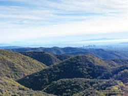
Downtown Los Angeles from Temescal Peak and the chaparral typical of the area.
Before descending to Trippet Ranch on Eagle Springs Fire Road, I turned east on Temescal Ridge Fire Road. I would return to the Hub, but first, I wanted to visit Temescal Peak and Temescal Lookout. These viewpoints have expansive views of the Santa Monica Mountains and beyond. This photo (from a previous run) is a view of downtown Los Angeles from Temescal Peak. The chaparral in the photo is typical of the vegetation in the Santa Monica Mountains. Most of this would have burned in the 2025 Palisades Fire. On a day with good visibility, San Jacinto Peak can be seen from either viewpoint. Despite some haziness, San Jacinto Peak could still be seen from Temescal Lookout this morning.
Returning to the Hub, I ran down Eagle Springs Fire Road and through the footprint of the 2021 Palisades Fire. The bright yellow flowers of bush poppy shone brightly in the morning sun. When the perimeter of the 2021 fire is overlapped with the 2025 fire, it suggests that bush poppy and other transitional vegetation in the 2021 burn area did not burn as readily in the 2025 fire as the usual chaparral species.
Continuing past the information kiosk at the corner of the parking lot, I headed up the paved road and picked up the Musch Trail. Although we haven’t had much rain this Rain Year, the past two Rain Years were very wet. Paradoxically, the vegetation is bone dry, but some small creeks and springs that haven’t run for years — such as Eagle Springs — still have water. Reflecting last year’s rain, a heavy load of red-orange berries cover most of the toyon bushes along the Musch Trail and throughout the Santa Monica Mountains.
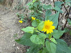
Canyon sunflower along the Garapito Trail
At the top of the Musch Trail, I turned left and worked up Eagle Rock Fire Road, past Eagle Rock, to the top of the Garapito Trail. At times, over the past couple of years, this outstanding trail has been almost impassable. Volunteer trailwork has cleared and repaired the trail multiple times. It’s a good trail for wildflowers, but the lack of rain has reduced the number of early bloomers. Today, canyon sunflower, California everlasting, and California fuchsia were blooming along the trail. This misshapen bush sunflower was blooming along Fire Road #30, near its junction with the Garapito Trail.
The last time Downtown Los Angeles had more than a smattering of rain was mid-April 2024 — more than 250 days ago. To date, the Rain Year beginning July 1, 2024 has been one of the two driest in the 147+ year weather record for Downtown Los Angeles.
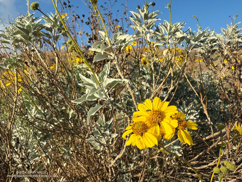
Because of the time of year, and lack of rain, not many wildflowers were blooming along Los Angeles area trails at the end of 2024. One exception was this brittlebush (Encelia farinosa) on the southwest corner of Lasky Mesa in Ahmanson Ranch.
If Los Angeles doesn’t see any rain by January 9 — which appears likely — the period July 1, 2024 to January 9, 2025 will be tied with 1962-63 for the driest on record.