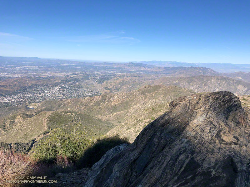
View west from Mt. Lukens, across the Crescenta and San Fernando Valleys.
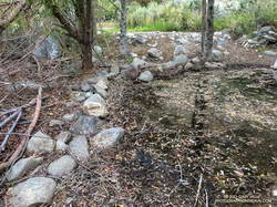
It was a chilly 45 degrees in the canyon, and I had already resigned myself to having to wade across Big Tujunga Creek. But I didn’t even get my shoes wet. The water level was low enough that the large rocks placed across the creek were high and dry.
Low water made it easy to cross Big Tujunga Creek.
It was a good start to what was to be an excellent run and hike. As I gained elevation, it was evident there had been recent work on the trail. Trimmings from the brush along the trail were still green, and in several spots the tread had been freshly manicured. The higher I climbed, the more work had been done. In a couple of places, substantial washouts had been repaired.
Last year, the trailwork ended abruptly about halfway up the trail. Not so this year. An impressive amount of work had been done to clear the trail of a tortuous mix of dead scrub oaks and thorny brush. Without having to crawl over, around, and through those snarls, my roundtrip time to the summit and back was a full hour faster than last year. Many thanks to whoever worked on the trail!
Here’s an interactive, 3D terrain view that shows a GPS track of the route up and down the Stone Canyon Trail on Mt. Lukens. The view can be zoomed, tilted, rotated, and panned. Placemark and track locations are approximate and subject to errors.
As of March 1, Downtown Los Angeles had recorded only 1.99 inches rain over the past eight months. Most of that was recorded in one storm in early January. It was the second driest July 1 – February 28 on record.
Following the January storm, temperatures warmed up and stayed relatively warm for much of the next 30 days. In the West San Fernando Valley the high temperature hit 89 °F at Pierce College on February 4, and was over 80 °F for 12 consecutive days. Some plants (and some rattlesnakes) responded as if it was Spring.
In mid February Winter returned, with cool daytime temperatures and cold nights. There were Frost and Freeze Warnings on several nights.
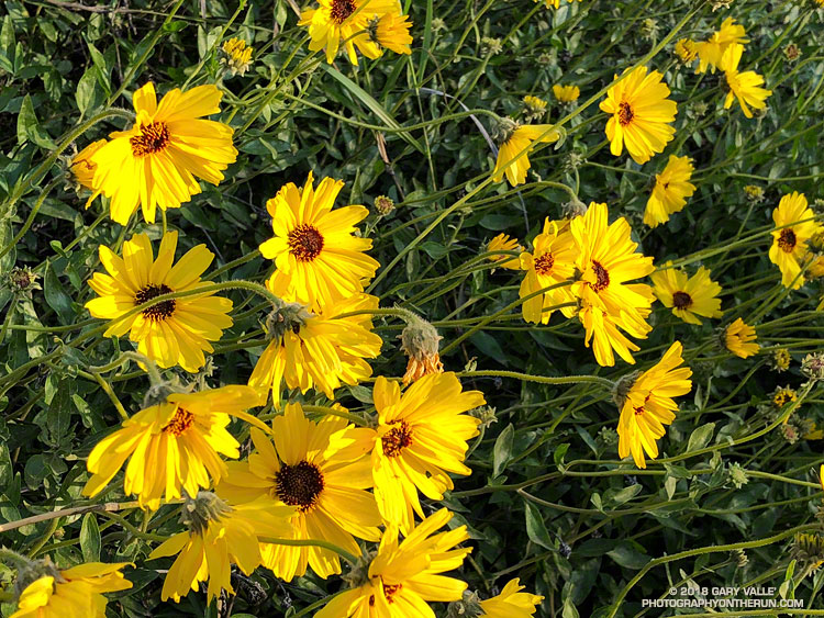
In March the ridiculously resilient ridge of high pressure over the West Coast finally relented, resulting in above normal rainfall. It took awhile, but the March rain and April sun eventually produced an assortment of wildflowers.
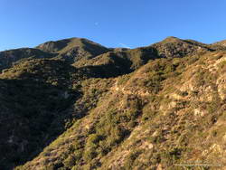
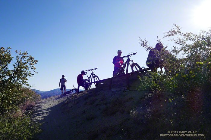
The group of five mountain bikers first passed me at Strawberry Potrero, a picturesque area on the north side of Strawberry Peak. The circuit around Strawberry Peak is a favorite of MTBers and in recent years I’ve encountered bikes on the loop nearly every time I’ve done it. It’s also an excellent run and part of the Mt. Disappointment 50K course.
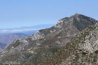
Josephine Peak and fire road. Click for larger image.
The trail segments that make up the usual loop are Josephine Fire Road, Strawberry Spur Trail, Colby Canyon Trail, Strawberry Peak Trail, Gabrielino Trail, and Nature’s Canteen Trail. Today, I was doing a variation of the circuit that swapped out some fire road for trail. Instead of parking at Clear Creek, and running up Josephine Fire Road, I parked at the Colby Canyon trailhead and ran up the Colby Canyon Trail. This variation joins the usual course at Josephine Saddle** and continues around the peak. (Another option climbs over Strawberry Peak.)
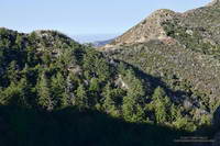
Stand of Bigcone Douglas-fir that didn’t burn in the 2009 Station Fire. Click for larger image.
I thought I’d seen the last of the mountain bikers, but found them taking a break near the beginning of the two mile, 750′ climb to Lawlor Saddle. We chatted about the great weather and the next section of trail. As I turned to continue, one of the riders asked, “Hey, do you need a GU or anything?” I told them I was good, and started running.
Mountain bikers expect to be faster than a runner — and they usually are — but there are certain situations where runners have an edge. This was one of them. The first half-mile of the climb to Lawlor Saddle is relatively steep. After that the trail backs off a bit, but is still a decent climb. Since I had a head start, I decided to play the “How Long Can I Stay Ahead of Them” game.
I didn’t know if they were going to play or not, but it really didn’t matter. It was a way of having a little fun and motivating myself to push a little harder and run a little faster.
Parish’s goldenbush. Click for a larger image.
Whether you’re doing the Mt. Disappointment race or not, the climb to Lawlor Saddle will tell you if you are having a good day or bad. Today I was having a good day. The temperature was about 30 degrees cooler than at this year’s Mt. D, and after the initial steep section I ran nearly every step to Lawlor Saddle. A couple of times I thought I heard the bikers behind me, but somehow made it to the saddle without being tagged.
But now I was in trouble. Just past Lawlor Saddle the uphill ends. The question wasn’t if they would catch me, but when. Just before the trail turned to the east I caught a glimpse of a bike at the saddle, so the when might be in just a few minutes. It would depend on how spread out the riders were and if they decided to take another break.
Hikers on the Strawberry Peak Trail. Click for a larger image.
From Lawlor Saddle the trail contours around the south side of Mt. Lawlor for a mile or so, winding in and out of one ravine after another. It’s not particularly technical, but I hoped the frequent turns might slow a bike. I pushed the pace as much as I could.
About a mile from Red Box the trail finished its traverse around Mt. Lawlor and dropped down a rocky section of trail to an abandoned Forest Service road. Foolishly I started thinking maybe, just maybe, I’d make it to Red Box ahead of them.
Only about a quarter-mile from Red Box and in sight of the parking lot, I heard the tell-tale jingle-jangle of a bike bell. It wasn’t far behind me, and I moved to the side of the trail to let them pass. As the lead bike rolled leisurely past, he commented, “Hey, we weren’t sure we were going to catch you!”
The game over, I settled back in for the last few miles of the run.
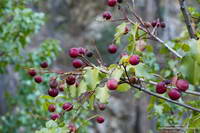
Holly-leaved cherry, a favorite of coyotes and black bears in Southern California.
** The location of Josephine Saddle is currently mismarked on Google Earth and Google Maps. The saddle at the top of the Colby Canyon Trail has long been known as Josephine Saddle. It is marked as such on the U.S.G.S 7.5 Minute Condor Peak Quadrangles from 1959 to 2012. It is called Josephine Saddle in John Robinson’s authoritative guidebook Trails of the Angeles and numerous other guidebooks and route descriptions.
The north side of San Gorgonio Mountain was closed in June 2015 when the Lake Fire burned approximately 31,359 acres of forest, chaparral, sage, pinyon and Joshua tree habitat at elevations ranging from about 10,700′ to 5350′. As a result of the determined efforts of firefighters, only one residence and some remote outbuildings were lost.
Of the 30,487 acres reviewed by the Burned Area Emergency Response (BAER) team 4,327 acres (14%) were categorized as Unburned; 17,100 acres (56%) as having Low soil burn severity; 8,420 acres (28%) as having Moderate soil burn severity; and 640 acres (2%)with High soil burn severity. (Note that soil burn severity isn’t necessarily synonymous with fire intensity and fire effects such as tree loss.)
I’d been keeping an eye on the Alerts & Notices section of the San Bernardino National Forest web site to see if the Lake Fire closure order would be renewed. I was curious to see the extent and impacts of the Lake Fire and how the area was recovering. Plus, the Dollar Lake – Dry Lake keyhole loop is an outstanding trail run — one of the best in Southern California. In addition to climbing San Gorgonio Mountain (11,499′), it encompasses some of the most scenic areas on the peak.
The area’s trails reopened July 20. The weekend prior to the reopening San Gorgonio Wilderness Association volunteers worked on the South Fork and Dry Lake Trails, clearing a number of large trees, removing debris and other hazards and improving the trail tread.
A week and a half after the opening I pulled into the South Fork parking lot on Jenks Lake Road, excited to get on the trail. There was a slight chance of thunderstorms in the forecast, and I hoped to be off the summit and on my way down by 10:30 or 11:00.
Most of the run is in the San Gorgonio Wilderness and a wilderness permit is required. Check a map, but the general sequence of trails is the South Fork Trail, Dollar Lake Trail, Divide Trail, Summit Trail, Sky High Trail, Dry Lake Trail and then back down the South Fork Trail to the trailhead. This Google Earth image shows the western part of the Lake Fire burn area in relation to San Gorgonio Mountain and some of the area’s trails.
On this particular run I also wanted to check out the Fish Creek Trail and the “use trail” down to Lodgepole Springs and Dry Lake, so rather than continuing down the Dry Lake Trail from Mineshaft Saddle, I turned right (east) and followed the Fish Creek Trail to Fish Creek Saddle.
There were some downed trees and a lot of fire debris on the Fish Creek Trail. Extra care was required and I probably hiked as much of it as I ran. As I worked toward Fish Creek Saddle I could not tell how much of the canyon leading down to Lodgepole Spring had burned. The slopes on the southwest side of Grinnell Mountain had burned and some areas along the Fish Creek Trail had burned as well. Whether I descended to Lodgepole Spring from Fish Creek Saddle or returned to Mineshaft Saddle would be a judgment call.
Arriving at Fish Creek Saddle I was glad to see the forest was intact. The path down to Lodgepole Spring looked promising, but had not been used in some time. As it turned out most of the trees along the path had not burned. In places, runoff from the burned slopes above had resulted in some erosion and small flows of sandy soil. There were also the usual downed trees, but other than being a little challenging to follow, the path was generally OK.
I was nearly off the trail when the “chance of thunderstorms” forecast materialized into threatening gray clouds, a few sprinkles, and a couple of rumbles of thunder.
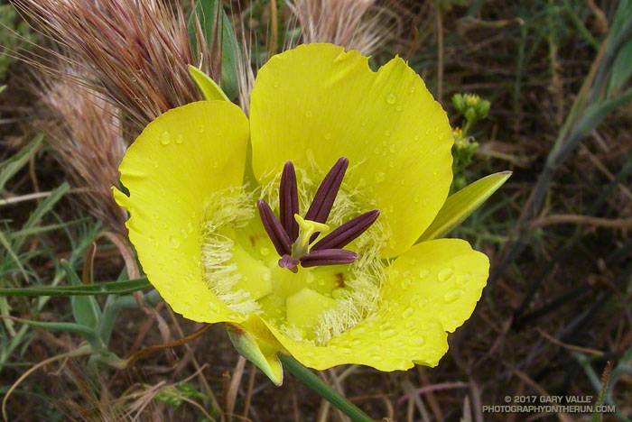
Still wet from a morning shower, this yellow mariposa lily (Calochortus clavatus) was found along the Satwiwa Loop Trail near the end of Saturday’s run to Serrano Valley.