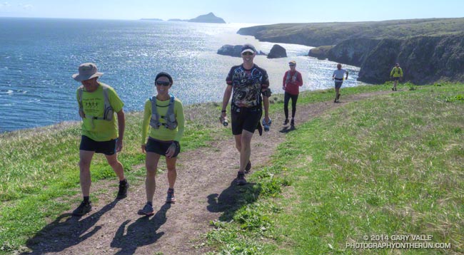
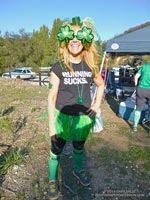
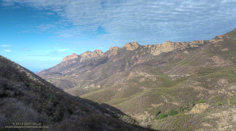
Great outing to Santa Cruz Island today as a guest of the Trail Runners Club.
Here are a few photos taken along the way.

Great outing to Santa Cruz Island today as a guest of the Trail Runners Club.
Here are a few photos taken along the way.
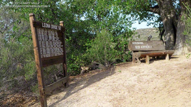
It had been “a while” since I’d run this segment of the Pacific Crest Trail. This photo will give you an idea of just how long. That year January was warm and dry and none of the local creeks had enough water to kayak, so Gary Gunder and I were doing a lot of running. Two of the most enjoyable runs we did were the segments of the PCT from Pine Canyon Rd to Lake Hughes Road (FS 7N05) and Lake Hughes Road to Sierra Highway in Aqua Dulce. These PCT segments are closely associated with the Leona Divide — both the race and geographic feature — and include some of the fastest single track trail in Southern California.

Today I was back in the Leona Divide neighborhood and getting reacquainted with the stretch of the PCT between Bouquet Canyon Road and San Francisquito Canyon Road. Bouquet Canyon Road is the turnaround point for the 2014 Leona Divide 50 mile and this 13 mile stretch — done on the way out and the way back — makes up most of the single track trail on the course.** With the Leona Divide 50/50 coming up April 26 a number of runners (Karl, Dave #1, Matt, Dave #2 and others) were also out on the trail.
This section of the PCT is about as non-technical as a single track trail can be. It’s generally in very good shape with surprisingly few rocks, technical obstacles, or steep hills to slow you down. Most of the trail is in chaparral, out in the open, and on sun-facing slopes. The elevation ranges from about 3300′ to 4300′. Trail mileages are close to what the trail signs advertise — about 7 miles between San Francisquito Canyon Road and Spunky Edison Road, and 6 miles between Spunky Edison Road and the 50 mile turnaround at Bouquet Canyon Road.
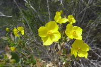
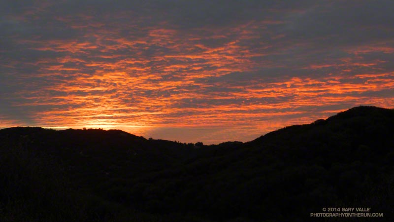
The weather could not have been better for today’s run. Some shaded sections of trail were lush and green from recent rains and in places yellow bush poppy, blue Phacelia, purple chia, scarlet bugler and other wildflowers bloomed along the trail. The midday temp was in the 60s at the Grass Mountain RAWS (just off the PCT near Leona Divide Road). The temps at this weather station were in the 80s during last year’s Leona Divide 50/50 when “in the sun” temps reached over 100 degrees.
In today’s cool conditions it was a long run kind of day, and the 26 miles were about as enjoyable as a longer trail run can be.
**Note: The 50M and 50K courses have been rerouted. See the Leona Divide 50/50 web site and the related post Up and Over Sierra Pelona Ridge.
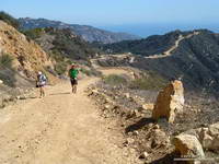
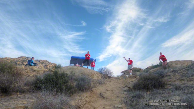
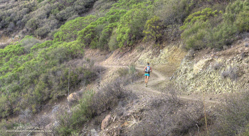
Runners on the Backbone Trail at About Mile 2 of the Backbone Ultra
Last year I ran the Coyote Backbone Trail Ultra and enjoyed everything about it — the trails and scenery, the runners, the volunteers, the approach of the organizers, and just the general vibe of the event. The Backbone Ultra team did a superb job, and as far as I know there no major issues. Nobody got lost or seriously injured. The runners and volunteers were respectful to the environment and everyone I talked to had a great time participating in the event.
Still I wondered. Because of its complex logistics and administrative requirements would there be a 2nd annual Backbone Trail Ultra? Then on August 22, a little after lunchtime, the news was posted — there would be a “Game 2!” I needn’t have worried, RDs Howard Cohen and Mike Epler were on it!
On March 15 at 6:07 a.m., at Will Rogers State Park, under the light of a 99% full moon, myself and 46 other runners in the first start group began our Backbone Trail adventure.
In the weeks leading up to the Backbone Ultra I’d been closely watching the weather. Two weeks prior to the run the area was inundated by the most rain in 48 hours since 2011. There had been some concern that heavy rainfall in the Springs Fire burn area in Pt. Mugu State Park would severely damage trails. That didn’t happen.
Ten days out it looked like an upper level low might affect the area. That didn’t happen. As the event neared, the forecast trended drier and warmer — much warmer. Friday as I was getting my drop bag ready, @NWSLosAngeles tweeted “Still expecting high temps to approach records at some locations this weekend” along with this graphic. That did happen!
On Saturday, the first day of the event, Santa Ana winds pushed the temperature at noon at Malibu & Piuma to 86 degrees — 16 degrees higher than during last year’s event! Note that this is the temperature in a ventilated, white-painted box several feet off the ground. The “in the sun” temperature, near the ground, on south-facing slopes was likely in the 90’s. Even more telling, the temperature at Circle X was in the 80’s from noon until 5:00 p.m. and at midnight was 74 degrees!
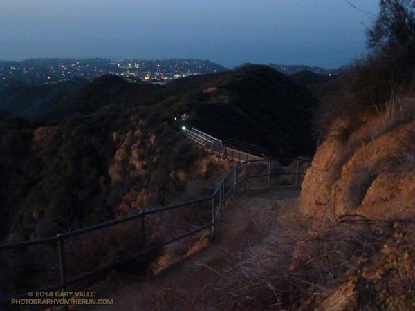
It must have been something to be on the Backbone Trail at its highpoint near Sandstone Peak in the middle of the night, with 100 mile visibility, a full moon and warm weather. I am really bummed to have missed that! I didn’t get to experience it because I had some kind of heat-related issue and dropped at the Encinal Aid Station at around mile 43.
This is the first time heat has kept me from completing a run or race. So what was the problem? Probably a combination of things. I don’t think I was under-trained or over-trained. I hadn’t just had the flu or a cold. My taper seemed OK. It wasn’t under-hydration, at least not in the first 30 miles. My best guess is that anticipating the heat, I drank too much early on. Not having trained much in the heat this year probably also contributed. It’s hard to know for sure. Sometimes it’s just not your day!
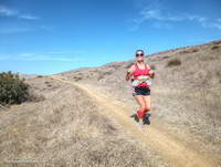
Although I didn’t get to the finish this year, I still very much enjoyed the miles I did run on the Backbone Trail. Here’s a slideshow of some images taken along the way.
It is a tribute to the many people that helped support the Backbone Trail Ultra that — by a substantial margin — there were more volunteers than runners! Many thanks to:
– RDs Howard Cohen & Mike Epler and their team Fred & Lauren Case, Willie Roland, Tres Smith, Erica Gratton and Dan Dicke.
– California State Parks and the National Park Service.
– Trippet Aid: Rene Canizales and the New Basin Blues.
– Stunt Aid: Alison Chavez/Amy Chavez and the SoCal Coyotes.
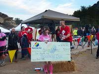
– Piuma Aid: Art Byrne and the Trail Runners Club.
– Corral Aid: George Plomarity and Patagonia.
– Kanan Aid: Paul Van Zuyle and his leprechauns.
– Encinal Aid: Bill Kee and wife Paula and the Coyote Cohorts.
– Mishe Mokwa Aid: Manley Klassen and wife Mara and the Coyote Cohorts.
– Sycamore Aid: Puerto Mauricio and the Coyote Cohorts.
– Finish: Erica Gratton & Janna Williams and the Conejo Valley Trail Runners.
– Breakfast: Luis Escobar, Jerry Gonzales and team.
– Medical: The Josepho Team and Ventura County Search and Rescue.
– HAM radio operators at each of the aid stations and the finish.
– Volunteers at the road crossings at Stunt, Piuma, Malibu Canyon, Latigo Canyon, Encinal Canyon, Mulholland Highway and Yerba Buena times 2.
– Sweeps: Kathy Higgins, Rene Canizales, Erin Chavin & Pedro Martinez, Ken Hughes and Jack Fierstadt.
– All the Course Markers & Safety Patrols.
Some related posts: Backbone Training Run 2014 #1, Backbone Training Run 2014 #2, Run, Lop and Shiver, Backbone Ultra 2013
As I worked up the hill toward “Fossil Point” I drank the last mouthful of water from my bottle. I wasn’t surprised that I had run out. The morning temperature had been the warmest in the six year history of the event, and the midday temp in the sun felt like it was in the mid-80’s — maybe higher.
In Southern California it has been the kind of Winter that those in northern climes can only dream about: Day after day with fair skies and the temperature in the 70’s and 80’s. Great for trail running, but with the trade-off that we had had the least amount of rain in over a century.
Chugging up the steep hill I thought about how the run had gone so far. Even if it was a little warm, it was still a pretty good day for a trail run! I hadn’t tried to push the pace on the initial steep climb from Corriganville, and had (mostly) resisted the temptation to pound down the Chumash Trail. The crazy-steep section of Hot Dog Hill on the out and back section of the course felt just as steep and insane as it did last year and the downhill to the Open Space aid station just as pleasant.
It was awe-inspiring to see the faster runners as they returned from Tapo Canyon. As I started the descent into Chivo Canyon Jay Bonthius, the eventual winner of the 50K, had flashed past. The youngest runner in the race, the 19 year old went on to finish his first 50K in 4:05:52 — setting a new course record. His average pace was a remarkable 7:55 min/mile! He ran up the hills faster than many of us ran down them!
I was very happy to get to the top of the climb at Fossil Point. Although it wasn’t the end of the running, or the hills, it was a key point in the 50K. It marked the end of a grueling 5 mile climb from the Las Llajas aid station — the last major climb on the course. It also had water.
I had carried two bottles and that was still not quite enough. There is only so much time during a race available for hydration, and I had made the mistake of not drinking water early, BEFORE I was thirsty. At this point I was dehydrated and that could not be completely remedied until sometime after I crossed the finish line.
Another four miles would find me at the top of the Corridor Trail, which on tired legs might as well be the edge of the earth. This steep one mile descent is the most technical on the course and as challenging as any of the hills. I am always happy to get to the bottom. From here the finish is a little more than a half-mile away and I smiled as I heard the cheers as another runner crossed the finish line.
More than 500 runners participated in the 6th edition of the Bandit Trail Runs, competing at distances that ranged from 6K up to 50K. Many thanks to Bandit Race Committee – RD Randy Shoemaker, Sarita Shoemaker, Eric Cartier, Tommi Diaz, Mat Diaz and Josh Lewis. Each year they find a way to make an outstanding event even better!
Once again the aid station volunteers were phenomenal! Thank you Nancy Shura-Dervin and the Ultraladies, the Encino Trail Heads, Sue Apostolof, Diane Treptows, and all the volunteers! There was not an aid station where I wasn’t greeted with a smile and all the help I needed. Also many thanks to those that worked registration, parking, the finish line, timing, finish line food, photography, safety, communications, and all the other work needed to put on an event like the Bandit.
Reflecting the dedication and character of its organizers, each year the Bandit gives back by supporting an important cause. Last year Bandit raised funds for a local high school running program. This year Bandit is rallying behind runner Alison Chavez in her battle against cancer.
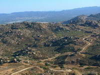
Here is a slideshow with a few images from this year’s 50K.
(The Bandit Trail Runs are now the Rocky Peak Trails races.)
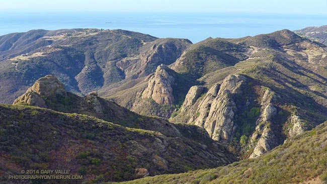
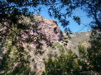
Rock Formations Along Wet Fork Arroyo Sequit from the Backbone Trail
The Coyote Backbone Trail Ultra was one of the most enjoyable runs I did last year. The low key approach with the emphasis on the experience rather than the clock was the perfect fit for my first 100K+ run. To be able to run the entire Backbone Trail with great support, company and entertainment was fantastic.
Today’s run — the second of four 2014 Backbone Ultra training runs — was from Kanan Road to the Mishe Mokwa trailhead near Circle X. This approximately 15 mile segment is one of the most scenic on the Backbone Trail with expansive views and superlative sections of single track trail. The 850′ climb from Encinal Canyon to Etz Meloy Motorway is so well-graded you (almost) don’t realize you’re gaining elevation.
I was looking to get in some extra mileage and it turned out running cohort Ann Ongena was as well. Ann was marking the course for the training run, so the plan was to do the Kanan to Mishe Mokwa segment and then continue from Mishe Mokwa another 13 miles or so to the Wendy Drive trailhead in Newbury Park.
A little before dawn Backbone Ultra RD Howard Cohen dropped us off at the Kanan Road trailhead and then headed back to Mishe Mokwa to coordinate the training run. The temp at the trailhead was around 60 degrees, which is about 30 degrees warmer than last year’s frosty training run on this segment.
For some reason my GPS watch was a little slow to sync with the satellites, and while I waited Ann was already busy on the trail. Course markings don’t have to be numerous or obtrusive to be effective. The few markers she would place would be removed by Tres when he swept the course.
The run from Kanan to Mishe Mokwa went well. As has been the case too often this Winter, the weather was nearly ideal for running. Last year at this time Downtown Los Angeles had recorded 4.35 inches of rain for the water year (since July 1). That was well below average. This water year to date we’ve only recorded 0.97 inch of rain — a meager amount and less than in the record driest water year of 2006-2007.
On this run and all the runs I’ve been doing this Winter I’ve been looking at how the chaparral plants deal with drought. Generally, they reduce their water needs by not flowering, remaining dormant, dropping leaves, producing much smaller leaves, folding or rolling their leaves and in other ways. Some annuals simply don’t germinate. Some plants such as chamise, with its needle-like leaves, deal with drought well; others such as bush monkeyflower are barely recognizable.
As I reached the high point of the Yerba Buena segment of the BBT above Mishe Mokwa and Circle X I vividly recalled being there during last year’s Backbone Ultra. It was about 9:30 at night and I had been running for 15 hours. I could see the lights of the aid station in the valley below and then heard — or thought I heard — cheers for a runner reaching the aid station. Although barely audible, those cheers picked up my spirits as much as they did the runner reaching the aid station!
I didn’t hear any shouts from Mishe Mokwa this morning, but the thought made me smile. Overhead the layer of clouds which had been with us most of the morning was beginning to dissipate, and the temperature was beginning to climb. Across the valley Boney Mountain’s iconic rock formations stood in relief against a mackerel sky and I stopped a couple of times to photograph the scene.
At Mishe Mokwa we enjoyed the fare at Howard’s & Victoria’s rolling aid station and relaxed for a few minutes as a large group of hikers assembled and then started up the trail.
When marking a course it’s preferable that when the main group finishes the run the course-markers be comfortably ensconced in folding lounge chairs, an IPA in hand, sweat-free and looking as they have been there for hours. With more miles to cover I substituted a soda for the IPA and after about 10 leisurely minutes we followed in the hiker’s footsteps and continued up the Backbone Trail to a busy Sandstone Peak — the highest peak in the Santa Monica Mountains.
After spending a few minutes on the summit of the popular peak we worked over to the west junction of the Tri Peaks Trail, then down the Chamberlain, Old Boney and Blue Canyon trails to Sycamore Canyon. Here we left the Backbone Trail and enjoyed a little easy running up Sycamore Canyon to the Upper Sycamore Trail. Upper Sycamore ends at Danielson Road, which we followed to Satwiwa and trails that connect to Wendy Drive.
Some related posts: Backbone Trail Training 2014 – Stunt to Kanan, Backbone Ultra – Training Run #2 (2013), Backbone Ultra 2013
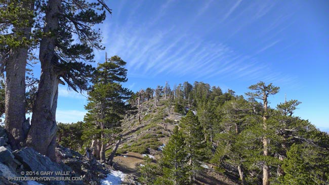
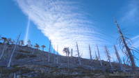
The unusually warm and dry weather made me wonder what the conditions were like in the Angeles high country. Might the PCT be runnable between Islip Saddle (6650′) and Mt. Baden-Powell (9399′)? As warm and as dry as its been, how much snow could there be?