Category Archives: running|adventures

Run, Lop and Shiver – Trail Work with the SMMTC on the Chamberlain Trail

No big deal, so the temp was in the low 40s and it was a little windy… and rainy… and my work gloves were sopping wet… Yes, Victoria did say she hadn’t been this cold since leaving Russia, but how bad could it be — Mike and Jeanne were wearing SHORTS. I quietly whimpered and lopped off another limb of encroaching chamise. If I kept lopping maybe no one would notice how much I was shivering.

Logistically, the Chamberlain Trail segment of the Backbone Trail is one of the more challenging trails in the Santa Monica Mountains to maintain. It’s difficult to get all the tools and people to the trail and out again and still have time to do a few hours of work.

Coordinating with the Santa Monica Mountains Trails Council, Howard Cohen, RD of the Coyote Backbone Trail Ultra, rounded up a bunch of trusting folk that will do just about anything if running in the mountains is involved.

Starting at the Wendy Drive trailhead runners hoofed it over Boney Mountain to the top of the Chamberlain Trail — about a two hour run/hike — then lopped, and sawed and cleared their way down the trail until told to stop. Then they ran back to their cars.

If the smiles (of relief?) at the end of the day were any indication, good, clean fun was had by all — even if it was a little damp and chilly.

Here are a few additional photos from the adventure. Click for a larger version of the photo.


Boney Mountain


Front Moving In


Soups On


Chamberlain Trail


Wrapping It Up


Clearing Clouds


After Work


Scott


Jeanne & Howard


Clearing Clouds Panorama


Chamberlain Rock Panorama

Sulfur Mountain Road Down and Back

View to the ocean from Sulfur Mountain Road Recreation Trail

With each stride I coasted a little further down the 10 mile long hill. If not effortless, running down Sulfur Mountain Road was about as easy as trail running gets. Just click on the cruise control and enjoy the great views and the superb Southern California sunshine.


Sulfur Mountain is an east-west oriented, approximately 13 mile long ridgeline on the south side of the Ojai Valley that extends from Hwy 150 on the east to Hwy 33 on the west. Geologically it is a large anticline created by a fault-propagated fold. 


The mountain figured prominently in the industrial development of the Ojai Valley, its oil seeps spurring petroleum exploration and extraction operations in the mid 1800s.

Sulfur Mountain Road traverses nearly the entire length of Sulfur Mountain and about half of the road is designated as the Sulfur Mountain Road Recreation Trail. The eastern trailhead of the recreation trail is at about the midpoint of the elongated peak. This is where I started this morning’s out and back run.


The eastern trailhead is at about 2600′ and over 10.2 miles the mostly dirt road descends to the western trailhead at about 400′. Including a couple of the short ups on the descent, the total elevation loss turned out to be about 2500′.

Of course 2500′ of descent means 2500′ of gain on the return, but I hadn’t looked at these details prior to run. I wasn’t sure what the run back up was going to be like, but was pleasantly surprised. The road was very runnable and I was able to maintain a reasonable pace for most of the 10 mile climb.


As advertised, the views of the Channel Islands, Ojai Valley and surrounding mountains were spectacular.

This particular day there were a number of mountain-bikers, a few hikers, but no runners.  Parking at the eastern trailhead is very limited, so most opt to do the out and back from the western trailhead near Hwy 33.

If you’re looking for a fast-paced, non-technical 20+ mile run with moderate elevation gain, the out and back on Sulfur Mountain should do the trick.

Whiskey Flat Trail Burger & Double Burger Run & Trek 2013

Runner on the Whiskey Flat Trail during the 2013 Burger Run

I heard it several seconds before I saw it, a sound like thunder rumbling in the distance, but rapidly growing in strength and intensity as it moved up the rugged river canyon.


I had just completed the mile-long climb that follows the Ant Canyon creek crossing and started the descent from the high point of the Burger Run course. The roar stopped me in my tracks — I did not want to miss sighting one of the fighter aircraft that fly through this canyon.

The weather was as good for flying as for running, mostly clear blue skies with only a tatter of cloud over the mountains. I looked in the direction of the growing sound, but had looked too high. The twin-engine fighter was at eye-level and over the river about a half-mile away.


At Fairview — where the Burger Run ends — the Kern River canyon narrows, with 2500′-3000′ tall mountain ridges closing in on the left and right. It would take me at least 30 minutes to get to the finish, but spellbound I watched as the jet covered the distance in three or four seconds. Approaching the cul-de-sac, the pilot added power, pulled back on the stick and in a steep, climbing turn pulled up and over the rocky ridge on the right, continuing the corkscrewing turn into a roll. Sigh…

Last year a spectacular rainbow had spanned the canyon; this year we’d been treated to a dramatic low level flyby. Whether you come for rainbows, fighter jets, the challenging terrain, or the superb views of the mountains and river, a hike or run of the Whiskey Flat Trail is an outstanding adventure.


The Run-4-A-Way Burger Run & Trek starts at the Burlando Trailhead in Kernville and follows the single track Whiskey Flat Trail up Kern River’s rugged canyon to Johnny McNally’s Fairview Lodge and Restaurant. As the 14.5 mile trail works up river it crosses a series of tributary canyons and ridges, gaining more than 2100′ and losing at least 1300′. It challenges the runner, and most take longer than expected the first time they run (or hike) it. Those seeking even more adventure can do the Double Burger option — starting at Fairview, running to Burlando, and then returning to Fairview.

The annual run and trek is organized by Mike Lane of Run-4-A-Way, a local non-profit group dedicated to enhancing the fitness and well-being of the local youth. Proceeds from the 2013 event will help the Kern Valley High School “Lady Broncs” soccer team with equipment and other expenses. Many thanks to Mike for organizing the event and to the Lady Broncs who managed the Burger Run & Trek aid station.

Some related posts: Whiskey Flat Trail Burger & Double Burger Run 2012, Whiskey Flat Trail Burger Run 2011

Related video: F-16 Auto-GCAS Demonstration Flight from Owens Dry Lake, into the Sierra, and down the Kern River.

Following are a few additional photos from the run. Click for a larger image:


Race Meeting


Steep Ascent


Steep Descent


Aid Station


Salmon Buttress & Falls


Fairview

Mt. Wilson – Newcomb Pass – Chantry Flat Loop

Santiago Peak (Saddleback) from the Rim Trail on Mt. Wilson

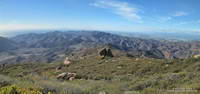
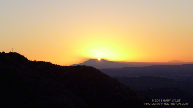
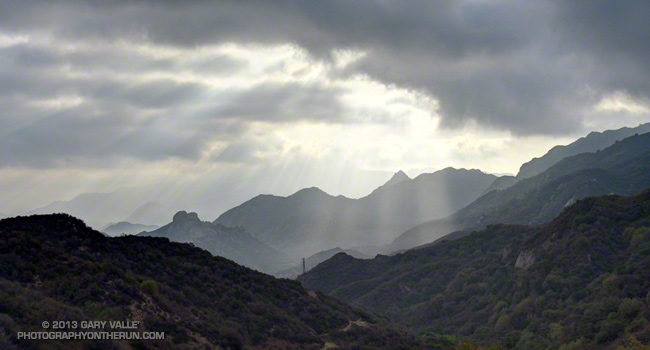
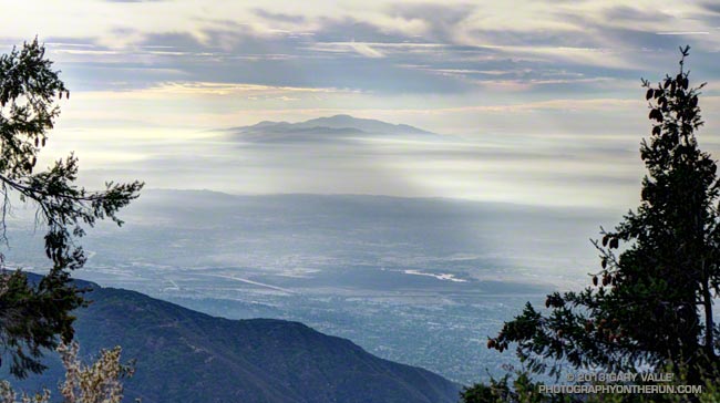
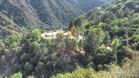
As I ran through the scrub oak near the summit of Mt. Wilson, my footfalls and the distant hum of a generator were the only sounds that disrupted the quiet of the early morning. A patchwork of high clouds covered the sky, muting the rising sun and prolonging the dawn-like light.

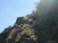
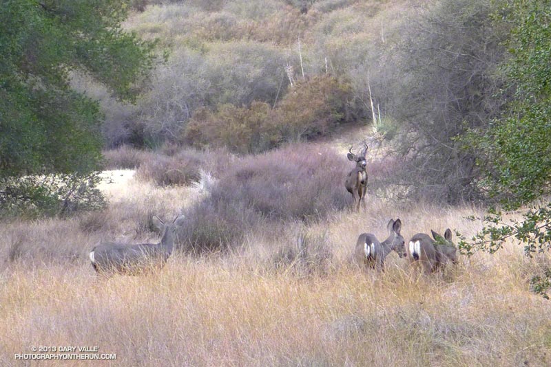
Suddenly, I caught the movement of something large off to the side on the trail ahead. It took a moment to decipher the scene, but over a second or two the camouflaged bowhunter emerged from the background of oak leaves and limbs. Never turning to look at me, he continued to creep up a game trail toward the observatory grounds.


I wasn’t sure how the bowhunter fit in the array of hunting seasons and regulations, but if the general deer hunting season was open in Angeles National Forest I hoped my bright blue shirt and yellow “rodeo clown” running shoes would make me appear sufficiently unnatural.

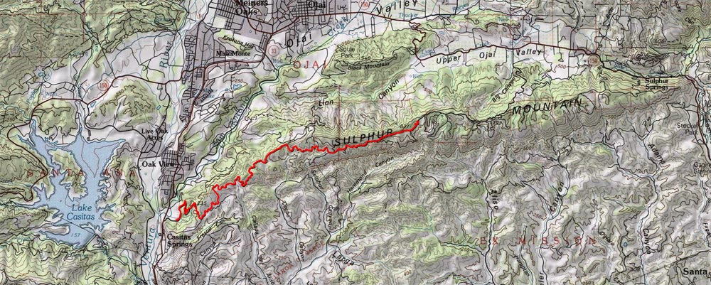
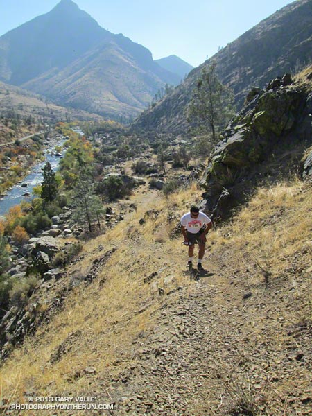
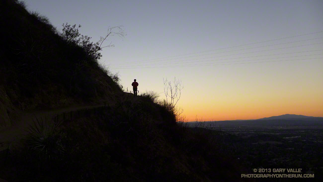
Unlike last week, today I had a plan — to run down the Rim Trail from Mt. Wilson to Newcomb Pass, then down the Gabrielino Trail to Chantry Flat and back up to Wilson on the Upper Winter Creek Trail. I had not done this loop and it would give me a chance to do the stretch of the AC100 course between Newcomb Pass and the Mt. Wilson Toll Road.


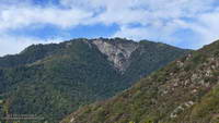
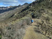
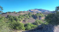
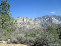
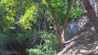
The Rim Trail is a key part of several Mt. Wilson loops. The trailhead is about a quarter-mile east of the Skyline parking lot along the lower paved road with the nature trail signs. It is an adventurous and scenic trail that switchbacks steeply down the rocky northeast shoulder of Mt. Wilson and then contours over to Newcomb Pass. The trail has many long stretches of outstanding running in a forest of bigcone Douglas-fir and oak.

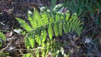
I’d been on the Rim Trail a few times this year and today was glad to see the poison oak along the trail was leafless and the patches of Poodle-dog bush had been trimmed. It’s harder to spot the poison oak without its “leaves of three” but it seems when it is dormant it is less of an issue.

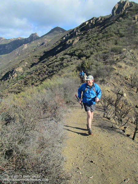
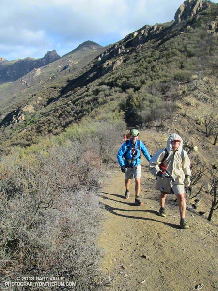
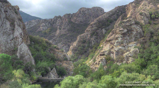
At Newcomb Pass I turned right (south) onto the Gabrielino Trail, joining the AC100 course and beginning the descent to Sturtevant Camp in Big Santa Anita Canyon. Of all the trails on today’s loop the Gabrielino was the most technical.


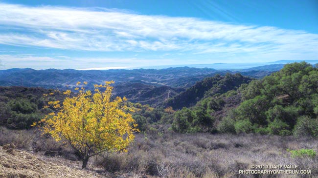
In true Fall fashion the temperature on the sun-facing, chaparral-covered upper reaches of Big Santa Anita Canyon contrasted sharply with the forested north-facing slopes traversed by the Rim Trail and along the streams in the depths of the canyon.

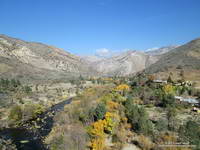
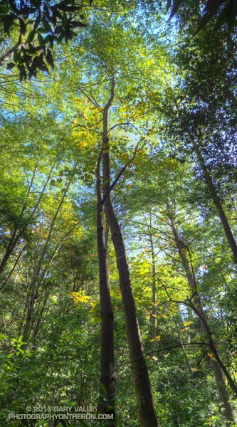
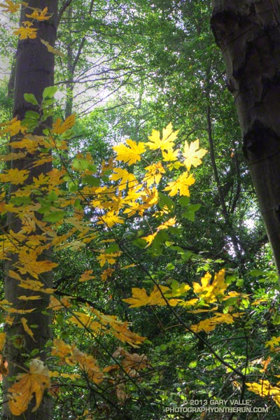
The running between Sturtevant Camp and Roberts Camp was superb. The forests of bigcone Douglas-fir, alder, California bay and bigleaf maple are remarkable and among the most developed in Southern California. The yellows of the bigleaf maples stood out brightly against the greens of the other trees, beacons of Autumn in a mostly evergreen habitat.


The 6 mile, 3100′ climb that starts at the green foot bridge below Chantry Flat and ends at the Mt. Wilson Toll Road is the biggest on the AC100 course. On today’s run it started at a little under the 10 mile point, but during the AC100 comes at about mile 74.

After huffing up the paved road three-quarters of a mile, I refilled my Camelbak at the picnic area at Chantry Flat and continued the loop on the Upper Winter Creek Trail. The uphill on this trail was mostly moderate and runnable, and there is even some downhill to be enjoyed on its descent to the Winter Creek Trail junction near Hoegees.


The climb out on the Winter Creek Trail to Manzanita Ridge is toughest on the loop. Last week I jumped onto the undulating and sunbaked Manzanita Ridge Trail to finish the climb to the Mt. Wilson Trail junction. The “Winton Bypass” extension of the Winter Creek Trail built by Hal Winton and AC100 volunteers is a much better trail and option.

From the turnout near the top of the Kenyon Devore Trail (outside of Skyline Park) the loop worked out to about 17.5 miles, with an elevation gain/loss of about 4500′. Two shorter variations of this loop are possible. At about mile 6.5 the Sturtevant Trail can be taken directly back up to Mt. Wilson or the trail can be used to connect to the Mt. Zion Trail and eventually the Winter Creek Trail near Hoegees.

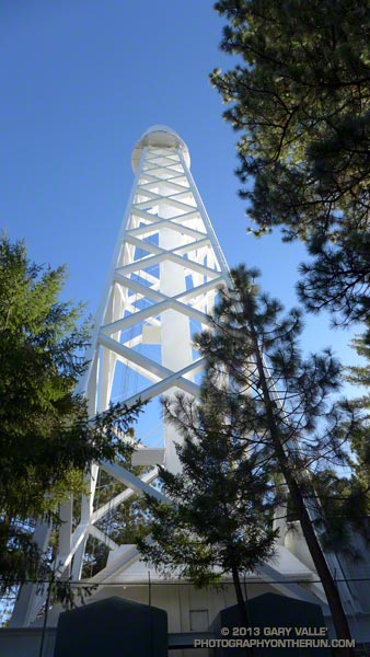
Some related posts: Mt. Wilson Trail Plus; Bigcone ENSO Prediction, Poodle-dog Bush Blues, and a Surprise on Kenyon Devore; GSU Mt. Wilson CHARA Telescope Array; Mt. Wilson Rim Trail – Kenyon Devore Trail Loop; Twenty-Two Miles and Two Classic Climbs

Mt. Wilson Trail Plus

Sunrise behind San Jacinto Peak from the Mt. Wilson Trail.

As I worked up the Mt. Wilson Trail the first flare of sunlight gleamed from behind Mt. San Jacinto. The entire mountain was backlit by the sun, an aura of sunbeams radiating from its ridges. It was about 7:15 and along with a few other hikers and runners, I was chugging up the well-used trail from its Mira Monte Avenue trailhead.

Other than going to the top of Mt. Wilson, I had no specific plan in mind. I’d see how I felt on top and then decide whether to run back down the Mt. Wilson Trail or do something longer.


The run/hike to the top is a little over 7 miles one way with an elevation gain of about 4700′. It’s a spectacular trail that works up rugged Little Santa Anita Canyon to historic Orchard Camp (about mile 3.5), and then climbs up to Manzanita Ridge and the Winter Creek Trail junction (about mile 5.4). Around mile 6 the trail joins the Mt. Wilson Toll Road for about a half-mile, then forks from it on the right, leading in another half-mile to the main parking lot at Skyline Park.

In addition to the original Mt. Wilson Trail there are four other trails that start/end at the top of Mt. Wilson: the Kenyon Devore Trail, Rim Trail, Sturtevant Trail and the Mt. Wilson Toll Road. Using these trails and interconnecting trails and roads a multitude of Mt. Wilson runs and hikes are possible.


At around 9:30 I topped out at the Skyline parking lot and while filling my Camelbak at a water faucet pondered some options. I could just retrace my steps and run back down the Mt. Wilson Trail. That would be the simplest and would be nearly all downhill. Tempting. But the weather was Autumn perfect and the visibility at least 100 miles. It was early and there was plenty of time to do a longer outing.

I’d been toying with the idea of descending the Sturtevant Trail to the Mt. Zion Trail, taking that trail to Hoegees Camp, and then ascending the Winter Creek Trail back up to the Mt. Wilson Trail at Manzanita Ridge. Variations of this loop are popular and most often done from Chantry Flats.


I didn’t know what it would be like to do the loop from the Mt. Wilson Trail, but I had a pretty good idea. On the way up Wilson I’d peered down, down, down into the canyon ascended by the Winter Creek Trail. It looked like the climb out would add another couple thousand feet to an already stout tally.

And it did! Overall the trails were in great shape and there were many miles of superb running. Near Sturtevant Camp at the Mt. Zion Trail junction (about mile 10.3) and continuing above Spruce Grove on the Mt. Zion Trail the forests of bigcone Douglas-fir, oak, alder and bay were so dense and shady I had to check if my sunglasses were still on.

The difficulty of the ascent of the Winter Creek Trail from Hoegees Camp (about mile 13) on tired legs was offset by the beauty of the canyon. At the top of the Winter Creek Trail, I jumped onto the Manzanita Ridge Trail, so that added a little extra gain. I was happy to finally see the bench at the Mt. Wilson Trail & Manzanita Ridge junction (about mile 15.4).


Although there are several places that a fall could “ruin your whole day,” the run down on the Mt. Wilson Trail is one of my favorite descents in Southern California. It’s generally not super steep and there are long stretches of relatively straightforward trail.

The run worked out to 20+ miles with an elevation gain/loss of about 7200′. Although a bit strenuous, it visited some of the most scenic areas found on Mt. Wilson.

Best Trailhead to Start the Bulldog Loop?

Goat Buttes and Century Lake and Gorge in Malibu Creek State Park.

There are several places runners can start the Bulldog Loop: the main parking lot at MCSP, Piuma & Malibu Canyon, and Malibu Canyon & Mulholland are all popular starting points.


One of the best trailheads for starting this loop is often overlooked — the Cistern Trail and Phantom Trail trailhead on Mulholland Highway. Starting at this trailhead adds about 1.5 mile and 500′ gain/loss to the standard 14+ mile loop. Less than a quarter-mile into the run this variation passes one of the best viewpoints in Malibu Creek State Park. 

The run begins on the Cistern Trail on the south side of Mulholland and follows that trail about a quarter-mile to the Lookout Trail junction. At the junction the route turns right on the Lookout Trail and follows it about 0.4 mile to the Cage Creek Trail, which leads down to Crags Road and the regular Bulldog Loop. Near the end of the loop, after climbing a hill and passing the spur trail down to Century Lake, the Lookout Trail is taken from Crags Road back up to the Cistern Trail and car.


Much of Malibu Creek State Park and the route of the Bulldog Loop can be seen from the Cistern Trail at the beginning of the run. There are excellent views of Reagan Ranch, Brents Mountain, Goat Buttes, Century Lake and Gorge on the way down the Cistern Trail and climbing back up the Lookout Trail at the end of the loop.

The run can be easily extended by tacking on the Yearling and Deer Leg Trails in the Reagan Ranch area or by doing the Phantom Loop when the Grasslands Trail & Crags Road junction is reached after passing the MCSP parking lot.

The title photo is of Goat Buttes and Century Lake & Gorge from this morning’s run of the loop.

Some related posts: Century Lake, Dam and Gorge on Malibu Creek, Malibu Creek State Park Scenic Loop, Vertical Relief