Category Archives: trails

Deerweed Carpets Hills and Canyons in the Santa Monica Mountains

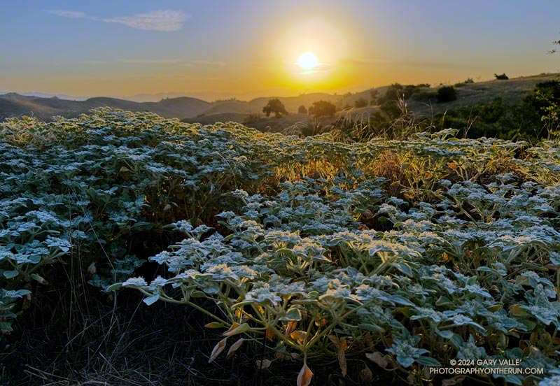
Deerweed (Acmispon glaber) blooming near the Encinal Canyon Trailhead of the Backbone Trail. May 2024.
Deerweed (Acmispon glaber) blooming near the Encinal Canyon Trailhead of the Backbone Trail.

A deerweed superbloom has emerged in the western Santa Monica Mountains this May, covering hillsides with a multitude of small yellow flowers.

The extensive bloom is occurring near the end of a two-year period that is the wettest in Los Angeles in over a century.

Sullivan Ridge – Will Rogers – Temescal Loop from the Top of Reseda

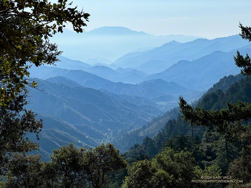
Creek in Rustic Canyon near the bottom of the Josepho Drop Trail.
Creek in Rustic Canyon from near the bottom of the Josepho Drop Trail.

The most popular trail run from the Top of Reseda to Will Rogers State Historic Park takes Fire Road #30 up to the Hub, turns left (east), and then follows the Roger’s Road segment of the Backbone Trail all the way to the Park. Many do the run as a keyhole loop, picking up the Rivas Canyon Trail on the west side of Will Rogers and using that trail to connect to Temescal Canyon. The Temescal Ridge Trail is then used to return to the Hub and Fire Road #30. The run is about 21 miles and gains/loses about 3400′.

There is another — more adventurous — way to do a loop from the Top of Reseda that visits Will Rogers and then returns via the Rivas Canyon and Temescal Ridge Trails. It is about the same length as the regular route and very nearly a complete loop. That’s the route I was doing this morning.

Solitary oak along Sullivan Ridge Fire Road. (thumbnail)
Solitary oak along Sullivan Ridge Fire Road.

Instead of going up to the Hub, I ran east about 2.5 miles on dirt Mulholland to Sullivan Ridge Fire Road and then 3.5 miles down the fire road to “Josepho junction.” There’s a yellow fire gate here, and the road changes from dirt to pavement.

From this point, the goal is to get to the Josepho Drop Trail — a short (0.75-mile) trail that connects Rustic Canyon to the Backbone Trail above the bridge. From the creek to the Backbone Trail, the trail gains about 650′. Much of it is steep, rough, and rubbly.

Years ago, we would run down the private service road from Sullivan Ridge to Camp Josepho, then follow a use trail down the canyon to the Josepho Drop Trail. That hasn’t been an option for some time, but there are other — more interesting — ways to get to the Josepho Drop.

Bougainvillea along the Old Stables Trail. (thumbnail)
Bougainvillea along the Old Stables Trail.

One option is to continue south from Joespho junction on the fire road a tenth of a mile to a single-track trail on the right. On some maps, the trail is labeled the “Old Stables Trail.” Initially, the trail contours below the crest of the ridge but eventually winds down into Rustic Canyon in the area of Murphy Ranch —  an abandoned 1930s compound said to have been a haven for fascists and Nazi sympathizers.

On the way down, there are vestiges of the old compound —  a flourishing Bougainvillea, an overgrown corral, an out-of-place palm.

Near the bottom, another trail/road enters from the left. I turned right here and followed the trail around a corner with a low, graffitied wall, and then down canyon about 130 yards to a trail sign near the creek. The collapsed structure found here must be the ruins of the stables.

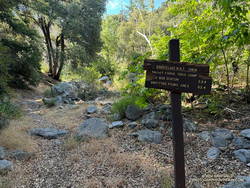
Trail sign marking junction of the Will Rogers and Josepho Drop Trails. (thumbnail)
Trail sign marking junction of the Will Rogers and Josepho Drop Trails.

Finding the junction at the trail sign is the key to staying on route. According to Google Earth, the approximate location is 34.074534°, -118.516381°. The coordinates recorded for the photo are 34° 4′ 28.480000″ N, 118° 30′ 58.720000″ W.

A right-hand (west) turn at the sign crosses the creek and joins the Josepho Drop Trail. I’ve explored the trail south of the sign a few times. In about a half-mile, it leads to the heavily graffitied building that housed the diesel generators for the enclave. Not only is the building graffitied, but everything within reach of a spray can — walls, steps, pavement —  even the trees are painted.

Maps show the “Will Rogers Trail” continuing to Will Rogers, but as the trail sign says, the trail is not maintained. With the rain we’ve had the last couple of years, there’s little doubt the trail is washed out, overgrown, and would be time-consuming to follow.

Creek at bottom of Josepho Drop Trail. (thumbnail)
Creek at bottom of Josepho Drop Trail.

I returned up the canyon to the trail sign and followed the Josepho Drop Trail west across the creek . It looked like some trailwork had been done on the bottom part of the trail.

As I worked up the trail, I kept an eye out above. The last time up the Drop, I’d encountered a mountain biker bumping down a steep and very rutted section of the trail. It looked like he was riding down stairs.

When I reached the top of the Drop, I turned left on the Backbone Trail and continued down to Will Roger’s State Park. The loop was completed by following the Rivas Canyon Trail over to Temescal Canyon, then picking up the Temescal Ridge Trail and following it past Skull Rock and Green Mountain to the Hub. From the Hub, Fire Road #30 was followed back to dirt Mulholland and the top of Reseda.

Eucalyptus along the Inspiration Point Loop Trail in Will Rogers State Historic Park. (thumbnail)
Eucalyptus along the Inspiration Point Loop Trail in Will Rogers State Historic Park

I was surprised to find that without the side trip to the Murphy Ranch powerhouse, the Sullivan Ridge variant of the Will Rogers – Temescal Ridge loop is virtually the same length as the “regular” route down the Roger’s Road segment of the Backbone Trail. It just has a bit more elevation gain.

If a shorter run is preferred, another option is to turn right (north) on the Backbone Trail at the top of the Drop and follow that to the Hub. From the Hub, it’s about 2.5 miles to the trailhead at the Top of Reseda. This variant of the trail run works out to about 16.5 miles.

This interactive 3-D terrain view shows my GPS track (yellow) of the Sullivan Ridge – Will Rogers – Temescal Loop from the Top of Reseda. Also shown is my GPS track (red) of the Roger’s Road option on the Backbone Trail.

Here are some photos taken along the way, including some native, non-native, and ornamental flowers.

Some related posts:
Will Rogers – Rivas Canyon – Temescal Canyon Trail Run
Will Rogers – Temescal Loop

Mugu Peak – Wood Canyon – Hidden Pond Loop

Hidden Pond from the Hidden Pond Trail in Point Mugu State Park. Photography by Gary Valle'.
Hidden Pond from the Hidden Pond Trail in Point Mugu State Park.

It had rained a few hundredths overnight, and even though it was May, the weather was decidedly March-like.

Raindrops glistened in the grass, and a little mud caked my shoes as I ran across Satwiwa. To the south, rugged Boney Mountain captured the first rays of the rising sun, a remnant cloud hiding its summit. I breathed deeply and thought, “This is going to be an outstanding run…”

Here’s an interactive, 3D-terrain view of the GPS track of the Mugu Peak – Wood Canyon – Hidden Pond Loop.

Some related posts:
Soggy Shoes, Soppy La Jolla Valley, and Sensational Wildflowers
Busy Mugu Peak
Hidden Pond – Old Boney Loop

Condor Peak Trail Run – April 2024

Condor Peak Trail above Fusier Canyon.

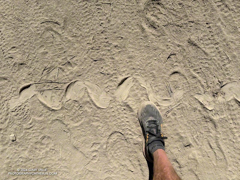
After climbing Condor Peak, I paused along the trail between the peak and Fox Mountain to take a photo. That’s when I heard a loud rattling behind me. I slowly turned around… A very upset snake was in the brush about 15 feet away and continuing to buzz.

Many rattlesnakes I encounter don’t rattle — even if directly on the trail. But for some reason this well-hidden snake was really agitated.

Josephine Peak and Strawberry Peak from the Condor Peak Trail. (thumbnail)
Josephine Peak and Strawberry Peak

The rattle sounded like that of a mature snake. I briefly considered looking for it. But, I reasoned, if the snake had been kind enough to rattle, then I should return the favor and leave it alone. It was already amped and clearly knew where I was. While I was curious, I didn’t need to see THIS snake. I turned and continued down the trail.

It had been one of those runs where everything goes as planned. Other than the first 50 yards or so of the Vogel Flat Trail — which was in terrible condition — it had been a nice change to be on a “normal” trail. By that, I mean a trail that (generally) wasn’t rutted, overgrown, or washed out. Consecutive wet rain seasons have been hard on lower elevation trails in the Los Angeles area.

The San Gabriel Mountains from East Condor Peak. (thumbnail)
The San Gabriels from East Condor Peak.

I was the first up to the peak, and on the way down passed several small groups of hikers. The topmost group was resting in the shade near Fox Mountain, and the others working up the trail farther down the mountain. All were enjoying the day.

According to the Tempe thermometer on my pack, the temperature climbed steadily from 60 degrees at the start of the run to around 75-80 degrees on Condor Peak. The day wasn’t forecast to be particularly hot — around 85 in the warmer valley locations. But on the return from Condor, the temperature in the sun in the south-facing bowl at the head of Fusier Canyon was in the 90s. This was offset somewhat by the shaded little streams in the corners of the canyon. In some years these have been completely dry.

Paintbrush mixed with bush poppy along the Condor Peak Trail. (thumbnail)
Paintbrush and bush poppy.

As elsewhere this Spring, the wildflowers along the trail were spectacular. Some of those in bloom included woolly paintbrush, yellow monkeyflower, chaparral whitethorn, hoary-leaved Ceanothus, bush poppy, collarless California poppy, chia, and black sage. The paintbrush and bush poppy were especially striking.

Here’s an interactive 3D-terrain map of my GPS track (yellow) of the route to Condor Peak, starting near Vogel Flat on Big Tujunga Canyon Road. It’s a strenuous 16-mile run, hike, or ride, with an elevation gain of about 4000′. The summit of Condor (either one) is at about 5441 feet.

Some related posts:
Condor Peak and Fox Mountain Adventure Run
Condor Peak Out and Back Adventure Run
Condor Peak Trail Run

Boney Mountain – Old Boney Loop from Wendy Drive

Western Ridge and escarpment of Boney Mountain from the Old Boney Trail

For months, it seems wet weather has had a particular affinity for Saturdays and Sundays. This has resulted in some wet, chilly runs. It’s also put a damper on other outdoor activities. A long-time rock climber, I enjoy going to Stoney Point and doing a circuit of easy bouldering problems. That’s been hard to do because 1) muddy climbing shoes don’t work so well, and 2) sandstone hand/footholds tend to break when wet.

That’s one of the reasons I was back on the western ridge of Boney Mountain — at least I’d get to climb something!

Near the halfway point on the Western Ridge of Boney Mountain. (thumbnail)
Near the halfway point on the Western Ridge.

Following a well-worn route, I scrambled up Boney’s western ridge to the crest and worked over Tri Peaks to the Backbone Trail. This time, after descending the Chamberlain Trail, I turned right (north) on the Old Boney Trail and looped back to where the western ridge route began. From there, I retraced my steps back to Wendy Drive. Here’s an interactive 3-D terrain map of my GPS track.

There were other reasons for doing this route. It’s been a very wet couple of years, and there is little trail infrastructure to handle the runoff from all the storms. Last weekend, another strong storm drenched Southern California, and on Friday, there was additional rain. The Boney – Old Boney route crosses just one creek (twice), and it usually has a decent limb/log/rock bridge. I suspected other routes would involve soaked socks and shoes.

Bush sunflower along the Old Boney Trail. (thumbnail)
Bush sunflower along the Old Boney Trail.

I’d also read that the Santa Monica Mountains Trails Council (SMMTC) recently worked on the Old Boney Trail. After experiencing the challenges of brush on that trail firsthand, I was curious to see what the trail was like now. In addition, the Old Boney return has fantastic views of Boney Mountain’s impressive western escarpment. It’s fun to look up at where you’ve been!

Another consideration — not necessarily positive or negative — is the Boney Mountain – Old Boney keyhole loop has nearly a 1000′ more elevation gain than the similar length (16-mile) Blue Canyon, Sycamore Canyon, Upper Sycamore route.

Here are a few photos taken along the way, including some of the vibrant wildflowers.

Some related posts:
Looking for Boney Mountain
An End of Year Boney Mountain Adventure
Boney Mountain Western Ridge & Loop

California Vole Foraging in Upper Las Virgenes Canyon Open Space Preserve (Video)

California vole foraging in Upper Las Virgenes Canyon Open Space Preserve (video)
Click for video!

Running south in upper Las Virgenes Canyon, I’d passed the connector to Cheeseboro Canyon and was nearing Las Virgenes Creek. Before reaching the creek, I turned left off the main road onto a path that has a log bridge across the creek.

As I stepped onto the berm at the edge of the road, I caught a glimpse of something small and furry moving at my feet. I stopped and stepped back.

That’s when the vole poked its head from a burrow. I could almost see it squinting as it assessed whether or not I was a threat. Deciding to continue foraging, it emerged from the hole as far as it dared, and worked to free a small clump of grass at the margin of the burrow. Mission accomplished, in a flash of fur it returned to its burrow.

Some other wildlife encounters while running:
Bear Cubs on the South Fork Trail
Coyote Tag
Hawk, Bobcat and Rabbit
Northern Harrier on Lasky Mesa
Reagan Ranch Bobcat
Big Southern Pacific Rattlesnake at Ahmanson Ranch
Deer Encounters
– and many more.